
Private grounds
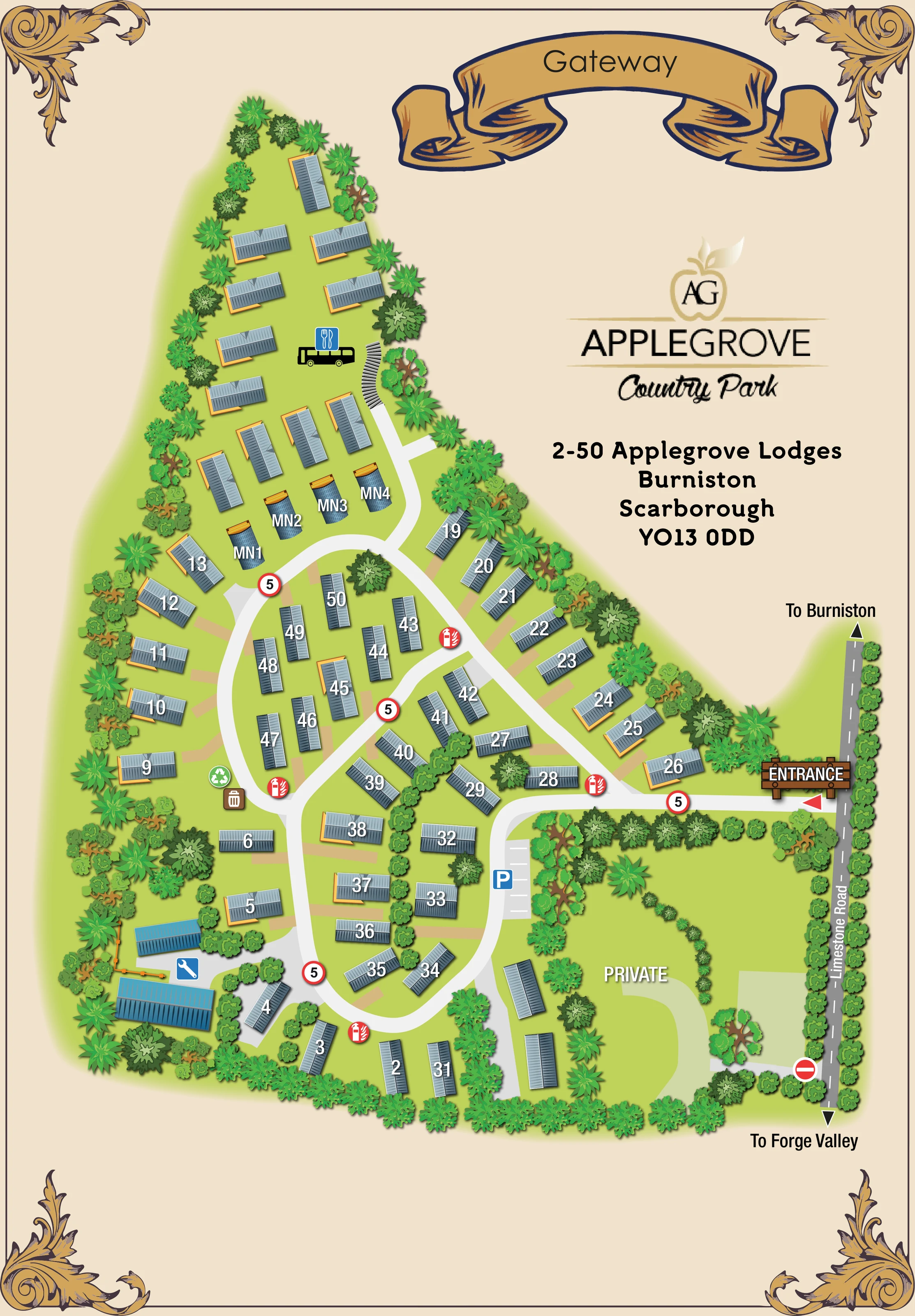
A substantial landscaped area in the lower-right corner is labelled PRIVATE, with its own curved drive and unnumbered buildings.
ILLUSTRATED PARK MAP · P009
2-50 Applegrove Lodges, Burniston, Scarborough · United Kingdom
 Enlarge the map ↗
A SENSE OF THE PLACE
Applegrove Retreat offers self-catering lodge holidays at Burniston near Scarborough. Its setting provides a quieter base outside the seaside town, with the North Yorkshire coast and countryside forming the backdrop to a stay.
Accommodation includes lodges with outdoor space, and selected properties offer hot tubs. The map gives an overview of the lodge layout and helps guests place their accommodation within the retreat.
LOOK CLOSER
A substantial landscaped area in the lower-right corner is labelled PRIVATE, with its own curved drive and unnumbered buildings.
Dense illustrated planting encloses the park, lines Limestone Road and separates several lodge groups. Mixed rounded and spiky tree canopies also punctuate the interior.
A timber-style ENTRANCE sign and red pointer identify the access on the right-hand edge of the park.
The grey roadside strip is labelled Limestone Road, with arrows towards Burniston at the top and Forge Valley at the bottom.
Broad pale drives form linked loops through the lodge groups, with a diagonal connection and a branch into the narrow northern extension.
A blue P and white bay markings identify parking beside the eastern internal drive, just below the entrance.
Repeated red extinguisher-and-flame symbols mark fire points around the internal road network.
Adjacent brown bin and green recycling symbols identify a collection point on the western side of the main loop.
A timber-style ENTRANCE sign and red pointer identify the access on the right-hand edge of the park.
The grey roadside strip is labelled Limestone Road, with arrows towards Burniston at the top and Forge Valley at the bottom.
Broad pale drives form linked loops through the lodge groups, with a diagonal connection and a branch into the narrow northern extension.
A blue P and white bay markings identify parking beside the eastern internal drive, just below the entrance.
Repeated red extinguisher-and-flame symbols mark fire points around the internal road network.
Adjacent brown bin and green recycling symbols identify a collection point on the western side of the main loop.
A blue spanner symbol accompanies two larger blue-roofed buildings and a partly fenced yard in the lower-left corner.
A black bus-shaped vehicle beneath a blue cutlery symbol appears among the northern lodges. This suggests a catering-related feature, but the artwork supplies no explanatory label.
A substantial landscaped area in the lower-right corner is labelled PRIVATE, with its own curved drive and unnumbered buildings.
A red no-entry symbol is drawn where the private drive meets Limestone Road, distinguishing it from the principal entrance.
Red-rimmed signs bearing the numeral 5 recur along the illustrated internal drives.
Dense illustrated planting encloses the park, lines Limestone Road and separates several lodge groups. Mixed rounded and spiky tree canopies also punctuate the interior.
Orange-edged platforms accompany many lodges, while short tan strips connect individual plots towards the drives.
READING THE MAP
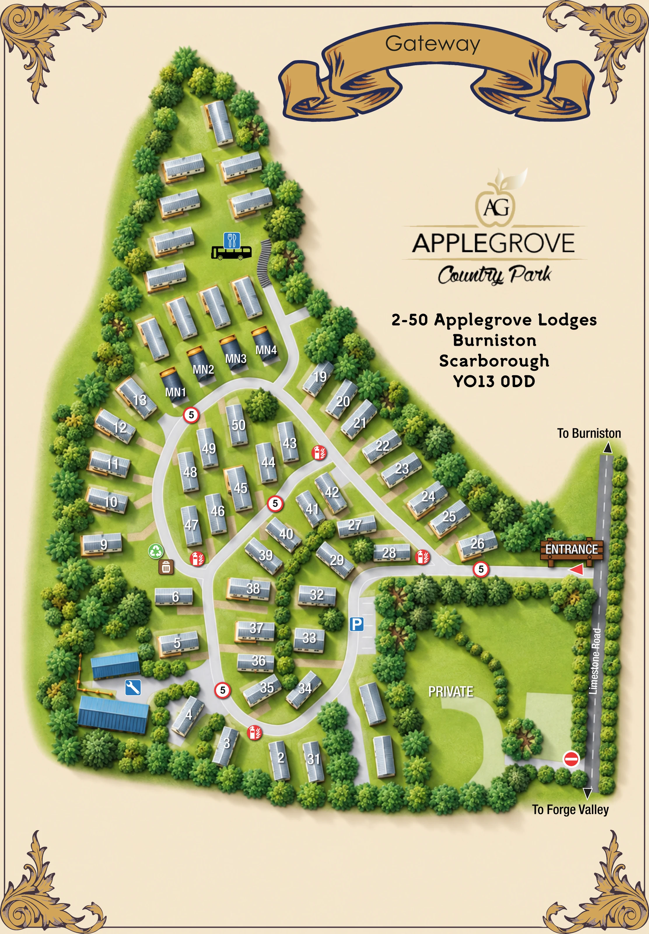
This illustrated map of Applegrove Country Park presents a tree-lined lodge retreat at Burniston, near Scarborough, in a distinctly traditional frame. A cream background, gold scroll banner and ornamental corners surround a bright green site plan, while the apple-shaped park monogram and address occupy the open space above the entrance side of the grounds.
The map shows roughly 50 accommodation-like units across a compact network of curving drives and a narrow northern extension. Grey pitched roofs, orange-edged decking and large white lodge labels make the accommodation the main visual focus. Dense trees and hedges define the boundaries and divide the interior into smaller groups, giving the plan a landscaped rather than purely diagrammatic character.
Arrival is clearly anchored to Limestone Road, with directions towards Burniston and Forge Valley. Parking, fire points, waste and recycling symbols, and a maintenance area add practical detail. A separately labelled private area is also shown. For a lodge park needing a recognisable guest orientation map, this sample demonstrates how accommodation finding, access information and prominent park branding can share one illustrated page.
The single portrait plan follows an irregular site footprint, widening from a slim northern arm into the main lodge grounds below. Accommodation sits both around the planted perimeter and within islands formed by the internal drives. The northern arm contains unnumbered lodge-like buildings, a small row of curved-roof units labelled MN1–MN4, and a vehicle illustration paired with a cutlery symbol. A curved, stepped-looking graphic appears beside this upper area, although its function is not named.
The main entrance is on the right, where a timber-style sign and red pointer meet Limestone Road. From here, a broad pale drive branches into linked loops, with a diagonal connection across the central accommodation area. Short tan strips lead towards individual lodges. A blue parking symbol and marked bays sit on the eastern loop below the entrance. Red fire-point icons recur around the routes, while waste and recycling symbols are grouped on the western side. Two larger blue-roofed buildings, a spanner icon and a partly fenced yard distinguish the maintenance or service area at the lower left.
The lower-right grounds are labelled PRIVATE. Their curved drive, planting and unnumbered buildings form a separate visual zone, with a no-entry symbol at the roadside connection. Outside the park, Limestone Road is rendered in darker grey with a dashed centre line and arrows towards Burniston and Forge Valley.
The artwork combines an overhead layout with shaded roof illustrations and layered tree canopies. White accommodation labels remain prominent against blue-grey roofs. There is no separate legend or inset: symbols are placed directly beside the relevant features. Gold corner flourishes, a Gateway scroll and the Applegrove identity block complete the decorative page composition.
 Enlarge this map ↗
KEEP EXPLORING
Chosen for shared landscapes, accommodation or facilities.
 Explore the map ↗
United Kingdom
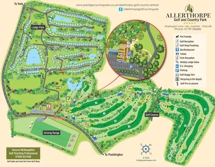
Lakeside lodge neighbourhoods and a nine-hole golf course, with an enlarged reception and facilities inset.
 Explore the map ↗
United Kingdom
A wooded Allerton park plan with colour-coded neighbourhoods, touring pitches and a central facilities hub.
 Explore the map ↗
United Kingdom
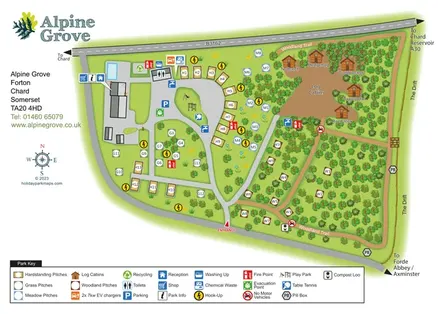
Colour-coded pitches, named log cabins and a woodland trail at Alpine Grove, Somerset.
Features may come from the sample artwork, its key or published park information. Approximate numbers describe the drawing and may cover only part of a park. They are intended to help you compare map examples. Current facilities and booking information should be checked with the park.
LET’S MAP YOUR PARK
For a map quotation, find your park and draw a rough boundary around it. The area you select helps us work out the design time and price.
Draw your park for a quote ↗Or talk to our map designers
01751 473136