
Woodland and planted clearings
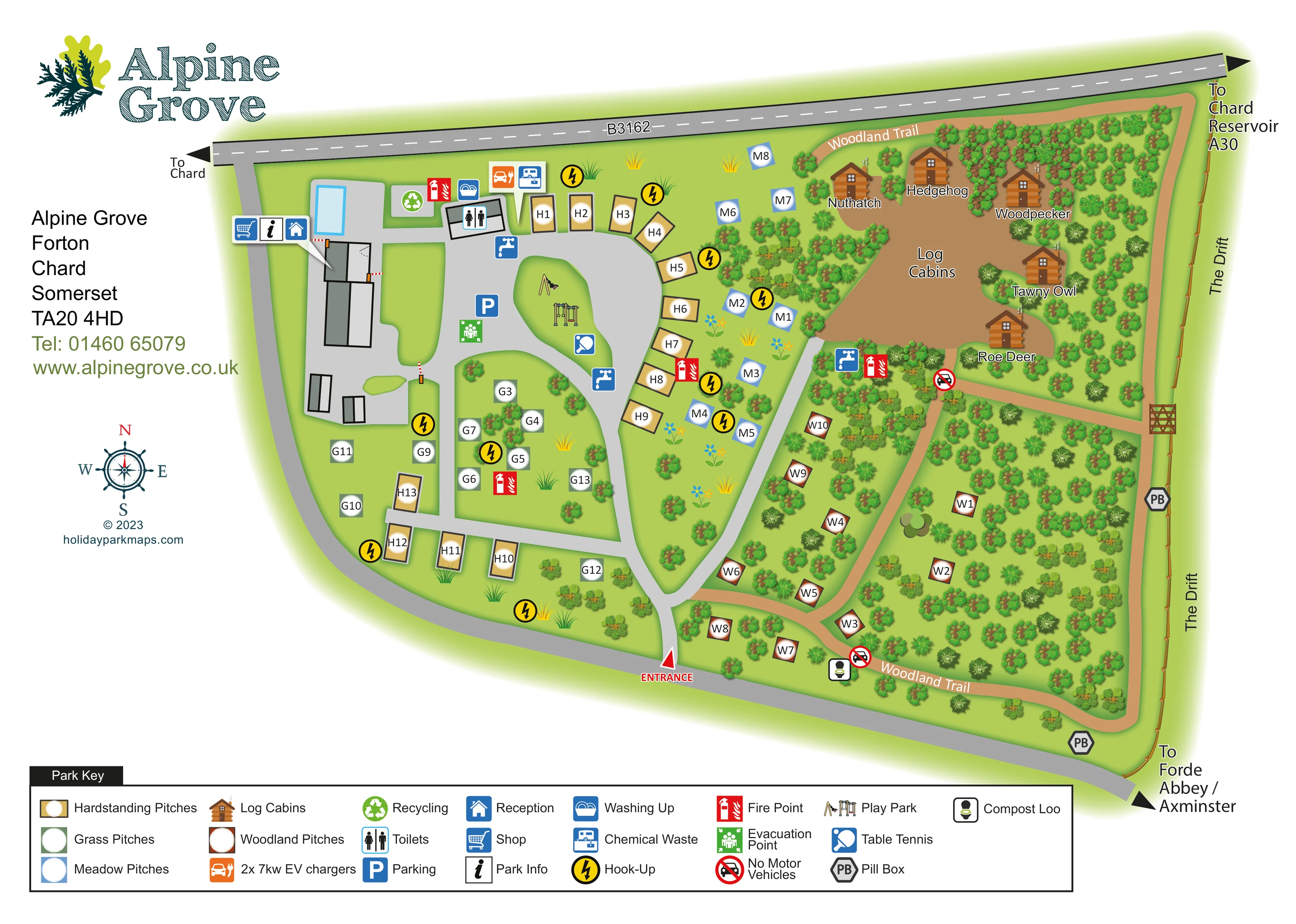
Dense mixed tree symbols frame the eastern pitches and cabins, with smaller planted groups throughout the western grass areas.
ILLUSTRATED PARK MAP · P006
Forton, Chard, Somerset · United Kingdom
 Enlarge the map ↗
A SENSE OF THE PLACE
Alpine Grove is based at Forton, Chard, Somerset. The official site offers camping pitches and log cabin stays.
The operator states that the site has sent no waste to landfill since 2020 and lists separate recycling streams. 10-amp electric hook-ups are available; the contact page also lists two 32-amp untethered EV chargers. Camping tariff includes free hot showers and seasonal use of the heated outdoor pool.
LOOK CLOSER
Dense mixed tree symbols frame the eastern pitches and cabins, with smaller planted groups throughout the western grass areas.
Two grey hexagonal PB markers identify pill boxes near the eastern and southern boundaries.
Three adjacent symbols point towards the western building complex beside the pool.
A pale-blue rectangular pool is drawn beside the western facilities. It is not named in the key; the park research identifies an outdoor pool.
Toilet and washing-up symbols mark the service area near the northern end of the internal road.
Blue tap symbols appear near the main facilities, central pitches and cabin-side woodland.
A chemical waste symbol is placed in the northern service cluster.
A green recycling symbol marks a point beside the northern facilities.
Three adjacent symbols point towards the western building complex beside the pool.
A pale-blue rectangular pool is drawn beside the western facilities. It is not named in the key; the park research identifies an outdoor pool.
Toilet and washing-up symbols mark the service area near the northern end of the internal road.
Blue tap symbols appear near the main facilities, central pitches and cabin-side woodland.
A chemical waste symbol is placed in the northern service cluster.
A green recycling symbol marks a point beside the northern facilities.
An orange charging symbol is placed in the northern service cluster; the key specifies two 7 kW EV chargers.
Yellow lightning-bolt circles identify hook-up locations across the main pitch areas.
A blue parking symbol appears on the central paved area beside the play park.
Illustrated swings and play equipment occupy a green island within the internal road loop.
A blue bat-and-ball symbol marks table tennis beside the play island.
A compost toilet symbol is positioned near the southern woodland trail entrance.
Red fire-point symbols are distributed between the main service area, pitch groups and cabin woodland.
A green assembly symbol is shown near the central parking and play area.
Dense mixed tree symbols frame the eastern pitches and cabins, with smaller planted groups throughout the western grass areas.
A tan walking route follows the eastern woodland perimeter, with connecting branches between pitches and the cabin clearing.
No-motor-vehicle symbols distinguish two woodland path access points from the grey vehicle routes.
Two grey hexagonal PB markers identify pill boxes near the eastern and southern boundaries.
A named route runs outside the eastern boundary, with a gate drawn where a woodland path meets it.
The red entrance marker sits at the southern internal-road connection. Broad grey roads link the western facilities and central pitch areas.
The B3162 borders the northern edge. Directional labels refer to Chard, Chard Reservoir, the A30, Forde Abbey and Axminster; these destinations are not depicted as park facilities.
READING THE MAP
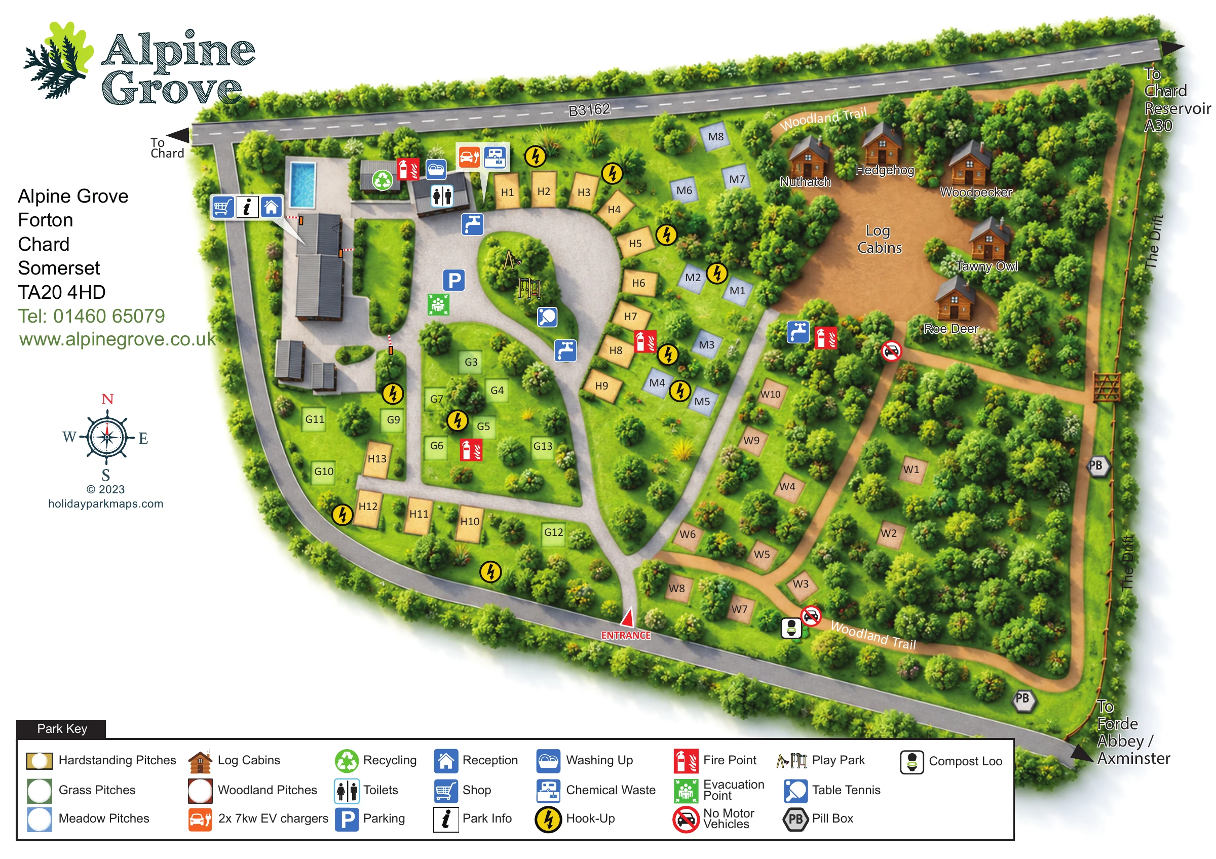
This illustrated map of Alpine Grove at Forton, near Chard in Somerset, brings together a compact touring park, woodland pitches and a small collection of log cabins. Its most useful distinction is between the open, serviced western half of the park and the tree-filled eastern half, where a Woodland Trail links quieter accommodation areas and named cabin clearings.
Four pitch styles make the accommodation mix easy to recognise: hardstanding, grass, meadow and woodland. Rather than drawing a caravan or tent on every pitch, the design uses coloured markers and short identifiers, leaving room for practical information. Brown timber cabin illustrations add a different visual character to the north-eastern corner.
The map also gives visitors a clear picture of the shared facilities, including reception, the shop, toilets, washing-up facilities, play equipment and table tennis. Electric hook-ups, EV charging, recycling and a compost loo sit within the same visual system. A broad bottom key, a separate contact panel and local destination arrows complete a map that combines arrival information with an engaging picture of the park’s wooded setting.
The plan places the B3162 across its upper edge, with Chard indicated to the west and Chard Reservoir and the A30 to the east. A grey access road follows the western and southern edges, while a red entrance arrow marks the connection into the internal roads near the bottom of the map. Within the park, broad grey routes curve around green islands and connect the accommodation areas with the western service buildings.
Hardstanding pitches line much of the central road, grass pitches occupy the western lawns, and blue meadow markers sit against the woodland edge. Reddish-brown woodland pitch markers are scattered through the eastern trees. In the north-east, five illustrated log cabins surround a clearing: Nuthatch, Hedgehog, Woodpecker, Tawny Owl and Roe Deer. Their individual names provide a different wayfinding system from the letter-prefixed pitch labels.
The main facility cluster combines reception, shop and information symbols with an illustrated rectangular pool. Nearby symbols identify toilets, washing up, recycling, chemical waste disposal and EV charging. Water points, hook-ups and fire points are distributed around the plan. Parking, an evacuation point, play equipment and table tennis are grouped around the central paved area and green island.
Tan paths form the Woodland Trail around the eastern side, with branches through the accommodation areas. No-motor-vehicle signs mark woodland access points, and a compost loo appears near the southern trail. Two pill-box markers and the boundary route labelled The Drift add distinctive local detail. The single artwork is supported by two overlapping enlargements of its bottom key; these clarify the symbols rather than presenting additional park sections.
 Enlarge this map ↗
KEEP EXPLORING
Chosen for shared landscapes, accommodation or facilities.
 Explore the map ↗
United Kingdom
A colour-zoned coastal park map with touring areas, woodland trails, ponds and a leisure club.
 Explore the map ↗
United Kingdom
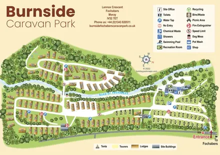
Illustrated Burnside Caravan Park plan, using a winding burn, shaded lodge roofs, touring blocks and separate symbol keys to organise a leafy, mixed-accommodation site.
 Explore the map ↗
United Kingdom
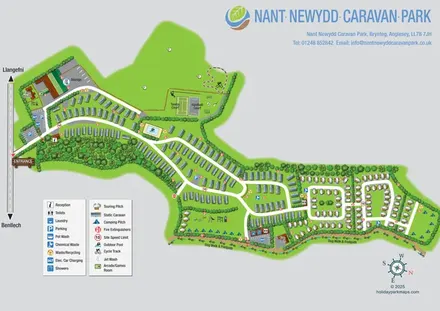
Illustrated Anglesey park map with static caravans, touring loops, camping, sports courts and a perimeter dog walk.
Features may come from the sample artwork, its key or published park information. Approximate numbers describe the drawing and may cover only part of a park. They are intended to help you compare map examples. Current facilities and booking information should be checked with the park.
TAKE A CLOSER LOOK
View the illustrated map in detail or choose a file to download. These are sample maps; contact the park for current visitor information.


LET’S MAP YOUR PARK
For a map quotation, find your park and draw a rough boundary around it. The area you select helps us work out the design time and price.
Draw your park for a quote ↗Or talk to our map designers
01751 473136