
Wooded setting
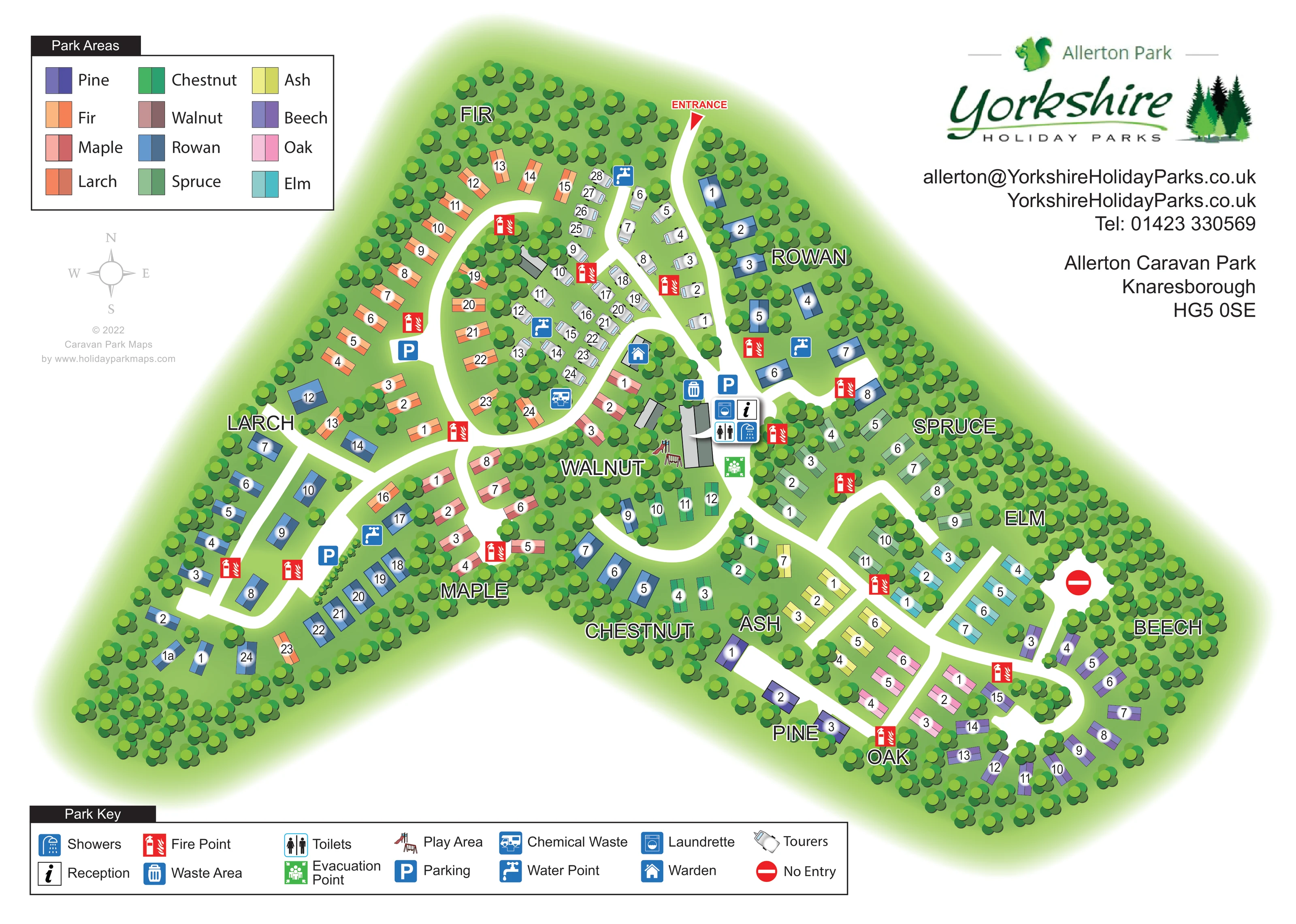
Dense stylised tree canopies enclose the park and separate accommodation rows, with softer green shading beneath.
ILLUSTRATED PARK MAP · P393
Allerton-Mauleverer, near Knaresborough, North Yorkshire · United Kingdom
 Enlarge the map ↗
A SENSE OF THE PLACE
Allerton Holiday Park is based at Allerton-Mauleverer, near Knaresborough, North Yorkshire. The site is located in pine woodland beside Allerton Castle near Knaresborough. The park provides caravan, tent and motorhome pitches plus holiday homes and lodges to rent or buy.
Showers, toilet blocks, washing-up room and children's play area are listed.
LOOK CLOSER
Dense stylised tree canopies enclose the park and separate accommodation rows, with softer green shading beneath.
An information symbol marks reception at the central building cluster beside the main arrival road.
Toilet and shower symbols are grouped with the central service buildings.
A washing-machine symbol identifies the laundrette in the central facilities cluster.
A small illustrated slide and swing structure sits immediately west of the central buildings.
A blue house symbol marks the warden location just north-west of the main facilities.
Blue P symbols mark parking near reception and within the western accommodation areas.
Tap symbols identify several water points serving the touring section and fixed accommodation areas.
An information symbol marks reception at the central building cluster beside the main arrival road.
Toilet and shower symbols are grouped with the central service buildings.
A washing-machine symbol identifies the laundrette in the central facilities cluster.
A small illustrated slide and swing structure sits immediately west of the central buildings.
A blue house symbol marks the warden location just north-west of the main facilities.
Blue P symbols mark parking near reception and within the western accommodation areas.
Tap symbols identify several water points serving the touring section and fixed accommodation areas.
A disposal symbol is positioned at the southern edge of the touring section, close to the central junction.
A blue bin symbol marks a waste area beside the central facilities.
Repeated red fire-point symbols are distributed beside roads throughout the accommodation groups.
A green assembly symbol marks an evacuation point directly south of the central service buildings.
A red ENTRANCE label and triangular marker identify the top of the main approach road.
Broad white roads lead from the entrance to the central hub, then branch into curved loops and short access spurs.
A red no-entry symbol marks a short road spur on the eastern side, near Elm and Beech.
Dense stylised tree canopies enclose the park and separate accommodation rows, with softer green shading beneath.
Twelve colour-coded areas are named Pine, Fir, Maple, Larch, Chestnut, Walnut, Rowan, Spruce, Ash, Beech, Oak and Elm.
A washing-up room is listed in the park information but is not separately labelled on this map.
The park information places the site in pine woodland beside Allerton Castle; the castle itself is not depicted.
READING THE MAP
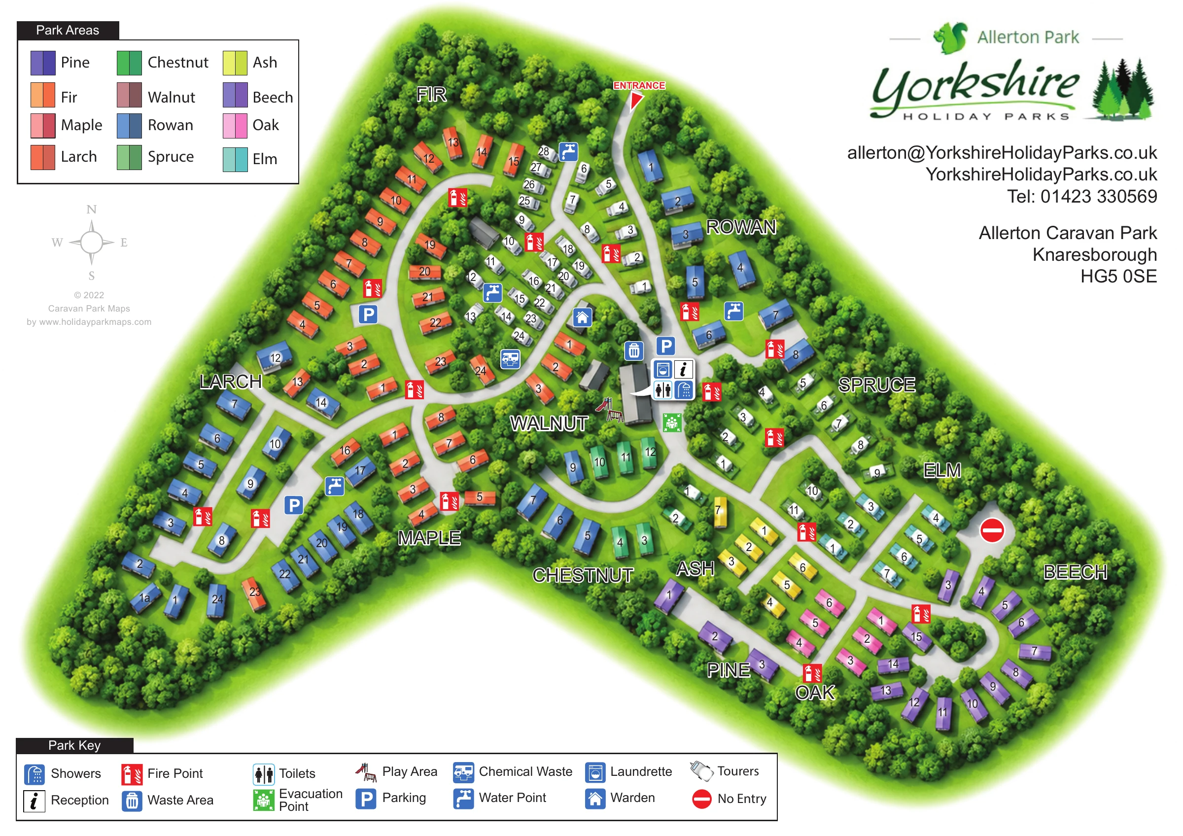
This illustrated map presents Allerton Holiday Park near Knaresborough as a collection of small, tree-lined neighbourhoods connected by a clear network of white roads. The artwork uses the name Allerton Caravan Park and pairs the site plan with Allerton Park and Yorkshire Holiday Parks branding. Its wooded character is expressed through dense green tree canopies around the boundary and between accommodation rows, rather than through a separate landscape inset.
The map brings together fixed caravan-style accommodation, a compact touring section and a central group of visitor facilities. Twelve tree-named areas, including Fir, Rowan, Chestnut and Beech, each have a colour reference in the Park Areas panel. Individual numbers then help visitors locate a particular unit within those groups.
Reception, toilets, showers, laundry, parking and the play area are concentrated around the main junction, while water and fire points appear across the site. The result is a useful sample for woodland parks needing to explain several accommodation neighbourhoods without losing the simplicity of an arrival map.
The single landscape-format plan follows an irregular wooded site, with a narrow northern approach opening into western and south-eastern accommodation areas. A red entrance marker sits at the top of the main road. From here, the route curves between the white touring-caravan symbols and the blue-toned Rowan units before reaching the central reception and service buildings.
Broad white roads form the main visual structure. They loop around the western rows, circle the central accommodation and branch towards Elm, Ash, Oak, Pine and Beech in the south-east. Fixed units sit at varying angles along these roads, using paired colour tones and white number badges. The touring section uses a different, recognisable caravan illustration rather than the coloured rectangular treatment.
At the centre, grey building shapes are accompanied by symbols for reception, toilets, showers and the laundrette. Nearby are the warden location, waste area, parking, an illustrated children's play area and a green evacuation-point marker. Additional parking, water points and red fire-point symbols are distributed around the accommodation groups. Chemical waste disposal is marked beside the touring area, and a no-entry symbol appears on an eastern spur.
Rounded tree canopies provide both a perimeter and internal separation. Large outlined area names remain visible against this planting. The upper-left colour panel explains all twelve tree-named neighbourhoods, while the bottom Park Key explains the facilities. A compass and restrained designer credit sit on the left; branding, contact information and the park title balance the composition on the right. The accompanying enlarged views show portions of this same legend, not additional park sections.
 Enlarge this map ↗
KEEP EXPLORING
Chosen for shared landscapes, accommodation or facilities.
 Explore the map ↗
United Kingdom
Woodland holiday-park map with named accommodation areas, touring loops and illustrated recreation facilities.
 Explore the map ↗
United Kingdom
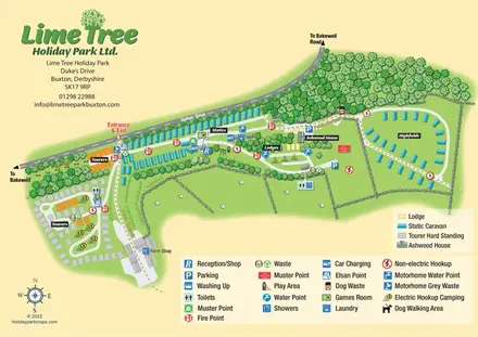
Mixed-accommodation park map with woodland, public footpaths and clearly differentiated service symbols.
 Explore the map ↗
United States
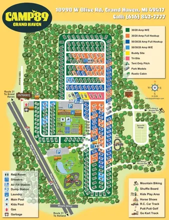
Colour-coded RV pitches, woodland borders and two activity hubs at Camp '89 Grand Haven.
Features may come from the sample artwork, its key or published park information. Approximate numbers describe the drawing and may cover only part of a park. They are intended to help you compare map examples. Current facilities and booking information should be checked with the park.
TAKE A CLOSER LOOK
View the illustrated map in detail or choose a file to download. These are sample maps; contact the park for current visitor information.


LET’S MAP YOUR PARK
For a map quotation, find your park and draw a rough boundary around it. The area you select helps us work out the design time and price.
Draw your park for a quote ↗Or talk to our map designers
01751 473136