
Coastal edge, beach and sea
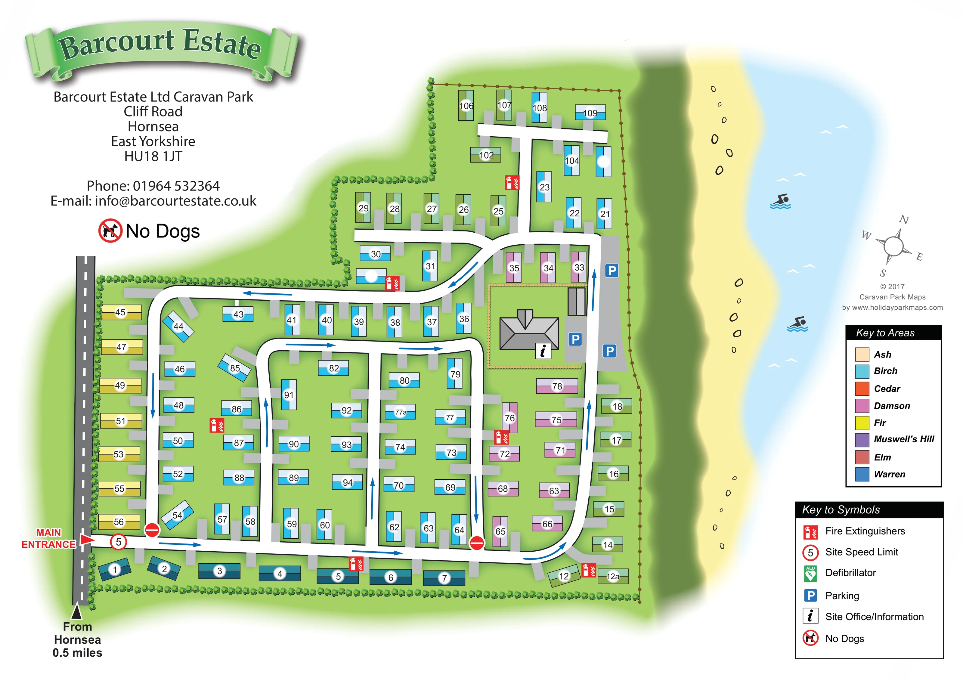
A dark green coastal strip separates the fenced park edge from a pale yellow beach and light blue sea. Pebbles, wave marks and swimmer motifs establish the seaside setting without depicting a specific beach access.
ILLUSTRATED PARK MAP · P400
Hornsea, East Yorkshire · United Kingdom
 Enlarge the map ↗
A SENSE OF THE PLACE
Barcourt Estate Caravan Park is a small, family-run park on Cliff Road in Hornsea. Its East Yorkshire coastal setting and sea views are central to its character.
The park is associated with holiday caravan ownership. The map illustrates the arrangement of homes and access routes, providing a useful overview of a compact coastal site.
LOOK CLOSER
A dark green coastal strip separates the fenced park edge from a pale yellow beach and light blue sea. Pebbles, wave marks and swimmer motifs establish the seaside setting without depicting a specific beach access.
Repeated leafy symbols enclose much of the western, southern and stepped northern boundary; a brown post-and-line fence follows the coastal side.
A grey, roofed building with an information symbol stands beside the eastern internal road, within a small outlined compound.
Several blue parking symbols identify grey areas alongside the eastern road near the office.
Red extinguisher symbols are distributed around the accommodation roads and near the entrance-side and coastal-side rows.
A red arrow and bold label mark the entrance on the western side, leading directly onto the lower internal road.
The external road carries a 'From Hornsea 0.5 miles' directional annotation.
Blue arrows indicate circulation along the main perimeter route and internal loops; red no-entry symbols mark two junctions.
A grey, roofed building with an information symbol stands beside the eastern internal road, within a small outlined compound.
Several blue parking symbols identify grey areas alongside the eastern road near the office.
Red extinguisher symbols are distributed around the accommodation roads and near the entrance-side and coastal-side rows.
A green AED symbol appears in the key, but a corresponding location is not clearly identifiable on the main plan.
A red arrow and bold label mark the entrance on the western side, leading directly onto the lower internal road.
The external road carries a 'From Hornsea 0.5 miles' directional annotation.
Blue arrows indicate circulation along the main perimeter route and internal loops; red no-entry symbols mark two junctions.
A circular sign displaying 5 appears at the entrance and is identified in the legend as the site speed limit.
A dark green coastal strip separates the fenced park edge from a pale yellow beach and light blue sea. Pebbles, wave marks and swimmer motifs establish the seaside setting without depicting a specific beach access.
Repeated leafy symbols enclose much of the western, southern and stepped northern boundary; a brown post-and-line fence follows the coastal side.
The area key lists Ash, Birch, Cedar, Damson, Fir, Muswell’s Hill, Elm and Warren, each with a distinct colour swatch.
A prominent crossed-dog symbol and 'No Dogs' wording appear beneath the contact details and again in the symbol key. This is a notice reproduced in the artwork, not confirmation of a current policy.
READING THE MAP
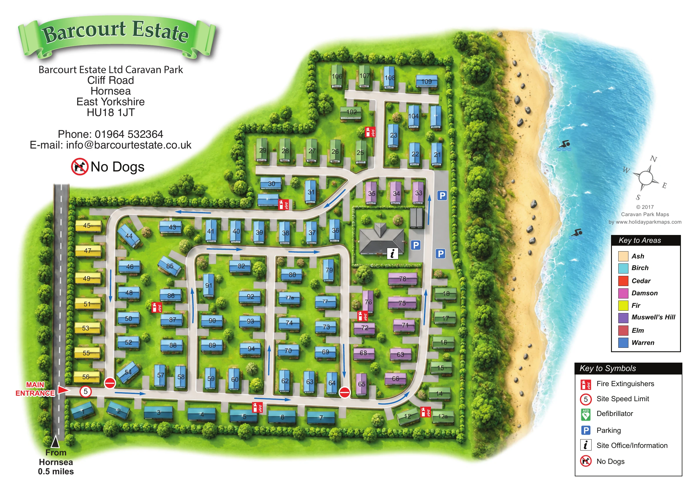
This map of Barcourt Estate Caravan Park places a compact caravan layout beside the beach and sea at Hornsea, East Yorkshire. The coastal setting is immediately apparent: a green boundary strip, pale yellow shore and blue water run down the right-hand side, while the entrance from Cliff Road sits opposite on the left. Between them, numbered caravan symbols and clearly drawn roads explain how the site fits together.
The design combines a practical top-down plan with a few softer illustrative touches. A curled green ribbon carries the park name, rounded foliage marks the boundaries, and small wave and swimmer motifs give the shore a seaside character. Accommodation colours are explained in a separate key of eight named areas, while a second key covers the principal wayfinding and safety symbols.
Blue road arrows, parking markers and the office symbol make this a useful example for caravan parks needing to communicate arrival, internal circulation and individual home locations on one page. The contact block and legends remain outside the busiest part of the plan, keeping the residential layout central to the composition.
The main plan shows a broad southern block of caravans narrowing into a smaller extension at the northern end. The western entrance opens onto a long lower road, which sweeps around the south-eastern corner and continues up the coastal side. Within this outer route, shorter loops and connecting lanes divide the accommodation into manageable rows. Blue arrows show the intended direction of travel, with red no-entry symbols at two internal junctions and a circular 5 speed-limit sign beside the entrance.
Each caravan is represented by a black-outlined rectangle with coloured panels and a white circular number label. Short grey strips connect many units to the roads. The colour key names Ash, Birch, Cedar, Damson, Fir, Muswell’s Hill, Elm and Warren, giving the numbered layout an additional area-based reference system.
Near the eastern road, a larger grey-roofed building carries the site office/information symbol. Blue parking markers identify nearby grey parking areas, and red fire extinguisher symbols recur around the road network. The symbol key also includes a defibrillator entry, although its position is not clearly marked in the plan. A prominent No Dogs notice is part of the original page furniture.
The setting receives almost as much visual attention as the plots. Leafy hedges follow much of the landward boundary, and a brown fence traces the coastal edge. Beyond it, a dark green strip, sandy beach and pale blue sea create a clear visual sequence. A compass rose occupies the open space beside the water. The single landscape-format artwork is supported by enlarged detail views of the same entrance and legend content, rather than separate site sections.
 Enlarge this map ↗
KEEP EXPLORING
Chosen for shared landscapes, accommodation or facilities.
 Explore the map ↗
United Kingdom
Coastal park map with static-caravan rows, touring pitches, a camping field and two leisure clusters.
 Explore the map ↗
United Kingdom
Illustrated coastal holiday-home plan with dense alphanumeric plot labels, orange-roofed amenities, a numbered facility key and beach-side context.
 Explore the map ↗
United Kingdom
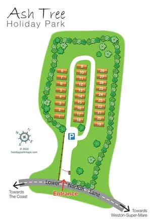
Tree-lined holiday-home park plan with a numbered road loop and clear Lower Norton Lane entrance.
Features may come from the sample artwork, its key or published park information. Approximate numbers describe the drawing and may cover only part of a park. They are intended to help you compare map examples. Current facilities and booking information should be checked with the park.
TAKE A CLOSER LOOK
View the illustrated map in detail or choose a file to download. These are sample maps; contact the park for current visitor information.


LET’S MAP YOUR PARK
For a map quotation, find your park and draw a rough boundary around it. The area you select helps us work out the design time and price.
Draw your park for a quote ↗Or talk to our map designers
01751 473136