
River Manifold
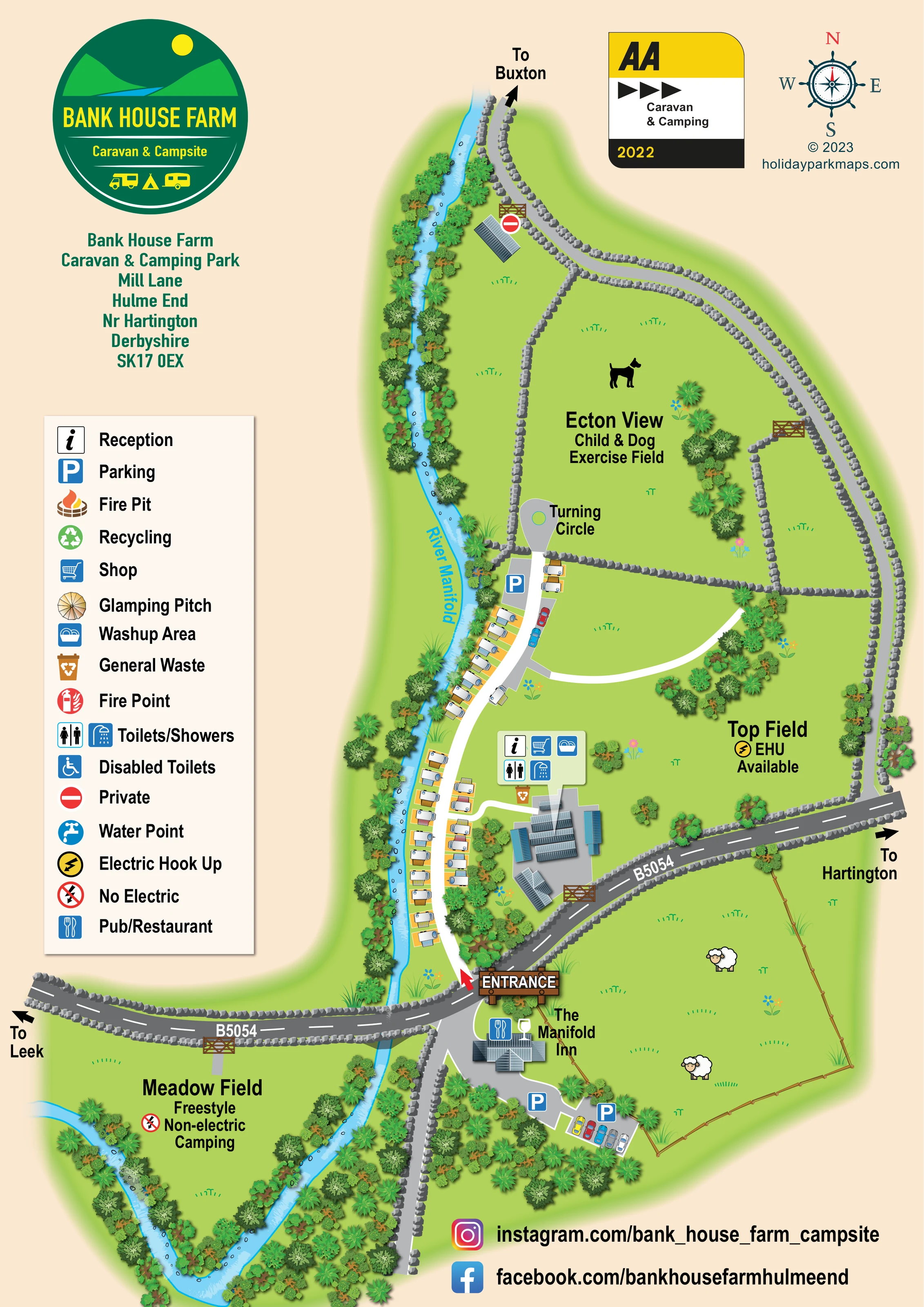
Named blue river runs along the western side of the caravan area, crosses beneath the B5054 and bends around Meadow Field.
ILLUSTRATED PARK MAP · P015
Mill Lane, Hulme End, near Hartington, Derbyshire · United Kingdom
 Enlarge the map ↗
A SENSE OF THE PLACE
Bank House Farm Caravan & Camping Park is based at Mill Lane, Hulme End, near Hartington, Derbyshire. This is a family-run campsite beside the River Manifold at Hulme End in the Peak District.
Free campsite-wide Wi-Fi and two electric-car chargers are advertised. The park provides an onsite food shop, showers with heated floors, family toilets and a covered washing-up area with shared fridges/freezers.
LOOK CLOSER
Named blue river runs along the western side of the caravan area, crosses beneath the B5054 and bends around Meadow Field.
Dense bands of varied tree and shrub symbols follow the river and frame the lower camping field.
Raised grey stone-wall illustrations divide the northern fields and edge the roads. Timber gates mark openings; fenced pasture with sheep illustrations appears beside the inn.
Information symbol in the shared facility callout beside the main building group in Top Field.
Shopping-trolley symbol in the main facility callout.
Toilet and shower symbols locate these facilities at the main building group.
Dishwashing symbol included in the callout for the main facilities.
Brown waste-bin symbol positioned immediately below the main facility callout.
Information symbol in the shared facility callout beside the main building group in Top Field.
Shopping-trolley symbol in the main facility callout.
Toilet and shower symbols locate these facilities at the main building group.
Dishwashing symbol included in the callout for the main facilities.
Brown waste-bin symbol positioned immediately below the main facility callout.
Blue parking symbols mark an area near the northern turning circle and parking beside The Manifold Inn.
Named neighbouring inn south of the B5054, illustrated with a pub/restaurant symbol and a glass motif.
Top Field is labelled 'EHU Available' with the yellow electrical symbol.
Large stone-walled field north of Top Field, identified by its name, stated use and dog silhouette.
Named blue river runs along the western side of the caravan area, crosses beneath the B5054 and bends around Meadow Field.
Dense bands of varied tree and shrub symbols follow the river and frame the lower camping field.
Raised grey stone-wall illustrations divide the northern fields and edge the roads. Timber gates mark openings; fenced pasture with sheep illustrations appears beside the inn.
Wooden entrance sign and red arrow identify the access from the B5054 into the riverside caravan lane.
The internal lane follows the caravan rows northwards to a labelled turning circle. White route lines branch towards the facilities and across Top Field.
The B5054 is labelled across the plan, with directions to Leek and Hartington. A separate northern lane is marked towards Buxton.
A red no-entry-style symbol, defined as 'Private' in the legend, marks the gated northern building area.
Listed in the key with a wheelchair symbol; a separate position is not identifiable on the plan.
Tap symbol appears in the legend without a clearly identifiable placement on the plan.
Recycling is included in the key, but its location is not clearly marked in the illustrated site.
Separate fire-pit and fire-point symbols are explained in the legend; no specific locations are clearly identifiable.
A circular tent illustration is labelled 'Glamping Pitch' in the key, without a clearly mapped pitch location.
Operator information advertises campsite-wide Wi-Fi and two electric-car chargers; these are not located on the map.
Operator information describes heated shower floors, family toilets and a covered washing-up area with shared fridges/freezers.
READING THE MAP
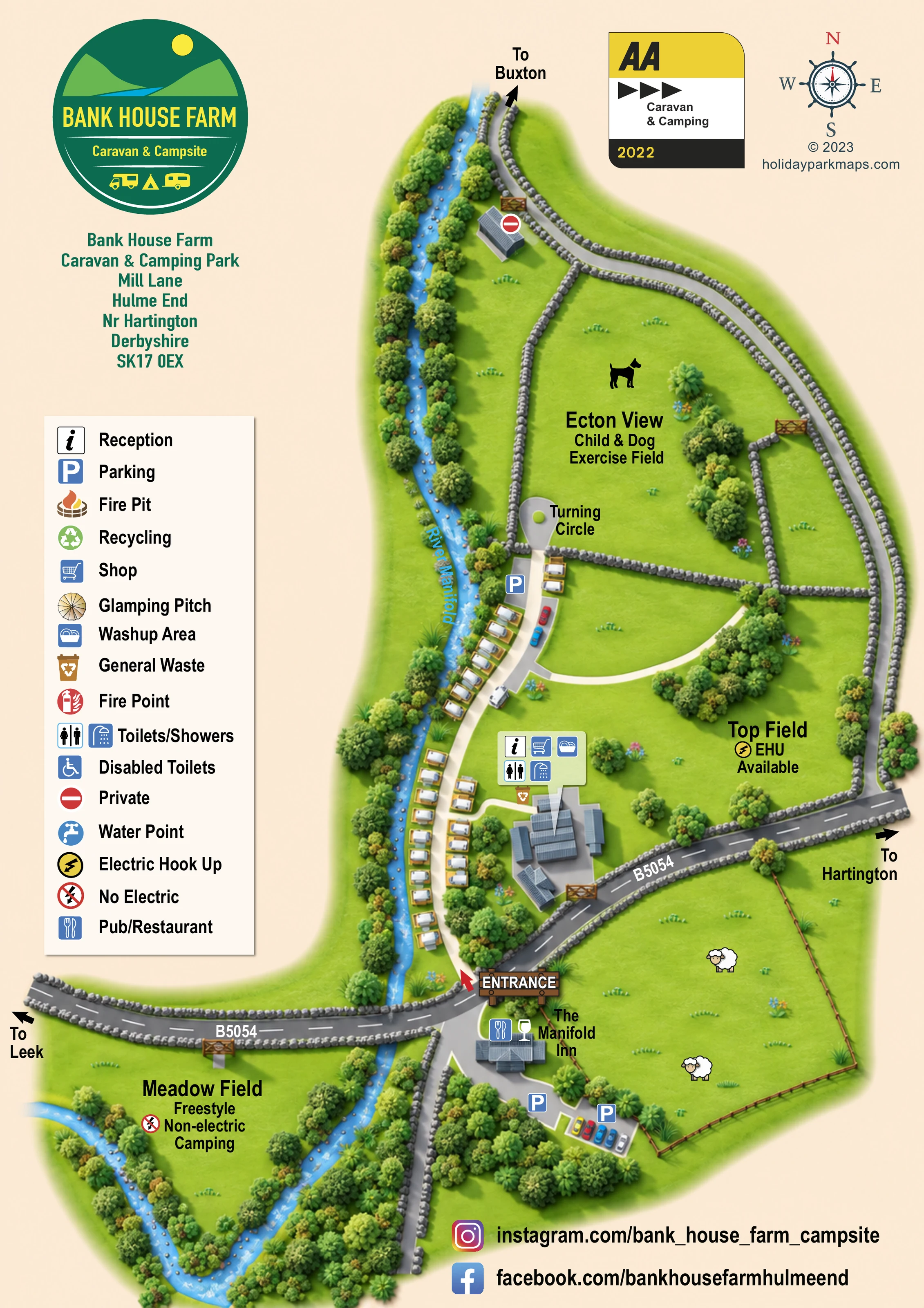
The River Manifold gives this illustrated map of Bank House Farm Caravan & Camping Park its shape and character. Set at Hulme End near Hartington in Derbyshire, the campsite is presented as a series of green fields, with touring caravans following a narrow riverside lane and a separate camping meadow tucked into a broad river bend.
The portrait design makes the different areas easy to distinguish. Top Field is labelled with electric hook-up availability, Meadow Field is identified as freestyle non-electric camping, and Ecton View is set apart as a child and dog exercise field. The B5054 crosses the composition, linking the entrance with directions towards Leek and Hartington, while The Manifold Inn provides a recognisable neighbouring landmark.
Illustrated stone walls, timber gates, roof details and densely planted riverbanks establish the rural setting without obscuring the principal routes. A large park logo, clear symbol key and grouped reception, shop and washroom callout give the page a practical visitor-information structure. It is a useful example of campsite mapping where named fields and landscape relationships matter more than numbered pitches.
The plan is organised around the River Manifold, drawn as a bright blue ribbon down the western side of the main campsite before curving around Meadow Field. Tree and shrub illustrations follow both banks, making the river corridor one of the page's strongest visual features. Raised grey stone walls outline the fields and roads, with timber gates marking openings.
The main entrance sits on the B5054 and is emphasised by a wooden sign and red arrow. From here, the internal lane runs north beside rows of touring caravans, each drawn with a coloured awning on a yellow pitch pad. A labelled turning circle and parking area terminate the route near the boundary of Ecton View. White branching routes connect the caravan area to the main buildings and extend across the open ground of Top Field.
A pale-green callout groups reception, shop, washing-up, toilet and shower symbols beside the service buildings, with a general-waste symbol below. Top Field carries an electric-hook-up label, while the large field to its north is named Ecton View Child & Dog Exercise Field. South of the public road, Meadow Field is explicitly described as freestyle non-electric camping. The Manifold Inn and its parking are illustrated on the opposite side of the river, beside fenced pasture containing sheep motifs.
The left-hand legend explains the symbol system, including several entries without clearly marked locations, such as glamping pitches, water points and fire facilities. Direction arrows towards Buxton, Leek and Hartington provide wider orientation. The single portrait artwork is completed by the park's circular logo, address block, AA badge, compass and social-media footer.
 Enlarge this map ↗
KEEP EXPLORING
Chosen for shared landscapes, accommodation or facilities.
 Explore the map ↗
United Kingdom
Riverside park map with named pitch fields, illustrated huts and a paw-print dog walk.
 Explore the map ↗
United Kingdom
Illustrated farm campsite map with touring pitches, pods, camping fields and a riverside dog-walk route.
 Explore the map ↗
United Kingdom
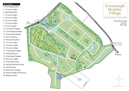
Numbered lodge and cottage areas, golf, ponds and shared facilities on a landscaped Goosnargh site plan.
Features may come from the sample artwork, its key or published park information. Approximate numbers describe the drawing and may cover only part of a park. They are intended to help you compare map examples. Current facilities and booking information should be checked with the park.
LET’S MAP YOUR PARK
For a map quotation, find your park and draw a rough boundary around it. The area you select helps us work out the design time and price.
Draw your park for a quote ↗Or talk to our map designers
01751 473136