
Clifftop grassland and sea
An elongated pale-green recreation area follows an irregular darker-green coastal edge, with a broad light-blue sea field beyond.
ILLUSTRATED PARK MAP · P412
Filey, North Yorkshire · United Kingdom
 Enlarge the map ↗
A SENSE OF THE PLACE
Blue Dolphin is Haven's clifftop holiday park near Filey on the North Yorkshire coast. Caravan holidays and a broad range of activities make it a family-focused base for the seaside.
Indoor and outdoor pools, a water slide and a fishing lake provide recreation on the park. The indoor SportsDrome offers further activities, including climbing and roller skating, while Filey's beach is a destination for time away from the site.
LOOK CLOSER
An elongated pale-green recreation area follows an irregular darker-green coastal edge, with a broad light-blue sea field beyond.
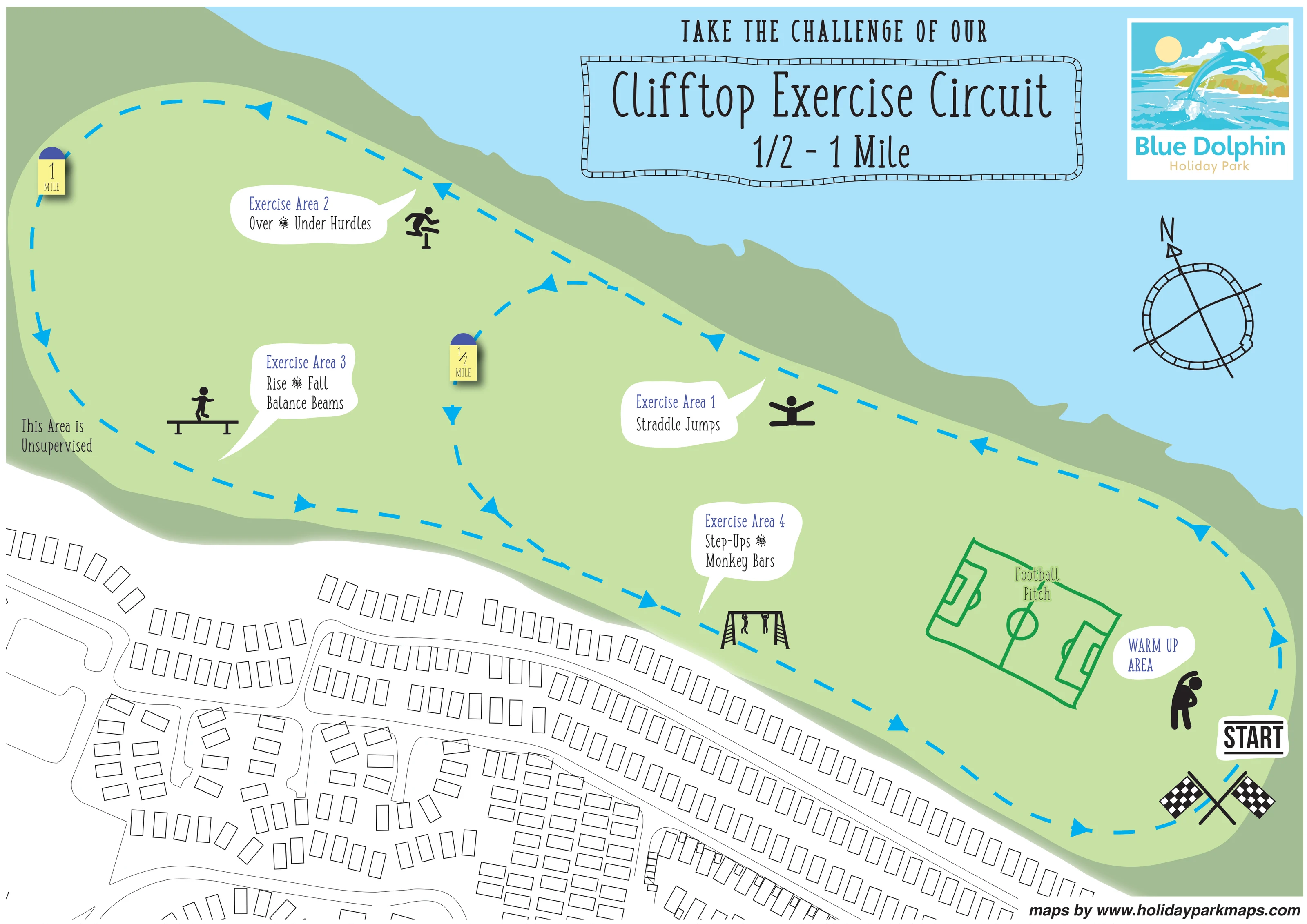
The title identifies a 1/2–1 mile circuit. A cyan dashed outer loop and an internal shortcut depict the route choices, with arrowheads indicating direction.
A bold START label and crossed chequered flags mark the beginning of the circuit at the lower-right end of the grassed area.
A labelled warm-up area with a stretching-person pictogram sits beside the start and football pitch.
A white callout and black exercise pictogram identify the straddle-jump station on the sea-facing side of the circuit.
The hurdle station is labelled towards the upper-left portion of the outer circuit, accompanied by a hurdling-person symbol.
The balance-beam station occupies the left-hand portion of the exercise area, with a figure balancing on a beam.
A callout identifies step-ups and monkey bars beside the lower route, illustrated with a climbing frame and hanging figures.
The title identifies a 1/2–1 mile circuit. A cyan dashed outer loop and an internal shortcut depict the route choices, with arrowheads indicating direction.
A bold START label and crossed chequered flags mark the beginning of the circuit at the lower-right end of the grassed area.
A labelled warm-up area with a stretching-person pictogram sits beside the start and football pitch.
A white callout and black exercise pictogram identify the straddle-jump station on the sea-facing side of the circuit.
The hurdle station is labelled towards the upper-left portion of the outer circuit, accompanied by a hurdling-person symbol.
The balance-beam station occupies the left-hand portion of the exercise area, with a figure balancing on a beam.
A callout identifies step-ups and monkey bars beside the lower route, illustrated with a climbing frame and hanging figures.
A large green pitch diagram with goal areas, halfway line and centre circle sits inside the right-hand end of the circuit.
Yellow marker illustrations with purple rounded tops distinguish the half-mile shortcut and the longer outer loop.
An elongated pale-green recreation area follows an irregular darker-green coastal edge, with a broad light-blue sea field beyond.
Thin outlined roads curve between caravan rows along the lower edge, providing local context without identifying a park entrance or a named connection to the circuit.
READING THE MAP
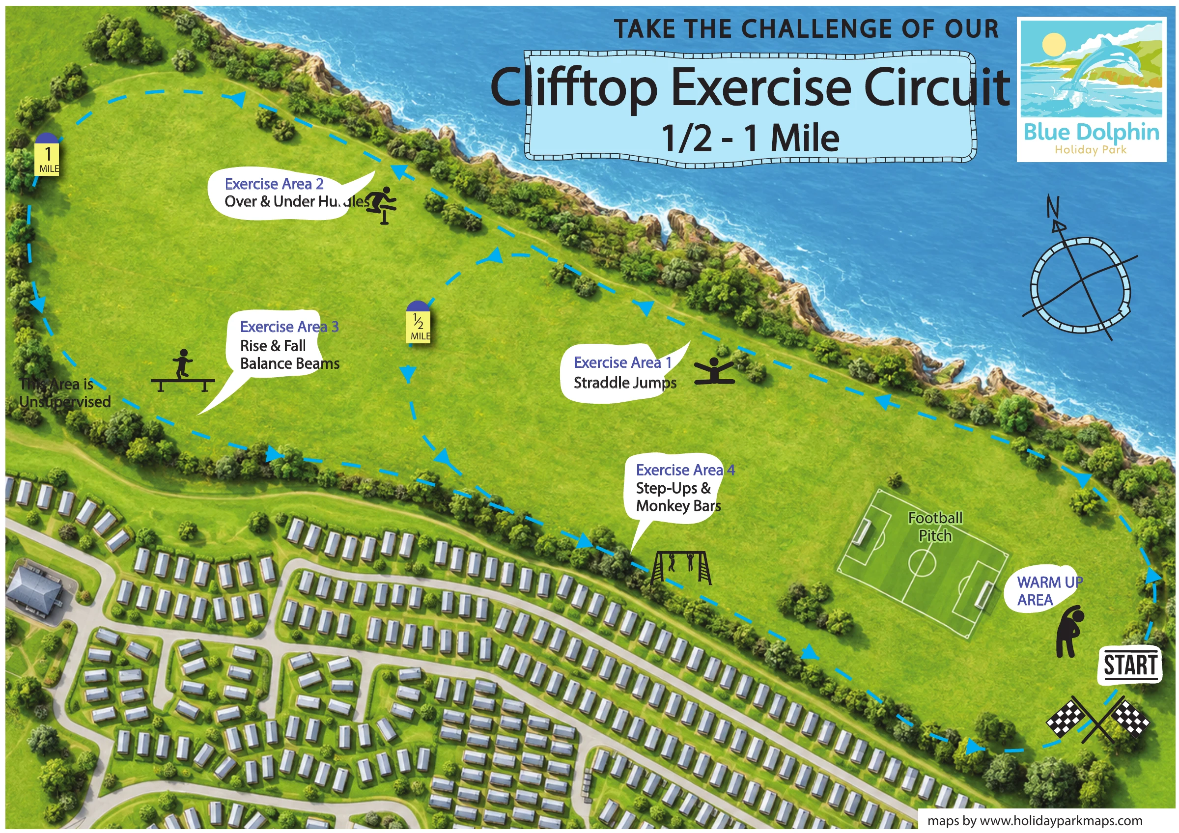
This Blue Dolphin Holiday Park sample focuses on a clifftop exercise circuit rather than the whole holiday park. Set against the North Yorkshire coast near Filey, the artwork turns an elongated grassed recreation area into a clear activity map, with the sea above and a lightly drawn caravan layout below. A bright cyan dashed route links four named exercise stations, while a shortcut distinguishes the half-mile option from the longer one-mile loop.
The map shows a marked start beside a warm-up area and football pitch. White speech-bubble labels identify straddle jumps, hurdles, balance beams, step-ups and monkey bars, each paired with a simple black pictogram. Large directional arrows and coloured distance markers carry the main wayfinding information without requiring a separate key.
For a sample gallery, this is a useful example of a focused visitor map: it gives one outdoor activity its own visual hierarchy, retaining just enough surrounding park detail to place the route in context.
The single landscape artwork is arranged around a long, pale-green clifftop recreation strip. Its irregular coastal edge runs diagonally beneath a broad light-blue sea field, while the lower portion of the page shows unnumbered caravan footprints and curving park roads in fine monochrome linework. This contrast keeps the exercise area prominent without removing its relationship to the accommodation nearby.
At the lower-right end, a bold START label and crossed chequered flags introduce the circuit. A stretching-person symbol marks the adjacent warm-up area, and a large green football-pitch diagram occupies the grass immediately to its left. The cyan dashed route follows the perimeter of the open space, with repeated arrowheads showing the illustrated direction. An internal curved link creates the shorter option, identified by a half-mile marker; a matching one-mile marker appears near the far-left end of the outer loop.
Four white callouts identify the activity stations. Exercise Area 1 names straddle jumps on the coastal side. Exercise Area 2 marks over and under hurdles towards the upper left, and Exercise Area 3 identifies rise and fall balance beams below it. Exercise Area 4 labels step-ups and monkey bars beside the lower section of the route. Each station has a black exercise or equipment pictogram, making the activities recognisable alongside their written names. The artwork also includes an unsupervised-area notice on the left.
Above the route, the oversized circuit title sits within a playful segmented border. The Blue Dolphin logo and a stylised north compass complete the upper-right composition. The result is a self-contained activity plan, not a full accommodation or facilities directory.
 Enlarge this map ↗
KEEP EXPLORING
Chosen for shared landscapes, accommodation or facilities.
 Explore the map ↗
United Kingdom
Coastal park map with static-caravan rows, touring pitches, a camping field and two leisure clusters.
 Explore the map ↗
United Kingdom
Illustrated coastal holiday-home plan with dense alphanumeric plot labels, orange-roofed amenities, a numbered facility key and beach-side context.
 Explore the map ↗
United Kingdom
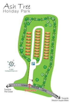
Tree-lined holiday-home park plan with a numbered road loop and clear Lower Norton Lane entrance.
Features may come from the sample artwork, its key or published park information. Approximate numbers describe the drawing and may cover only part of a park. They are intended to help you compare map examples. Current facilities and booking information should be checked with the park.
TAKE A CLOSER LOOK
View the illustrated map in detail or choose a file to download. These are sample maps; contact the park for current visitor information.


LET’S MAP YOUR PARK
For a map quotation, find your park and draw a rough boundary around it. The area you select helps us work out the design time and price.
Draw your park for a quote ↗Or talk to our map designers
01751 473136