
Wooded approach and tree clusters
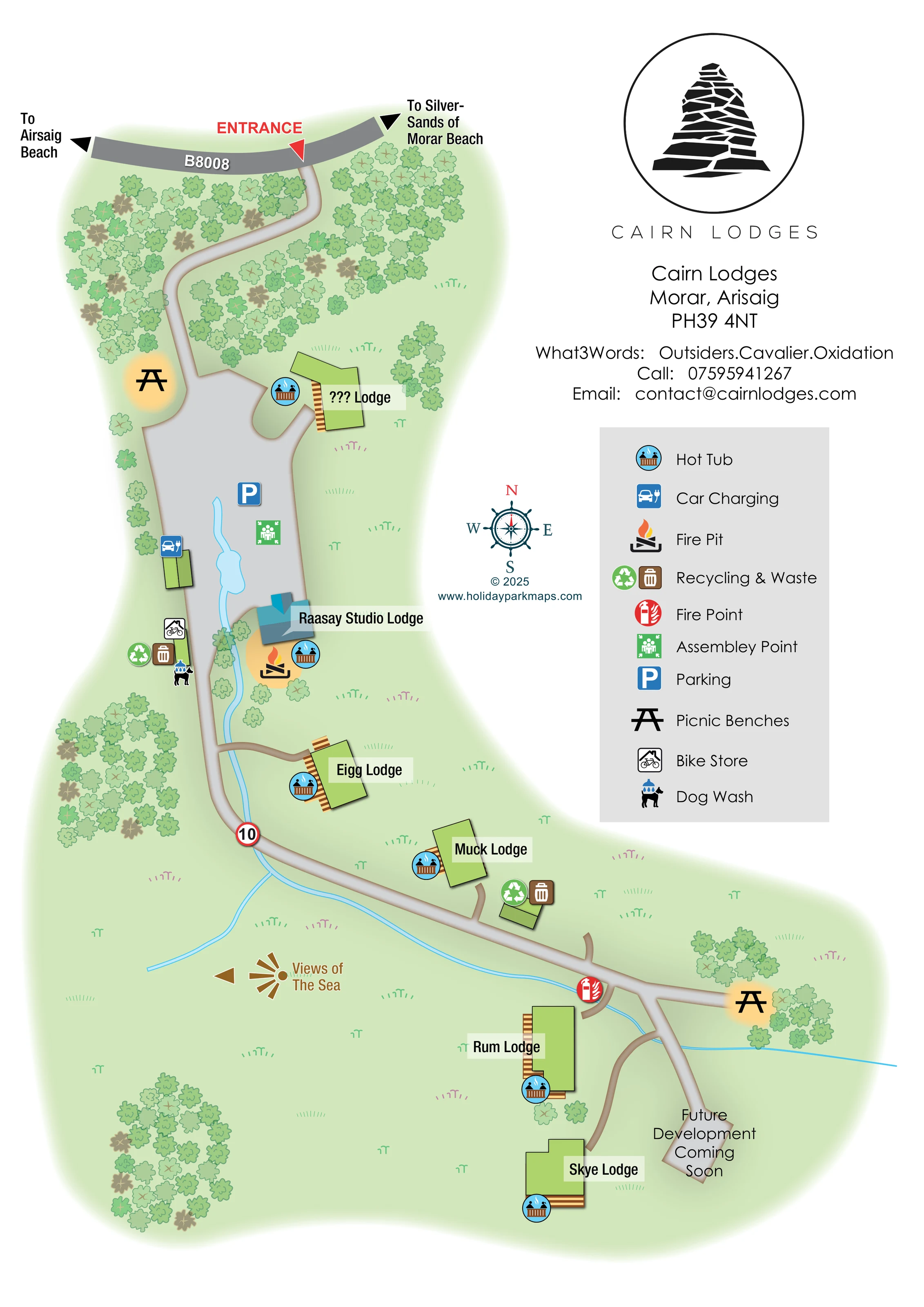
Dense illustrated trees frame the entrance drive, with smaller woodland groups scattered around the open grounds.
ILLUSTRATED PARK MAP · P055
Cairn Lodges, Morar, Arisaig · United Kingdom
 Enlarge the map ↗
A SENSE OF THE PLACE
Cairn Lodges offers self-catering accommodation on a Highland hillside near Morar and Arisaig. Several lodges have views towards Eigg, Rum and Skye, with the beaches around the Silver Sands of Morar adding to the setting.
Individually designed properties cater for different group sizes and include private hot tubs. The map helps guests understand the position of each lodge within the hillside grounds and its relationship to the coast.
LOOK CLOSER
Dense illustrated trees frame the entrance drive, with smaller woodland groups scattered around the open grounds.
An unnamed pale-blue watercourse, widened locally near the parking area, follows part of the central route and branches across the lower grounds.
A brown viewing graphic and west-facing arrow identify the direction of sea views; the sea itself is not drawn.
A southern road extension ends at an area labelled 'Future Development Coming Soon', separate from the illustrated lodges.
Blue circular hot-tub symbols appear beside the accommodation buildings.
A car-and-plug symbol marks charging beside a small structure on the western edge of the main parking area.
A flame-and-logs symbol marks a fire pit beside Raasay Studio Lodge, within a warm yellow highlighted area.
Paired green recycling and brown waste symbols appear beside the central service area and near Muck Lodge.
Blue circular hot-tub symbols appear beside the accommodation buildings.
A car-and-plug symbol marks charging beside a small structure on the western edge of the main parking area.
A flame-and-logs symbol marks a fire pit beside Raasay Studio Lodge, within a warm yellow highlighted area.
Paired green recycling and brown waste symbols appear beside the central service area and near Muck Lodge.
A red fire-point symbol is positioned at the lower road junction near the branch to Rum Lodge.
A green assembly-point symbol sits within the main grey parking and arrival area.
A broad grey area below the wooded entrance approach carries a blue parking symbol.
Black picnic-table symbols with yellow halos mark locations near the upper arrival area and the eastern end of the lower road.
A bicycle-in-building symbol marks storage along the western side of the central access route.
A dog beneath a shower symbol appears in the central service cluster beside the bike store and waste facilities.
Dense illustrated trees frame the entrance drive, with smaller woodland groups scattered around the open grounds.
An unnamed pale-blue watercourse, widened locally near the parking area, follows part of the central route and branches across the lower grounds.
A brown viewing graphic and west-facing arrow identify the direction of sea views; the sea itself is not drawn.
The public road crosses the top of the plan, with a red entrance label and triangular pointer marking the turn into the grounds.
Black arrows at opposite ends of the B8008 point towards Arisaig Beach and the Silver Sands of Morar Beach. These are off-map destinations.
A single curving drive connects the entrance, main parking area and lower grounds, with short branches serving individual lodges.
A red-ringed sign bearing 10 appears on the internal route below Eigg Lodge.
A southern road extension ends at an area labelled 'Future Development Coming Soon', separate from the illustrated lodges.
READING THE MAP
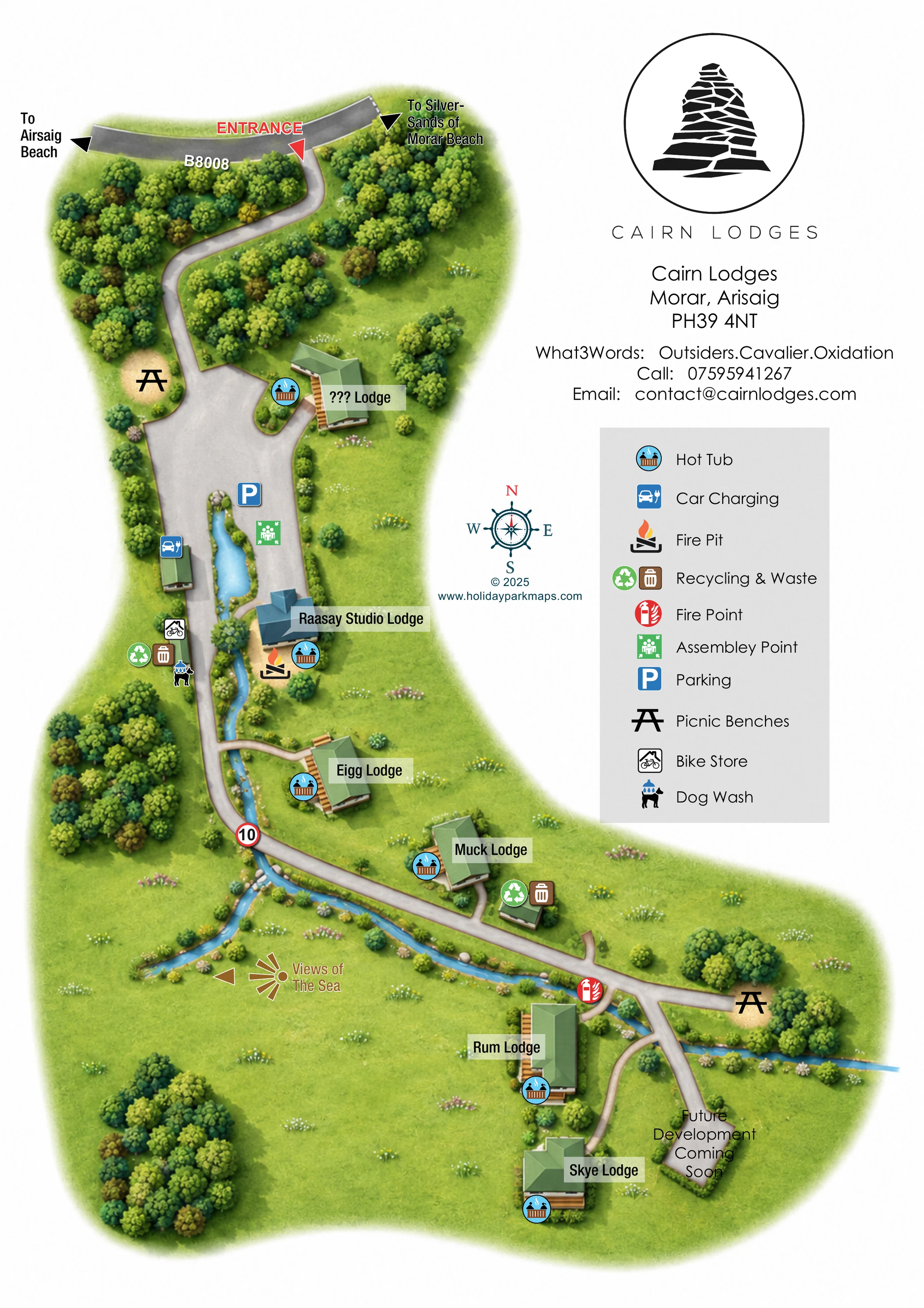
This illustrated map presents Cairn Lodges as a small, spacious lodge retreat near Morar and Arisaig in the Scottish Highlands. A winding entrance drive leads from the B8008 through a belt of trees before opening into the parking area and the more widely spaced accommodation below. Rather than relying on numbered plots, the design gives each lodge a clear name label and shows its relationship to the main route, neighbouring trees and the blue watercourse running through the grounds.
The coastal setting is communicated through arrows towards Arisaig Beach and the Silver Sands of Morar, together with a separate sea-view direction marker. Hot-tub symbols beside the lodges sit alongside practical visitor information, including car charging, recycling and waste points, a bike store and a dog wash. Picnic benches and a fire pit add further detail to the outdoor spaces.
A large black cairn logo, generous white space and a neatly separated symbol key give the portrait page a clear hierarchy. It is a useful example of a map designed for individually named accommodation in a landscape-led setting.
The single portrait plan begins with the B8008 across its upper edge. A red entrance pointer marks the turn into Cairn Lodges, while black arrows indicate the directions towards the two beach destinations. Below the road, a curving grey drive threads through dense illustrated woodland and enters a broad parking area. Parking, car charging and an assembly point are marked here, with a picnic bench just above the arrival space.
The upper accommodation building has a hot-tub symbol and a pale label panel. Further down, Raasay Studio Lodge stands out through its angular blue-grey roof treatment. A fire pit is illustrated beside it, while the opposite side of the route contains a compact service cluster for bike storage, dog washing, recycling and waste. A narrow blue watercourse passes through this central area and continues beside the drive.
The route then bends past Eigg Lodge and Muck Lodge, each shown as a separate green building with timber-coloured decking and a hot-tub symbol. A red-ringed 10 marker appears on this stretch. At the lower junction, the map places a fire point beside the branch towards Rum Lodge. Skye Lodge occupies a separate position farther south, and another branch leads to the area labelled for future development. A second picnic-bench symbol sits among trees to the east.
Open pale-green ground, scattered tree groups and small grass marks keep the spaces between buildings legible. A westward sea-view graphic supplies landscape context without extending the drawing to the coast. On the right, the cairn branding, address and contact block sit above a ten-item facility legend. A decorative compass completes the orientation information.
 Enlarge this map ↗
KEEP EXPLORING
Chosen for shared landscapes, accommodation or facilities.
 Explore the map ↗
United Kingdom
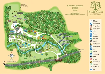
A woodland-valley park map combining named glamping stays, numbered pitches, riverside lodges and footprint-marked walking routes.
 Explore the map ↗
United Kingdom
Illustrated coastal campsite plan with named fields, electric pitch colours, beach routes and the Afon Hen.
 Explore the map ↗
United Kingdom
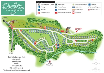
Woodland-framed caravan park plan with numbered and lettered units, a central play area and routes towards Aberporth’s village and sea.
Features may come from the sample artwork, its key or published park information. Approximate numbers describe the drawing and may cover only part of a park. They are intended to help you compare map examples. Current facilities and booking information should be checked with the park.
LET’S MAP YOUR PARK
For a map quotation, find your park and draw a rough boundary around it. The area you select helps us work out the design time and price.
Draw your park for a quote ↗Or talk to our map designers
01751 473136