
Beach and rock pools
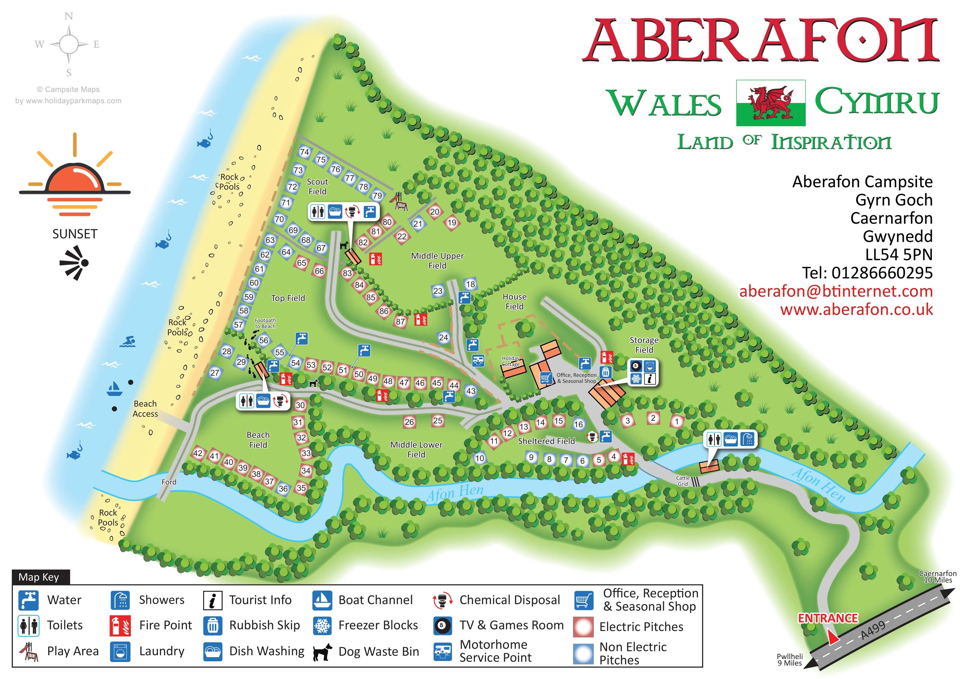
A long beach runs along the western side of the campsite, with rock pools labelled at several points.
Beach, river and woodland — brought together in a welcoming, easy-to-follow park map.
 Explore the map
Named fields, clear pitch colours and familiar landmarks. Made to help guests find their way.
View map PDF · 4.7 MB ↗MEET ABERAFON
Aberafon Campsite lies between the beach and Gyrn Goch mountain near Caernarfon. Sheltered valley grounds create a distinctive setting for a coastal camping break.
The operator's published information lists electric connections, showers, laundry, washing-up facilities and water and waste-disposal points. A holiday cottage or bungalow offers an alternative to camping, while the map shows the arrangement of the grounds.
 Enlarge this map ↗
Show us the area to map and we can work out a quote for your park.
LOOK CLOSER
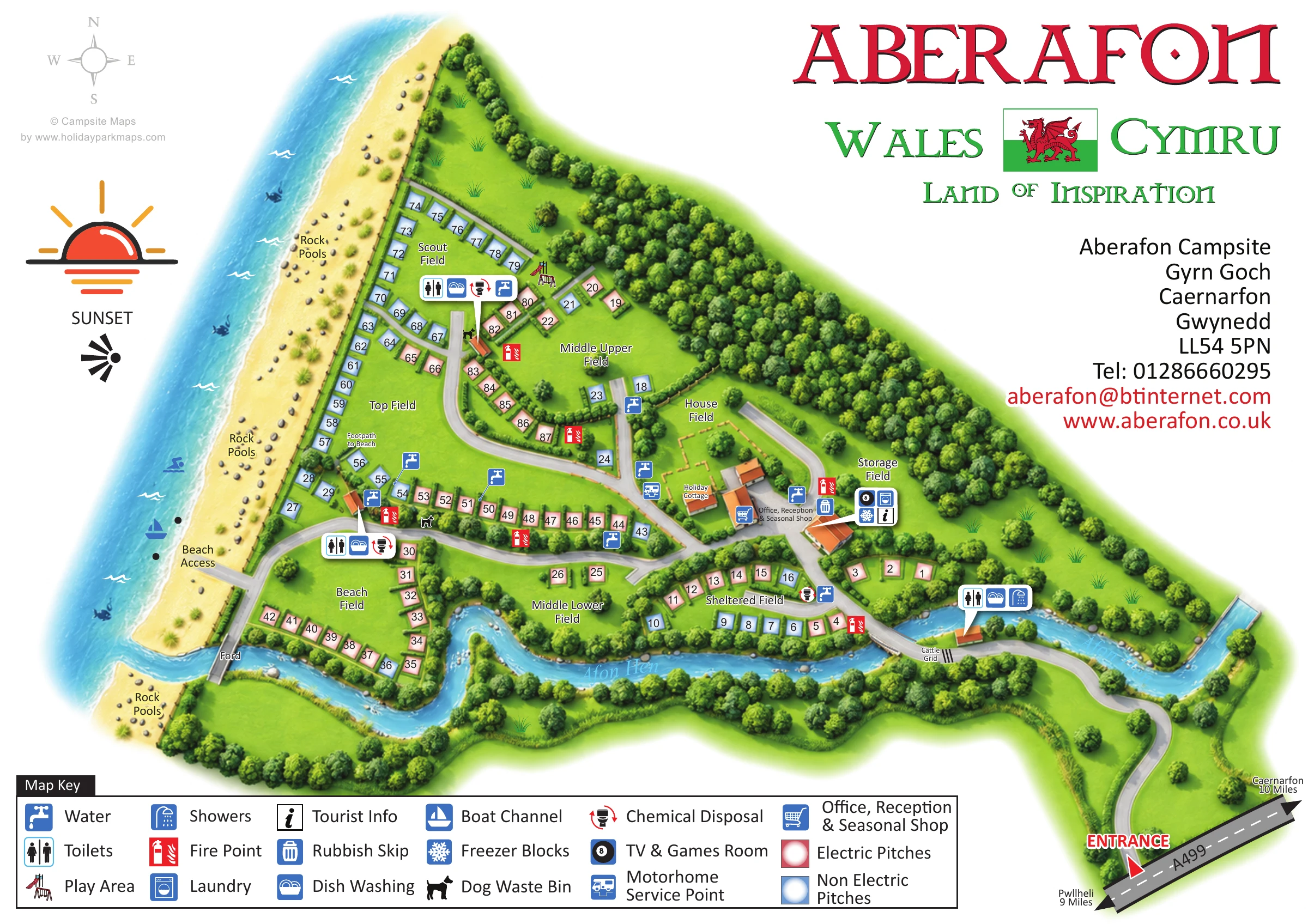
A long beach runs along the western side of the campsite, with rock pools labelled at several points.
The named river winds along the lower edge of the camping fields before reaching the shore.
Dense tree symbols form the inland boundary, line the river and divide the named camping fields.
Beach Field, Top Field, Scout Field, Middle Upper Field, Middle Lower Field and Sheltered Field organise the camping grounds; House Field and Storage Field are also labelled.
A prominent sunset graphic sits beside the coast, while a compass rose gives north, south, east and west.
Labelled central building beside the main internal route, with a shopping-trolley symbol.
Toilet facilities are indicated near Scout Field, Beach Field and the entrance-side river crossing. The entrance-side cluster also carries a shower symbol.
Dish-washing symbols appear in the facility callouts near Scout Field, Beach Field and the entrance-side crossing.
Labelled central building beside the main internal route, with a shopping-trolley symbol.
Toilet facilities are indicated near Scout Field, Beach Field and the entrance-side river crossing. The entrance-side cluster also carries a shower symbol.
Dish-washing symbols appear in the facility callouts near Scout Field, Beach Field and the entrance-side crossing.
Blue tap symbols are distributed along pitch rows and internal routes, with leader lines clarifying some positions.
Chemical-disposal symbols appear at the Scout Field and Beach Field service clusters and beside Sheltered Field.
A motorhome service symbol is placed beside the central route near House Field and the cottage area.
The laundry symbol is grouped with other visitor facilities beside the reception buildings.
An eight-ball symbol in the reception-area callout identifies the TV and games room.
An information symbol is included in the facility callout beside reception.
A snowflake symbol in the reception-area callout denotes freezer blocks.
A small illustrated play structure sits at the inland edge of Scout Field.
A rubbish-skip symbol appears beside reception; black dog symbols identify dog-waste bins at several points within the grounds.
Repeated red extinguisher symbols mark fire points beside accommodation areas and the central facilities.
Red square pitch markers denote electric pitches and blue square markers denote non-electric pitches.
A long beach runs along the western side of the campsite, with rock pools labelled at several points.
The named river winds along the lower edge of the camping fields before reaching the shore.
Dense tree symbols form the inland boundary, line the river and divide the named camping fields.
Beach Field, Top Field, Scout Field, Middle Upper Field, Middle Lower Field and Sheltered Field organise the camping grounds; House Field and Storage Field are also labelled.
A red entrance pointer marks access from the A499 at the lower right, with road arrows towards Caernarfon and Pwllheli.
The arrival road crosses the river beside a labelled cattle grid before reaching the internal facilities and pitch areas.
A broad beach-access spur leads from the western internal road to the shore. A separate footprint-marked footpath is labelled near Top Field, and a ford is marked at the river crossing beside Beach Field.
A blue sailing-boat symbol between two dark markers identifies the boat channel offshore from the beach-access area.
A prominent sunset graphic sits beside the coast, while a compass rose gives north, south, east and west.
READING THE MAP
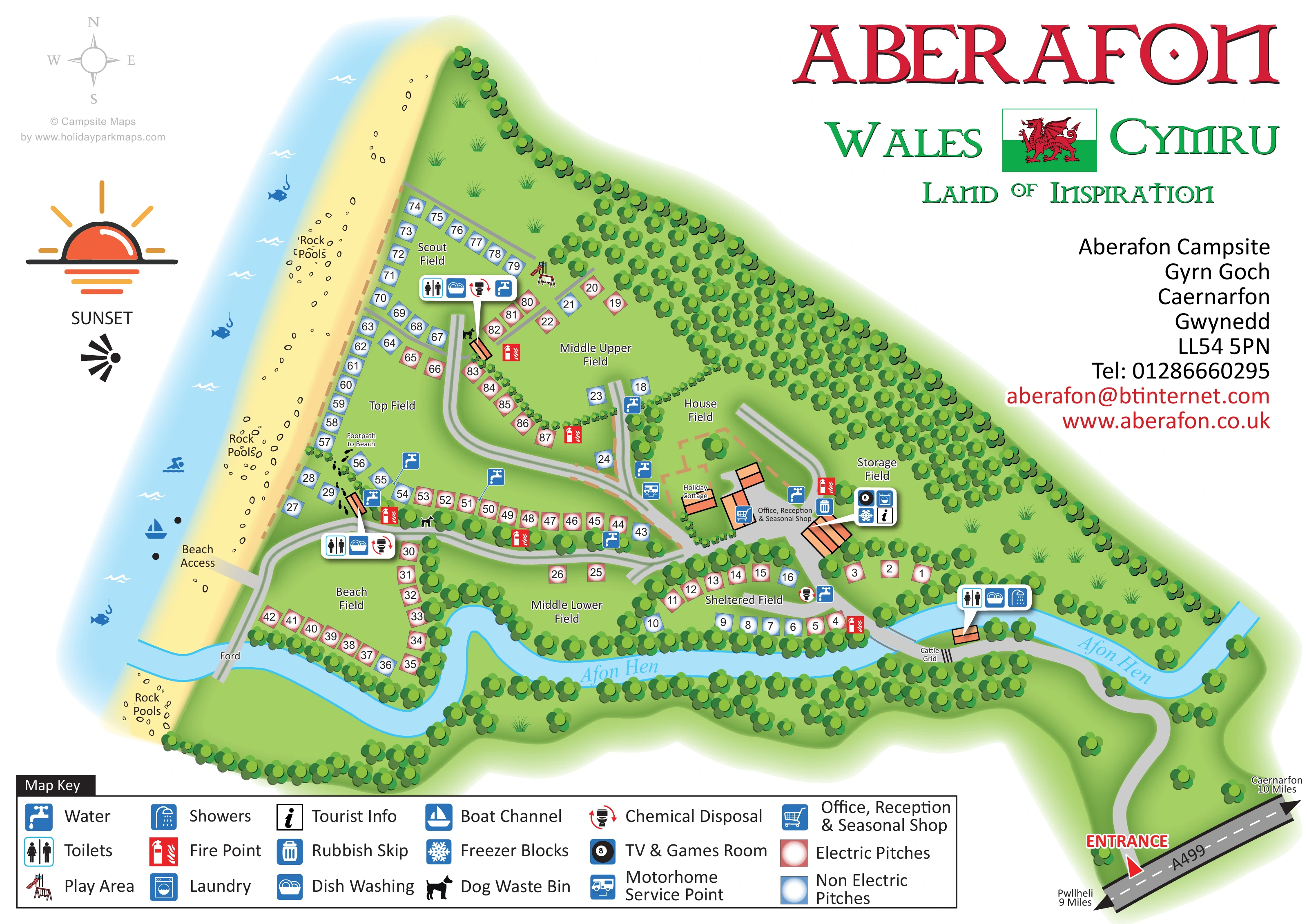
This illustrated map of Aberafon Campsite places its coastal setting at the centre of the design. The beach runs down the left-hand side, the Afon Hen curves around the lower camping fields, and belts of trees separate the pitches from the wooded inland boundary. Named areas such as Beach Field, Scout Field and Sheltered Field give visitors an easy way to understand the grounds before looking for an individual pitch.
The plan shows approximately 90 marked pitches, using red and blue squares to distinguish electric and non-electric options. Reception, the seasonal shop and a holiday cottage sit near the middle of the site, while facility symbols identify washing areas, water points, waste disposal and other visitor services. Routes from the A499 entrance lead through the grounds towards the beach, with a ford, cattle grid and separate beach footpath adding useful local detail.
Large Welsh-themed lettering, a flag and a sunset illustration give the page a strong sense of place. It is a useful example of campsite mapping that combines practical pitch finding with a clear picture of the surrounding landscape.
The single landscape-format plan follows Aberafon's irregular coastal footprint rather than imposing a rectangular site diagram. Pale blue sea and a yellow beach occupy the western edge, with rock pools labelled along the shore. The Afon Hen winds across the lower part of the map, enclosing tree-lined camping areas before meeting the coast. Dense woodland symbols form the inland boundary and divide the grounds into smaller, recognisable fields.
The entrance is marked on the A499 at the lower right. A curved approach crosses the river beside a labelled cattle grid, then leads towards the office, reception and seasonal shop. From here, grey internal lanes branch between Sheltered Field, Middle Lower Field, House Field and the upper camping areas. Numbered red and blue squares follow road edges and field boundaries, distinguishing electric from non-electric pitches. The holiday cottage is shown separately beside reception within a dashed enclosure.
Facility callouts identify toilets and dish washing near Scout Field and Beach Field, and toilets, dish washing and showers near the entrance-side crossing. The reception-area group includes laundry, a TV and games room, tourist information and freezer blocks. Water points, fire points, chemical disposal, dog-waste bins, a rubbish skip and a motorhome service point are also marked. A small play structure sits beside Scout Field.
On the coast, a broad beach-access spur and a footprint-marked footpath provide distinct wayfinding cues. A ford is labelled beside Beach Field, and a boat-channel symbol appears offshore. The bottom legend explains the visual system, while the upper-right title, Welsh flag and contact block balance the illustrated site. The enlarged detail view shows the same artwork, making the coastal labels and legend easier to read rather than adding another site section.
KEEP EXPLORING
Chosen for shared landscapes, accommodation or facilities.
 Explore the map ↗
United Kingdom
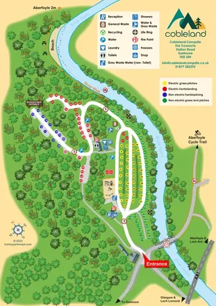
Colour-coded camping pitches, woodland routes and River Forth frontage at Cobleland Campsite.
 Explore the map ↗
United Kingdom
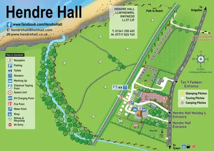
Coastal camping, touring and glamping map with a railway-side layout, beach path and illustrated rural surroundings.
 Explore the map ↗
United Kingdom
A tree-framed mixed-accommodation park map with a central green, service icons and coastal walking connections.
Features may come from the sample artwork, its key or published park information. Approximate numbers describe the drawing and may cover only part of a park. They are intended to help you compare map examples. Current facilities and booking information should be checked with the park.
TAKE A CLOSER LOOK
View the illustrated map in detail or choose a file to download. These are sample maps; contact the park for current visitor information.



LET’S MAP YOUR PARK
For a map quotation, find your park and draw a rough boundary around it. The area you select helps us work out the design time and price.
Draw your park for a quote ↗Or talk to our map designers
01751 473136
 aberafon.png
 aberafon_large.png