
Tree-lined reservoir
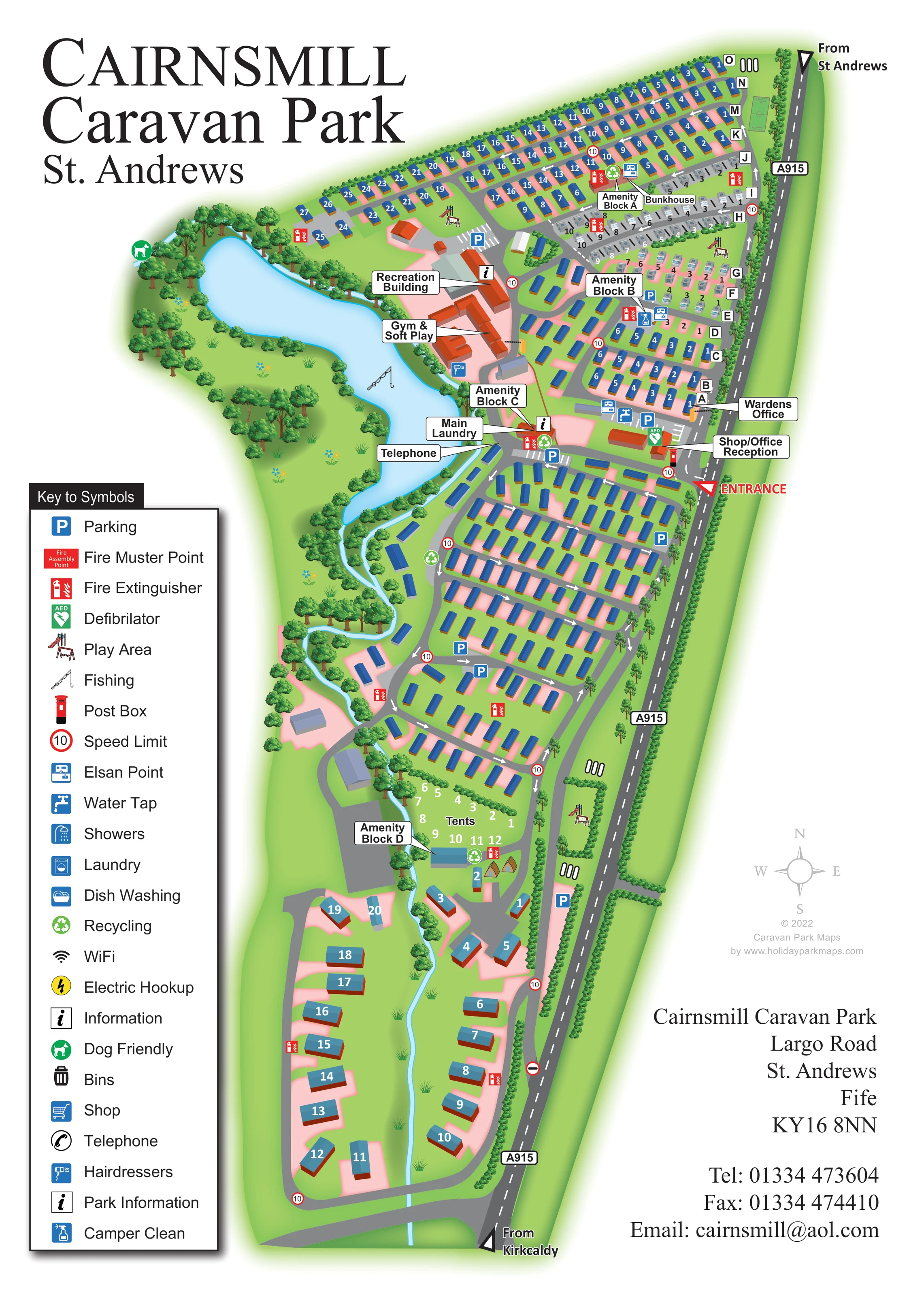
An irregular pale-blue reservoir forms the broad western edge of the northern park and a strong orientation landmark.
ILLUSTRATED PARK MAP · P431
Largo Road, St Andrews, Fife · United Kingdom
 Enlarge the map ↗
A SENSE OF THE PLACE
Cairnsmill Caravan Park is based at Largo Road, St Andrews, Fife. The site is located on the outskirts of St Andrews. The park offers static caravans to buy or hire, touring-caravan pitches, pods and a bunkhouse. Touring bays have space for a car, power connections and water taps, with toilets, showers and laundry nearby.
There is a heated swimming pool, Jacuzzi and sauna. A regularly stocked reservoir is available for fly fishing, with timed tickets and catch-and-release options.
LOOK CLOSER
An irregular pale-blue reservoir forms the broad western edge of the northern park and a strong orientation landmark.
A narrow blue watercourse continues south from the reservoir area, weaving through trees and the lower accommodation sections.
Dense illustrated trees line the water, roadside boundary and section edges, with open grass around accommodation and recreation areas.
A labelled arrival building stands just inside the entrance from the A915.
A separate office is labelled beside the roadside accommodation rows, north of reception.
Part of the prominent red-roofed building group beside the reservoir.
Explicitly labelled within the central recreation complex.
Four named amenity blocks serve different accommodation areas, including the northern touring rows and southern tent section.
A labelled arrival building stands just inside the entrance from the A915.
A separate office is labelled beside the roadside accommodation rows, north of reception.
Part of the prominent red-roofed building group beside the reservoir.
Explicitly labelled within the central recreation complex.
Four named amenity blocks serve different accommodation areas, including the northern touring rows and southern tent section.
Labelled near Amenity Block C, between the reservoir-side buildings and the main internal road.
Blue service symbols mark water taps, showers and Elsan disposal points around the northern and central service areas.
Blue P symbols mark parking beside communal buildings and at several points within the accommodation sections.
Small illustrated play structures appear in northern accommodation areas and in a separate roadside green space further south.
A rectangular green pitch with court-style markings is drawn at the northern end beside the A915; the sport is not labelled.
A fishing-rod symbol identifies recreation on the large western water feature.
An irregular pale-blue reservoir forms the broad western edge of the northern park and a strong orientation landmark.
A narrow blue watercourse continues south from the reservoir area, weaving through trees and the lower accommodation sections.
Dense illustrated trees line the water, roadside boundary and section edges, with open grass around accommodation and recreation areas.
A green dog symbol appears beside the wooded western reservoir edge. It does not define a park-wide pet policy.
Green recycling symbols are distributed across the northern, central and tent-pitch areas.
Red extinguisher symbols recur throughout the accommodation areas, and a green AED symbol appears by the reception buildings.
Black information symbols identify points near the recreation buildings and central service area.
A telephone is labelled beside the main laundry and central internal road.
The blue hairdryer symbol from the key is positioned beside the recreation complex.
The key also includes fire muster points, a post box, dish washing, WiFi, electric hookup, bins and Camper Clean. Their inclusion in the key alone does not establish individual locations.
The A915 follows the eastern boundary, with approaches labelled From St Andrews and From Kirkcaldy and a prominent entrance marker near reception.
Grey roads connect rows, communal facilities and the southern loop. White arrows and repeated red-ringed 10 signs provide mapped traffic guidance.
Park information describes a heated swimming pool, Jacuzzi and sauna; these are not individually labelled on this artwork.
READING THE MAP
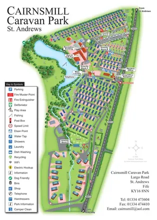
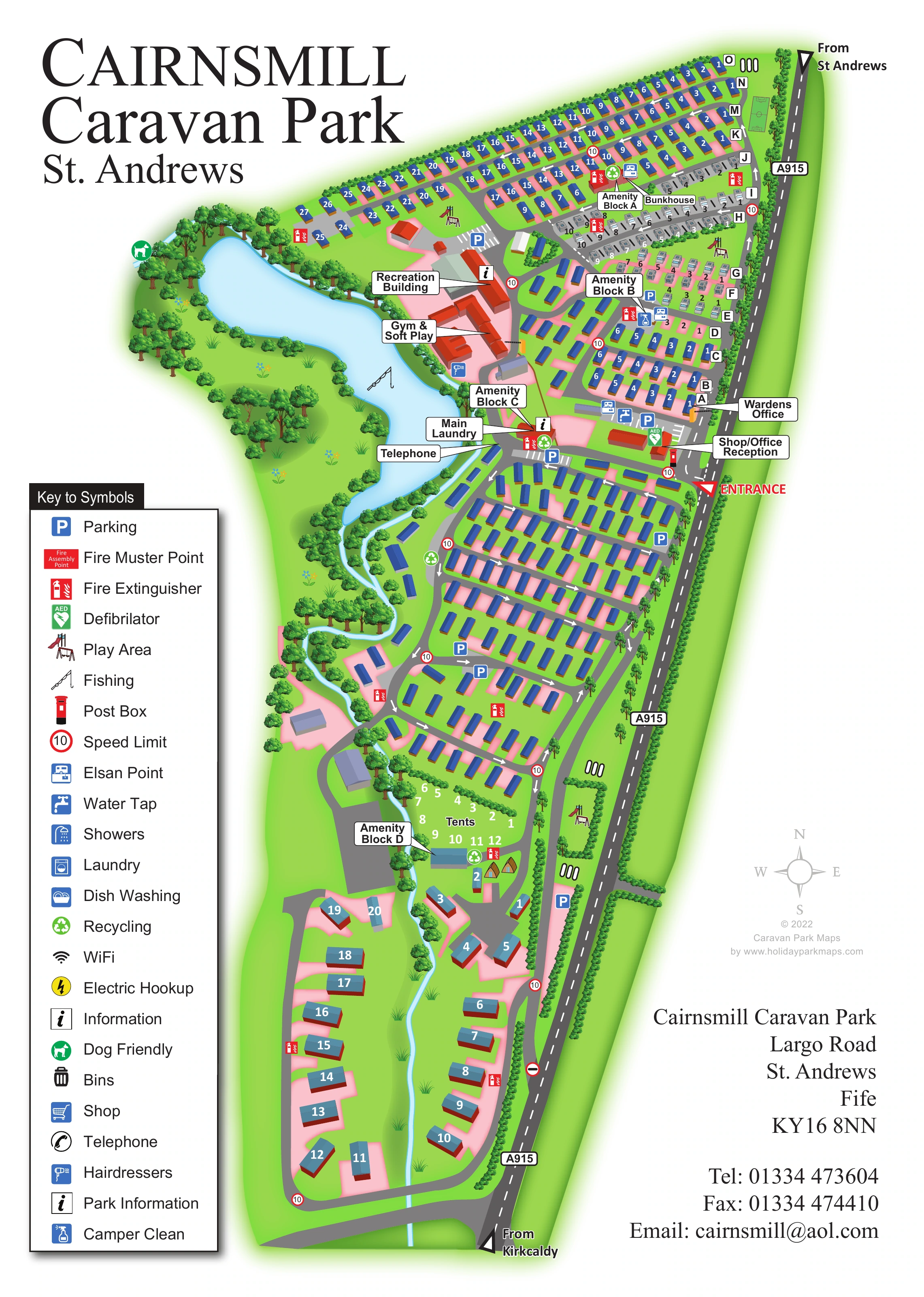
This illustrated map of Cairnsmill Caravan Park brings together a substantial caravan layout, a waterside recreation hub and a clear roadside arrival point. Set on the outskirts of St Andrews in Fife, the park is shown stretching alongside the A915, with a tree-lined reservoir shaping its western side and a narrow watercourse continuing through the grounds.
The artwork gives different parts of the park distinct visual identities. Closely arranged caravan rows fill the northern and central sections, touring pitches sit near named amenity blocks, and a smaller tent area leads towards a more spacious southern loop. Reception, the recreation building, gym and soft play are picked out with direct labels rather than left to symbols alone.
A tall illustrated key explains the practical service markers, while numbered roofs, lettered rows and internal road arrows help visitors connect their accommodation with nearby facilities. The portrait composition makes room for a large park title and contact panel without losing the shape of this long, landscape-led site.
The plan follows the park’s elongated footprint, with the A915 running down the right-hand boundary and approach labels from St Andrews and Kirkcaldy at opposite ends. A red entrance marker directs attention to the shop, office and reception buildings. From here, grey internal roads branch through the accommodation, with white directional arrows, parking markers and repeated speed signs providing a readable circulation framework.
Across the north, blue-roofed caravan units form sloping rows identified by letters and individual numbers. Smaller grey touring-caravan symbols occupy a contrasting cluster near Amenity Blocks A and B, with the bunkhouse labelled alongside Block A. Below the entrance, a broad grid of caravan rows fills the central section. Further south, the numbered Tents area sits beside Amenity Block D before the layout opens into a loop of more widely spaced units around the stream.
The reservoir is the main landscape landmark. Shaded trees enclose its irregular blue outline, and a fishing symbol identifies its recreational role. Beside it, terracotta-roofed buildings are labelled Recreation Building and Gym & Soft Play. Amenity Block C, the main laundry and telephone sit close to this central hub. Play structures, a marked sports pitch, recycling points, water and disposal symbols, fire points and an AED add practical detail throughout the plan.
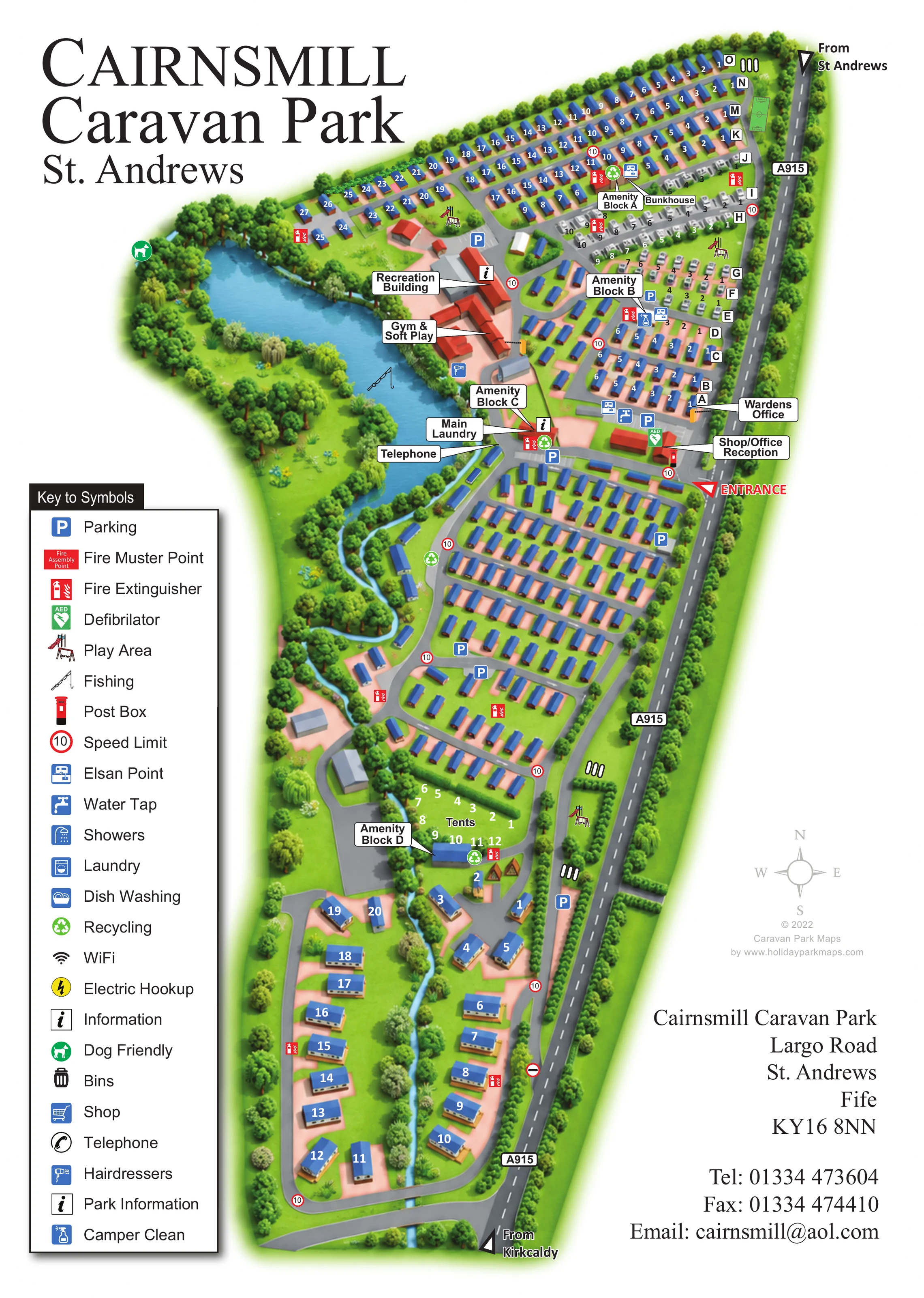
The oversized serif title occupies the upper-left corner, balanced by the long symbol key below and the address panel at lower right. The accompanying enlargement reveals the same legend and neighbouring southern map detail; it is not a separate park section or additional accommodation plan.
 Enlarge this map ↗
KEEP EXPLORING
Chosen for shared landscapes, accommodation or facilities.
 Explore the map ↗
United Kingdom
Illustrated caravan park plan with woodland and riverside walks, fishing pools and wildlife panels.
 Explore the map ↗
United Kingdom
A woodland estate park map combining caravan loops, touring pitches, riverside paths and Bruce’s Cave landmarks.
 Explore the map ↗
France
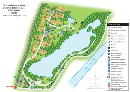
Bilingual lakeside campsite map with numbered pitches, recreation areas and colour-coded service points.
Features may come from the sample artwork, its key or published park information. Approximate numbers describe the drawing and may cover only part of a park. They are intended to help you compare map examples. Current facilities and booking information should be checked with the park.
TAKE A CLOSER LOOK
View the illustrated map in detail or choose a file to download. These are sample maps; contact the park for current visitor information.


LET’S MAP YOUR PARK
For a map quotation, find your park and draw a rough boundary around it. The area you select helps us work out the design time and price.
Draw your park for a quote ↗Or talk to our map designers
01751 473136
 page_Page_1.png
 page_Page_2.png
 page_page_2_large.png
 page_page_2_large.webp