
Sea
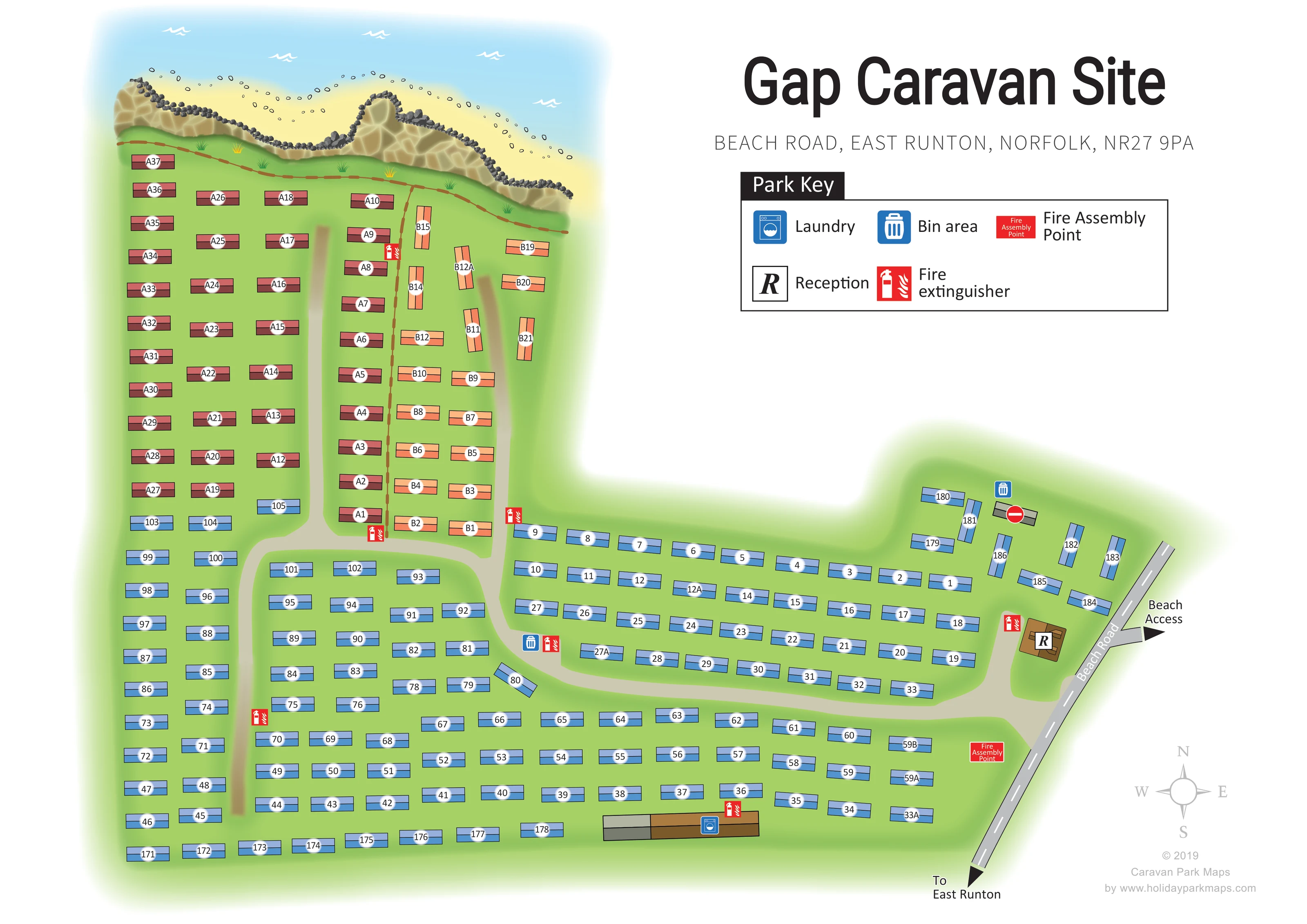
A pale-blue sea vignette with white wave marks forms the coastal backdrop along the top of the plan.
ILLUSTRATED PARK MAP · P467
Beach Road, East Runton, Norfolk · United Kingdom
 Enlarge the map ↗
A SENSE OF THE PLACE
Gap Caravan Site is a family-run static caravan site on the cliffs at East Runton. Sea views and a beach-access slope opposite the entrance make the North Norfolk coast central to its setting.
The village's shops, pubs and bus stop are close by, with Cromer available for a wider choice of outings. The map provides an overview of the compact caravan layout and access routes above the beach.
LOOK CLOSER
A pale-blue sea vignette with white wave marks forms the coastal backdrop along the top of the plan.
A sandy yellow strip with scattered pebble marks lies between the illustrated sea and cliffs.
An irregular ochre cliff face, topped and edged with dark stones, separates the caravan ground from the beach illustration.
A brown post-and-rail line follows the coast-facing edge and extends down between the A and B caravan groups.
A small brown building marked R stands immediately inside the Beach Road side of the site.
A blue washing-machine symbol identifies the long building near the lower edge of the plan.
Blue bin symbols mark a point beside the central internal road and another near the small roadside caravan cluster.
Repeated red extinguisher symbols are distributed through the accommodation areas and beside service buildings.
A small brown building marked R stands immediately inside the Beach Road side of the site.
A blue washing-machine symbol identifies the long building near the lower edge of the plan.
Blue bin symbols mark a point beside the central internal road and another near the small roadside caravan cluster.
Repeated red extinguisher symbols are distributed through the accommodation areas and beside service buildings.
A red labelled assembly point appears near the lower-right entrance approach.
A pale-blue sea vignette with white wave marks forms the coastal backdrop along the top of the plan.
A sandy yellow strip with scattered pebble marks lies between the illustrated sea and cliffs.
An irregular ochre cliff face, topped and edged with dark stones, separates the caravan ground from the beach illustration.
A brown post-and-rail line follows the coast-facing edge and extends down between the A and B caravan groups.
The named grey road runs diagonally along the right-hand side, with a dashed white centre line.
An entrance from Beach Road connects to a curving internal road network, with branches serving the lower rows and upper cliff-side accommodation.
A labelled arrow points away from Beach Road opposite the reception area towards beach access; the descent itself is not drawn.
An arrow at the lower end of Beach Road is labelled To East Runton.
A red no-entry symbol overlays a small grey rectangle beside the upper roadside bin point; its specific purpose is not explained in the key.
READING THE MAP
This map of Gap Caravan Site places a compact static caravan layout in its distinctive North Norfolk coastal setting. Along the top of the artwork, a blue sea, sandy beach and illustrated cliff face establish the park’s relationship with the shore. Below them, colour-coded caravan rows and clear number badges turn a densely occupied site into a readable visitor plan.
The layout follows the park from its cliff-side accommodation down to the entrance on Beach Road. Reception is easy to pick out beside the road, while a separate arrow indicates beach access opposite this part of the site. Another points towards East Runton. A large park key explains the laundry, bin areas and fire-safety markers without crowding the accommodation.
For a designer’s gallery, this sample demonstrates how a straightforward numbered site plan can retain a strong sense of place. Its coastal illustration adds character, while the restrained buildings, broad internal roads and spacious title panel keep practical navigation at the centre of the design.
The plan is arranged around an irregular L-shaped caravan site, with the coast across the upper edge and Beach Road running diagonally down the right. The tall western section contains burgundy A-labelled caravans in regular columns. Beside them, a narrower group of peach B-labelled caravans uses a mixture of horizontal and vertical orientations. Blue numbered units occupy most of the lower ground and extend towards reception, with a smaller cluster beside the road above it. These colours distinguish groups visually, although the key does not assign them separate accommodation descriptions.
A pale internal road enters from Beach Road and curves through the lower half of the park. Branches reach north into the longer rows, making the relationship between the entrance and the different accommodation groups clear. Reception is drawn as a small brown building with an R marker. The laundry occupies a longer building near the bottom of the plan. Blue bin symbols appear at two locations, and red fire-extinguisher markers recur around the site. A labelled fire assembly point sits near the entrance approach.
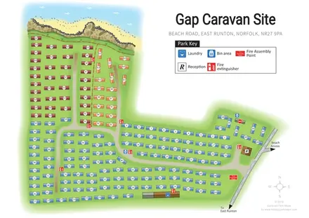
The coastal edge is more pictorial than the accommodation: faceted ochre cliffs, dark stones, a sandy beach and white wave marks create a recognisable seaside backdrop. A brown fence follows the grass above the cliffs. The upper-right white space holds the large park title, address and boxed key, while a compass and designer credit occupy the lower-right corner. The accompanying enlarged view shows the same artwork’s key and roadside area, clarifying the symbols rather than adding a separate section or site.
KEEP EXPLORING
Chosen for shared landscapes, accommodation or facilities.
 Explore the map ↗
United Kingdom
Coastal park map with static-caravan rows, touring pitches, a camping field and two leisure clusters.
 Explore the map ↗
United Kingdom
Illustrated coastal holiday-home plan with dense alphanumeric plot labels, orange-roofed amenities, a numbered facility key and beach-side context.
 Explore the map ↗
United Kingdom
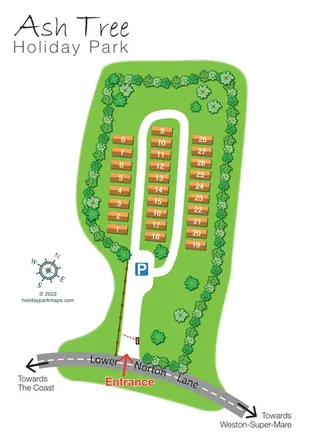
Tree-lined holiday-home park plan with a numbered road loop and clear Lower Norton Lane entrance.
Features may come from the sample artwork, its key or published park information. Approximate numbers describe the drawing and may cover only part of a park. They are intended to help you compare map examples. Current facilities and booking information should be checked with the park.
TAKE A CLOSER LOOK
View the illustrated map in detail or choose a file to download. These are sample maps; contact the park for current visitor information.


LET’S MAP YOUR PARK
For a map quotation, find your park and draw a rough boundary around it. The area you select helps us work out the design time and price.
Draw your park for a quote ↗Or talk to our map designers
01751 473136