
Tree belts and landscaped planting
Dense mixed-colour trees enclose much of the park, with additional shrub belts, flowering trees and planted islands separating accommodation rows.
ILLUSTRATED PARK MAP · P130
Malton Road, Pickering, North Yorkshire · United Kingdom
 Enlarge the map ↗
A SENSE OF THE PLACE
Galtres Retreat and Lodge Park offers self-catering lodge stays near Pickering in North Yorkshire. The Ashdown Retreat development is set among woodland and open countryside.
Privately owned rental lodges provide accommodation for couples and families, with private decks and views forming part of their appeal. Facilities vary by property, and the map helps guests locate their lodge within the wider park.
LOOK CLOSER
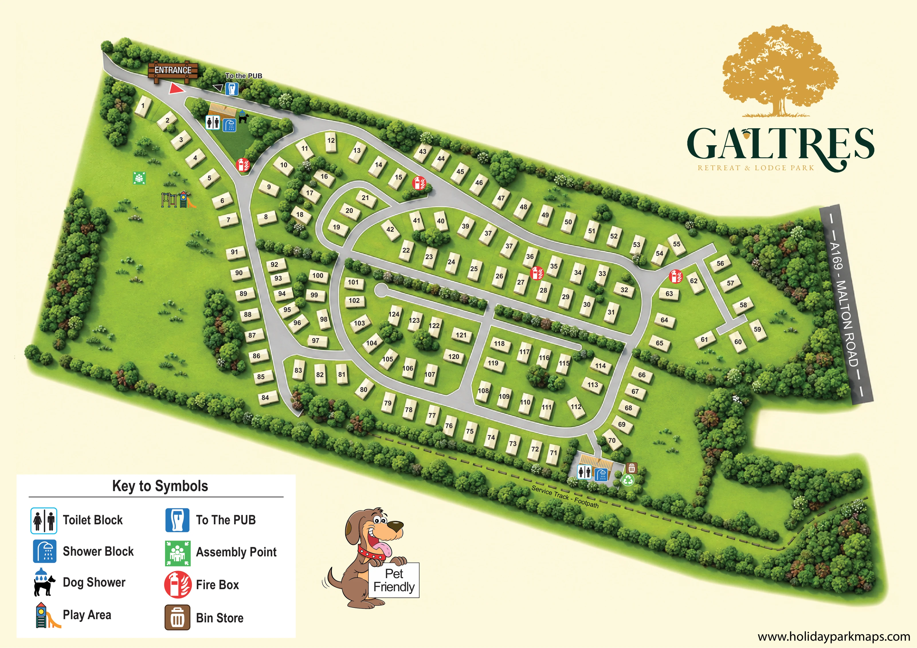
Dense mixed-colour trees enclose much of the park, with additional shrub belts, flowering trees and planted islands separating accommodation rows.
A substantial lawn occupies the left side, while smaller grassy spaces and a tree-enclosed clearing appear towards the right.
A timber-style ENTRANCE sign and red triangular marker identify the arrival road at the upper-left edge of the plan.
A labelled grey road strip with dashed white centre markings provides external context along the right-hand edge.
A broad arrival spine connects curving loops, planted islands and several short access spurs serving the numbered accommodation.
A dark dashed route labelled Service Track - Footpath follows the lower tree-lined boundary and bends around the lower-right woodland.
A To the PUB label, directional triangle and blue pint-glass symbol appear beside the entrance approach. The pub itself is not illustrated.
Two small service-building groups carry toilet and shower symbols: one near the entrance and one beside the lower-right accommodation roads.
A timber-style ENTRANCE sign and red triangular marker identify the arrival road at the upper-left edge of the plan.
A labelled grey road strip with dashed white centre markings provides external context along the right-hand edge.
A broad arrival spine connects curving loops, planted islands and several short access spurs serving the numbered accommodation.
A dark dashed route labelled Service Track - Footpath follows the lower tree-lined boundary and bends around the lower-right woodland.
A To the PUB label, directional triangle and blue pint-glass symbol appear beside the entrance approach. The pub itself is not illustrated.
Two small service-building groups carry toilet and shower symbols: one near the entrance and one beside the lower-right accommodation roads.
The dog-shower symbol is placed beside the entrance-side toilet and shower building and explained in the key.
Illustrated swings and a colourful slide mark a play area within the large open lawn on the left.
A green assembly-point symbol stands on the left-hand lawn near the play area.
Repeated red circular fire-box symbols mark locations beside the internal road network.
A brown bin-store symbol and green recycling symbol appear beside the lower-right service building. The bin store is explained in the key; recycling is shown directly on the plan.
Dense mixed-colour trees enclose much of the park, with additional shrub belts, flowering trees and planted islands separating accommodation rows.
A substantial lawn occupies the left side, while smaller grassy spaces and a tree-enclosed clearing appear towards the right.
A cartoon dog holds a Pet Friendly sign below the plan. This is a general message in the artwork, not a statement of detailed pet rules or eligibility for individual lodges.
READING THE MAP
This illustrated map of Galtres Retreat & Lodge Park presents a tree-lined lodge setting near Pickering in North Yorkshire. The park stretches diagonally across the page, with numbered accommodation arranged beside curving grey roads and generous areas of green space. Dense perimeter planting and smaller landscaped islands give the plan a distinctly wooded character without obscuring the routes between lodges.
Arrival is marked by a timber-style entrance sign at the upper left, while the A169 – Malton Road label provides local road context on the opposite side. A large lawn contains the play area and assembly point, and clearly coloured symbols identify toilet and shower blocks, a dog shower, fire boxes and the bin store. A dashed service track and footpath runs along the lower boundary.
The composition also makes room for the park’s gold tree emblem, a prominent Galtres wordmark and a cartoon Pet Friendly message. It is a useful example of a branded accommodation map that combines individual lodge finding with shared-facility information and a strong impression of the surrounding landscape.
The single-page plan uses an elevated oblique view to show an elongated park enclosed by trees. Pale, numbered accommodation blocks sit on textured green lawns, with shaded sides giving them a modest three-dimensional appearance. Their orientation changes with the roads, helping the viewer read the curved rows and smaller accommodation groups as part of one connected layout.
From the entrance at the upper left, a broad grey road descends through the park and joins several rounded loops. Short spurs reach additional groups, while planted strips and tree-filled islands separate neighbouring roads. The centre and right contain most of the accommodation; the left is more open, with a large lawn, scattered shrubs, swings and a slide. A green assembly-point marker is placed near this play space.
Two service-building locations carry toilet and shower pictograms. The entrance-side group also includes a dog-shower symbol, while the lower-right group is accompanied by bin-store and recycling markers. Red fire-box symbols are distributed around the roads. A pub direction appears beside the entrance approach, rather than depicting a pub building within the park. Along the bottom, a dashed line labelled Service Track - Footpath follows the wooded edge and turns around the lower-right planting. The A169 – Malton Road is shown as a separate labelled strip on the right.
A large two-column key explains the principal symbols beneath the plan. The upper-right space is reserved for the gold tree logo and Galtres name, with a cartoon dog carrying a Pet Friendly sign below the landscape. The accompanying detail views enlarge this same artwork’s key and lower boundary; they are not separate park sections or additional accommodation areas.
KEEP EXPLORING
Chosen for shared landscapes, accommodation or facilities.
 Explore the map ↗
United Kingdom
A wooded Allerton park plan with colour-coded neighbourhoods, touring pitches and a central facilities hub.
 Explore the map ↗
United Kingdom
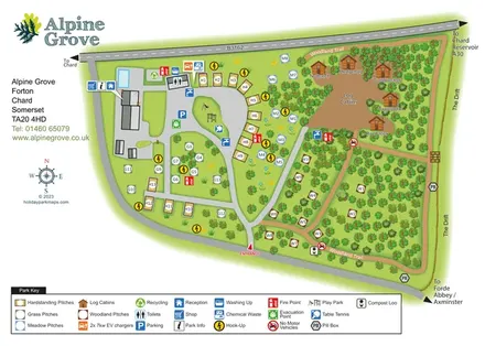
Colour-coded pitches, named log cabins and a woodland trail at Alpine Grove, Somerset.
 Explore the map ↗
United Kingdom
Woodland camping, lodges, lakes and colour-coded bike trails at Avon Tyrrell Outdoor Centre.
Features may come from the sample artwork, its key or published park information. Approximate numbers describe the drawing and may cover only part of a park. They are intended to help you compare map examples. Current facilities and booking information should be checked with the park.
LET’S MAP YOUR PARK
For a map quotation, find your park and draw a rough boundary around it. The area you select helps us work out the design time and price.
Draw your park for a quote ↗Or talk to our map designers
01751 473136