
Shoreline and beach edge
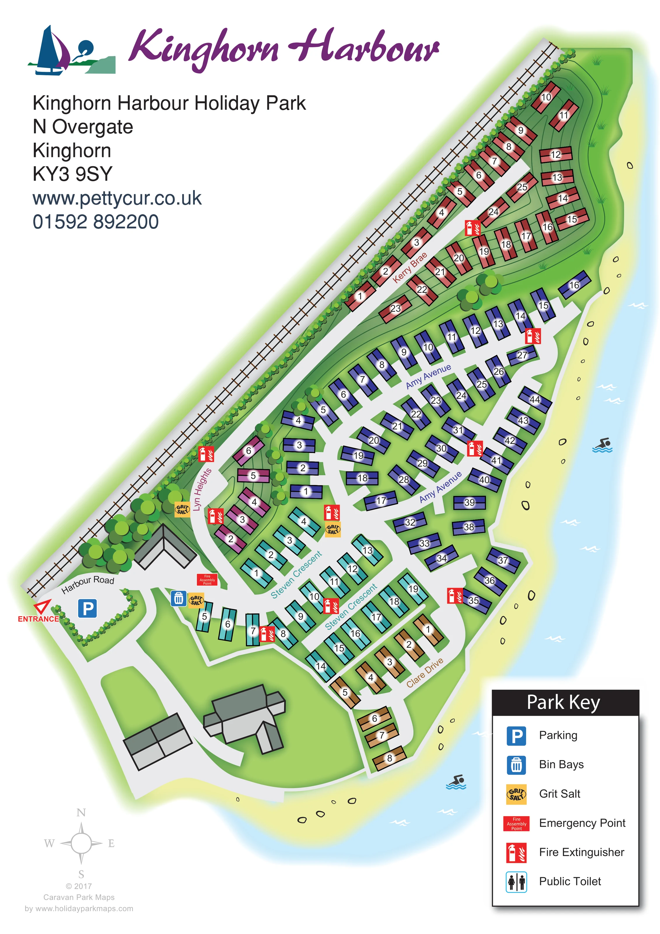
A pale yellow shoreline with scattered outlined stones follows the eastern and southern edges of the park, beside light blue water and white wave marks.
ILLUSTRATED PARK MAP · P512
Nethergate, Kinghorn, Fife · United Kingdom
 Enlarge the map ↗
A SENSE OF THE PLACE
Kinghorn Harbour Holiday Park is based at Nethergate, Kinghorn, Fife. The park occupies a shoreline location on Fife's south coast with views across the Firth of Forth. New and used static caravans are offered for sale.
The map brings the site layout and its access routes together in one view, providing a reference for understanding the arrangement of the grounds.
LOOK CLOSER
A pale yellow shoreline with scattered outlined stones follows the eastern and southern edges of the park, beside light blue water and white wave marks.
A continuous planted railway boundary, rounded tree clusters and curved terrain lines distinguish the inland edge and the rising ground around Kerry Brae.
A long railway, drawn with rails and sleepers, runs diagonally beside the north-western edge of the park, separated from the caravans by a planted strip.
A red arrow and ENTRANCE label identify arrival from Harbour Road at the lower-left end of the plan.
Kerry Brae, Amy Avenue, Lyn Heights, Steven Crescent and Clare Drive organise the caravan sections. Curved roads, short branches and turning ends connect the plots.
A blue parking symbol marks the broad paved arrival area beside Harbour Road.
A blue bin-bay symbol is placed near the entrance-side junction below Lyn Heights.
Yellow grit salt symbols appear at several lower-park road junctions, including the entrance area and the roads near Lyn Heights and Steven Crescent.
A pale yellow shoreline with scattered outlined stones follows the eastern and southern edges of the park, beside light blue water and white wave marks.
The park occupies a shoreline location on Fife's south coast with views across the Firth of Forth.
A long railway, drawn with rails and sleepers, runs diagonally beside the north-western edge of the park, separated from the caravans by a planted strip.
A red arrow and ENTRANCE label identify arrival from Harbour Road at the lower-left end of the plan.
Kerry Brae, Amy Avenue, Lyn Heights, Steven Crescent and Clare Drive organise the caravan sections. Curved roads, short branches and turning ends connect the plots.
A blue parking symbol marks the broad paved arrival area beside Harbour Road.
A blue bin-bay symbol is placed near the entrance-side junction below Lyn Heights.
Yellow grit salt symbols appear at several lower-park road junctions, including the entrance area and the roads near Lyn Heights and Steven Crescent.
A red Fire Assembly Point marker stands near the arrival junction. The key describes this symbol as an Emergency Point.
Repeated red extinguisher symbols are distributed through the caravan sections and along internal roads.
Public Toilet appears in the Park Key, but no corresponding location is clearly identifiable on the illustrated plan.
A continuous planted railway boundary, rounded tree clusters and curved terrain lines distinguish the inland edge and the rising ground around Kerry Brae.
Several grey-roofed building forms sit beside the arrival area and southern road loop. Their functions are not labelled.
READING THE MAP
This illustrated map of Kinghorn Harbour Holiday Park places its coastal setting at the centre of the design. The long, tapering grounds sit between a railway and the shoreline, with caravans arranged along named roads that curve through the site. Pale blue water, a yellow shore and a planted inland boundary make the park's shape easy to understand before the visitor begins looking for an individual unit.
Approximately 100 static caravans are depicted in five colour-coded sections. Matching road-name colours connect Kerry Brae, Amy Avenue, Lyn Heights, Steven Crescent and Clare Drive to their surrounding plots, while clear numbers identify individual units. Arrival from Harbour Road is marked beside the parking area, with practical symbols for bins, grit salt and fire equipment placed around the roads.
The portrait composition also gives the Kinghorn Harbour branding, contact details and Park Key their own space. It is a useful example of a caravan park map that combines plot-level wayfinding with a distinctive shoreline setting in Kinghorn, Fife.
The plan runs diagonally from the broad arrival area at the lower left to the narrow Kerry Brae section at the upper right. A railway follows the inland boundary, drawn with individual sleepers and edged by a continuous strip of planting. On the opposite side, the shoreline wraps around the park in pale yellow, with outlined stones, white waves and light blue water defining the coastal edge.
Harbour Road leads to a red entrance arrow and a paved parking area. Beyond this arrival space, the road network divides into colour-coded caravan groups. Pink units line Lyn Heights near a cluster of trees; turquoise caravans follow the branches of Steven Crescent; and ochre units sit beside the curved Clare Drive close to the southern shore. Violet-blue caravans occupy the central Amy Avenue network, while coral-red units extend along Kerry Brae at the tapered end. Thin curved lines around this upper section suggest sloping or terraced ground.
Each caravan is shown as a simple outlined roof form with a number on a white highlight. Larger grey-roofed buildings appear near the entrance and southern road loop, but are not assigned functions. Red fire extinguisher symbols recur throughout the accommodation areas, while blue bin and parking symbols, yellow grit salt markers and a fire assembly marker identify practical points around the lower road junctions.
The lower-right key explains the service symbols and includes a public toilet entry, although its location is not clearly plotted. Large branding and contact text occupy the upper-left white space, with a compass below the plan. The accompanying detail views enlarge the lower-page buildings, compass, credit and key; they are crops of the same artwork, not separate park sections.
KEEP EXPLORING
Chosen for shared landscapes, accommodation or facilities.
 Explore the map ↗
United Kingdom
Coastal park map with static-caravan rows, touring pitches, a camping field and two leisure clusters.
 Explore the map ↗
United Kingdom
Illustrated coastal holiday-home plan with dense alphanumeric plot labels, orange-roofed amenities, a numbered facility key and beach-side context.
 Explore the map ↗
United Kingdom
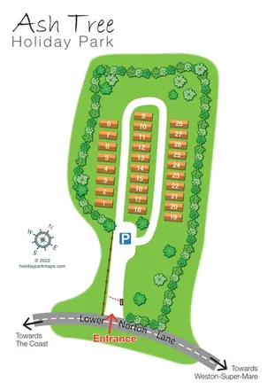
Tree-lined holiday-home park plan with a numbered road loop and clear Lower Norton Lane entrance.
Features may come from the sample artwork, its key or published park information. Approximate numbers describe the drawing and may cover only part of a park. They are intended to help you compare map examples. Current facilities and booking information should be checked with the park.
LET’S MAP YOUR PARK
For a map quotation, find your park and draw a rough boundary around it. The area you select helps us work out the design time and price.
Draw your park for a quote ↗Or talk to our map designers
01751 473136