
Lake and ponds
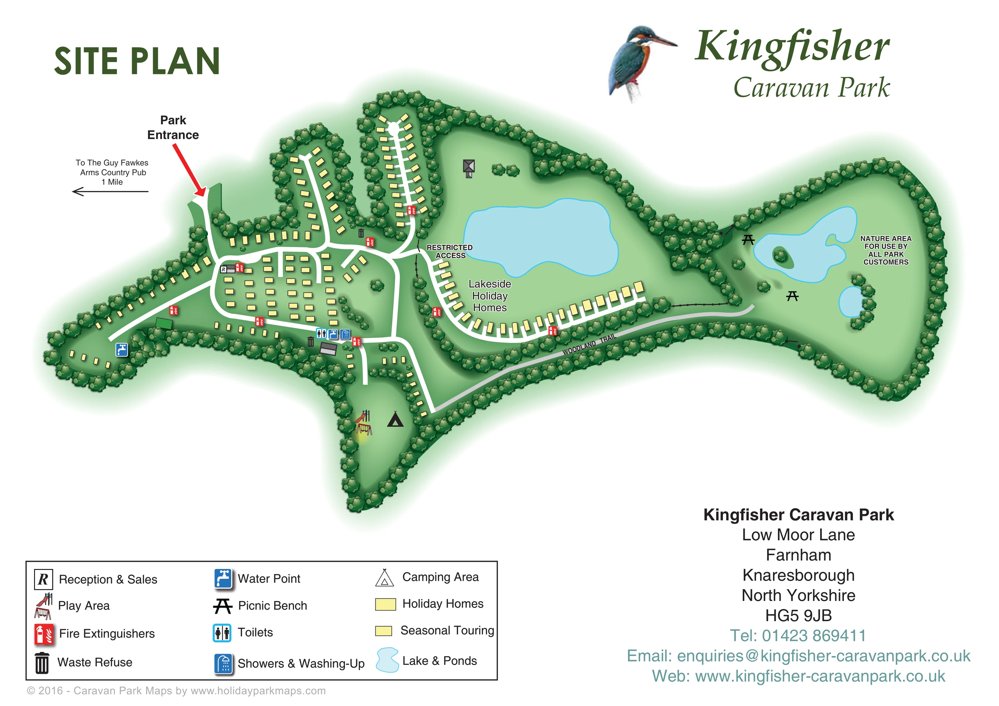
A large irregular lake lies above the lakeside holiday homes. The eastern nature area contains another substantial water body with a small planted island and a smaller pond.
ILLUSTRATED PARK MAP · P511
Knaresborough, Yorkshire · United Kingdom
 Enlarge the map ↗
A SENSE OF THE PLACE
Kingfisher Holiday Park is based at Knaresborough, Yorkshire. This is a rural park with ponds, lakes, a nature reserve and woodland trail. Grass and hardstanding pitches accommodate tourers, motorhomes and tents; the page specifies 10-amp hook-ups.
Playground, laundry, washrooms and washing-up facilities are listed.
LOOK CLOSER
A large irregular lake lies above the lakeside holiday homes. The eastern nature area contains another substantial water body with a small planted island and a smaller pond.
The broad eastern enclosure is labelled as a nature area for use by all park customers, with water, scattered trees and picnic benches.
Dense illustrated tree belts define the perimeter, divide accommodation branches and frame the route to the nature area.
A small grey building with an R marker sits beside the arrival road at the western edge of the central accommodation group.
Illustrated slide and swings mark the play area within the southern enclosure, next to the camping symbol.
Grouped toilet, shower and washing-up symbols identify a service building along the southern edge of the central accommodation area.
Blue tap symbols mark water points near the western pitches and the central service building.
Black bin symbols appear at several locations around the accommodation roads and service area.
A small grey building with an R marker sits beside the arrival road at the western edge of the central accommodation group.
Illustrated slide and swings mark the play area within the southern enclosure, next to the camping symbol.
Grouped toilet, shower and washing-up symbols identify a service building along the southern edge of the central accommodation area.
Blue tap symbols mark water points near the western pitches and the central service building.
Black bin symbols appear at several locations around the accommodation roads and service area.
Repeated red extinguisher symbols provide conspicuous reference points throughout the accommodation groups.
Two black picnic-table symbols are placed beside the water in the eastern nature area.
A large irregular lake lies above the lakeside holiday homes. The eastern nature area contains another substantial water body with a small planted island and a smaller pond.
The broad eastern enclosure is labelled as a nature area for use by all park customers, with water, scattered trees and picnic benches.
Dense illustrated tree belts define the perimeter, divide accommodation branches and frame the route to the nature area.
A labelled light-grey trail runs eastwards from the southern accommodation area, below the lakeside homes, towards the nature area.
A large red arrow identifies the entrance at the upper-left edge of the plan, leading towards reception and the internal road junctions.
A restricted-access label and dark barrier-like line mark the connection into the lakeside holiday-home road.
An outward-pointing arrow beside the entrance names the nearby country pub, providing an off-site reference rather than an on-site facility.
Laundry is listed in the wider park information but is not separately labelled or located on this artwork.
READING THE MAP
This illustrated site plan presents Kingfisher Caravan Park at Farnham, near Knaresborough in North Yorkshire, as a place shaped by trees, water and distinct accommodation areas. The composition stretches from the clearly marked entrance on the left to a broad nature area on the right, giving the landscape as much visual importance as the holiday homes and touring pitches.
White roads organise the busier western half into a central group and two narrow, tree-lined branches. Further east, a curved row of lakeside holiday homes follows the edge of a large blue lake. A separate woodland trail leads towards ponds, picnic benches and the nature area, while an open camping area and illustrated playground occupy the southern tip.
The design combines simple accommodation shapes with softly shaded trees and easily recognised facility symbols. A generous legend explains reception, washrooms, water points and other practical markers. The kingfisher illustration and green wordmark complete a landscape-led map that helps visitors understand both the park's layout and its outdoor character.
The plan uses an overhead layout with an irregular, densely wooded boundary. A bold red arrow marks the entrance at the upper left, and the arrival road leads towards a small reception and sales building. An outward-pointing arrow names The Guy Fawkes Arms Country Pub, adding a local reference without placing it inside the park.
Within the western accommodation area, white roads divide a compact central arrangement of holiday homes from peripheral seasonal-touring strips. Two long northern branches end in turning areas, each enclosed by trees. Pale-yellow rectangles represent accommodation, with the legend distinguishing larger holiday-home symbols from smaller seasonal-touring symbols. There are no individual plot numbers, so orientation depends on road shape, landscape and shared facilities.
The main service cluster sits along the southern edge of the central group, where blue symbols identify toilets, water, showers and washing-up. Other water points, refuse markers and bright-red fire-extinguisher symbols are distributed around the accommodation areas. Below this cluster, a triangular green enclosure contains the camping symbol and an illustrated slide and swings.
The lakeside section has its own sweeping road and a restricted-access label at its western connection. Beyond it, the light-grey woodland trail follows a tree-lined corridor into the eastern nature area. This spacious enclosure includes an irregular water body with a planted island, a smaller pond and two picnic-bench symbols.
The artwork is a single landscape-format page, with the title and bird branding above, a boxed three-column legend below left and an address and contact block below right. Its soft green shading, blue water and white roads make the transition from accommodation to outdoor space especially clear.
KEEP EXPLORING
Chosen for shared landscapes, accommodation or facilities.
 Explore the map ↗
United Kingdom
Woodland holiday-park map with named accommodation areas, touring loops and illustrated recreation facilities.
 Explore the map ↗
United Kingdom
A lakeside holiday-park and fishery map with numbered accommodation, fishing positions and clearly grouped visitor services.
 Explore the map ↗
United Kingdom
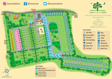
Colour-coded pitches, a leafy facilities hub and a long static-caravan wing at Haw Wood Farm, Suffolk.
Features may come from the sample artwork, its key or published park information. Approximate numbers describe the drawing and may cover only part of a park. They are intended to help you compare map examples. Current facilities and booking information should be checked with the park.
TAKE A CLOSER LOOK
View the illustrated map in detail or choose a file to download. These are sample maps; contact the park for current visitor information.


LET’S MAP YOUR PARK
For a map quotation, find your park and draw a rough boundary around it. The area you select helps us work out the design time and price.
Draw your park for a quote ↗Or talk to our map designers
01751 473136