
Grass around caravan plots
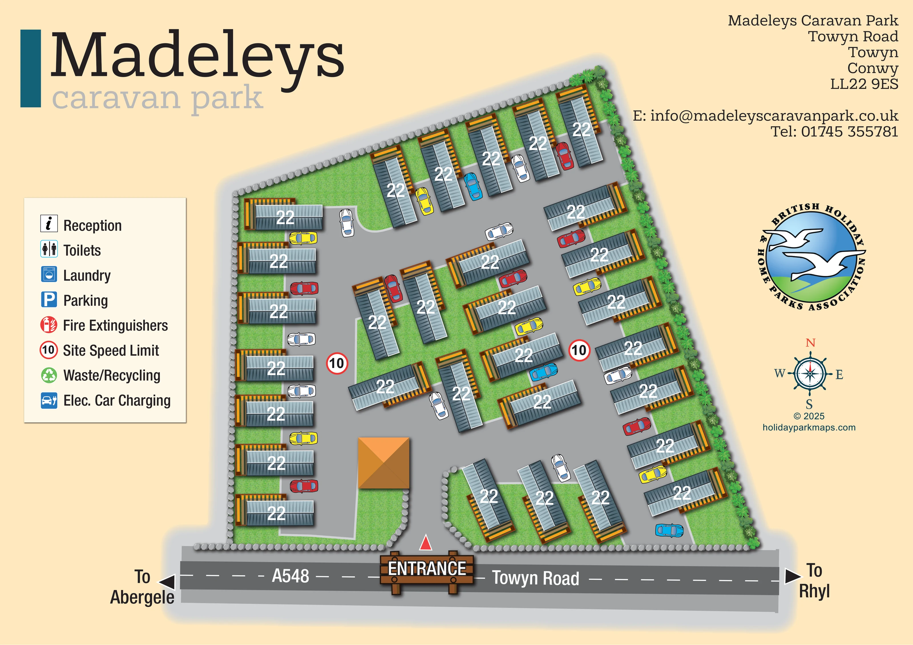
Textured green strips and pockets separate the caravans from the access lanes and boundaries.
ILLUSTRATED PARK MAP · P202
Towyn Road, Towyn, Conwy · United Kingdom
 Enlarge the map ↗
A SENSE OF THE PLACE
Madeleys Caravan Park is a small, family-run static caravan park in Towyn on the North Wales coast. It focuses on privately used holiday homes and does not permit caravan letting.
Its smaller scale is part of the park's quieter character. The map illustrates the arrangement of caravan plots and access routes, with Towyn and the surrounding coastal towns providing options for time away from the site.
LOOK CLOSER
Textured green strips and pockets separate the caravans from the access lanes and boundaries.
Repeated rounded grey stones outline much of the site, with a dense line of shrubs and small trees along the right-hand edge.
A prominent timber-style ENTRANCE sign marks the central opening in the road-facing boundary.
The public road runs across the bottom of the composition, with arrows towards Abergele on the left and Rhyl on the right.
Broad grey lanes connect the entrance with perimeter rows and smaller central accommodation groups.
Illustrated cars show vehicle spaces beside many caravans; a separate designated communal parking area is not identified.
Two red-ringed 10 symbols appear on internal lanes and correspond to the site speed-limit entry in the key.
A square building with a shaded orange hipped roof stands just inside the entrance on the left. Its function is not labelled.
A prominent timber-style ENTRANCE sign marks the central opening in the road-facing boundary.
The public road runs across the bottom of the composition, with arrows towards Abergele on the left and Rhyl on the right.
Broad grey lanes connect the entrance with perimeter rows and smaller central accommodation groups.
Illustrated cars show vehicle spaces beside many caravans; a separate designated communal parking area is not identified.
Two red-ringed 10 symbols appear on internal lanes and correspond to the site speed-limit entry in the key.
Textured green strips and pockets separate the caravans from the access lanes and boundaries.
Repeated rounded grey stones outline much of the site, with a dense line of shrubs and small trees along the right-hand edge.
A square building with a shaded orange hipped roof stands just inside the entrance on the left. Its function is not labelled.
Reception is included in the key, but no corresponding location symbol is visible within the plan.
Male and female toilet symbols appear in the key without a clearly marked position on the site.
A blue washing-machine symbol identifies laundry in the key only.
A blue P symbol is listed in the key, but is not visibly assigned to a particular parking area.
A red extinguisher symbol appears in the key; individual extinguisher positions are not marked.
Waste/recycling is named beside a green recycling symbol in the key, without a visible collection-point location.
Electric car charging is listed with a blue vehicle-and-plug symbol, but a charging location is not identified on the plan.
READING THE MAP
This illustrated map presents Madeleys Caravan Park as a compact holiday-home site on Towyn Road in Towyn, Conwy, on the North Wales coast. Roughly 30 static caravans are shown around a connected network of access lanes, with grass between the plots and planting along the right-hand boundary. The arrangement is easy to grasp as a whole: perimeter rows frame smaller central groups, while the entrance sits prominently on the road-facing edge.
The artwork gives considerable space to arrival and orientation. A timber-style entrance sign anchors the lower part of the page, and the A548/Towyn Road is labelled with directions towards Abergele and Rhyl. Blue-grey caravan roofs, warm timber-coloured decks and bright illustrated cars distinguish the accommodation from the grey roads and green surroundings.
A large facility key, oversized Madeleys branding and a separate contact-information area complete the composition. This sample is particularly relevant to smaller static caravan parks needing an illustrated overview that explains their layout without expanding into a wider resort or visitor-attraction map.
The single landscape-format plan places the park within an irregular boundary above the A548/Towyn Road. Its upper edge slopes upwards to the right, and the caravan rows turn to follow that outline. A central entrance opens through the lower boundary, immediately beside a small square building with an orange hipped roof. The building is illustrated but not assigned a function.
Grey access lanes spread through the site, serving a long left-hand row, a shorter upper row and several rows on the right. Smaller groups of caravans occupy the middle, with another short group on a grass pocket just to the right of the entrance. Cars drawn in red, yellow, blue and white sit beside many homes, helping explain the relationship between accommodation and vehicle access. Two red-ringed speed-limit markers are placed within the lanes.
Each caravan uses a consistent blue-grey roof symbol with contrasting shaded halves, fine roof detailing and timber-coloured decking. White labels sit on the roofs. Textured grass fills the spaces around the units; rounded stone motifs define much of the perimeter, and closely spaced shrubs and small trees soften the right-hand edge.
The left-hand key lists reception, toilets, laundry, parking, fire extinguishers, the site speed limit, waste/recycling and electric car charging. Most of these entries do not have matching location symbols within the plan. Outside the boundary, bold arrows point towards Abergele and Rhyl. Large branding occupies the upper left, while address and contact text, an association emblem, a nautical compass and the designer credit occupy the right. The road frontage and entrance sign provide a strong visual base to the page.
KEEP EXPLORING
Chosen for shared landscapes, accommodation or facilities.
 Explore the map ↗
United Kingdom
Coastal park map with static-caravan rows, touring pitches, a camping field and two leisure clusters.
 Explore the map ↗
United Kingdom
Illustrated coastal holiday-home plan with dense alphanumeric plot labels, orange-roofed amenities, a numbered facility key and beach-side context.
 Explore the map ↗
United Kingdom
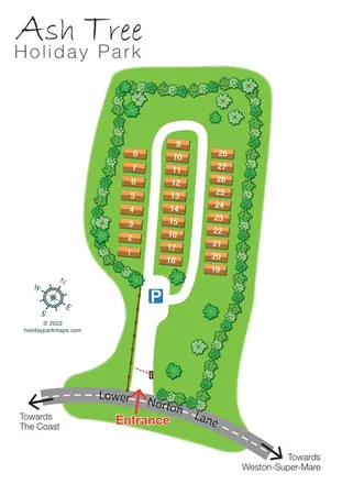
Tree-lined holiday-home park plan with a numbered road loop and clear Lower Norton Lane entrance.
Features may come from the sample artwork, its key or published park information. Approximate numbers describe the drawing and may cover only part of a park. They are intended to help you compare map examples. Current facilities and booking information should be checked with the park.
LET’S MAP YOUR PARK
For a map quotation, find your park and draw a rough boundary around it. The area you select helps us work out the design time and price.
Draw your park for a quote ↗Or talk to our map designers
01751 473136