
Small ponds
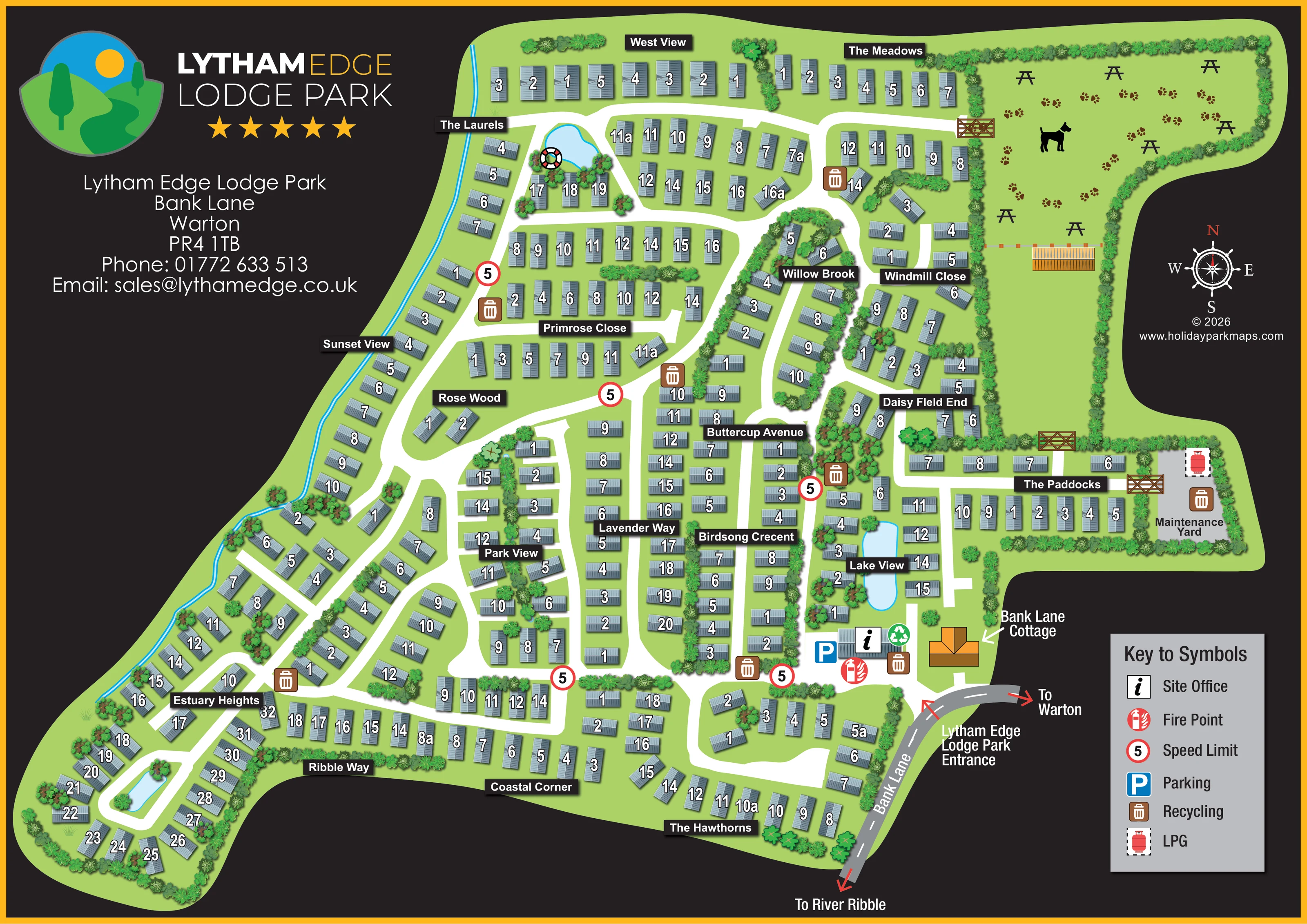
Blue ponds provide landmarks near the northern accommodation, Lake View and the south-western loop. A lifebuoy illustration appears beside the northern pond.
ILLUSTRATED PARK MAP · P201
Bank Lane, Warton, Preston, Lancashire · United Kingdom
 Enlarge the map ↗
A SENSE OF THE PLACE
Lytham Edge Lodge Park is based at Bank Lane, Warton, Preston, Lancashire. The location provides access to Lytham St Annes and the Fylde coast. This is an owners-only park selling lodges and static holiday caravans.
The park advertises landscaped grounds, on-park service/maintenance teams and CCTV.
LOOK CLOSER
Blue ponds provide landmarks near the northern accommodation, Lake View and the south-western loop. A lifebuoy illustration appears beside the northern pond.
A narrow blue watercourse follows much of the long western boundary.
Dense illustrated planting outlines boundaries, separates accommodation groups and frames ponds, road junctions and the recreation area.
An information symbol identifies the office building immediately inside the Bank Lane entrance.
A blue parking symbol marks the arrival area beside the site office.
A red fire-point symbol is positioned beside the office and entrance facilities.
Brown recycling symbols occur around the internal roads and maintenance yard; a separate green recycling emblem appears at the office.
An LPG cylinder symbol is located in the maintenance yard on the eastern side.
An information symbol identifies the office building immediately inside the Bank Lane entrance.
A blue parking symbol marks the arrival area beside the site office.
A red fire-point symbol is positioned beside the office and entrance facilities.
Brown recycling symbols occur around the internal roads and maintenance yard; a separate green recycling emblem appears at the office.
An LPG cylinder symbol is located in the maintenance yard on the eastern side.
A labelled, hedge-enclosed grey service area adjoins The Paddocks and contains recycling and LPG symbols.
A distinct orange-roofed building is labelled beside the entrance. Its use as guest accommodation is not established by the artwork.
The large enclosed green space in the north-east contains a dog silhouette, paw prints, timber gates, picnic tables and a timber structure. It suggests a dog-oriented recreation area, without specifying access rules.
Several dark picnic-table illustrations are distributed across the enclosed north-eastern green space.
Blue ponds provide landmarks near the northern accommodation, Lake View and the south-western loop. A lifebuoy illustration appears beside the northern pond.
A narrow blue watercourse follows much of the long western boundary.
Dense illustrated planting outlines boundaries, separates accommodation groups and frames ponds, road junctions and the recreation area.
The principal entrance is labelled at the south-east, connecting Bank Lane to the office and branching internal roads.
Red arrows indicate opposite directions along Bank Lane towards Warton and the River Ribble; neither destination is depicted within the park.
Black nameplates distinguish areas including West View, The Meadows, Primrose Close, Willow Brook, Lake View, The Paddocks, Estuary Heights, Ribble Way and The Hawthorns.
Repeated red-ringed signs displaying 5 are placed beside internal roads and explained as speed-limit symbols in the key.
READING THE MAP
This illustrated map of Lytham Edge Lodge Park in Warton, Lancashire, brings a large holiday-home layout into one clearly organised plan. The park's distinctive shape stretches from a broad northern section into a long south-western arm, with the main entrance positioned on Bank Lane at the lower right. Numbered accommodation units follow looping roads and named neighbourhoods, while trees, hedges and small ponds help break the site into recognisable places.
The map gives particular emphasis to arrival and everyday navigation. The office, parking and fire point sit together near the entrance, and recycling symbols appear throughout the grounds. A separate maintenance yard is clearly labelled on the eastern side. At the opposite end of the plan, an enclosed green space uses a dog silhouette, paw prints and picnic-table illustrations to convey its recreational character.
Grey-blue roofs, bright green grounds and white roads stand out against a near-black background. The large park branding, gold border and compact symbol key complete a design that combines detailed plot finding with a strong visual identity.
The plan is arranged around a network of broad white roads, with accommodation set in straight rows, curved perimeter runs and smaller planted clusters. West View and The Meadows occupy the northern edge; Primrose Close sits across the upper centre; and Willow Brook, Windmill Close and Daisy Field End organise the eastern accommodation. Farther south, Lavender Way, Buttercup Avenue and Birdsong Crescent form long internal strips, while Estuary Heights, Ribble Way, Coastal Corner and The Hawthorns follow the extended lower boundary.
Each holiday-home symbol has a shaded, ribbed grey roof and a prominent white number with a dark outline. Black nameplates provide a second level of navigation, allowing visitors to identify an area before locating an individual unit. Tree and hedge illustrations separate the rows without obscuring the road network. Small blue ponds appear at several points, including Lake View and the south-western loop, and a narrow watercourse follows the western edge.
The Bank Lane entrance leads to a compact office and parking area, marked with information, parking, fire-point and recycling symbols. Bank Lane Cottage is distinguished by its orange roof. The maintenance yard lies farther east beside The Paddocks, with LPG and recycling indicated inside its planted boundary. The large north-eastern green space contains gates, picnic tables, a timber structure and dog-themed graphics.
The page uses the empty spaces around the irregular site outline for a large logo and contact block, a compass rose and a grey six-entry legend. Red arrows on Bank Lane point towards Warton and the River Ribble. The accompanying enlargements show overlapping details from this same artwork, including the southern accommodation and entrance key, rather than separate park sections.
KEEP EXPLORING
Chosen for shared landscapes, accommodation or facilities.
 Explore the map ↗
United Kingdom
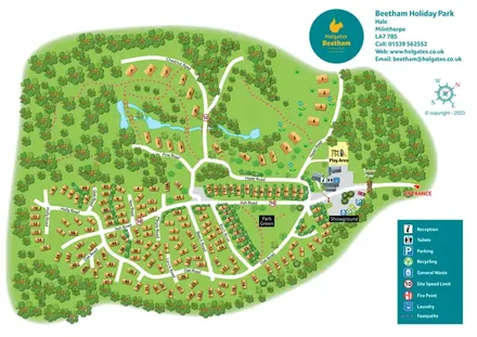
A woodland holiday-park plan with numbered homes, tree-named roads, walking loops and a distinctive entrance totem pole.
 Explore the map ↗
United Kingdom
Illustrated lakeside park plan with numbered holiday units, leisure buildings and a looping Woodland Walk.
 Explore the map ↗
United Kingdom
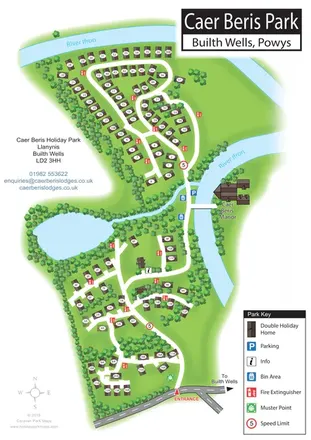
Portrait holiday-home park map with riverside loops, a tree-fringed pond and a separate manor landmark.
Features may come from the sample artwork, its key or published park information. Approximate numbers describe the drawing and may cover only part of a park. They are intended to help you compare map examples. Current facilities and booking information should be checked with the park.
LET’S MAP YOUR PARK
For a map quotation, find your park and draw a rough boundary around it. The area you select helps us work out the design time and price.
Draw your park for a quote ↗Or talk to our map designers
01751 473136