
Central open green
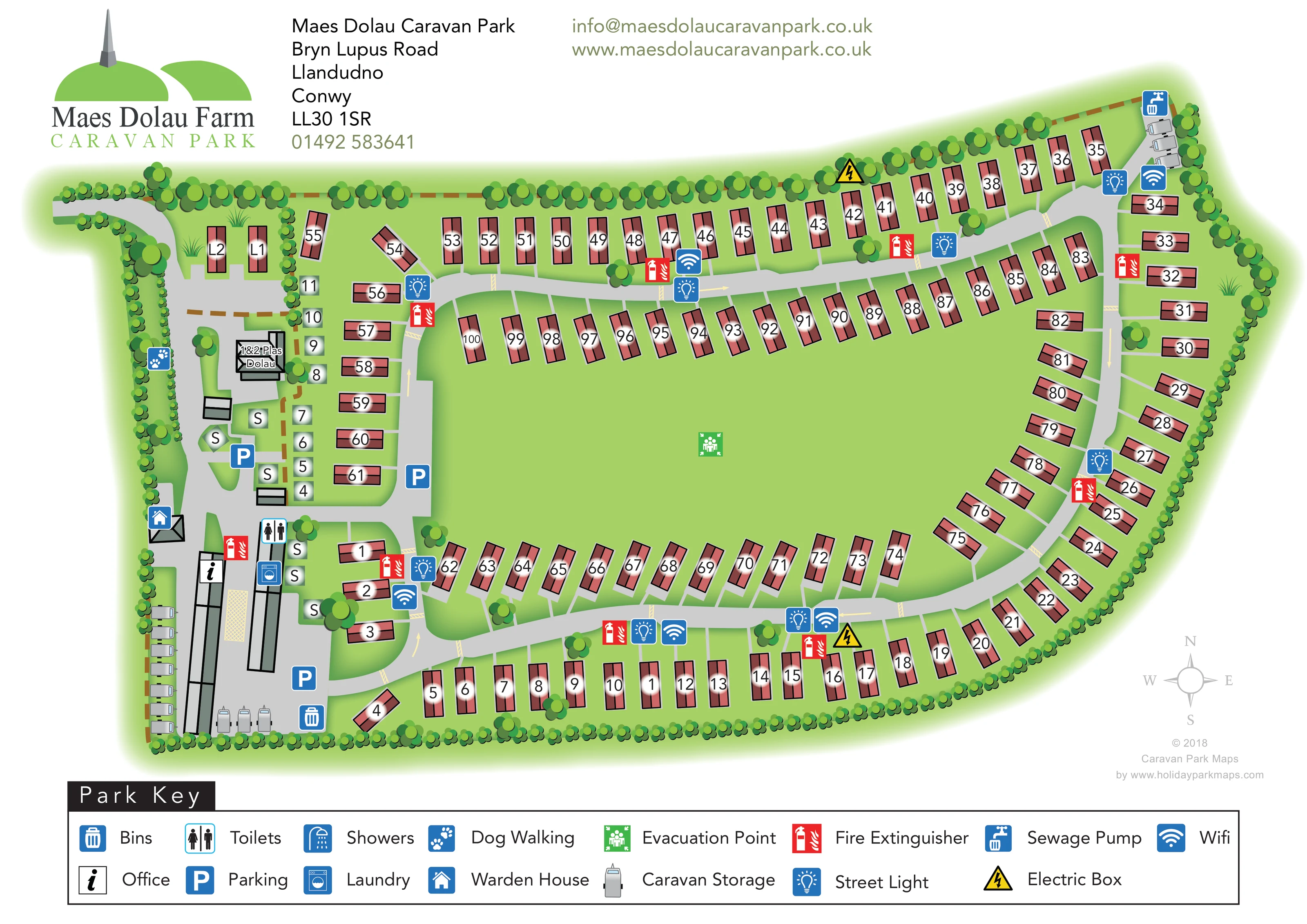
A broad, largely uninterrupted green interior separates the inner accommodation rows and contains the evacuation point.
ILLUSTRATED PARK MAP · P534
Bryn Lupus Road, Llandudno, Conwy · United Kingdom
 Enlarge the map ↗
A SENSE OF THE PLACE
Maes Dolau Caravan Park is based at Bryn Lupus Road, Llandudno, Conwy. The park provides owner-occupied static caravans/lodges and touring pitches; static caravan hire is expressly unavailable.
A controlled vehicle barrier and an on-site warden are described. Touring pitches have water, drainage and 12-amp hook-ups; WC facilities are included.
LOOK CLOSER
A broad, largely uninterrupted green interior separates the inner accommodation rows and contains the evacuation point.
Continuous stylised trees frame most of the park, with scattered larger trees and grass tufts inside.
An information symbol identifies the office in the long building at the south-western service compound.
A house symbol marks a small detached building beside the western access lane.
A toilet symbol identifies the service building beside the office and touring area.
A washing-machine symbol is placed on the elongated toilet and service building.
Blue P symbols mark several parking positions around the western service area and its connection to the main loop.
Grey towable-caravan symbols show storage beside the south-western buildings and in a small north-eastern spur.
An information symbol identifies the office in the long building at the south-western service compound.
A house symbol marks a small detached building beside the western access lane.
A toilet symbol identifies the service building beside the office and touring area.
A washing-machine symbol is placed on the elongated toilet and service building.
Showers appear in the Park Key, but a separate shower symbol is not clearly positioned on the plan.
Blue P symbols mark several parking positions around the western service area and its connection to the main loop.
Grey towable-caravan symbols show storage beside the south-western buildings and in a small north-eastern spur.
A paw-print symbol marks dog walking along the tree-lined western side; no separate extended walking circuit is drawn.
A green assembly symbol occupies the large central open space.
Repeated red symbols identify extinguisher locations around the accommodation loop and western buildings.
Blue Wi-Fi symbols are distributed around the loop road, rather than shown as a coverage boundary.
Repeated blue light-bulb symbols mark lighting positions beside the internal roads.
Yellow lightning-bolt triangles mark electrical infrastructure on the northern and southern sides.
Bin symbols appear at the south-western compound and within the combined utility symbol at the north-eastern tip.
The key's tap-and-bin pictogram is positioned at the end of the north-eastern storage spur and labelled Sewage Pump.
A broad, largely uninterrupted green interior separates the inner accommodation rows and contains the evacuation point.
Continuous stylised trees frame most of the park, with scattered larger trees and grass tufts inside.
The entrance approaches from the north-west, feeds the western service area and connects to a broad loop. Pale arrows indicate circulation, with short hatched bands across parts of the road.
A named building in the western cluster provides a local landmark; its accommodation or operational use is not defined by the key.
READING THE MAP
This map of Maes Dolau Caravan Park in Llandudno, Conwy, presents a tree-framed site with a particularly clear organising feature: a broad central green surrounded by rows of caravan plots. The main accommodation follows a curving loop road, while the entrance, smaller pitch area and service buildings form a distinct cluster on the western side. Two units marked L1 and L2 sit close to the arrival lane, giving the entrance area its own recognisable layout.
The artwork combines a top-down plan with simple illustrated roofs, layered green trees and bold facility symbols. Large plot labels remain prominent against the red caravan shapes, and a wide Park Key explains the symbols beneath the drawing. The map shows the office, warden house, toilets, laundry, parking, caravan storage and dog-walking location, alongside lighting, Wi-Fi and safety infrastructure.
For a sample gallery, this is a useful example of a practical caravan-park map that balances individual plot finding with an immediate understanding of the whole site. Its green setting and restrained page structure leave room for both operational detail and park branding.
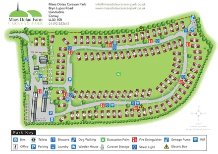
The single landscape plan places the park logo and contact block above the illustrated site, with a full-width, two-row Park Key below. A pale compass sits in the lower-right margin. The overlapping detail views enlarge the same artwork rather than showing additional sections or separate maps.
Arrival is shown at the north-western corner, where a grey lane curves between trees before continuing down the western side. The two L-labelled units occupy a small enclosure near this approach. Farther south, the building labelled 1&2 Plas Dolau sits among green pitch markers and smaller structures. The office, warden house, toilet and laundry symbols distinguish the main service cluster, with several parking markers nearby. Grey towable-caravan illustrations identify storage along the south-western boundary and at the opposite, north-eastern tip.
Most accommodation is drawn as two-tone red roof rectangles with black outlines and large halo-backed labels. These form parallel inner and outer rows around a broad grey loop, turning with the rounded eastern boundary. Short grey links connect the individual units to the road. Pale directional arrows indicate circulation, and short yellow hatched bands punctuate the route without obscuring it.
The expansive central green contains a single evacuation-point symbol. Tree canopies line almost the entire perimeter, with occasional larger trees between plots. Blue symbols mark Wi-Fi and street lights around the loop; red extinguisher symbols and yellow electrical triangles provide a separate visual hierarchy for safety and infrastructure. The western dog-walking marker, bin points and north-eastern sewage-pump symbol complete the mapped service detail. Showers are listed in the key, although a separate shower location is not clearly marked on the plan.
KEEP EXPLORING
Chosen for shared landscapes, accommodation or facilities.
 Explore the map ↗
United Kingdom
Woodland-framed Barnsoul map with mixed accommodation, shared facilities and paw-marked walking routes.
 Explore the map ↗
United Kingdom
A wooded, streamside park map with a linked farm, café, touring and cottage area.
 Explore the map ↗
United Kingdom
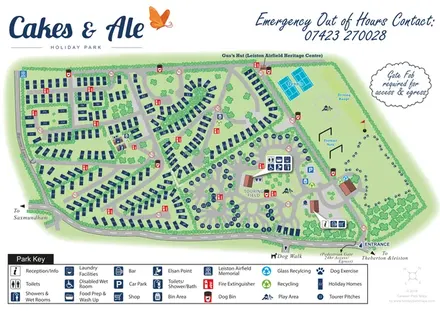
Branded Suffolk park plan with holiday homes, touring loops, recreation grounds and airfield heritage landmarks.
Features may come from the sample artwork, its key or published park information. Approximate numbers describe the drawing and may cover only part of a park. They are intended to help you compare map examples. Current facilities and booking information should be checked with the park.
TAKE A CLOSER LOOK
View the illustrated map in detail or choose a file to download. These are sample maps; contact the park for current visitor information.


LET’S MAP YOUR PARK
For a map quotation, find your park and draw a rough boundary around it. The area you select helps us work out the design time and price.
Draw your park for a quote ↗Or talk to our map designers
01751 473136