
Sandy beach
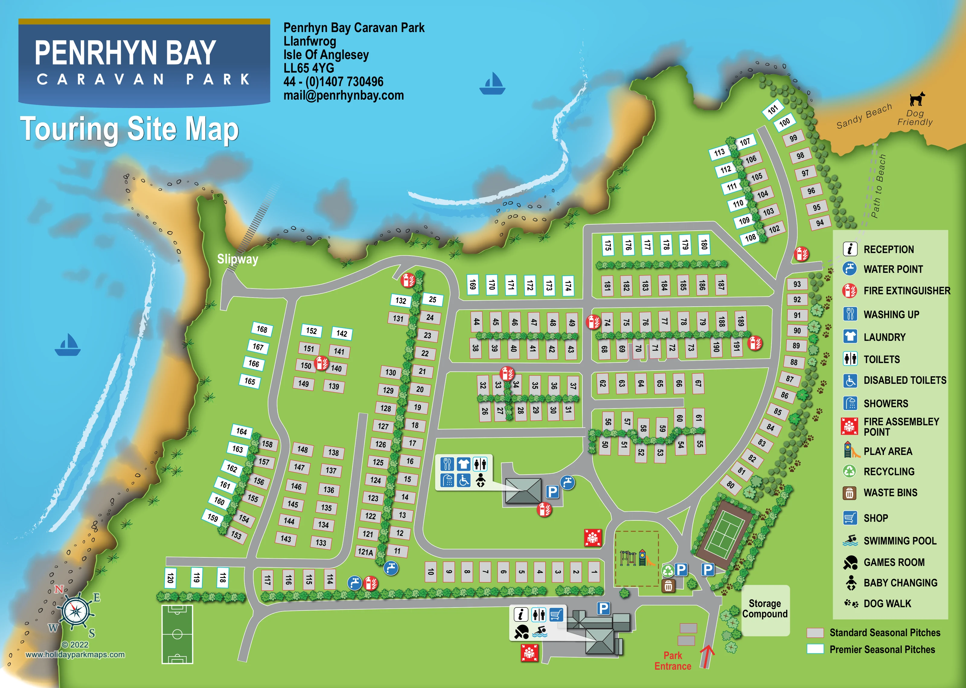
The upper-right beach is labelled 'Sandy Beach' and 'Dog Friendly'. The wording applies to this mapped beach and does not establish a park-wide pet policy.
ILLUSTRATED PARK MAP · P568
Llanfwrog, Isle of Anglesey · United Kingdom
 Enlarge the map ↗
A SENSE OF THE PLACE
Penrhyn Bay Caravan Park is a family-run coastal site at Llanfwrog on Anglesey. Its west-coast location provides views across the Irish Sea.
Owner-occupied static caravans and seasonal touring pitches form the park's main accommodation. The map illustrates the arrangement of these areas and the routes through the grounds, providing an overview for visitors returning to the island.
LOOK CLOSER
The upper-right beach is labelled 'Sandy Beach' and 'Dog Friendly'. The wording applies to this mapped beach and does not establish a park-wide pet policy.
Blue sea wraps around the upper and left sides, with irregular grassy headlands, sand, rocks and white surf.
Repeated shrubs divide paired pitch rows, line the lower boundary and enclose the tennis court and dog-walk corridor.
Reception symbol linked to the main building complex near the entrance.
Shopping-trolley symbol grouped with reception and other facilities at the entrance-side complex.
Swimming-pool symbol attached to the main facility complex; the pool itself is not drawn as a separate water basin.
Table-tennis-style games-room symbol in the entrance-side facility callout.
Toilets marked at the main complex and a separate central service building; showers are included in the central building's callout.
Reception symbol linked to the main building complex near the entrance.
Shopping-trolley symbol grouped with reception and other facilities at the entrance-side complex.
Swimming-pool symbol attached to the main facility complex; the pool itself is not drawn as a separate water basin.
Table-tennis-style games-room symbol in the entrance-side facility callout.
Toilets marked at the main complex and a separate central service building; showers are included in the central building's callout.
Wheelchair toilet symbol at the central service building, described in the key as 'Disabled Toilets'.
Washing-up and laundry symbols grouped beside the central service building.
Baby-changing symbol included in the central service-building callout.
Blue tap symbols mark several water points around the lower pitch rows and central service area.
Red extinguisher symbols are distributed through the pitch areas, with assembly-point symbols around the entrance and recreation facilities.
Swings and a slide illustrated inside a dashed rectangular boundary near the main road junction.
A green court with recognisable tennis markings and a brown surround sits within planting beside the entrance route.
A small green football pitch with white touchlines, centre circle and goal areas is illustrated at the lower-left edge of the plan.
Recycling and waste-bin symbols appear beside the play area and nearby parking.
Blue P markers identify parking beside the main buildings, central service building and recreation area.
A labelled storage compound lies alongside the entrance road.
Red text and an inward-pointing arrow identify arrival at the lower-right edge.
A dashed route leads from the right-hand road network to the sandy beach.
Repeated pawprints mark a planted perimeter route along the right-hand side, passing the tennis court and outer pitch row towards the beach.
The upper-right beach is labelled 'Sandy Beach' and 'Dog Friendly'. The wording applies to this mapped beach and does not establish a park-wide pet policy.
A labelled, striped slipway extends from the upper-left road branch into the coastal water.
Blue sea wraps around the upper and left sides, with irregular grassy headlands, sand, rocks and white surf.
Repeated shrubs divide paired pitch rows, line the lower boundary and enclose the tennis court and dog-walk corridor.
READING THE MAP
This touring-site map for Penrhyn Bay Caravan Park places the coastal setting at the heart of the design. Blue sea, sandy coves and a rocky shoreline frame the numbered pitches, while the park's branding sits prominently over the water. Located at Llanfwrog on the Isle of Anglesey, the park is represented here through its seasonal touring area, with Standard and Premier pitches clearly distinguished by colour.
The plan brings together practical arrival information and the features visitors use to orient themselves. A red entrance arrow leads into the road network beside the storage compound, with reception and the main leisure facilities close by. Further into the grounds, a separate service building is identified through a compact group of washing-up, laundry, toilet and shower symbols.
Coastal access gives this sample particular character: a slipway reaches the water on one side, while a dashed path leads to the sandy beach on the other. A pawprint-marked dog walk, illustrated play area and sports facilities add useful landmarks without obscuring the pitch layout.
The artwork is a single landscape-format touring plan, arranged around an irregular coastal boundary. Sea fills the upper and left portions of the page, leaving room for the large Penrhyn Bay logo, contact details and 'Touring Site Map' heading. Shaded sand, rocky patches and white surf give the shoreline texture, while small sailboats and a nautical compass reinforce the setting.
Arrival is shown at the lower right with a red arrow beside the storage compound. The road passes the entrance-side building complex, where a grouped callout identifies reception, toilets, shop, swimming pool and games room. Blue parking markers sit around this complex and the nearby recreation facilities. The play area is illustrated with swings and a slide inside a dashed boundary; a planted tennis court lies alongside the entrance route, and a football pitch appears at the lower-left edge.
Beyond these landmarks, grey roads form loops and cross-routes through numbered pitch rows. Many pitches are arranged back to back with shrub hedges between them, while longer rows follow the perimeter. Grey rectangles with red outlines denote Standard Seasonal Pitches; white rectangles with cyan outlines denote Premier Seasonal Pitches. The latter are particularly noticeable around the outer and coastal rows.
A separate central building has a callout for washing-up, laundry, toilets, showers, accessible toilets and baby changing. Water points and fire extinguishers are distributed around the plan, with assembly points, recycling and waste bins also marked. At the coast, a striped slipway extends into the water, while a dashed beach path and pawprint dog-walk route lead towards the labelled sandy beach. The tall right-hand legend brings the facility symbols and pitch colours together.
KEEP EXPLORING
Chosen for shared landscapes, accommodation or facilities.
 Explore the map ↗
United Kingdom
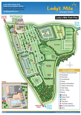
Portrait park plan with named fields, numbered accommodation, beach directions and an enlarged leisure-complex inset.
 Explore the map ↗
United Kingdom
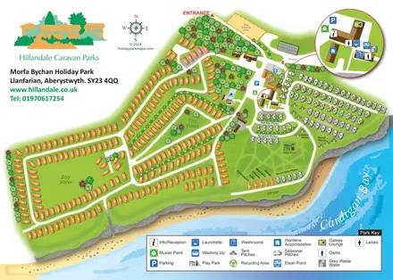
Coastal park plan with mixed accommodation, bird-themed pitch areas and an enlarged facilities inset.
 Explore the map ↗
United Kingdom
Trevornick’s colour-coded park map, with mixed accommodation, fishing ponds, golf and wooded trails.
Features may come from the sample artwork, its key or published park information. Approximate numbers describe the drawing and may cover only part of a park. They are intended to help you compare map examples. Current facilities and booking information should be checked with the park.
LET’S MAP YOUR PARK
For a map quotation, find your park and draw a rough boundary around it. The area you select helps us work out the design time and price.
Draw your park for a quote ↗Or talk to our map designers
01751 473136