
Pond
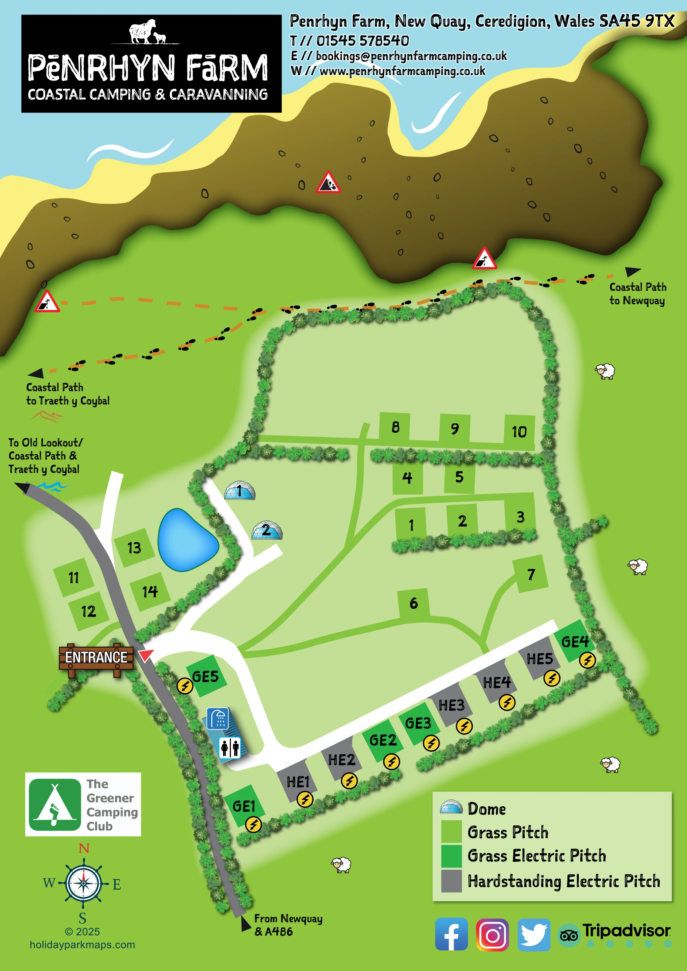
An unlabelled, rounded blue pond lies beside the western grass-pitch group, across a hedge from the domes.
ILLUSTRATED PARK MAP · P251
Penrhyn Farm, New Quay, Ceredigion, Wales · United Kingdom
 Enlarge the map ↗
A SENSE OF THE PLACE
Penrhyn Coastal Camping & Caravanning is based at Penrhyn Farm, New Quay, Ceredigion, Wales. Accommodation is on a working sheep farm within walking distance of New Quay. Other options include a static caravan, farm apartment and Stargazer domes. Camping pitches overlook the sea and sit beside the coastal footpath.
Domes are advertised with wood-fired hot tubs, stoves and private toilet/shower facilities. The park provides five touring pitches for caravans, motorhomes and campervans.
LOOK CLOSER
An unlabelled, rounded blue pond lies beside the western grass-pitch group, across a hedge from the domes.
The upper page shows blue sea, a pale yellow shoreline and a broad shaded brown rocky coastal edge.
Dense illustrated hedgerows define the site perimeter, divide pitch groups and separate the dome access from the pond-side pitches.
Cartoon sheep in the surrounding green space reinforce the farm character without defining livestock enclosures.
A small blue-roofed building near the entrance carries toilet and shower pictograms.
Yellow lightning-bolt discs mark electricity beside the green grass-electric and grey hardstanding-electric pitches.
A prominent timber-style ENTRANCE sign and red pointer mark the junction between the grey approach lane and white internal access road.
The grey lane enters from the bottom of the page with the label 'From Newquay & A486'.
A small blue-roofed building near the entrance carries toilet and shower pictograms.
Yellow lightning-bolt discs mark electricity beside the green grass-electric and grey hardstanding-electric pitches.
An unlabelled, rounded blue pond lies beside the western grass-pitch group, across a hedge from the domes.
The upper page shows blue sea, a pale yellow shoreline and a broad shaded brown rocky coastal edge.
Dense illustrated hedgerows define the site perimeter, divide pitch groups and separate the dome access from the pond-side pitches.
Cartoon sheep in the surrounding green space reinforce the farm character without defining livestock enclosures.
A prominent timber-style ENTRANCE sign and red pointer mark the junction between the grey approach lane and white internal access road.
The grey lane enters from the bottom of the page with the label 'From Newquay & A486'.
Orange dashed routes with footprint symbols run along the coastal side of the site, with arrows towards New Quay and Traeth y Coybal.
The lane continuing beyond the entrance is labelled towards the Old Lookout, coastal path and Traeth y Coybal; these destinations are not illustrated as on-site facilities.
Red triangular cliff-edge and falling-rock pictograms appear beside the coastal routes and rocky edge.
The park information describes wood-fired hot tubs, stoves and private toilet/shower facilities for the domes; these amenities are not individually depicted.
READING THE MAP
This illustrated map of Penrhyn Farm Coastal Camping & Caravanning places a small camping and glamping site firmly within its Welsh coastal setting. Located at New Quay in Ceredigion, the park is shown beneath a sweeping band of sea, shoreline and rocky cliffs, with the coastal path running along the edge of its hedged fields. Sheep illustrations and the farm’s black-and-white logo give the page a recognisable rural character.
The accommodation plan combines ordinary grass pitches, grass electric pitches, hardstanding electric pitches and two blue geodesic domes. Rather than filling the site with vehicle illustrations, the design uses clear coloured pitch shapes and large labels, making the different areas easy to distinguish. A signed entrance, toilet and shower block, pond and branching access routes provide useful landmarks.
The portrait layout also accommodates directions towards New Quay, Traeth y Coybal and the Old Lookout. It is a useful example of a compact campsite map that gives walking connections and landscape as much attention as pitch-finding.
The single portrait map is organised around the relationship between the campsite and the coast. Blue sea and a pale yellow shoreline stretch across the top, above a shaded brown cliff band. Immediately inland, orange dashed walking routes carry black footprint symbols and arrows towards New Quay and Traeth y Coybal. Red triangular warning pictograms punctuate this coastal area.
Arrival is shown from New Quay and the A486 along a grey lane entering from the bottom of the page. A timber-style entrance sign marks the turn into the campsite, where a broad white route branches through the accommodation areas. One branch serves the two numbered dome illustrations on the western side; another runs beside the electric pitches along the southern boundary. A small blue-roofed building near the entrance is marked with toilet and shower symbols.
The grass pitches sit in several short groups within a pale green field, linked by narrower green lines and divided in places by illustrated hedges. A further grass-pitch group lies beside the approach lane and a bright blue pond. The domes sit across the hedge from this pond-side area. Along the southern frontage, strong green grass-electric pitches alternate with grey hardstanding-electric pitches, each accompanied by a yellow lightning symbol.
A lower-right key explains the four accommodation symbols. The lower-left compass supports orientation, while the Greener Camping Club badge and scattered sheep motifs reinforce the farm identity. Branding and contact details occupy the upper margin, with social and review-platform logos below the key. The composition combines a straightforward accommodation plan with a particularly prominent illustration of the surrounding coastal landscape.
KEEP EXPLORING
Chosen for shared landscapes, accommodation or facilities.
 Explore the map ↗
United Kingdom
A colour-zoned coastal park map with touring areas, woodland trails, ponds and a leisure club.
 Explore the map ↗
United Kingdom
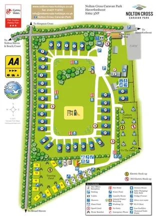
Portrait park map with a central caravan loop, separate touring field and fenced camping paddock.
 Explore the map ↗
United Kingdom
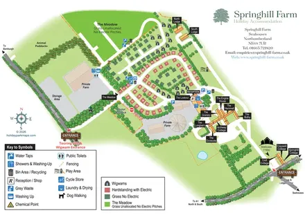
Mixed-accommodation farm map with separate entrances, touring loops, wigwams, cottages and an open camping meadow.
Features may come from the sample artwork, its key or published park information. Approximate numbers describe the drawing and may cover only part of a park. They are intended to help you compare map examples. Current facilities and booking information should be checked with the park.
LET’S MAP YOUR PARK
For a map quotation, find your park and draw a rough boundary around it. The area you select helps us work out the design time and price.
Draw your park for a quote ↗Or talk to our map designers
01751 473136