
Cardigan Bay
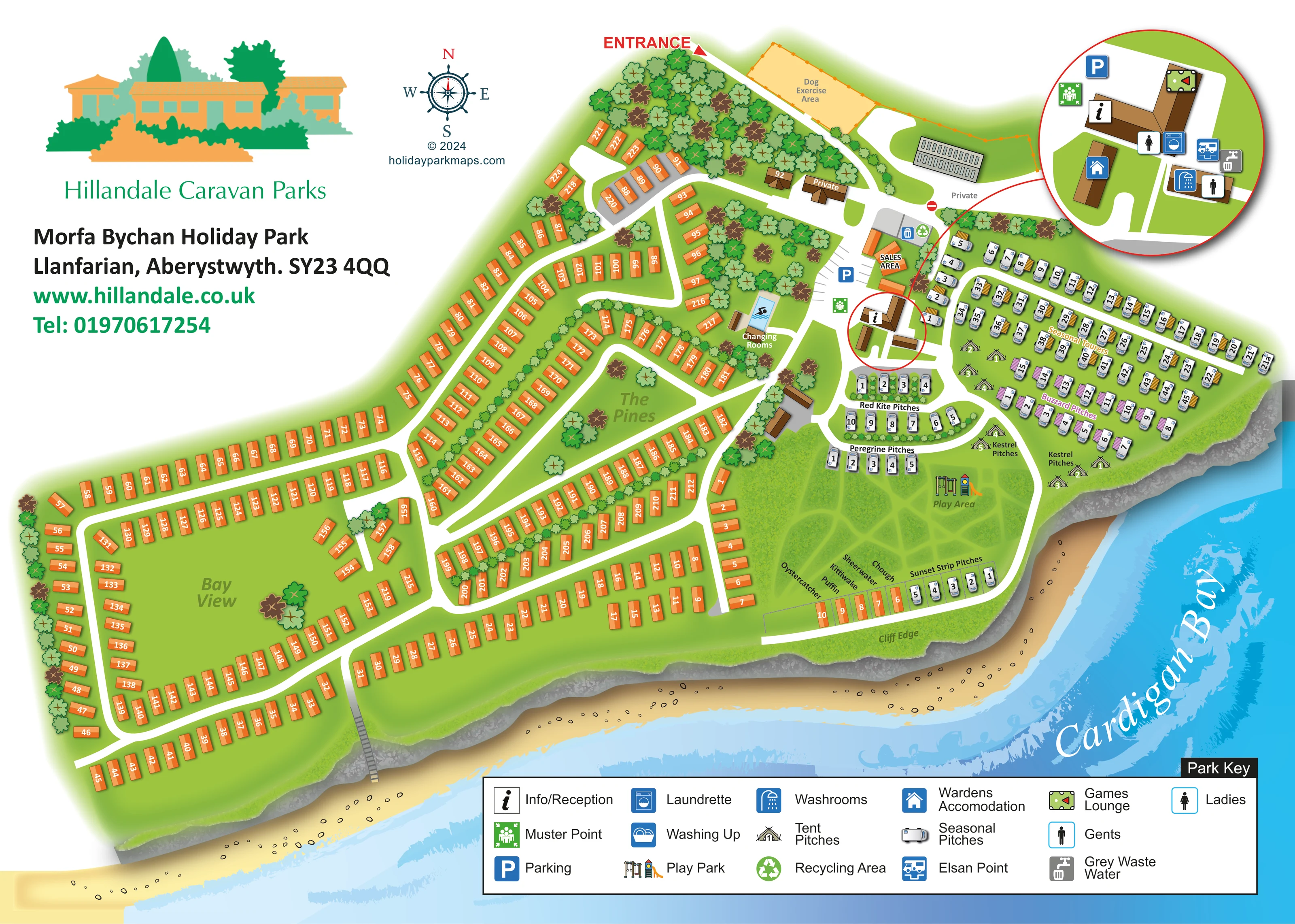
The bay is named in large white script across the illustrated blue sea along the lower and right-hand edges.
ILLUSTRATED PARK MAP · P220
Morfa Bychan Holiday Park, Llanfarian, Aberystwyth · United Kingdom
 Enlarge the map ↗
A SENSE OF THE PLACE
Morfa Bychan Holiday Park near Aberystwyth overlooks Cardigan Bay and has direct access to a pebble beach. Rolling hills around the park provide a countryside backdrop to its coastal setting.
A heated pool with an all-weather enclosure, pirate-ship play area and games lounge offer recreation on site. Beach walks, rock pools and water-based activities are part of the surrounding area's appeal.
LOOK CLOSER
The bay is named in large white script across the illustrated blue sea along the lower and right-hand edges.
A pale golden shoreline with scattered pebble marks runs beneath the park's rocky coastal boundary.
The coastal edge is explicitly labelled below Sunset Strip Pitches and illustrated as a grey rock face.
Trees frame the entrance, divide accommodation rows and surround central open spaces labelled Bay View and The Pines.
Marked at the central arrival and service-building cluster, with a linked circular enlargement.
A parking symbol and marked parking spaces sit beside the central arrival area.
An orange-roofed building group near reception is labelled Sales Area.
A blue pool with a swimmer symbol and adjacent Changing Rooms label appears just west of the main arrival road.
Marked at the central arrival and service-building cluster, with a linked circular enlargement.
A parking symbol and marked parking spaces sit beside the central arrival area.
An orange-roofed building group near reception is labelled Sales Area.
A blue pool with a swimmer symbol and adjacent Changing Rooms label appears just west of the main arrival road.
A games-table symbol locates the lounge within the enlarged service-building cluster.
Washroom, ladies and gents symbols identify facilities in the circular building inset.
A washing-machine symbol marks the laundrette in the service inset.
Included in the Park Key; a separate position is not clearly identifiable in the main plan or inset.
Both disposal facilities are marked beside the service buildings in the enlarged inset.
Recycling and bin symbols sit near the sales area and the junction leading towards the touring pitches.
A house symbol identifies wardens' accommodation in the service-building inset.
A green assembly symbol appears beside the central arrival road and is repeated in the inset.
Illustrated swings and a slide mark a grassy play area below Peregrine Pitches.
A pale orange, fenced-looking enclosure is labelled beside the entrance road at the top of the plan.
The bay is named in large white script across the illustrated blue sea along the lower and right-hand edges.
A pale golden shoreline with scattered pebble marks runs beneath the park's rocky coastal boundary.
The coastal edge is explicitly labelled below Sunset Strip Pitches and illustrated as a grey rock face.
A stairway descends from the western accommodation area across the rocky edge to the beach.
Trees frame the entrance, divide accommodation rows and surround central open spaces labelled Bay View and The Pines.
A red Entrance label and triangular marker identify arrival at the upper edge beside the tree belt.
Private labels distinguish buildings and a short branch near the upper arrival junction; a no-entry symbol reinforces the separation.
READING THE MAP
This illustrated map of Morfa Bychan Holiday Park places its Cardigan Bay setting at the centre of the design. The park at Llanfarian, near Aberystwyth, is shown above a rocky coastal edge, with a pebble beach and layered blue surf sweeping across the bottom of the page. Orange holiday-home roofs stand out against green lawns, while pale caravan symbols and small tents distinguish the touring and camping areas to the east.
The plan brings together a large accommodation layout and a relatively compact cluster of shared facilities. Reception, parking and the sales area form a clear arrival hub, with the swimming pool and changing rooms nearby. A circular enlargement gives the closely grouped service buildings more room, making the games lounge, laundrette, washrooms and touring waste facilities easier to recognise.
Named areas including Bay View, The Pines and the bird-themed pitch groups give visitors useful landmarks beyond individual numbers. Hillandale branding, a compass and a broad symbol key complete a map that combines practical site navigation with a strong sense of the park's coastal character.
The main plan follows the park's irregular coastal footprint, with the entrance at the upper edge and Cardigan Bay extending along the bottom and right. From the entrance, a white road passes the dog exercise area and wooded boundary before reaching the central arrival junction. Reception, marked parking spaces and the sales area sit here, at the meeting point of the holiday-home and touring sections. Private branches are distinguished by text and a no-entry symbol.
Most of the western and central plan consists of orange holiday-home units. Long rows follow the perimeter roads, while shorter curved rows enclose open greens labelled Bay View and The Pines. Trees help divide the accommodation into recognisable groups. The pool and changing rooms sit towards the eastern side of this section, close to the main route.
To the east, pale caravan symbols are organised into named groups, including Red Kite, Peregrine and Buzzard Pitches, with Seasonal Tourers across the upper rows. Kestrel tent pitches occupy small grassy pockets nearby. Sunset Strip Pitches follow the coastal edge, alongside a short row of orange units with bird names. An illustrated play area sits within the open green space below the central touring pitches.
A red-bordered circular inset enlarges the service buildings, locating reception, games lounge, laundrette, toilets, washrooms, wardens' accommodation and waste-disposal facilities. Its linking line makes clear that it is an enlargement, not another accommodation area. The lower Park Key explains the symbol system. Along the coast, a grey cliff face, pebble-marked beach and breaking waves establish the setting, while a drawn stairway provides a visible connection from the western park to the shore.
KEEP EXPLORING
Chosen for shared landscapes, accommodation or facilities.
 Explore the map ↗
United Kingdom
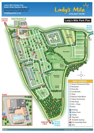
Portrait park plan with named fields, numbered accommodation, beach directions and an enlarged leisure-complex inset.
 Explore the map ↗
United Kingdom
Trevornick’s colour-coded park map, with mixed accommodation, fishing ponds, golf and wooded trails.
 Explore the map ↗
United Kingdom
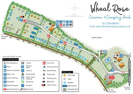
A tree-lined Cornish campsite map with colour-coded pitches, grouped facility callouts and the Coast to Coast Path.
Features may come from the sample artwork, its key or published park information. Approximate numbers describe the drawing and may cover only part of a park. They are intended to help you compare map examples. Current facilities and booking information should be checked with the park.
TAKE A CLOSER LOOK
View the illustrated map in detail or choose a file to download. These are sample maps; contact the park for current visitor information.


LET’S MAP YOUR PARK
For a map quotation, find your park and draw a rough boundary around it. The area you select helps us work out the design time and price.
Draw your park for a quote ↗Or talk to our map designers
01751 473136