
Pond
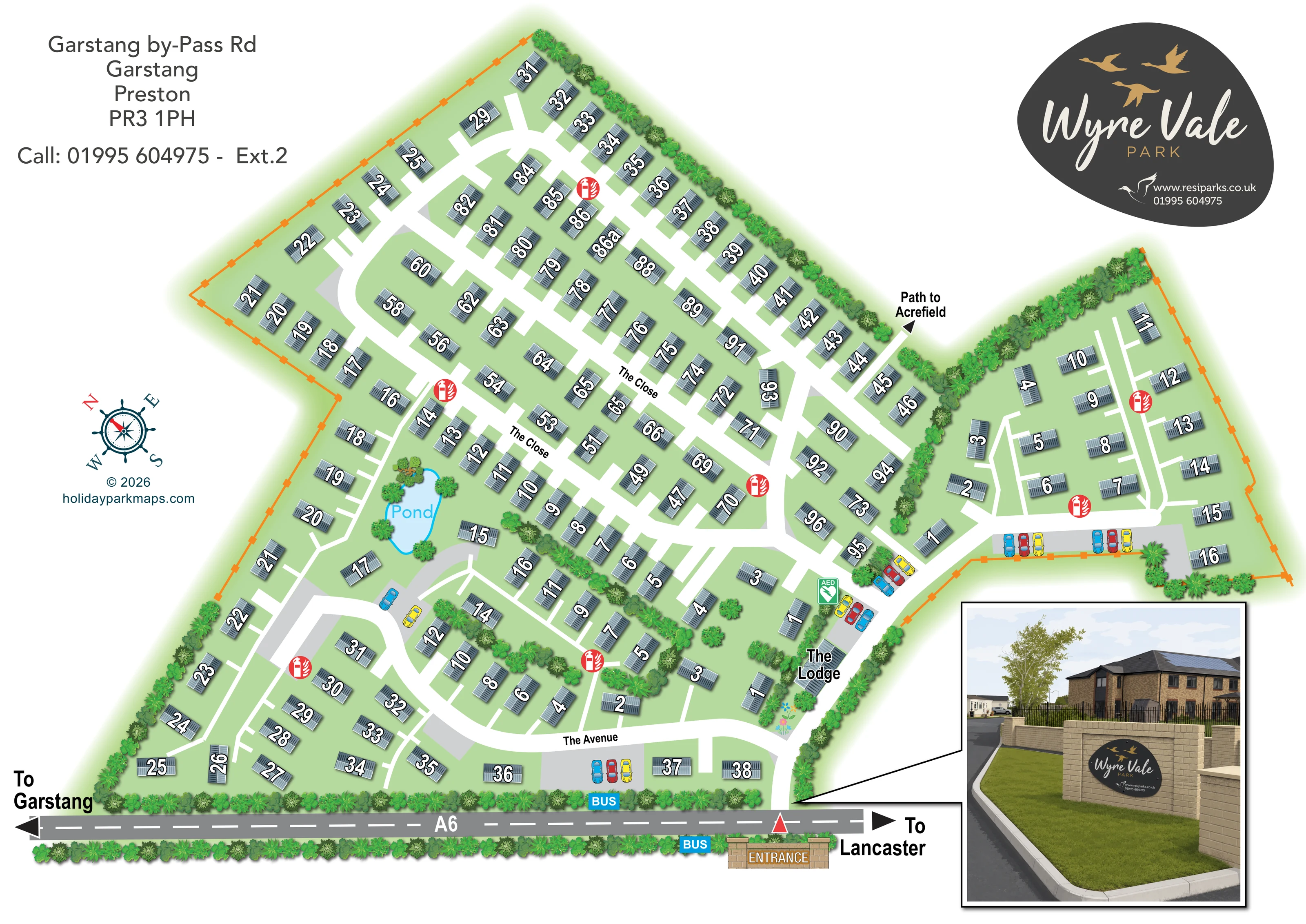
A small pale-blue pond with a bright cyan outline and label sits within the western part of the estate, surrounded by trees and shrubs.
ILLUSTRATED PARK MAP · P381
Garstang By-Pass Road, Garstang, Preston · United Kingdom
 Enlarge the map ↗
A SENSE OF THE PLACE
Wyre Vale is a residential park home estate near Garstang in Lancashire. Its location offers access to river, canal and fell walks and the wider Forest of Bowland area.
Homes have mains services, and residents can join the adjacent Acresfield Health Club and Spa under its membership arrangements. The map shows the residential layout and internal routes through the estate.
LOOK CLOSER
A small pale-blue pond with a bright cyan outline and label sits within the western part of the estate, surrounded by trees and shrubs.
Dense mixed planting follows much of the boundary and separates some residential rows. Small trees, shrubs and flowers also appear near the entrance.
An orange line with regular square marks defines exposed sections of the estate perimeter, complementing the illustrated planted edges.
The principal entrance is labelled beside the A6 at the bottom of the plan, with an illustrated stone entrance sign and a red triangular marker.
A grey road with a dashed white centre line runs along the lower edge; arrows indicate Garstang to the left and Lancaster to the right.
Named white internal roads connect the residential rows, frontage loop and eastern branch.
A labelled outward-pointing arrow marks a path through the planted boundary at the upper-right side of the main residential area. The artwork uses the spelling 'Acrefield'.
Blue BUS labels appear on opposite sides of the A6 near the entrance frontage.
The principal entrance is labelled beside the A6 at the bottom of the plan, with an illustrated stone entrance sign and a red triangular marker.
A grey road with a dashed white centre line runs along the lower edge; arrows indicate Garstang to the left and Lancaster to the right.
Named white internal roads connect the residential rows, frontage loop and eastern branch.
A labelled outward-pointing arrow marks a path through the planted boundary at the upper-right side of the main residential area. The artwork uses the spelling 'Acrefield'.
Blue BUS labels appear on opposite sides of the A6 near the entrance frontage.
Groups of blue, red and yellow cars identify grey parking areas beside the entrance approach, beneath the eastern home section and along the southern frontage.
A building beside the entrance approach is labelled The Lodge. Its function is not specified, so it is not classified as reception or lodge accommodation.
A green AED heart-and-lightning symbol is positioned beside the parking area near The Lodge.
Repeated red circular extinguisher-and-flame symbols mark fire equipment points throughout the residential sections.
A small pale-blue pond with a bright cyan outline and label sits within the western part of the estate, surrounded by trees and shrubs.
Dense mixed planting follows much of the boundary and separates some residential rows. Small trees, shrubs and flowers also appear near the entrance.
An orange line with regular square marks defines exposed sections of the estate perimeter, complementing the illustrated planted edges.
The park context identifies an adjacent health club and spa which residents may join under its membership arrangements. The club's facilities are not drawn on this plan.
READING THE MAP
This illustrated map of Wyre Vale Park presents a residential park home estate near Garstang in Lancashire. Rather than separating holiday pitches by accommodation type, it focuses on finding individual homes within a network of estate roads. Around 150 homes are depicted, with prominent numbers set over grey roof illustrations and the named routes The Avenue and The Close helping readers understand the different residential sections.
The A6 forms a clear lower edge to the drawing, with the entrance, bus markers and directions towards Garstang and Lancaster grouped along the frontage. Inside the estate, a small pond, planted boundaries and The Lodge provide recognisable landmarks. A footpath connection towards Acrefield is also identified.
The page combines practical navigation with the park's visual identity. A large charcoal-and-gold logo occupies the upper-right corner, while a perspective entrance inset links the plan to the appearance of the arrival point. This makes the sample particularly relevant to residential estates needing a numbered home map that also communicates landscaping, road access and a distinctive entrance.
The main plan is arranged diagonally across a landscape page, with the broadest residential section extending towards the upper left and a smaller wing branching to the right. The entrance comes off the A6 at the bottom, passing The Lodge and several illustrated parking groups before dividing into the estate's internal routes. The Avenue curves around the southern homes, while The Close is labelled through the denser central rows. Short white access spurs connect individual homes to the wider white lanes.
Each home is represented by a shaded grey roof with a large white, black-outlined number. Units turn to follow the roads and irregular perimeter, allowing the residential organisation to remain visible without drawing detailed gardens. Mixed tree and shrub illustrations define the edges and form planted belts between some rows. A labelled blue pond breaks up the western residential area, and a small flower display adds detail near the entrance approach.
Practical symbols are placed directly on the plan: red fire equipment markers recur across the estate, a green AED marker sits near The Lodge, and blue BUS labels appear beside the A6. External arrows point towards Garstang and Lancaster, while a labelled path leaves the main section towards Acrefield. A compass rose in the left margin explains the rotated orientation.
The lower-right inset provides a more realistic perspective of the entrance, including the branded stone wall, landscaping, railings and a brick building behind it. Its black frame and leader line connect this arrival view to the overhead plan. Address and contact details occupy the upper-left margin, balanced by the large park logo at upper right. The result is a single integrated estate map, not a set of separate accommodation or walking-map variants.
KEEP EXPLORING
Chosen for shared landscapes, accommodation or facilities.
 Explore the map ↗
United Kingdom
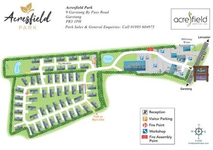
Illustrated Acresfield Park map with numbered residential homes, two ponds and a health-club arrival complex.
 Explore the map ↗
United Kingdom
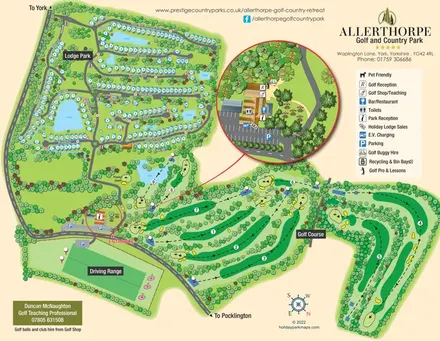
Lakeside lodge neighbourhoods and a nine-hole golf course, with an enlarged reception and facilities inset.
 Explore the map ↗
United Kingdom
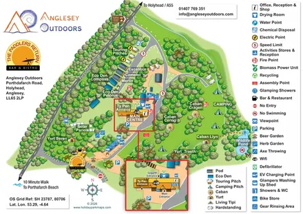
Illustrated camping and glamping map with an activity-centre inset and wildlife pond.
Features may come from the sample artwork, its key or published park information. Approximate numbers describe the drawing and may cover only part of a park. They are intended to help you compare map examples. Current facilities and booking information should be checked with the park.
LET’S MAP YOUR PARK
For a map quotation, find your park and draw a rough boundary around it. The area you select helps us work out the design time and price.
Draw your park for a quote ↗Or talk to our map designers
01751 473136