
Tree-lined park boundary
A dense illustrated belt of mixed green tree crowns encloses most of the accommodation layout.
ILLUSTRATED PARK MAP · P653
Y Fron Caravan Park, Borth, Ceredigion · United Kingdom
 Enlarge the map ↗
A SENSE OF THE PLACE
Y Fron is a holiday caravan park at Borth in Ceredigion, with views across Cardigan Bay towards the Dyfi estuary and Cambrian Mountains. Its coastal setting is close to Borth beach.
Visitors benefit from facilities at the separate sister park, Brynrodyn, including The View bar and restaurant, soft play and other leisure spaces. The map presents Y Fron's own holiday home layout and access routes.
LOOK CLOSER
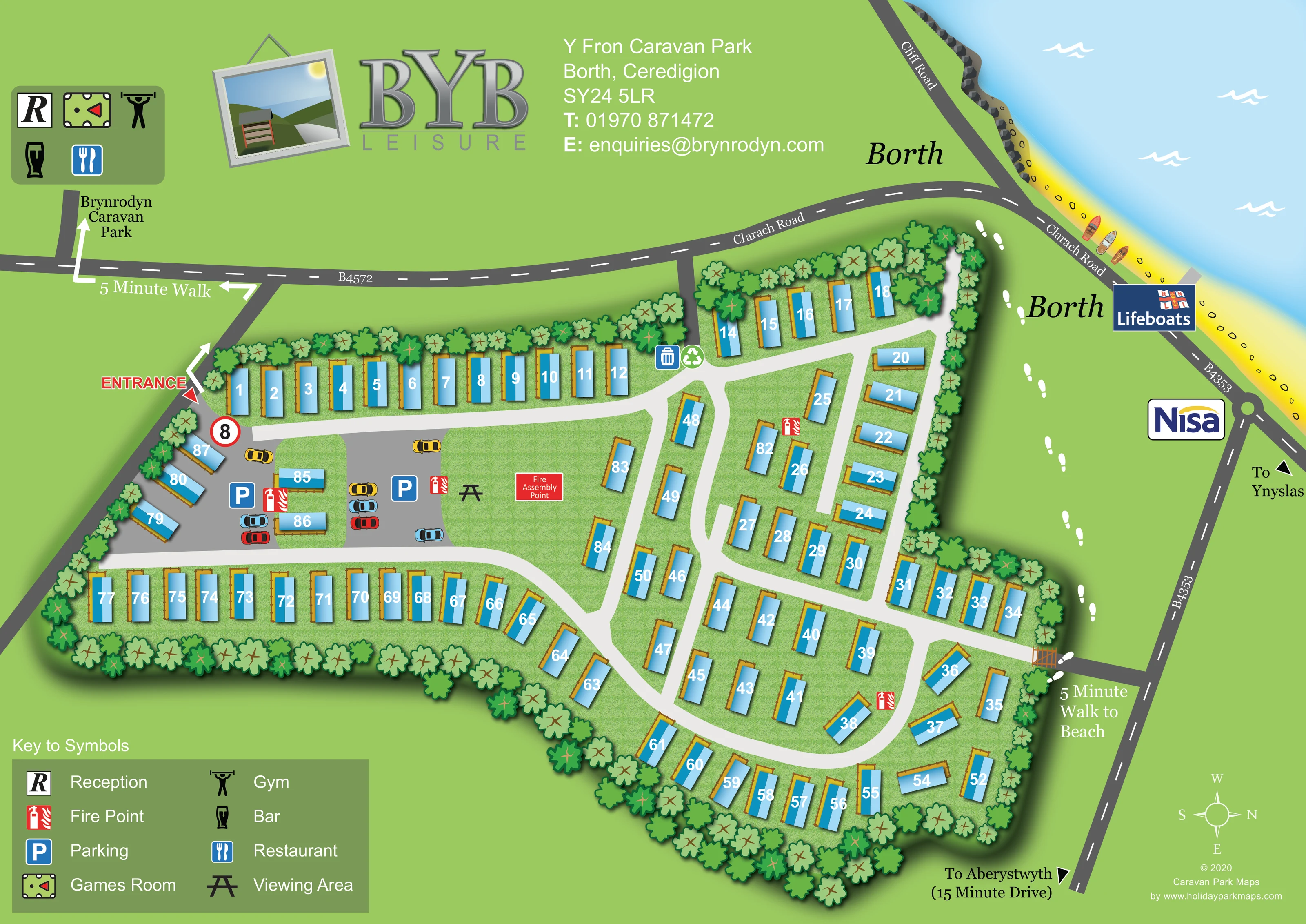
A dense illustrated belt of mixed green tree crowns encloses most of the accommodation layout.
The upper-right corner shows pale blue sea, a yellow beach, a darker rocky edge, small boats and white wave marks.
A red entrance label and pointer identify access from the road on the left of the plan, close to the parking area.
Broad pale lanes branch from the entrance area, serving the long western rows and looping through the more irregular eastern accommodation groups.
Two blue parking symbols mark grey surfaced areas near the entrance, with small illustrated cars reinforcing their use.
Red fire-point symbols are distributed between the entrance parking area and the internal caravan groups.
A red labelled panel marks the fire assembly point on the open grass beside the entrance-side parking and viewing area.
A black picnic-table-style symbol, identified in the key as a viewing area, appears on the central grass near the parking.
A red entrance label and pointer identify access from the road on the left of the plan, close to the parking area.
Broad pale lanes branch from the entrance area, serving the long western rows and looping through the more irregular eastern accommodation groups.
Two blue parking symbols mark grey surfaced areas near the entrance, with small illustrated cars reinforcing their use.
Red fire-point symbols are distributed between the entrance parking area and the internal caravan groups.
A red labelled panel marks the fire assembly point on the open grass beside the entrance-side parking and viewing area.
A black picnic-table-style symbol, identified in the key as a viewing area, appears on the central grass near the parking.
Adjacent bin and recycling symbols appear at the upper internal junction, close to the access from Clarach Road.
A dense illustrated belt of mixed green tree crowns encloses most of the accommodation layout.
The upper-right corner shows pale blue sea, a yellow beach, a darker rocky edge, small boats and white wave marks.
A lower-right boundary connection and a trail of white footprints relate the park to the coast. The artwork labels the beach as a five-minute walk.
White directional arrows indicate a five-minute walk from the entrance side towards the separately labelled Brynrodyn Caravan Park.
An off-site destination panel beside the Brynrodyn label groups reception, games room, gym, bar and restaurant symbols. These are not placed within Y Fron's accommodation layout.
Clarach Road, Cliff Road, the B4572 and B4353 provide local context, with directional references to Ynyslas and Aberystwyth. The latter carries a 15-minute-drive annotation.
Borth Lifeboats and Nisa logos identify nearby landmarks along the coastal road, outside the park boundary.
The park's wider setting includes views across Cardigan Bay towards the Dyfi estuary and Cambrian Mountains; those distant features are not individually drawn on this plan.
READING THE MAP
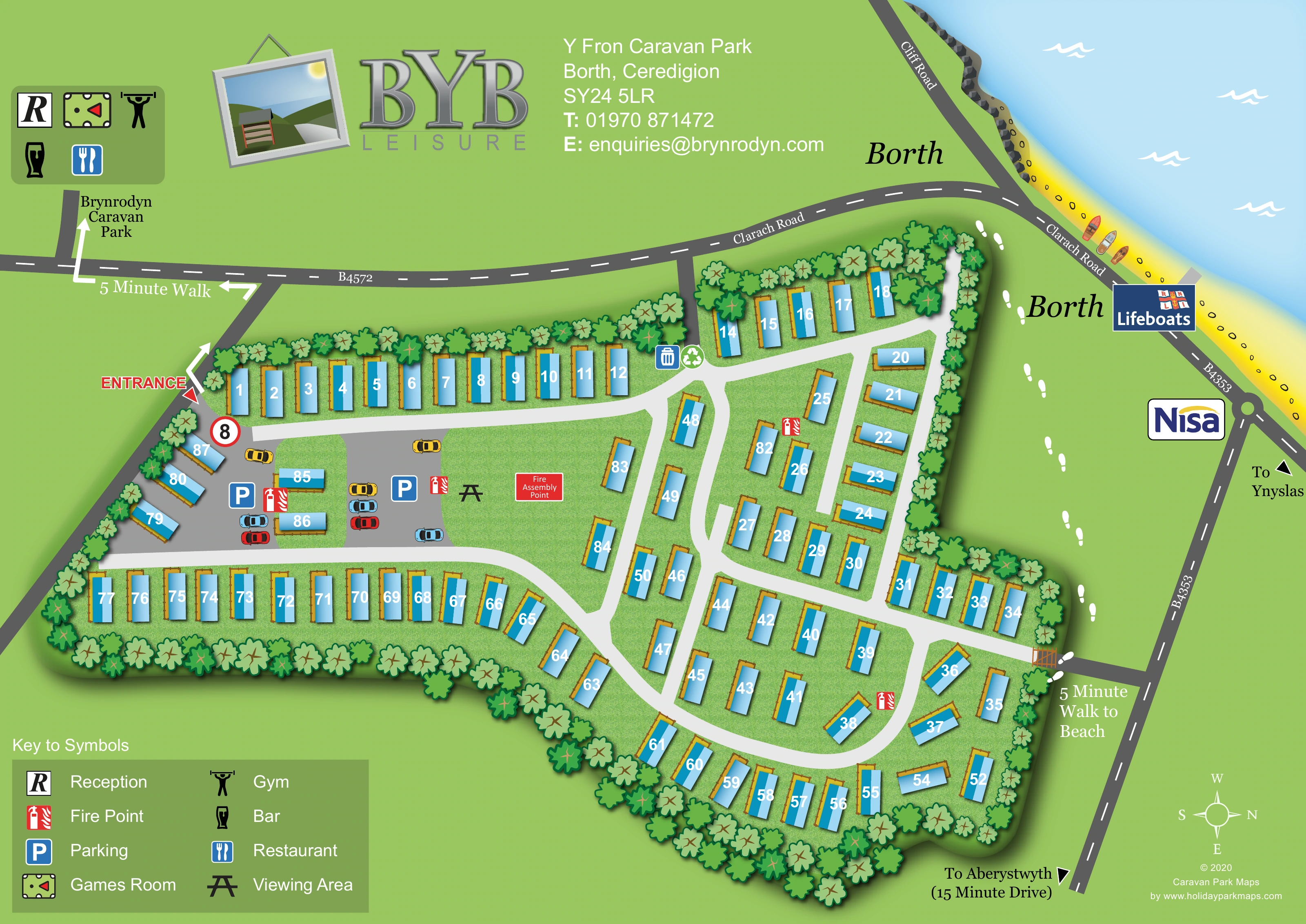
This illustrated map of Y Fron Caravan Park places its holiday homes within the coastal setting of Borth, Ceredigion. A tree-lined plan of roughly 80 caravans fills the centre of the artwork, while the beach, sea and surrounding roads give visitors a useful sense of where the park sits. Blue numbered units stand out against textured grass, and broad white lanes make the accommodation groups easy to follow.
The map also explains an important relationship beyond the park boundary. A marked walking route leads towards nearby Brynrodyn Caravan Park, where a separate symbol panel identifies reception and leisure facilities. Another annotation connects Y Fron with the beach. Parking, fire points, a viewing area and the fire assembly point remain clearly located within the main plan.
With BYB Leisure branding above and a generous symbol key below, this sample combines a practical accommodation map with local orientation. It is particularly relevant to coastal caravan parks whose visitors need to understand both their own holiday-home layout and nearby shared facilities.
The main plan follows Y Fron's irregular boundary, using a continuous belt of illustrated trees to separate the caravan grounds from the surrounding roads and open green space. Long rows occupy the upper and lower-left edges, while shorter groups and angled units follow the curving lanes on the right. Each caravan has a blue body, gold-coloured decking or surround, a soft shadow and a large white plot number.
Arrival is marked on the left with a red entrance label. Just inside, grey parking areas contain blue parking signs and small coloured cars. Nearby grass carries a viewing-area symbol and a prominent fire assembly label. Red fire-point icons appear elsewhere through the accommodation layout, and bin and recycling symbols sit beside an upper junction. The white internal lanes provide a strong visual contrast with the dark grey public roads outside.
Beyond the boundary, Clarach Road, Cliff Road and numbered roads connect the park to Borth and directional references for Ynyslas and Aberystwyth. The upper-right shoreline is illustrated with yellow sand, rocks, small boats and white waves on pale blue water. Borth Lifeboats and Nisa logos act as local landmarks. Walking arrows towards Brynrodyn and footprints along the coast-facing side complement the beach-walk annotation.
The page balances this detailed plan with a large BYB Leisure logo, park contact information and a two-column symbol key. Brynrodyn's reception, games room, gym, bar and restaurant are grouped outside Y Fron's boundary. A lower-right compass makes the unusual west-up orientation explicit.
KEEP EXPLORING
Chosen for shared landscapes, accommodation or facilities.
 Explore the map ↗
United Kingdom
Coastal park map with static-caravan rows, touring pitches, a camping field and two leisure clusters.
 Explore the map ↗
United Kingdom
Illustrated coastal holiday-home plan with dense alphanumeric plot labels, orange-roofed amenities, a numbered facility key and beach-side context.
 Explore the map ↗
United Kingdom
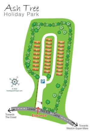
Tree-lined holiday-home park plan with a numbered road loop and clear Lower Norton Lane entrance.
Features may come from the sample artwork, its key or published park information. Approximate numbers describe the drawing and may cover only part of a park. They are intended to help you compare map examples. Current facilities and booking information should be checked with the park.
TAKE A CLOSER LOOK
View the illustrated map in detail or choose a file to download. These are sample maps; contact the park for current visitor information.


LET’S MAP YOUR PARK
For a map quotation, find your park and draw a rough boundary around it. The area you select helps us work out the design time and price.
Draw your park for a quote ↗Or talk to our map designers
01751 473136
 yfronmap_large.png