
Horse paddock
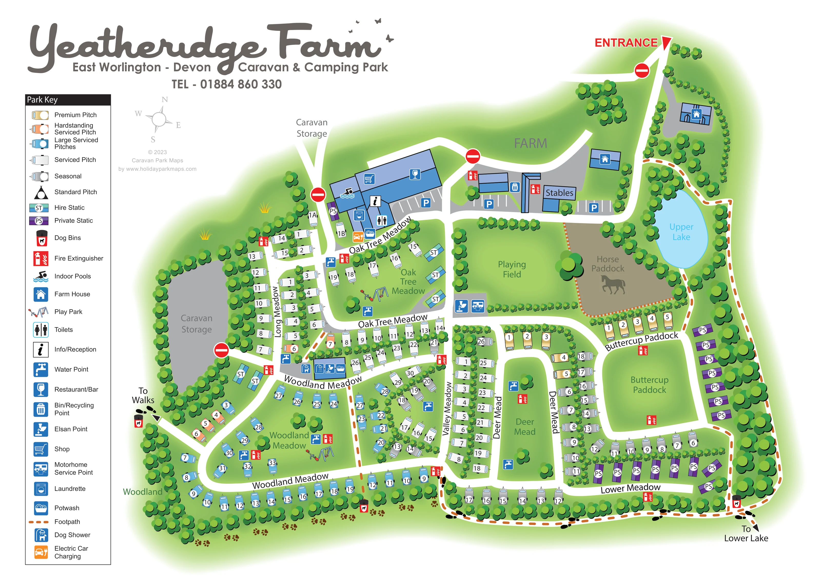
Muted brown paddock with a horse silhouette lies between the playing field and Upper Lake.
ILLUSTRATED PARK MAP · P382
East Worlington, Crediton, Devon · United Kingdom
 Enlarge the map ↗
A SENSE OF THE PLACE
Yeatheridge Farm is a family-run caravan and camping park near Crediton in Mid Devon. Its working-farm setting is surrounded by countryside, with marked walks helping visitors enjoy the landscape.
Indoor swimming pools, fishing lakes, a bar and restaurant, shop and opportunities to meet farm animals provide activities on site. The map helps guests locate the camping areas, shared facilities and routes around the farm.
LOOK CLOSER
Muted brown paddock with a horse silhouette lies between the playing field and Upper Lake.
Light-blue lake is enclosed by trees on the eastern side of the plan.
Dense illustrated trees define the western woodland, site perimeter, lake edge and divisions between pitch rows.
Prominent red ENTRANCE lettering and an arrow mark the approach at the upper-right edge.
Information symbol marks the principal facilities complex beside Oak Tree Meadow.
Swimming symbol identifies the western wing of the main blue-roofed building group.
Glass symbol locates the restaurant/bar within the central visitor complex.
Shopping-trolley symbol appears on the main facilities building.
Prominent red ENTRANCE lettering and an arrow mark the approach at the upper-right edge.
Information symbol marks the principal facilities complex beside Oak Tree Meadow.
Swimming symbol identifies the western wing of the main blue-roofed building group.
Glass symbol locates the restaurant/bar within the central visitor complex.
Shopping-trolley symbol appears on the main facilities building.
Toilets are marked at the main complex; a shower symbol also appears at the Woodland Meadow service building.
Washing-machine symbol is positioned at the main facilities complex.
Potwash symbols appear at the main complex and the Woodland Meadow service building.
Dog-shower symbol is grouped with the Woodland Meadow washing and service facilities.
Orange charging symbol stands out beside the main facilities complex.
Illustrated swings and seesaws mark play areas within Oak Tree Meadow and Woodland Meadow.
Large green recreation field lies between Oak Tree Meadow and the horse paddock.
Repeated blue tap symbols are distributed through the accommodation areas.
Disposal symbols appear at the Woodland Meadow service building and beside the playing field.
Motorhome service symbol is located on the western side of the playing field beside an Elsan point.
Bin/recycling symbol is shown beside the farm and stables building group.
Distinctive red-and-black dog-bin symbols appear near the walking exit and along the southern perimeter.
Repeated red extinguisher symbols punctuate accommodation areas and building groups.
Grey bays with white stall lines and blue P symbols sit beside the main complex and stables.
A large tree-enclosed grey storage area occupies the western side; a further storage label points towards a northern access branch.
Two detached blue building footprints on the eastern approach carry house symbols defined as Farm House in the key.
The farm area sits above the main visitor roads, with a labelled stables building beside parking.
Muted brown paddock with a horse silhouette lies between the playing field and Upper Lake.
Light-blue lake is enclosed by trees on the eastern side of the plan.
A bottom-right directional label points beyond the illustrated park to Lower Lake; the lake itself is not depicted.
Dense illustrated trees define the western woodland, site perimeter, lake edge and divisions between pitch rows.
Orange dashed paths run through parts of the site and around the eastern and southern edges. A western 'To Walks' label and footprint markers identify outward walking connections.
Broad white roads connect the entrance, facilities and meadow loops; red no-entry signs mark selected branches.
The supplied park information identifies fishing lakes. The map labels Upper Lake and a direction to Lower Lake without explicitly labelling fishing.
READING THE MAP
This illustrated map of Yeatheridge Farm Caravan & Camping Park places a busy touring site within its working-farm setting at East Worlington in Devon. Tree-lined meadows, a horse paddock and Upper Lake give the plan a recognisable countryside character, while clearly differentiated pitches and facility symbols make it useful for everyday guest orientation.
The map brings together the main arrival route, reception, indoor pools, restaurant and bar, shop and shared services in one coherent view. Accommodation is arranged around named areas including Woodland Meadow, Oak Tree Meadow, Deer Mead and Buttercup Paddock. Colour-coded caravan symbols distinguish several pitch categories, with separate markings for hire and private statics.
Walking is also part of the design: orange dashed paths trace internal and perimeter connections, with directions towards wider walks and Lower Lake. A tall key sits beside the plan beneath prominent Yeatheridge Farm branding. The result is a sample particularly relevant to countryside caravan and camping parks that need to explain a varied accommodation layout alongside recreation, farm features and practical guest facilities.
The plan is organised around an entrance at the upper-right corner, where bold red lettering marks the approach. A white road descends past two house-marked buildings and connects with the farm and stables area. Parking bays accompany the stables and the larger visitor complex to the west. Within that blue-roofed complex, symbols locate reception, indoor pools, the shop, restaurant and bar, toilets, laundrette, potwash and electric car charging.
Below the facilities, linked roads divide the accommodation into named meadows. Long Meadow occupies the western-central strip beside caravan storage, while Oak Tree Meadow wraps around a play area and several hire statics. Woodland Meadow spreads across the lower-left portion, with many blue-coded large serviced pitches and another illustrated play area. Valley Meadow forms a narrow central run; Deer Mead and Buttercup Paddock organise the eastern accommodation, with Lower Meadow along the bottom edge. Purple private statics are particularly noticeable on the eastern and southern boundaries.
The landscape is integral to the composition. Tree belts separate rows, enclose the storage area and surround Upper Lake. A playing field and a horse paddock sit between the facilities and lake. Orange dashed footpaths cross selected areas and continue around the eastern and southern perimeter, with outward labels for walks and Lower Lake.
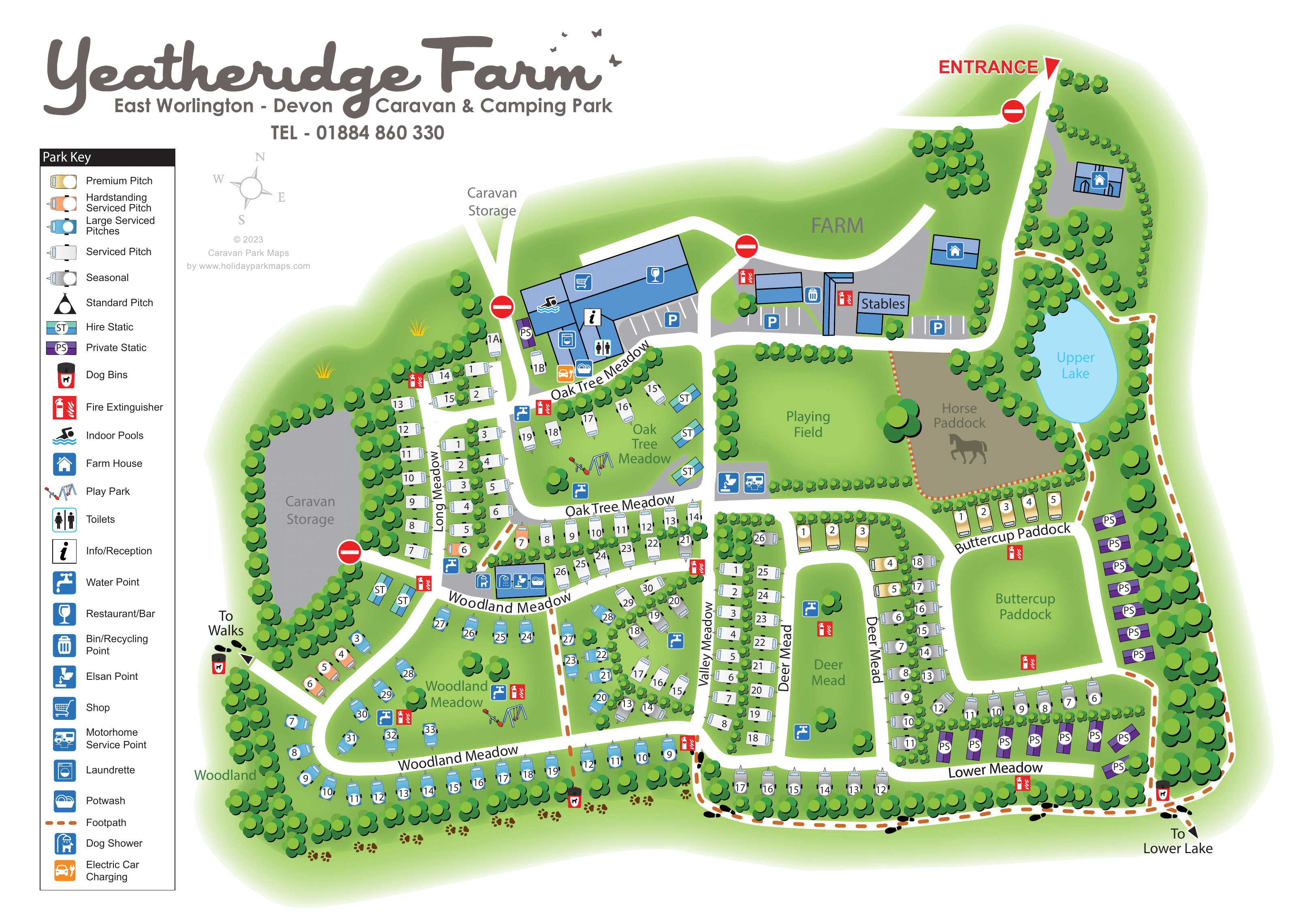
Repeated water and fire-extinguisher symbols support local wayfinding. The Woodland Meadow service building groups washing, potwash, dog-shower and disposal symbols, while a motorhome service point appears beside the playing field. The tall left-hand key explains the colour and pictogram system. The accompanying enlargement shows part of this same plan at a larger scale, making the key and western facilities easier to read rather than introducing another map variant.
KEEP EXPLORING
Chosen for shared landscapes, accommodation or facilities.
 Explore the map ↗
United Kingdom
Illustrated caravan park plan with woodland and riverside walks, fishing pools and wildlife panels.
 Explore the map ↗
United Kingdom
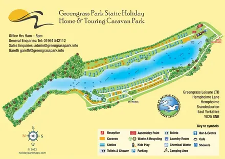
Colour-coded lakeside accommodation and illustrated facilities at Greengrass Park, East Yorkshire.
 Explore the map ↗
United Kingdom
Ashby Park map with seven fishing lakes, colour-coded accommodation and illustrated wooded shorelines.
Features may come from the sample artwork, its key or published park information. Approximate numbers describe the drawing and may cover only part of a park. They are intended to help you compare map examples. Current facilities and booking information should be checked with the park.
TAKE A CLOSER LOOK
View the illustrated map in detail or choose a file to download. These are sample maps; contact the park for current visitor information.


LET’S MAP YOUR PARK
For a map quotation, find your park and draw a rough boundary around it. The area you select helps us work out the design time and price.
Draw your park for a quote ↗Or talk to our map designers
01751 473136
 yeatheridge_large.png