
Seasonal mown maze
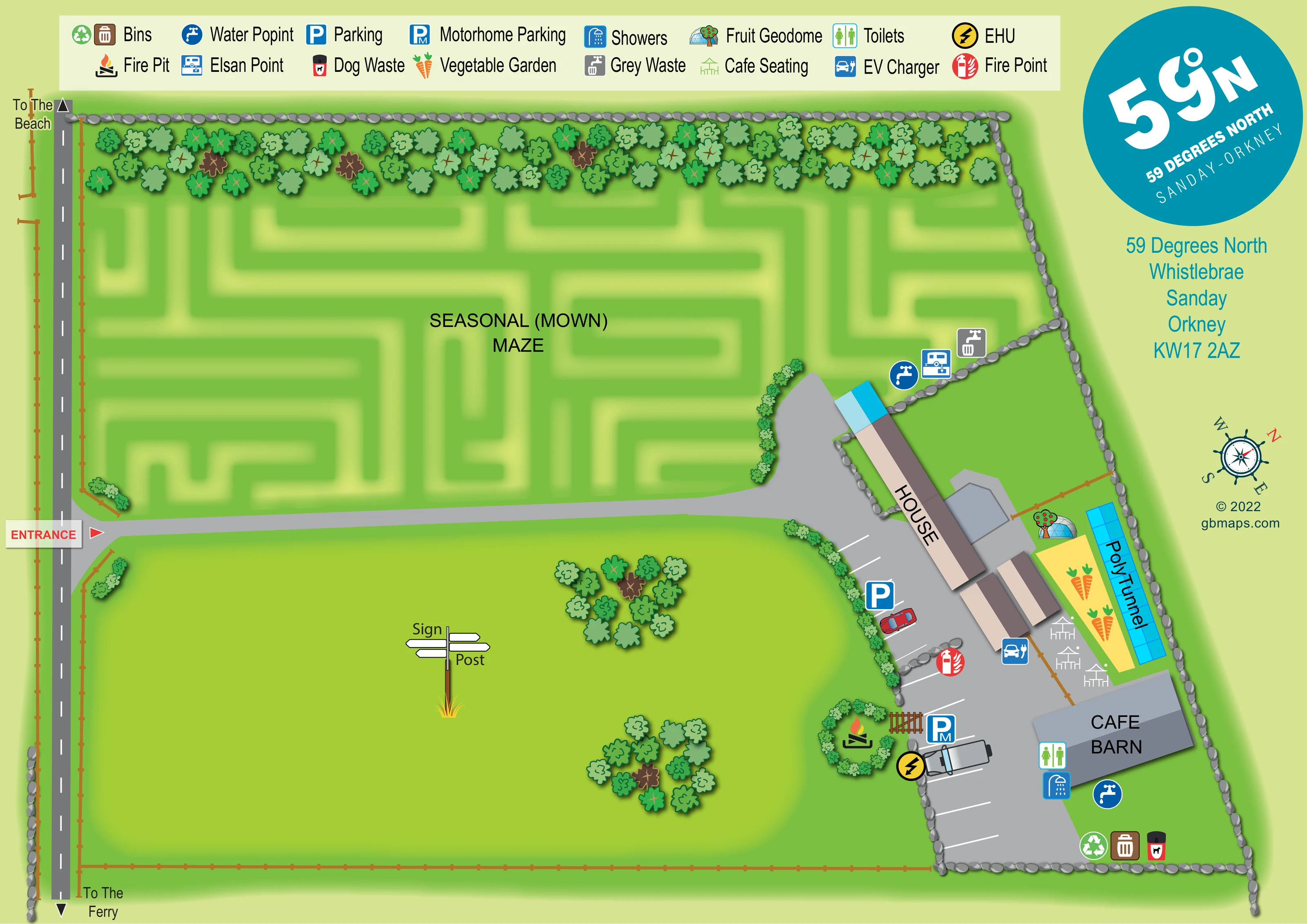
A large pale-green maze occupies most of the upper half of the site and is explicitly labelled as seasonal and mown.
ILLUSTRATED PARK MAP · P388
Whistlebrae, Sanday, Orkney · United Kingdom
 Enlarge the map ↗
A SENSE OF THE PLACE
59 Degrees North is based at Whistlebrae, Sanday, Orkney. The motorhome aire occupies an eight-acre wildflower meadow on Sanday, with sea views. Grass and hardstanding pitches accept motorhomes, campervans and caravans.
Facilities include 6-amp electric hook-ups, showers, toilets, laundry and Wi-Fi.
LOOK CLOSER
A large pale-green maze occupies most of the upper half of the site and is explicitly labelled as seasonal and mown.
A broad, largely uninterrupted green area fills the lower-left part of the plan, with two clusters of stylised trees and a signpost.
A dense tree belt runs along the upper boundary; smaller hedges edge the drive and parking. Grey stone walls and brown fences define the perimeter and internal spaces.
A red entrance label and arrow mark the junction on the left-hand roadside. A grey drive crosses the site and widens around the house and parking areas.
An arrow at the upper end of the roadside points towards the beach; the beach itself is outside the depiction.
An arrow at the lower end of the roadside points towards the ferry, without a distance or wider route.
A conspicuous illustrated multi-arm signpost is labelled in the open grass area.
A long labelled house forms the upper part of the building group beside the arrival courtyard.
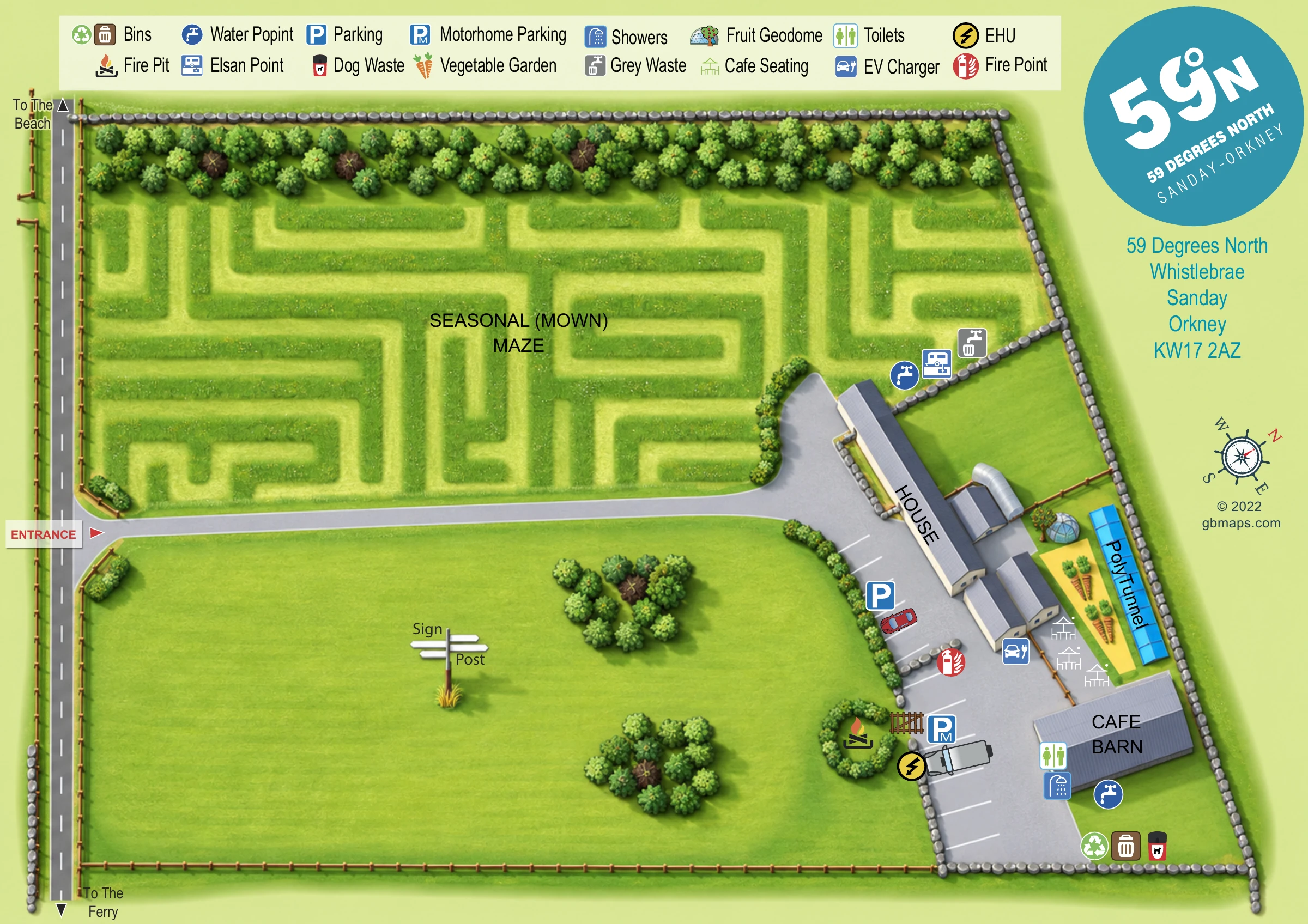
A large pale-green maze occupies most of the upper half of the site and is explicitly labelled as seasonal and mown.
A broad, largely uninterrupted green area fills the lower-left part of the plan, with two clusters of stylised trees and a signpost.
A dense tree belt runs along the upper boundary; smaller hedges edge the drive and parking. Grey stone walls and brown fences define the perimeter and internal spaces.
A red entrance label and arrow mark the junction on the left-hand roadside. A grey drive crosses the site and widens around the house and parking areas.
An arrow at the upper end of the roadside points towards the beach; the beach itself is outside the depiction.
An arrow at the lower end of the roadside points towards the ferry, without a distance or wider route.
A conspicuous illustrated multi-arm signpost is labelled in the open grass area.
A long labelled house forms the upper part of the building group beside the arrival courtyard.
A substantial labelled café barn sits at the lower end of the building group, adjoining motorhome parking and amenity symbols.
Repeated table-and-parasol symbols mark an outdoor seating area between the smaller buildings, vegetable garden and café barn.
A yellow vegetable bed with carrot symbols, a bright cyan labelled polytunnel and a small fruit geodome illustration are grouped along the right-hand boundary.
White bay markings and distinct P and PM symbols differentiate parking beside the house from the motorhome strip beside the café barn.
A yellow lightning-bolt EHU symbol is positioned beside the illustrated motorhome.
A blue car-and-plug symbol marks an EV charging location within the building and parking cluster.
Toilet and shower symbols are placed at the café barn.
Blue tap symbols identify water points near the upper servicing area and beside the café barn.
Separate Elsan and grey-waste symbols appear together beside the stone boundary above the house.
A grouped set of recycling, rubbish and dog-waste symbols is placed near the lower-right boundary.
A flame-and-logs symbol sits within a small hedge-enclosed space beside a gate and the motorhome parking area.
A red extinguisher symbol marks a fire point between the car parking and motorhome parking areas.
READING THE MAP
This illustrated map of 59 Degrees North at Whistlebrae on Sanday, Orkney, brings a motorhome aire and its distinctive outdoor spaces into one landscape-led plan. Rather than filling the page with numbered pitches, it gives prominence to the site's character: a large seasonal mown maze, open grass, boundary planting and a compact group of buildings and visitor facilities.
The entrance is easy to pick out on the roadside at the left, with a drive leading across to the house, café barn and parking areas. Separate symbols distinguish car parking from motorhome parking, while a colourful key explains water, waste disposal, electric hook-up, showers and other practical features. Directions towards the beach and ferry connect the site plan to its island setting without adding a wider location map.
The garden area is particularly memorable, combining a polytunnel, vegetable beds and a fruit geodome beside outdoor café seating. Bright greens, simple roof forms and a prominent teal 59°N logo make this a useful sample for small touring sites whose landscape and shared spaces matter as much as their parking layout.
The plan is organised around a single drive entering from the road along the left edge. Above the drive, a seasonal mown maze fills a broad green enclosure, backed by a dense band of illustrated trees and a stone boundary. Below it, a large open grass area contains small tree groups and a labelled multi-arm signpost. Timber fencing and individually drawn grey stones help define the site's edges without overwhelming the plan.
Most buildings and practical facilities are concentrated on the right. The long house stands beside the arrival courtyard, with car parking marked along its approach. Farther down, a short strip of white-lined motorhome bays sits beside the café barn. A vehicle illustration and separate motorhome parking symbol clarify the purpose of this area; an electric hook-up symbol is placed alongside it.
The café barn is accompanied by toilet, shower and water-point symbols. Another water point, together with Elsan and grey-waste disposal, appears above the house. Recycling, rubbish and dog-waste bins are grouped near the lower boundary. A red fire-point symbol marks the parking area, while a hedge-enclosed fire pit provides a distinct outdoor feature nearby.
Between the buildings and the right-hand wall, outdoor café seating adjoins a vegetable garden, fruit geodome and bright blue polytunnel. An EV charger is also marked within this compact cluster. These details give the service area a recognisable identity beyond its parking function.
A two-row legend stretches across the top, while the logo, address and nautical compass occupy the right margin. The artwork is a single site plan: beach and ferry arrows are directional references, not inset maps or additional accommodation areas.
 Enlarge this map ↗
KEEP EXPLORING
Chosen for shared landscapes, accommodation or facilities.
 Explore the map ↗
United Kingdom
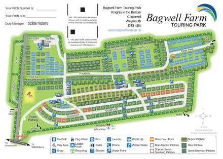
A colour-coded touring park plan with named pitch areas, service symbols and Coast Path links.
 Explore the map ↗
United Kingdom
Tree-framed mixed-accommodation park map with two entrances, touring loops and a clearly illustrated social hub.
 Explore the map ↗
United Kingdom
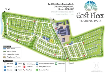
Coastal touring-park plan with three named fields, four pitch categories and lagoon-side walking connections.
Features may come from the sample artwork, its key or published park information. Approximate numbers describe the drawing and may cover only part of a park. They are intended to help you compare map examples. Current facilities and booking information should be checked with the park.
LET’S MAP YOUR PARK
For a map quotation, find your park and draw a rough boundary around it. The area you select helps us work out the design time and price.
Draw your park for a quote ↗Or talk to our map designers
01751 473136