
Railway corridor
A strongly drawn diagonal railway separates the accommodation strip from the broad pasture and stream landscape.
ILLUSTRATED PARK MAP · P494
Hendre Hall, Llwyngwril, Gwynedd · United Kingdom
 Enlarge the map ↗
A SENSE OF THE PLACE
Hendre Hall offers camping, glamping and touring stays at Llwyngwril, between the coast and the mountains of Gwynedd. Sea views and the surrounding landscape shape the setting.
Electric and non-electric pitches are available, with water and waste services for touring vehicles. Toilets, showers and laundry support stays, and the site also hosts private celebrations. The map helps visitors locate the different accommodation and shared areas.
LOOK CLOSER
A strongly drawn diagonal railway separates the accommodation strip from the broad pasture and stream landscape.
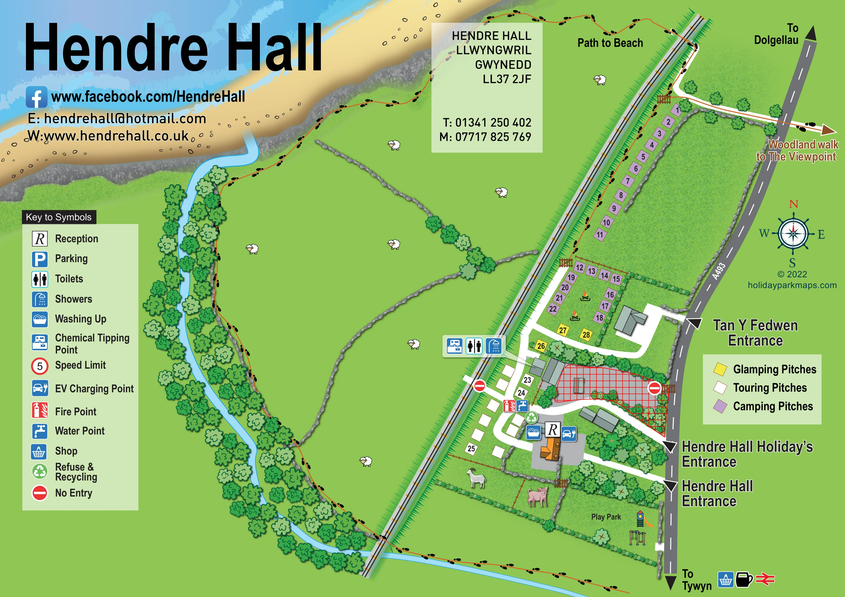
Blue sea, pale wave textures, a sandy beach and a grey rocky shoreline fill the upper-left edge.
A winding blue stream runs from the shoreline through dense illustrated trees and continues across the lower edge beneath the railway.
Large green fields are divided by irregular grey stone walls. Hedges and tree rows enclose the pitch areas and southern grounds; sheep, a horse and pigs add rural character without establishing a visitor attraction.
An R symbol identifies reception beside the southern building and service cluster.
Toilet and shower symbols are grouped beside the railway-side facilities near the transition from camping to touring.
A washing-up symbol is positioned near reception and the southern shared facilities.
The chemical tipping symbol appears alongside the toilets and showers near the touring area.
An R symbol identifies reception beside the southern building and service cluster.
Toilet and shower symbols are grouped beside the railway-side facilities near the transition from camping to touring.
A washing-up symbol is positioned near reception and the southern shared facilities.
The chemical tipping symbol appears alongside the toilets and showers near the touring area.
Water and fire-point symbols are grouped on the internal lane beside the touring pitches.
A green recycling symbol marks the shared service area near reception.
An EV charging symbol is shown beside reception and the southern buildings.
A labelled, hedge-bordered play area at the southern end contains illustrated slide and swing equipment.
Parking is included in the key, but no separate parking symbol is clearly located on the plan.
A red-ringed 5 speed-limit symbol appears in the key without a clearly mapped position.
Shop, cup and railway symbols accompany the southward ‘To Tywyn’ direction at the bottom edge. They are contextual references rather than clearly located on-site facilities.
The A493 runs along the right-hand edge, with arrows towards Dolgellau and Tywyn.
Separate arrows identify Tan Y Fedwen Entrance, Hendre Hall Holiday’s Entrance and Hendre Hall Entrance from the A493.
Broad white lanes connect the roadside entrances, building groups and pitch areas. Red no-entry symbols mark two points beside the central cross-hatched area.
A footprint-marked route runs through the wider landscape and follows the railway-side edge towards the labelled beach path.
An arrow at the upper right directs visitors beyond the A493 towards a woodland walk and viewpoint.
A strongly drawn diagonal railway separates the accommodation strip from the broad pasture and stream landscape.
Blue sea, pale wave textures, a sandy beach and a grey rocky shoreline fill the upper-left edge.
A winding blue stream runs from the shoreline through dense illustrated trees and continues across the lower edge beneath the railway.
Large green fields are divided by irregular grey stone walls. Hedges and tree rows enclose the pitch areas and southern grounds; sheep, a horse and pigs add rural character without establishing a visitor attraction.
READING THE MAP
This illustrated map of Hendre Hall Holidays places a small camping, touring and glamping park within its coastal setting at Llwyngwril, Gwynedd. Rather than filling the page with pitches alone, it gives substantial space to the beach, a winding tree-lined stream and stone-walled pasture. A diagonal railway forms a clear boundary between this open landscape and the accommodation strip beside the A493.
The map shows three accommodation categories using purple, white and yellow pitch markers. Shared facilities are identified with pictograms, while separate entrance labels help distinguish the holiday park from Hendre Hall and Tan Y Fedwen. A footprint-marked beach route and an arrow towards the woodland viewpoint walk extend the visitor information beyond the immediate pitch areas.
For a sample gallery, this is a useful example of a compact park map that also explains its surroundings. Its large title, two complementary keys and conspicuous road directions combine practical arrival information with a recognisable picture of the coast and countryside.
The plan is organised around two strong diagonal features: the railway through the centre-right and the A493 along the right-hand edge. Between them sits a narrow accommodation strip. Purple camping markers form a long northern row, with a second group arranged around a smaller enclosure below. Yellow glamping markers occupy the transition towards the white touring pitches in the southern section.
Broad white lanes connect the accommodation areas and grey-roofed buildings to three individually labelled roadside entrances. Reception, washing up, refuse and recycling, water, a fire point and EV charging are marked around the southern service cluster. Toilets, showers and chemical tipping are grouped nearer the railway. At the lower end, the labelled play park is illustrated with a slide and swings inside a green boundary. A red cross-hatched area is conspicuous near the central buildings, although its purpose is not labelled.
The left side gives the wider landscape equal visual importance. A blue stream curves through dense rows of outlined trees, while grey stone walls divide broad green fields dotted with sheep illustrations. The upper edge opens onto sand, rocky shoreline and blue sea. Black footprints follow a thin brown walking route through this setting towards the beach; a separate arrow indicates the woodland walk to the viewpoint beyond the road.
A large facility key occupies the lower left, while a smaller colour key explains the accommodation markers on the right. The oversized Hendre Hall heading, contact panels, compass and destination arrows complete the single-page composition. The enlarged legend view is a detail of this same artwork, not a separate park section.
KEEP EXPLORING
Chosen for shared landscapes, accommodation or facilities.
 Explore the map ↗
United Kingdom
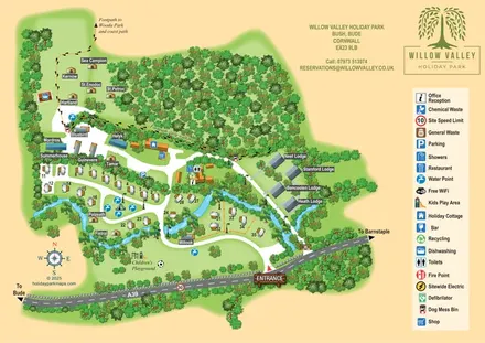
A woodland-valley park map combining named glamping stays, numbered pitches, riverside lodges and footprint-marked walking routes.
 Explore the map ↗
United Kingdom
Woodland park map with mixed pitches, bell tents, lodges and a fishing lake.
 Explore the map ↗
United Kingdom
A colour-zoned coastal park map with touring areas, woodland trails, ponds and a leisure club.
Features may come from the sample artwork, its key or published park information. Approximate numbers describe the drawing and may cover only part of a park. They are intended to help you compare map examples. Current facilities and booking information should be checked with the park.
LET’S MAP YOUR PARK
For a map quotation, find your park and draw a rough boundary around it. The area you select helps us work out the design time and price.
Draw your park for a quote ↗Or talk to our map designers
01751 473136