
Two ponds
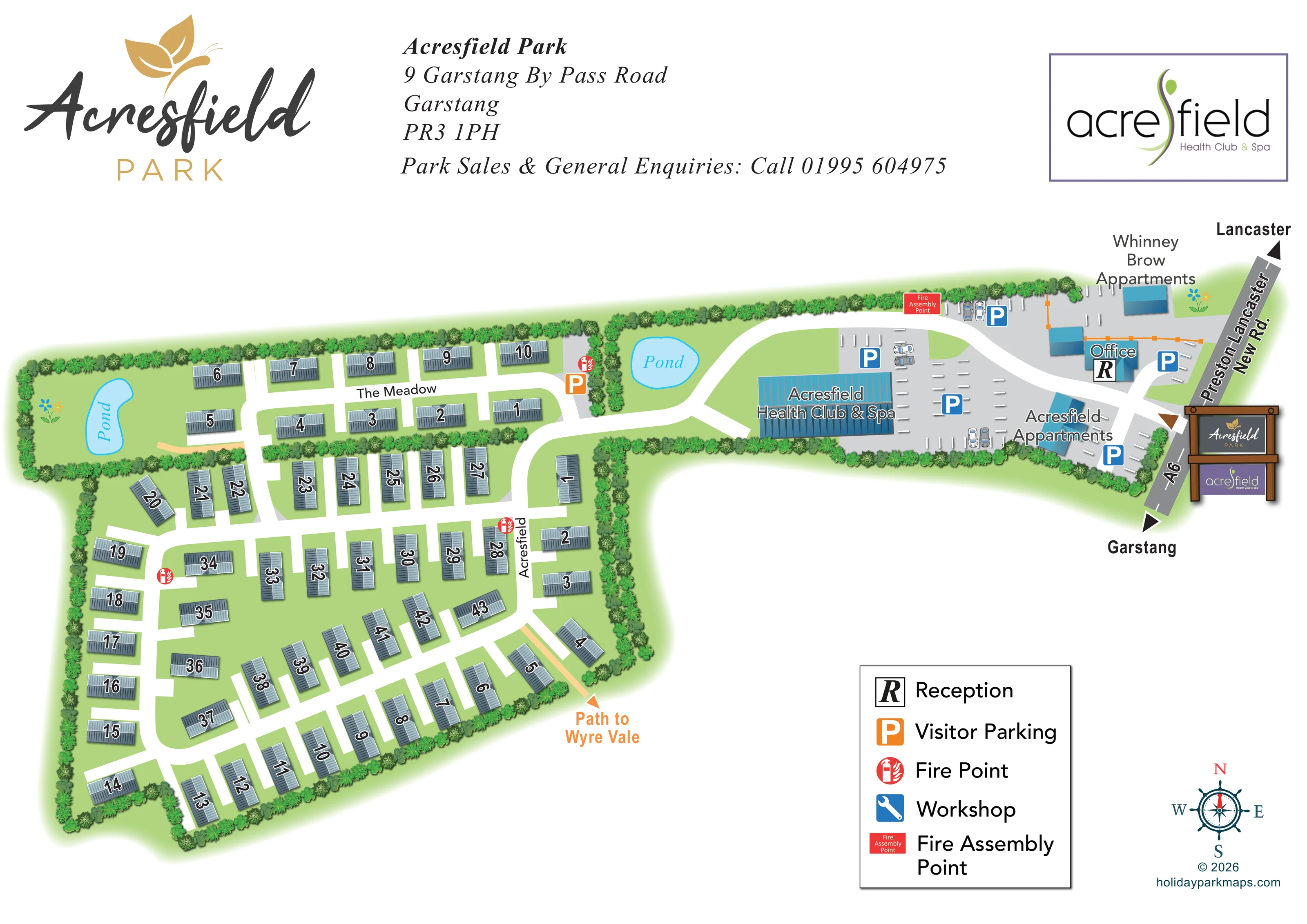
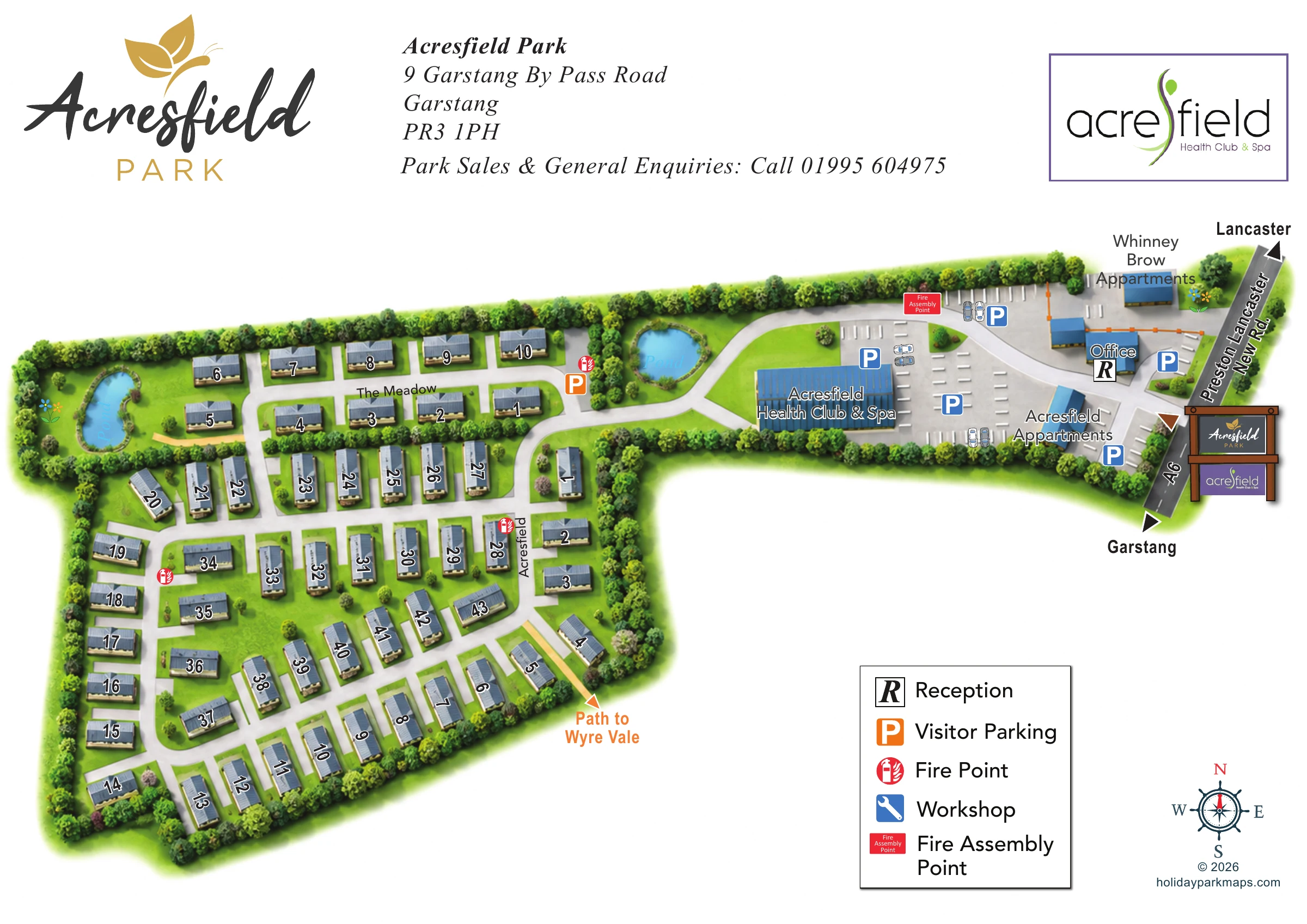
Two pale-blue ponds are labelled: an elongated pond at the western end of The Meadow and a rounder pond between the homes and the health-club approach.
ILLUSTRATED PARK MAP · P002
The Office, Acresfield, 9 Garstang By Pass Road, Garstang · United Kingdom
 Enlarge the map ↗
A SENSE OF THE PLACE
Acresfield Park is based at The Office, Acresfield, 9 Garstang By Pass Road, Garstang. This is a residential development of detached two-bedroom bungalow-style park homes for people aged over 55.
The homes are advertised with wider doors, raised sockets and low-threshold showers or wet rooms.
LOOK CLOSER
Two pale-blue ponds are labelled: an elongated pond at the western end of The Meadow and a rounder pond between the homes and the health-club approach.
Dense illustrated planting encloses the site and separates The Meadow from the main residential area.
The labelled office carries the reception symbol and stands close to the road entrance, among parking areas and neighbouring buildings.
A large blue-roofed building is explicitly labelled Health Club & Spa, with surrounding parking and a separate branded logo above the plan.
An orange visitor-parking symbol marks a small parking area at the eastern end of The Meadow.
Several blue P symbols identify parking around the health club, office and apartment buildings. Individual bays and a few cars are illustrated.
Repeated red fire-point symbols appear beside the residential roads and near The Meadow visitor parking.
A red labelled assembly marker is positioned along the northern edge of the entrance-complex parking.
The labelled office carries the reception symbol and stands close to the road entrance, among parking areas and neighbouring buildings.
A large blue-roofed building is explicitly labelled Health Club & Spa, with surrounding parking and a separate branded logo above the plan.
An orange visitor-parking symbol marks a small parking area at the eastern end of The Meadow.
Several blue P symbols identify parking around the health club, office and apartment buildings. Individual bays and a few cars are illustrated.
Repeated red fire-point symbols appear beside the residential roads and near The Meadow visitor parking.
A red labelled assembly marker is positioned along the northern edge of the entrance-complex parking.
A blue spanner symbol is included in the key, but no corresponding workshop location is clearly marked on the plan.
Two pale-blue ponds are labelled: an elongated pond at the western end of The Meadow and a rounder pond between the homes and the health-club approach.
Dense illustrated planting encloses the site and separates The Meadow from the main residential area.
The entrance meets the road labelled Preston–Lancaster New Rd. and A6. Direction arrows point towards Lancaster and Garstang.
A broad white access road links the entrance complex to the homes, where loops, branches and short plot approaches organise the residential streets.
A pale-orange path leaves the south-eastern edge of the main home area, with an orange arrow and the label Path to Wyre Vale.
READING THE MAP
This illustrated map of Acresfield Park in Garstang brings a residential park-home neighbourhood and its road-facing amenity complex together on one landscape page. Rather than presenting holiday pitches, the artwork shows detached homes arranged around internal streets, with a smaller area called The Meadow set apart by planting. Two labelled ponds provide recognisable landscape landmarks, while the office, apartment buildings and Acresfield Health Club & Spa establish a clear arrival area beside the A6.
The design combines a largely overhead plan with shaded roofs, leafy boundaries and an illustrated entrance sign. White roads remain easy to follow against green plots, and prominent home numbers help visitors locate individual addresses. Parking areas, reception and fire-safety markers add practical information without overwhelming the residential layout.
Large park and health-club logos occupy the upper part of the page, with a boxed symbol key and compass below. This sample is particularly relevant to residential developments that need to explain several neighbourhoods, shared facilities and an external pedestrian connection within a single branded visitor map.
The plan reads from the road entrance on the right towards the residential areas on the left. Preston–Lancaster New Road is labelled A6, with arrows towards Lancaster and Garstang. Just inside the entrance, the office is identified by a reception symbol. Nearby blue-roofed buildings carry the Acresfield Apartments and Whinney Brow Apartments labels, while the larger Health Club & Spa building occupies the southern side of the arrival complex. Grey parking courts, white bay markings, blue parking symbols and small illustrated cars make this part of the site visually distinct from the green residential plots.
A white access road curves west around a labelled pond before reaching the home areas. The main Acresfield neighbourhood has a mixture of straight rows, perimeter homes and angled plots following bends in the road. Short approaches connect the individual homes to the street network. To the north-west, The Meadow forms a narrower, more regular arrangement of two facing rows, with another pond at its western end and orange-marked visitor parking at the opposite end.
Continuous trees and shrubs frame the site, and an internal planted strip helps distinguish the two residential areas. A pale-orange path and directional label identify the connection towards Wyre Vale at the south-eastern edge of the homes. Red fire-point symbols are distributed through the residential streets, and a fire assembly marker appears near the northern entrance parking.
The lower-right key explains reception, visitor parking, fire points, workshop and fire assembly symbols, although the workshop is not clearly located on the plan. A compass rose completes the layout. The gallery artwork is a single complete plan; the enlarged views show overlapping details of that same page rather than additional sections or sites.
 Enlarge this map ↗
KEEP EXPLORING
Chosen for shared landscapes, accommodation or facilities.
 Explore the map ↗
United Kingdom
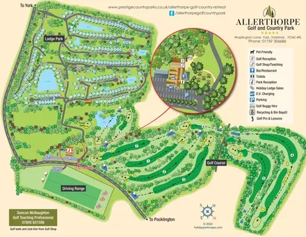
Lakeside lodge neighbourhoods and a nine-hole golf course, with an enlarged reception and facilities inset.
 Explore the map ↗
United Kingdom
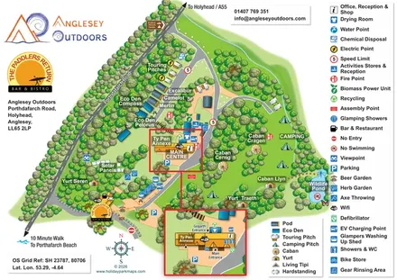
Illustrated camping and glamping map with an activity-centre inset and wildlife pond.
 Explore the map ↗
United Kingdom
Woodland camping, lodges, lakes and colour-coded bike trails at Avon Tyrrell Outdoor Centre.
Features may come from the sample artwork, its key or published park information. Approximate numbers describe the drawing and may cover only part of a park. They are intended to help you compare map examples. Current facilities and booking information should be checked with the park.
LET’S MAP YOUR PARK
For a map quotation, find your park and draw a rough boundary around it. The area you select helps us work out the design time and price.
Draw your park for a quote ↗Or talk to our map designers
01751 473136