
River Yar
The river curves around the southern and eastern boundary as a pale blue ribbon with bright blue outlines.
ILLUSTRATED PARK MAP · P003
Lower Road, Brading, Sandown, Isle of Wight · United Kingdom
 Enlarge the map ↗
A SENSE OF THE PLACE
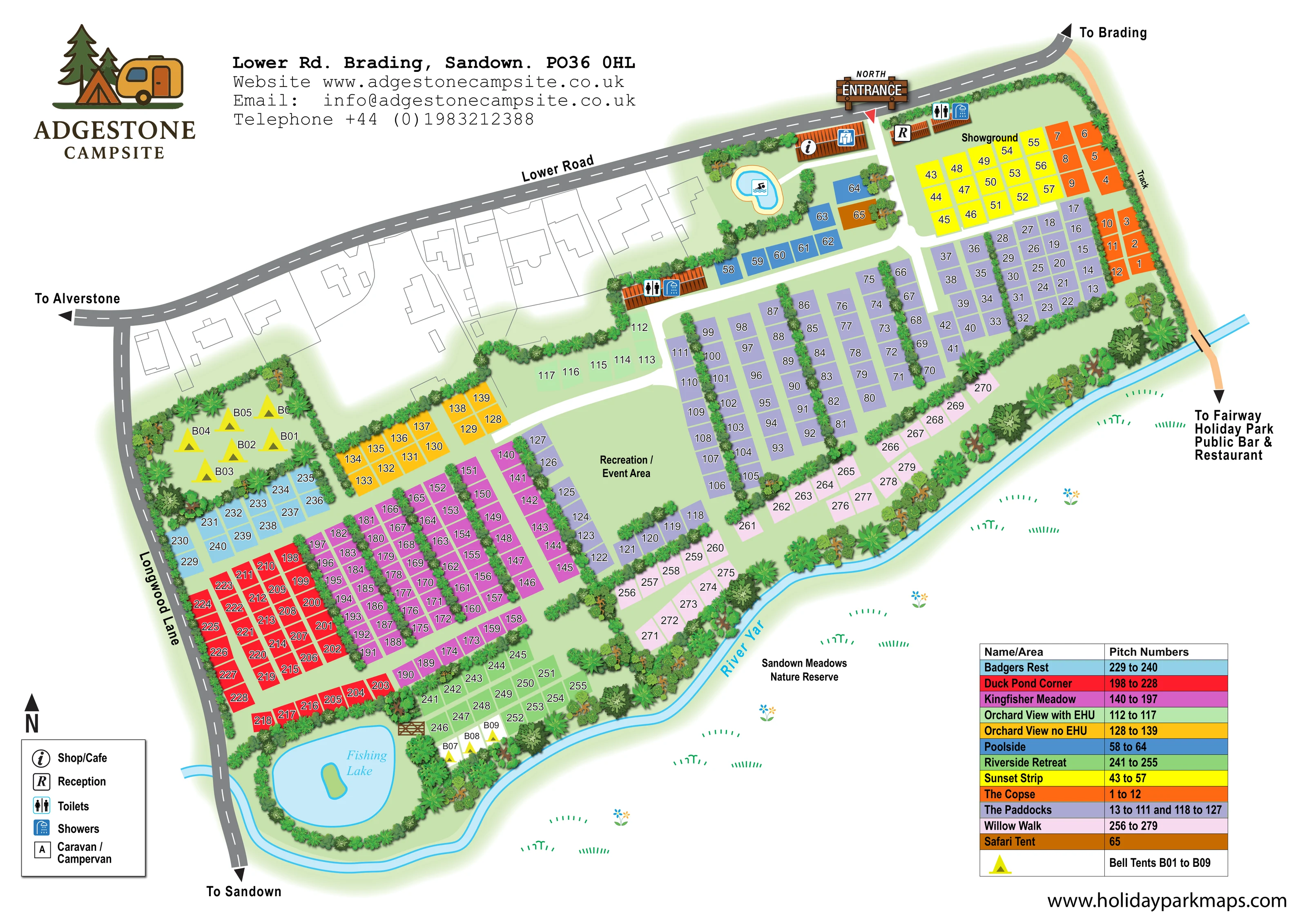
Adgestone Campsite is based at Lower Road, Brading, Sandown, Isle of Wight. Touring caravans, motorhomes and tents are accepted, with seasonal pitches also advertised.
Showers, accessible toilets/showers, family shower rooms, washing-up points, electric hook-ups and Starlink Wi-Fi are listed. The park provides a heated outdoor pool, fishing lake, football area and table tennis.
LOOK CLOSER
The river curves around the southern and eastern boundary as a pale blue ribbon with bright blue outlines.
The neighbouring reserve is labelled beyond the River Yar, with sparse grass and flower motifs indicating meadowland.
Dense illustrated planting encloses the site, frames the lake and glamping pockets, and divides rows of pitches into smaller groups.
A prominent timber-style entrance sign and red pointer identify arrival from Lower Road near the upper-right part of the plan.
A small orange-roofed building marked R sits immediately inside the entrance.
The keyed shop/cafe symbol is placed on a larger building west of the entrance, beside the pool area.
Two illustrated amenity buildings carry paired toilet and shower symbols: one near reception and another beside the internal route west of Poolside.
A small irregular blue pool with a pale yellow surround and swimmer pictogram is shown near the shop/cafe. Park information describes the pool as heated and outdoor.
A prominent timber-style entrance sign and red pointer identify arrival from Lower Road near the upper-right part of the plan.
A small orange-roofed building marked R sits immediately inside the entrance.
The keyed shop/cafe symbol is placed on a larger building west of the entrance, beside the pool area.
Two illustrated amenity buildings carry paired toilet and shower symbols: one near reception and another beside the internal route west of Poolside.
A small irregular blue pool with a pale yellow surround and swimmer pictogram is shown near the shop/cafe. Park information describes the pool as heated and outdoor.
A labelled blue lake with a small green island occupies the south-western corner, enclosed by trees and hedging.
A substantial central grass space separates the northern and southern pitch blocks.
A labelled open grass area lies near reception, above Sunset Strip.
The area key distinguishes Orchard View with EHU from Orchard View no EHU using different colours. It does not establish the electrical provision of every other area.
The river curves around the southern and eastern boundary as a pale blue ribbon with bright blue outlines.
The neighbouring reserve is labelled beyond the River Yar, with sparse grass and flower motifs indicating meadowland.
Dense illustrated planting encloses the site, frames the lake and glamping pockets, and divides rows of pitches into smaller groups.
Broad white lanes branch from the entrance, link the amenity buildings and run between the coloured accommodation blocks.
Grey roads with dashed white centre lines frame the northern and western sides. Directional arrows identify Brading, Alverstone and Sandown.
A peach-coloured track follows the eastern edge and crosses the river, with a directional reference to Fairway Holiday Park and its public bar and restaurant. These are off-site destinations, not mapped Adgestone facilities.
A boxed A symbol is defined as caravan/campervan in the legend; this does not establish the position or number of such units on the plan.
Park information lists accessible toilets/showers, family shower rooms and washing-up points. These distinctions are not individually labelled in the artwork.
Listed in the park information, without a mapped location or coverage indication.
Listed in the park information but not individually identified on the map; the labelled recreation/event area should not be treated as a precise location for either.
READING THE MAP
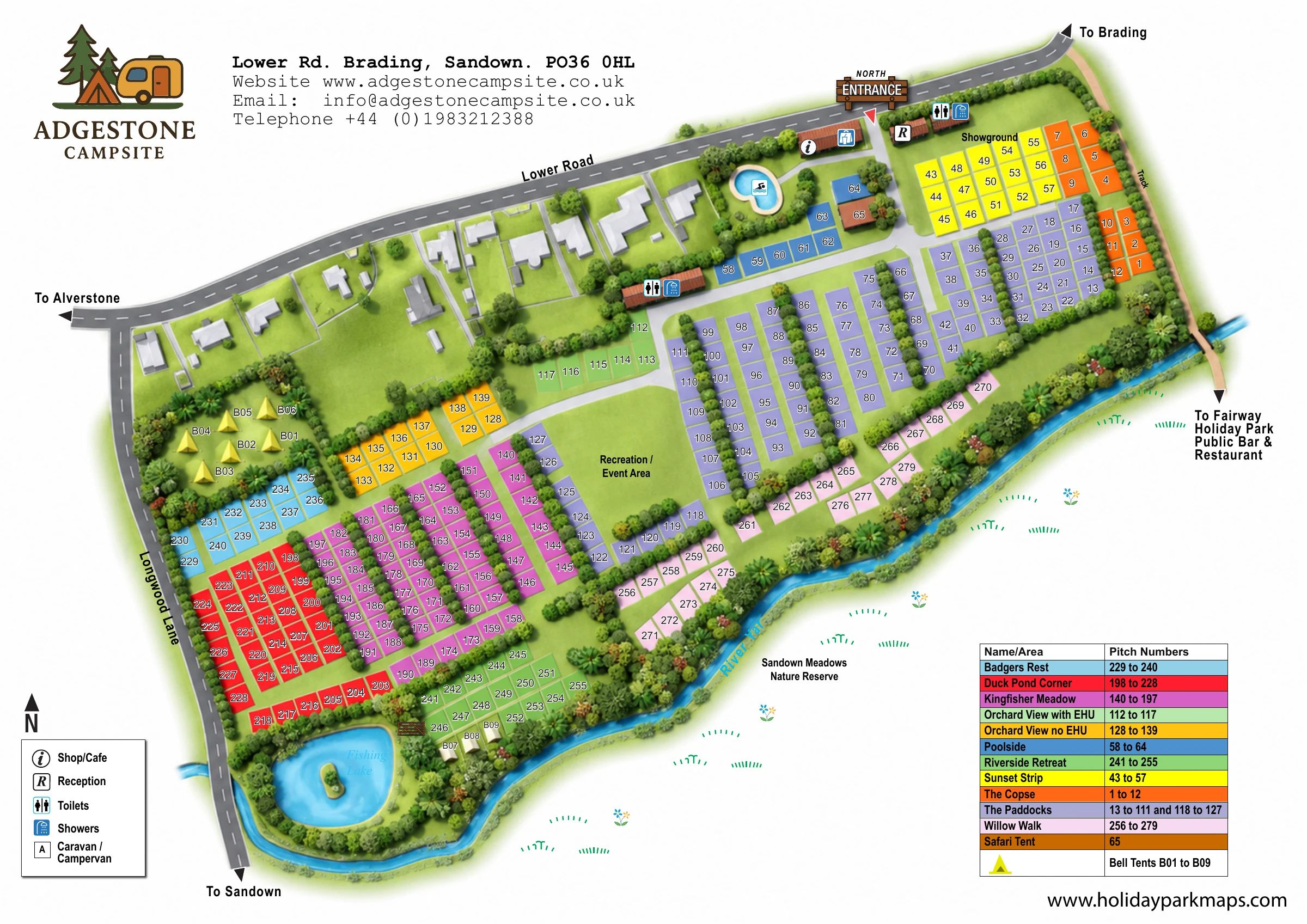
This illustrated map of Adgestone Campsite on the Isle of Wight brings a large, varied pitch layout into one landscape-format plan. Set beside the River Yar and Sandown Meadows Nature Reserve, the campsite is shown as a series of colourful accommodation areas divided by hedges, tree belts and clear internal lanes. A fishing lake with a small island anchors the southern end, while the swimming pool and arrival facilities sit close to the marked north entrance on Lower Road.
The design combines practical pitch finding with a recognisable sense of place. Named areas such as Kingfisher Meadow, Badgers Rest and Willow Walk are matched to a colour-coded table, while bell tents and a safari tent receive their own visual treatment. Reception, the shop/cafe, toilets and showers are identified with compact symbols. Surrounding roads and destination arrows connect the campsite to Brading, Alverstone and Sandown, making this a useful example of a detailed touring and camping map that also explains its immediate surroundings.
The plan is arranged diagonally between Lower Road at the top, Longwood Lane on the left and the curving River Yar along the lower and right-hand boundaries. The north entrance is emphasised with an illustrated timber sign and red pointer. Just inside, reception faces the shop/cafe building, with toilets and showers nearby. A small blue swimming pool sits west of this arrival cluster, beside the blue Poolside pitches and the separately coloured safari-tent plot.
White internal lanes lead into long rows of lavender pitches in The Paddocks and magenta pitches in Kingfisher Meadow. Hedge strips break these larger blocks into readable groups. At the centre, a broad recreation/event area leaves an open green space between the accommodation sections. Smaller colour-coded areas include Badgers Rest, Duck Pond Corner, Sunset Strip and The Copse, while Orchard View is explicitly divided into electric and non-electric sections.
Towards the southern edge, Riverside Retreat and Willow Walk follow the planted river boundary. Yellow bell-tent symbols appear in a sheltered north-western group and a smaller group near the fishing lake. The lake itself is drawn with a green island and a dense ring of planting. Across the river, sparse meadow symbols accompany the Sandown Meadows Nature Reserve label.
The single-page artwork includes a facility legend at lower left and a colour-matched area table at lower right. Grey external roads carry destination arrows, and a peach-coloured eastern track points towards Fairway Holiday Park's public bar and restaurant. The layout balances detailed pitch identification with larger landmarks that help visitors understand the campsite as a whole.
 Enlarge this map ↗
KEEP EXPLORING
Chosen for shared landscapes, accommodation or facilities.
 Explore the map ↗
United Kingdom
Woodland park map with mixed pitches, bell tents, lodges and a fishing lake.
 Explore the map ↗
United Kingdom
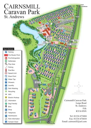
Portrait park map combining numbered caravan rows, touring and tent areas with a reservoir-side recreation hub.
 Explore the map ↗
United Kingdom
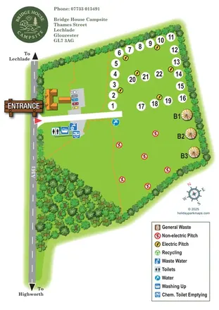
Leafy campsite map with numbered electric pitches, open camping and a prominent illustrated entrance.
Features may come from the sample artwork, its key or published park information. Approximate numbers describe the drawing and may cover only part of a park. They are intended to help you compare map examples. Current facilities and booking information should be checked with the park.
TAKE A CLOSER LOOK
View the illustrated map in detail or choose a file to download. These are sample maps; contact the park for current visitor information.

LET’S MAP YOUR PARK
For a map quotation, find your park and draw a rough boundary around it. The area you select helps us work out the design time and price.
Draw your park for a quote ↗Or talk to our map designers
01751 473136