
Wooded boundaries and planted divisions
Dense stylised trees line the park perimeter and divide many accommodation rows and recreation spaces.
ILLUSTRATED PARK MAP · P091
Craigtoun Meadows Holiday Park, St Andrews, Fife · United Kingdom
 Enlarge the map ↗
A SENSE OF THE PLACE
Craigtoun Meadows Holiday Park is based at St Andrews, Fife. Craigtoun Meadows is described as a rural woodland park near St Andrews. The park provides lodges, caravan holiday homes, glamping little lodges, motorhome and touring caravan stays, and tents.
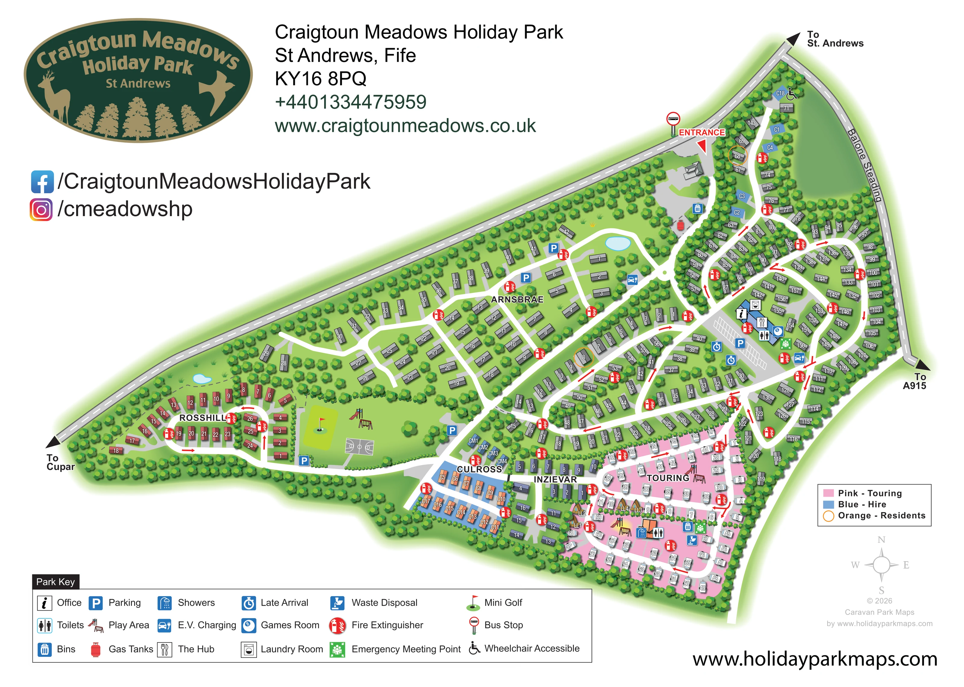
The map brings the site layout and its access routes together in one view, providing a reference for understanding the arrangement of the grounds.
LOOK CLOSER
Dense stylised trees line the park perimeter and divide many accommodation rows and recreation spaces.
Two light-blue water features are illustrated in the western and central-western green spaces.
A broad green space between Rosshill and Culross contains the principal play equipment, mini golf and marked court.
An information-style office symbol identifies the central-right facilities building.
The Hub is represented by a cutlery symbol in the central facilities cluster.
A blue pool-ball symbol locates the games room beside the main facilities.
A washing-machine symbol marks the laundry in the central building group.
Toilet symbols appear at the central facilities and in the touring area; showers are marked in the touring service cluster.
An information-style office symbol identifies the central-right facilities building.
The Hub is represented by a cutlery symbol in the central facilities cluster.
A blue pool-ball symbol locates the games room beside the main facilities.
A washing-machine symbol marks the laundry in the central building group.
Toilet symbols appear at the central facilities and in the touring area; showers are marked in the touring service cluster.
Blue P symbols identify several parking locations near accommodation, recreation space and the main facilities.
Charging symbols appear along the central approach and beside the main facilities.
A stopwatch-style symbol marks a late-arrival location near the central parking and facilities.
Illustrated play equipment occupies the western recreation lawn and a smaller space within the touring area.
A bright green putting area with a red flag is illustrated beside the western play space.
A small grey court with football-style markings is drawn on the western recreation lawn; it has no separate key entry.
A blue waste-disposal symbol is positioned within the touring facilities cluster.
Bin symbols are shown near the entrance and within the touring area.
A red gas-cylinder symbol appears just inside the entrance-side approach.
Repeated red extinguisher symbols are distributed through the accommodation areas and road network.
Green assembly-point symbols appear by the main facilities and in the touring section.
Wheelchair symbols appear at selected accommodation and facility locations. They identify mapped points rather than establishing park-wide accessibility.
A bus-stop symbol stands on the external road beside the entrance.
The entrance is labelled in red at the upper edge, with a triangular marker directing attention to the inward access road.
External arrows point towards Cupar, St Andrews and the A915; the eastern boundary road is labelled Balone Steading.
White branching roads and loops connect the accommodation sections, with red arrows indicating mapped travel directions on selected stretches.
Dense stylised trees line the park perimeter and divide many accommodation rows and recreation spaces.
Two light-blue water features are illustrated in the western and central-western green spaces.
A broad green space between Rosshill and Culross contains the principal play equipment, mini golf and marked court.
READING THE MAP
This illustrated map of Craigtoun Meadows Holiday Park brings a wooded St Andrews setting and a varied accommodation layout into one landscape-format page. The grounds stretch diagonally across the artwork, with tree-lined caravan rows, named neighbourhoods and a clearly differentiated touring area. Broad white roads remain easy to follow against the green landscape, while red arrows and a prominent entrance marker help visitors understand the connections between sections.
The map shows more than accommodation. A central facilities cluster brings together the office, The Hub, games room and laundry, while the western recreation lawn includes play equipment, mini golf and a marked sports court. Parking, charging points and touring services are integrated into the same view using a consistent symbol system.
Two keys keep the information organised: one explains visitor facilities, and the other distinguishes touring, hire and resident markings. The park's green-and-gold logo, contact details and social links occupy the open upper-left space, balancing the angled site illustration. It is a useful example for a substantial holiday park that needs detailed plot finding without losing its landscape character.
The single-page plan follows an elongated, irregular footprint bounded by external roads along its upper and eastern edges. Destination arrows point towards Cupar, St Andrews and the A915, with Balone Steading labelled on the eastern road. The entrance sits near the northern end beside a bus-stop symbol. From here, a white internal road leads into the park and divides into a network of branches and loops, with red arrows marking selected travel directions.
Arnsbrae occupies much of the central-western accommodation area, while Rosshill forms a compact loop at the far western end. Culross and Inzievar lie along the southern side. The eastern half contains closely arranged numbered rows around the main facilities, and the pink touring section occupies the lower-right corner. Blue hire markings and orange resident outlines add another layer of accommodation identification without replacing the individual labels.
The central building group is accompanied by symbols for the office, The Hub, games room, laundry and toilets. Nearby markers identify parking, late arrival, E.V. charging and an emergency meeting point. The touring section has its own service cluster, including showers, toilets, bins and waste disposal, together with a small group of pitched-roof little lodges. Fire-extinguisher symbols recur throughout the grounds.
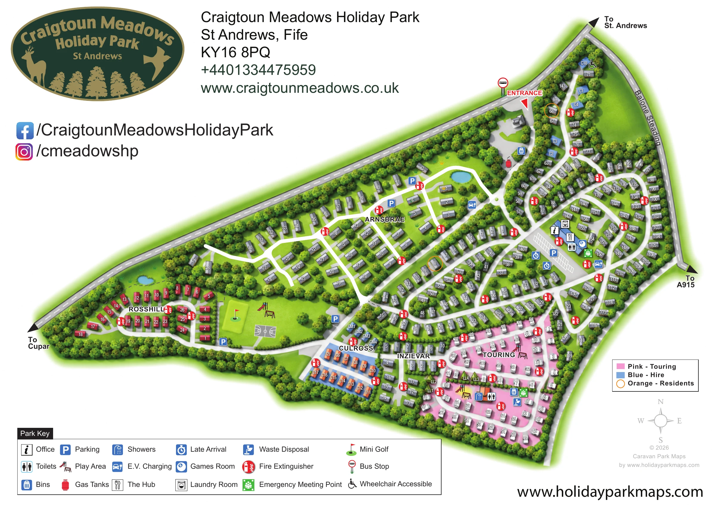
Landscape illustration helps explain the spaces between these destinations. Dense tree belts enclose the site and separate rows; two small ponds punctuate the western green areas. A recreation lawn holds play equipment, mini golf and a marked court, with another play space in the touring section. The long lower-edge facilities key and smaller accommodation-colour key complete the page. The accompanying enlargements show these same keys in greater detail rather than separate park sections.
 Enlarge this map ↗
KEEP EXPLORING
Chosen for shared landscapes, accommodation or facilities.
 Explore the map ↗
United Kingdom
Woodland-framed Barnsoul map with mixed accommodation, shared facilities and paw-marked walking routes.
 Explore the map ↗
United Kingdom
A colour-zoned coastal park map with touring areas, woodland trails, ponds and a leisure club.
 Explore the map ↗
United Kingdom
A woodland estate park map combining caravan loops, touring pitches, riverside paths and Bruce’s Cave landmarks.
Features may come from the sample artwork, its key or published park information. Approximate numbers describe the drawing and may cover only part of a park. They are intended to help you compare map examples. Current facilities and booking information should be checked with the park.
TAKE A CLOSER LOOK
View the illustrated map in detail or choose a file to download. These are sample maps; contact the park for current visitor information.



LET’S MAP YOUR PARK
For a map quotation, find your park and draw a rough boundary around it. The area you select helps us work out the design time and price.
Draw your park for a quote ↗Or talk to our map designers
01751 473136