
Morecambe Bay shoreline
The western edge of the page shows pale-blue water, a peach foreshore and the Morecambe Bay label.
ILLUSTRATED PARK MAP · P018
Bay View Holiday Park, A6 Main Road, Bolton-le-Sands, Carnforth · United Kingdom
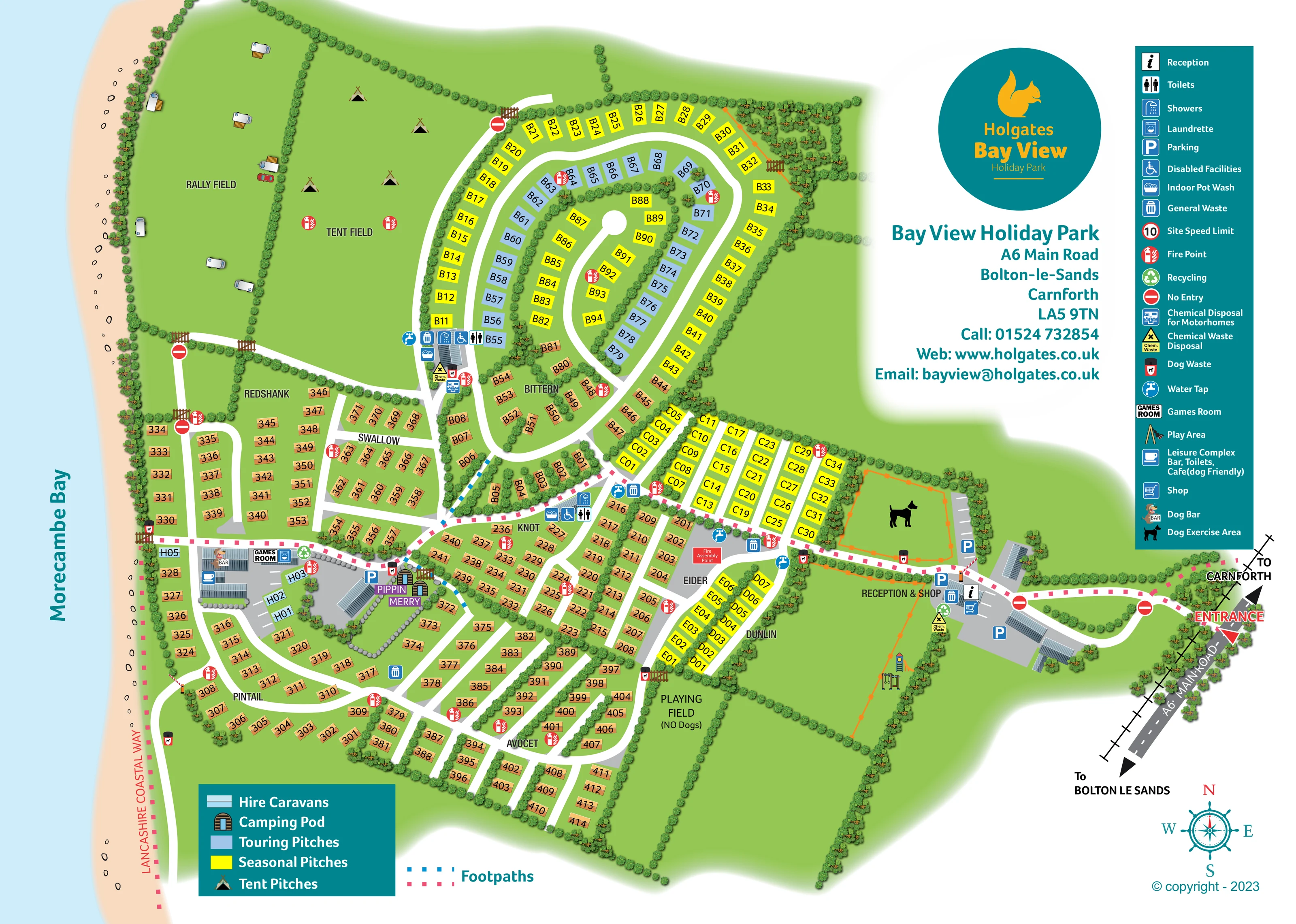 Enlarge the map ↗
A SENSE OF THE PLACE
Bay View Holiday Park at Bolton-le-Sands looks across Morecambe Bay towards Grange-over-Sands. Holgates' park focuses on holiday home ownership, with coastal paths and open views contributing to its setting.
A bar and restaurant, games room and outdoor play area provide places to spend time on site. Direct access to the coastal footpath makes walking part of the park's appeal, while Lancaster and the nearby coastal villages offer further places to explore.
LOOK CLOSER
The western edge of the page shows pale-blue water, a peach foreshore and the Morecambe Bay label.
Repeated illustrated trees divide fields, line the shoreline and separate accommodation rows, with a denser wooded patch at the north-east corner.
Labelled building and reception/shop symbols beside the eastern arrival road and parking area.
Grey parking courts with marked bays and blue P symbols occur around reception, beside the dog exercise area and at the western leisure complex.
The cup symbol locates the western leisure complex; its legend describes a bar, toilets and dog-friendly café.
Explicitly labelled in the western leisure-building group.
A distinctive cartoon dog-bar symbol is placed on the western leisure building and explained in the legend.
Grouped toilet, shower and wheelchair symbols mark service buildings near the northern touring area and the central accommodation junction.
Labelled building and reception/shop symbols beside the eastern arrival road and parking area.
Grey parking courts with marked bays and blue P symbols occur around reception, beside the dog exercise area and at the western leisure complex.
The cup symbol locates the western leisure complex; its legend describes a bar, toilets and dog-friendly café.
Explicitly labelled in the western leisure-building group.
A distinctive cartoon dog-bar symbol is placed on the western leisure building and explained in the legend.
Grouped toilet, shower and wheelchair symbols mark service buildings near the northern touring area and the central accommodation junction.
The washing-machine symbol appears at the western leisure buildings.
Dish-washing symbols accompany the northern and central sanitary-facility groups.
Chemical-waste symbols appear near reception and the northern service building; a separate motorhome disposal symbol is shown at the northern service cluster.
Blue tap symbols identify several water points around the touring and seasonal accommodation areas.
Repeated waste and recycling symbols are distributed around service areas; dog-waste bins appear along footpaths, the coastal edge and near the exercise area.
Illustrated swings and a small play tower occupy the long green space immediately south-west of reception.
A separate large green field is labelled south of the eastern seasonal pitches. The artwork includes a no-dogs annotation for this field.
An orange-outlined enclosure with a black dog silhouette lies north-west of reception, beside parking and the cross-park footpath.
Red fire-point symbols recur throughout the accommodation areas and camping field. A labelled fire assembly point appears at the Eider road junction.
The western edge of the page shows pale-blue water, a peach foreshore and the Morecambe Bay label.
Repeated illustrated trees divide fields, line the shoreline and separate accommodation rows, with a denser wooded patch at the north-east corner.
A pink dotted route follows the western shoreline and connects with a dotted path crossing the park towards its eastern entrance.
Blue and pink dotted lines distinguish walking connections from the solid white road network; the key identifies both as footpaths.
A red entrance label and arrow mark access from the A6 at the eastern tip, with directional arrows towards Carnforth and Bolton-le-Sands.
Illustrated gates, rising barriers and red no-entry symbols distinguish controlled connections and road approaches within the plan.
The facilities legend includes a speed-limit symbol; it is not treated as evidence of a particular mapped sign location.
READING THE MAP
This illustrated map of Bay View Holiday Park places its Morecambe Bay setting at the heart of the page. A pale-blue strip of water and a softly coloured shoreline run down the western edge, while the Lancashire Coastal Way links the coast with the park's internal walking routes. At the opposite side, a clearly marked entrance from the A6 leads towards reception, the shop and arrival parking.
The plan brings together several different accommodation patterns: compact holiday-home neighbourhoods, colour-coded touring and seasonal pitches, an open tent field, a rally field and two named camping pods. Bird-themed area names help organise the extensive network of roads and numbered plots. Facilities are shown where visitors need them, from sanitary buildings and water taps to the western leisure complex, games room and dog bar.
Tree-lined boundaries, a playing field, illustrated play equipment and a separate dog exercise enclosure add useful landmarks without obscuring the practical layout. The result is a sample for a sizeable coastal park where arrival, accommodation choice and walking connections all need to be understood on one page.
The single landscape-format plan stretches from the A6 entrance on the right to the Morecambe Bay shoreline on the left. Reception and the shop sit beside grey parking courts near the arrival road. From there, broad white roads lead into a series of loops, short branches and closely arranged accommodation rows. Red no-entry symbols, gates and barriers distinguish particular connections within this network.
The northern pitch area has a particularly recognisable shape: a sweeping outer loop of yellow seasonal pitches surrounds an inner arc of blue touring pitches and a short central spur. More yellow pitch rows appear nearer reception, while peach-coloured accommodation blocks fill much of the centre and south. Names including Bittern, Swallow, Knot, Pintail and Avocet give these neighbourhoods identities beyond their individual plot labels. The open rally and tent fields occupy the north-western corner, separated by tree belts.
Near the coast, the western leisure-building group carries symbols for the bar and café complex, games room, laundrette and dog bar. Pale-cyan hire caravans sit nearby, along with the illustrated Pippin and Merry camping pods. Grouped service symbols identify toilets, showers, accessible facilities and indoor pot washing at other points in the park. Water taps, waste facilities and fire points are distributed across the plan.
A pink dotted footpath crosses the park and meets the Lancashire Coastal Way along the shoreline; a blue dotted connection passes through the central-western area. Beside reception, an orange-outlined dog exercise enclosure is distinguished from the playing field and illustrated children's play area. Two teal keys explain accommodation and facilities, while the Holgates logo, contact block and nautical compass occupy the surrounding white space.
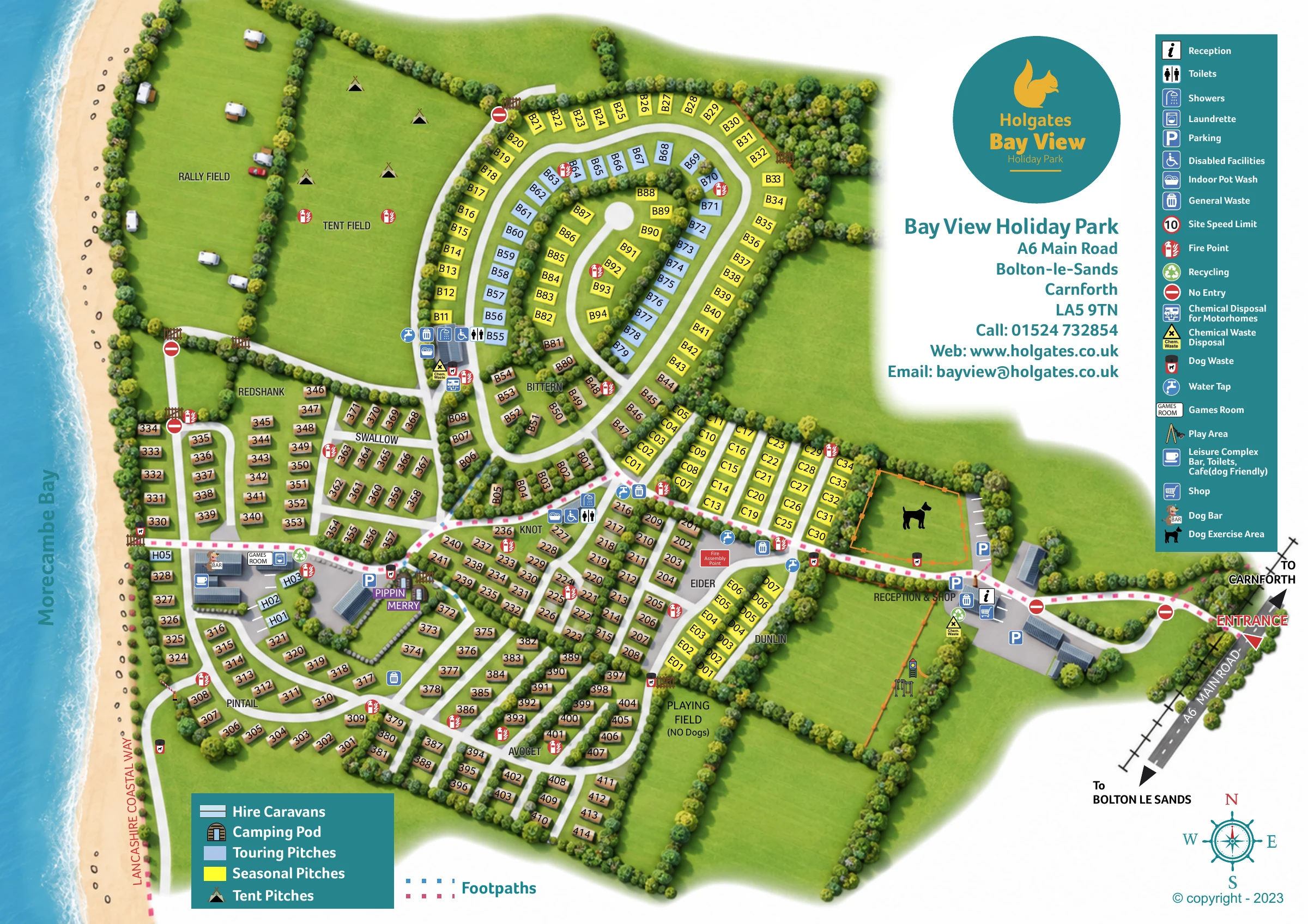 Enlarge this map ↗
KEEP EXPLORING
Chosen for shared landscapes, accommodation or facilities.
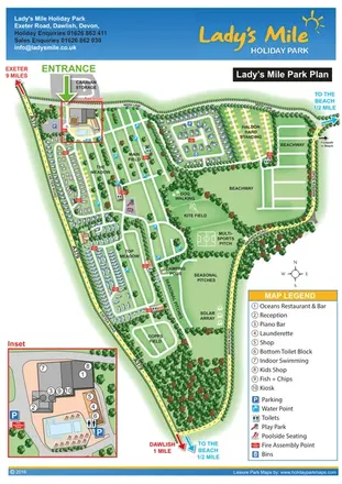 Explore the map ↗
United Kingdom
Portrait park plan with named fields, numbered accommodation, beach directions and an enlarged leisure-complex inset.
 Explore the map ↗
United Kingdom
Trevornick’s colour-coded park map, with mixed accommodation, fishing ponds, golf and wooded trails.
 Explore the map ↗
United Kingdom
A colour-zoned coastal park map with touring areas, woodland trails, ponds and a leisure club.
Features may come from the sample artwork, its key or published park information. Approximate numbers describe the drawing and may cover only part of a park. They are intended to help you compare map examples. Current facilities and booking information should be checked with the park.
LET’S MAP YOUR PARK
For a map quotation, find your park and draw a rough boundary around it. The area you select helps us work out the design time and price.
Draw your park for a quote ↗Or talk to our map designers
01751 473136