
Lawns, trees and shrubs
Bright-green lawns separate the homes, while varied tree and shrub illustrations line the roadside, perimeter and selected internal spaces.
ILLUSTRATED PARK MAP · P024
Creuddyn Bridge, Lampeter, Ceredigion · United Kingdom
 Enlarge the map ↗
A SENSE OF THE PLACE
The Bertheos map records a caravan site at Creuddyn Bridge near Lampeter in Ceredigion. Historic property particulars identify residential occupation at the site.
The artwork is therefore presented as a residential park example. It shows the organisation of the grounds without making claims about current holiday accommodation, visitor facilities or the number of occupied homes.
LOOK CLOSER
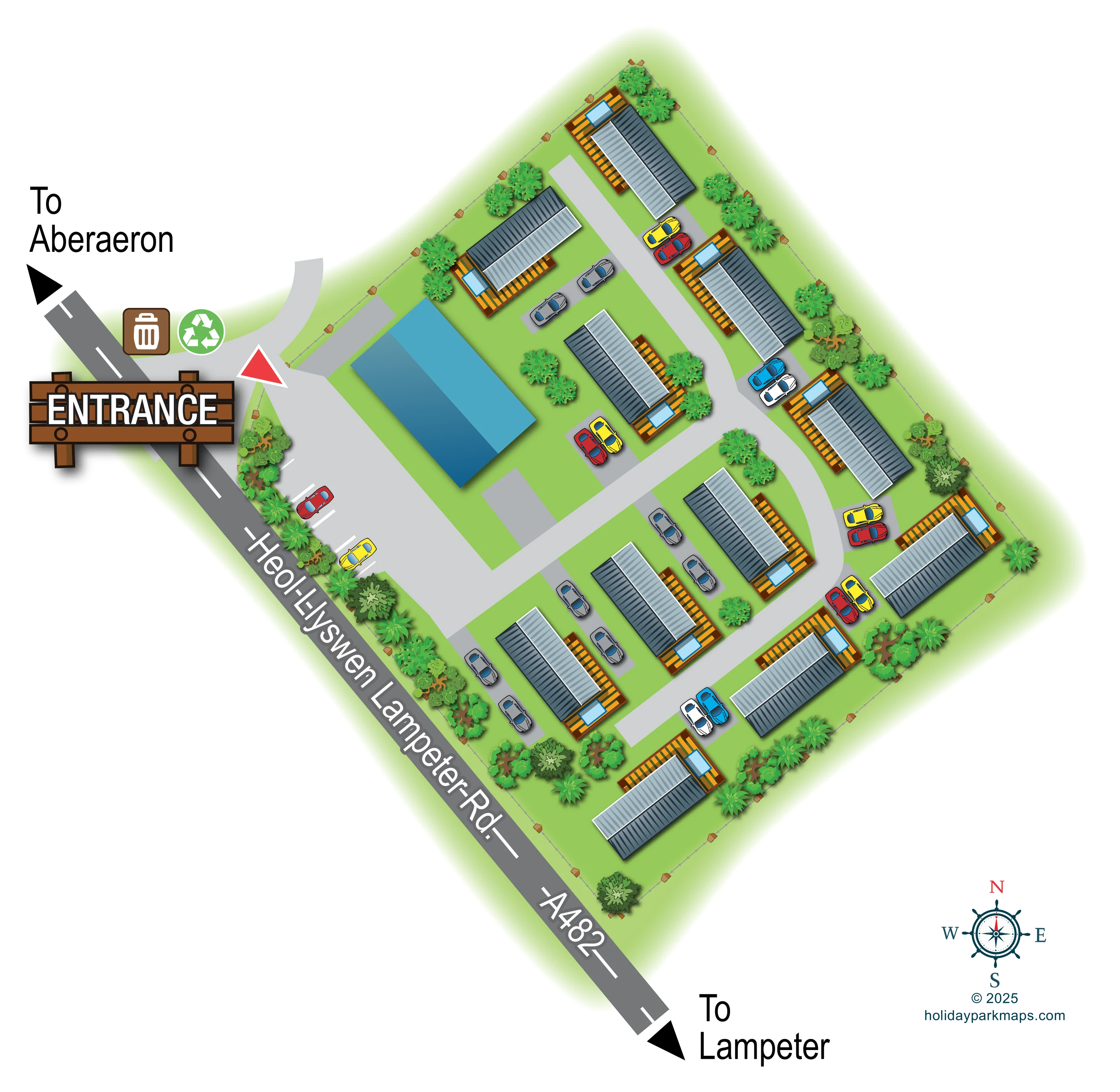
Bright-green lawns separate the homes, while varied tree and shrub illustrations line the roadside, perimeter and selected internal spaces.
A fine grey fence line with regularly spaced brown posts outlines much of the compact site.
A prominent timber-style ENTRANCE sign and red triangular marker identify the access from the roadside into the paved forecourt.
The adjoining road runs diagonally along the lower-left edge, with its name and A482 designation written directly on the carriageway.
Large black arrows at opposite ends of the roadside strip indicate the directions towards Aberaeron and Lampeter.
Light-grey lanes connect the entrance forecourt with the homes, including a curved lane through the right-hand part of the site and connecting branches between rows.
Cars occupy individual hardstandings beside the homes; white-lined parking bays are also shown along the roadside forecourt.
A brown bin icon and green recycling icon are positioned together beside the entrance approach.
A prominent timber-style ENTRANCE sign and red triangular marker identify the access from the roadside into the paved forecourt.
The adjoining road runs diagonally along the lower-left edge, with its name and A482 designation written directly on the carriageway.
Large black arrows at opposite ends of the roadside strip indicate the directions towards Aberaeron and Lampeter.
Light-grey lanes connect the entrance forecourt with the homes, including a curved lane through the right-hand part of the site and connecting branches between rows.
Cars occupy individual hardstandings beside the homes; white-lined parking bays are also shown along the roadside forecourt.
A brown bin icon and green recycling icon are positioned together beside the entrance approach.
Orange and brown slatted decks accompany the residential units, with small pale-blue rectangular details that are not labelled.
A large rectangular building with a two-tone blue roof stands beside the entrance forecourt. Its function is not identified.
Bright-green lawns separate the homes, while varied tree and shrub illustrations line the roadside, perimeter and selected internal spaces.
A fine grey fence line with regularly spaced brown posts outlines much of the compact site.
Historic property particulars cited in the catalogue identify residential occupation at the site; this is contextual information, not an artwork label.
READING THE MAP
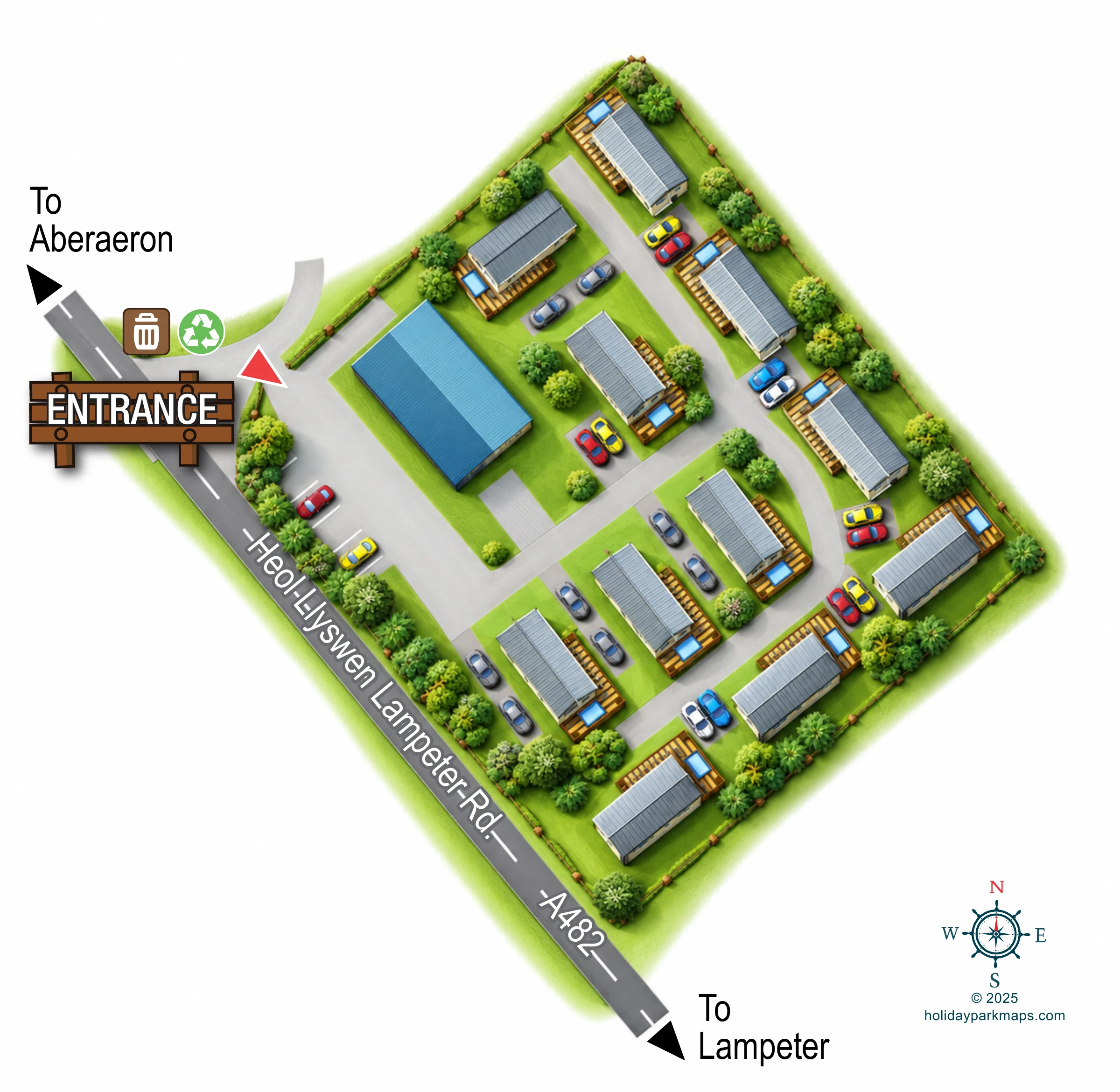
This illustrated map of Bertheos Caravan Park presents a small residential site at Creuddyn Bridge near Lampeter in Ceredigion. The compact grounds sit beside the A482, shown as a strong diagonal road frontage with directions towards Lampeter and Aberaeron. An oversized timber-style entrance sign makes the arrival point immediately recognisable, while a decorative compass rose provides orientation without adding a separate information panel.
Within the boundary, the map shows roughly ten caravan or park-home-style units arranged around light-grey access lanes. Slate-coloured roofs, orange-brown decks and colourful parked cars give the individual homes a consistent visual character. Trees, shrubs and bright-green lawns distinguish the spaces between them and frame the roadside edge. A larger blue-roofed building provides a clear landmark near the entrance, although its use is not labelled.
The sample demonstrates a straightforward approach to residential park mapping: concentrate on the entrance, local road connection, home arrangement and everyday practical details, rather than filling a small plan with holiday-facility icons or extensive text.
The artwork uses one nearly square page, with the compact site rotated diagonally so that the A482 frontage runs from the upper left towards the lower centre. The public road is dark grey with white dashed markings and large lettering for Heol Llyswen / Lampeter Road and the A482. Black arrows outside the grounds point towards Aberaeron at one end and Lampeter at the other.
The entrance is emphasised by a large brown timber-style sign and a red triangular marker. Immediately inside, a broad paved forecourt contains white-lined parking bays and sits beside a substantial building illustrated with a two-tone blue roof. Bin and recycling pictograms appear together near the approach. These practical features are located directly on the plan rather than explained through a separate legend.
Light-grey internal lanes branch from the forecourt and connect the short rows of homes. A gently curving lane serves the right-hand part of the grounds, with further connections between the internal and boundary plots. Each home is represented by a long roof with contrasting grey slopes and fine repeated roof lines. Timber-coloured decks and adjacent parking pads reinforce the distinction between the individual residential spaces.
Varied tree canopies and shrubs cluster along the roadside, perimeter and gaps between homes. A fine post-and-wire-style boundary encloses much of the grounds, while a soft green halo fades into the surrounding white page. The lower-right margin contains a compass rose and the designer credit. The composition relies on recognisable illustrated landmarks rather than plot numbering, with no separate inset or reverse-side map.
 Enlarge this map ↗
KEEP EXPLORING
Chosen for shared landscapes, accommodation or facilities.
 Explore the map ↗
United Kingdom
Coastal park map with static-caravan rows, touring pitches, a camping field and two leisure clusters.
 Explore the map ↗
United Kingdom
A wooded Allerton park plan with colour-coded neighbourhoods, touring pitches and a central facilities hub.
 Explore the map ↗
United Kingdom
Illustrated coastal holiday-home plan with dense alphanumeric plot labels, orange-roofed amenities, a numbered facility key and beach-side context.
Features may come from the sample artwork, its key or published park information. Approximate numbers describe the drawing and may cover only part of a park. They are intended to help you compare map examples. Current facilities and booking information should be checked with the park.
LET’S MAP YOUR PARK
For a map quotation, find your park and draw a rough boundary around it. The area you select helps us work out the design time and price.
Draw your park for a quote ↗Or talk to our map designers
01751 473136