
Tree-lined boundaries and planted site divisions
Dense illustrated trees line the right boundary, with further trees, hedges and shrubs around the perimeter, site groups and communal spaces.
ILLUSTRATED PARK MAP · P407
26 Corser Street, Point Vernon, Queensland · Australia
 Enlarge the map ↗
A SENSE OF THE PLACE
BIG4 Hervey Bay Holiday Park is located at Point Vernon in Queensland. It offers cabin accommodation and caravan sites, providing a base for exploring Hervey Bay and its coastal attractions.
Landscaped areas, barbecue facilities and a saltwater swimming pool provide places to relax on site. The bay's beaches, boating and whale-watching opportunities add to the location's appeal, while some touring options welcome pets.
LOOK CLOSER
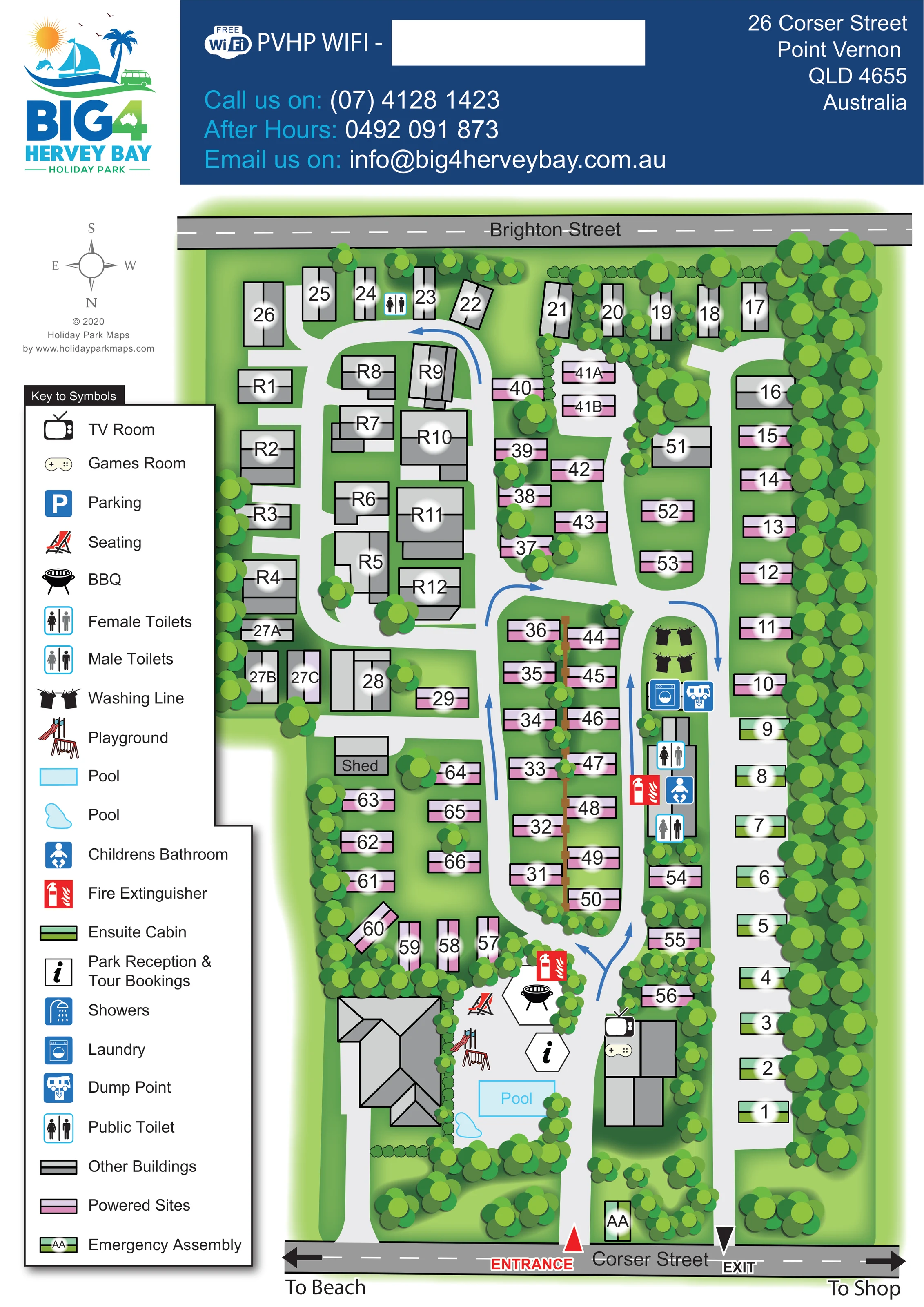
Dense illustrated trees line the right boundary, with further trees, hedges and shrubs around the perimeter, site groups and communal spaces.
An information symbol marks reception and tour bookings within the communal area close to the entrance.
A labelled rectangular pool and a smaller irregular blue pool shape appear together in the lower communal area. The map does not explain their separate functions.
A slide-and-swing illustration identifies the playground beside reception and the pool area.
Barbecue and deckchair symbols mark a small communal space just above reception.
Television and controller symbols identify rooms in a grey building east of the pool and reception cluster.
Male and female toilet symbols and a children's bathroom symbol appear at the central amenities building. A further toilet symbol appears near the upper accommodation row.
A laundry symbol and washing-line illustrations sit immediately above the central amenities building.
An information symbol marks reception and tour bookings within the communal area close to the entrance.
A labelled rectangular pool and a smaller irregular blue pool shape appear together in the lower communal area. The map does not explain their separate functions.
A slide-and-swing illustration identifies the playground beside reception and the pool area.
Barbecue and deckchair symbols mark a small communal space just above reception.
Television and controller symbols identify rooms in a grey building east of the pool and reception cluster.
Male and female toilet symbols and a children's bathroom symbol appear at the central amenities building. A further toilet symbol appears near the upper accommodation row.
A laundry symbol and washing-line illustrations sit immediately above the central amenities building.
A blue dump-point symbol is positioned beside the laundry area on the internal circulation route.
Showers are included in the key, but a separate shower symbol is not clearly located in the plan.
A parking symbol is provided in the key without a clearly identifiable matching marker on the plan.
A shed is explicitly labelled on the left side of the central site area. Grey building footprints vary in shape and include larger structures near the communal facilities.
Red extinguisher symbols appear at the central amenities area and near the barbecue and reception cluster.
An AA marker identifies an assembly point near Corser Street, between the entrance and exit lanes.
The header advertises free Wi-Fi. No access credentials are reproduced here.
Dense illustrated trees line the right boundary, with further trees, hedges and shrubs around the perimeter, site groups and communal spaces.
Separate entrance and exit markers connect the internal lanes to Corser Street along the bottom edge. Brighton Street borders the opposite side.
Blue arrows indicate travel direction around the linked internal lanes and the central amenities island.
Opposing arrows on Corser Street are labelled To Beach and To Shop. Neither destination is drawn within the park.
The supplied park information describes the swimming pool as saltwater; that specification is not stated in the map key.
READING THE MAP
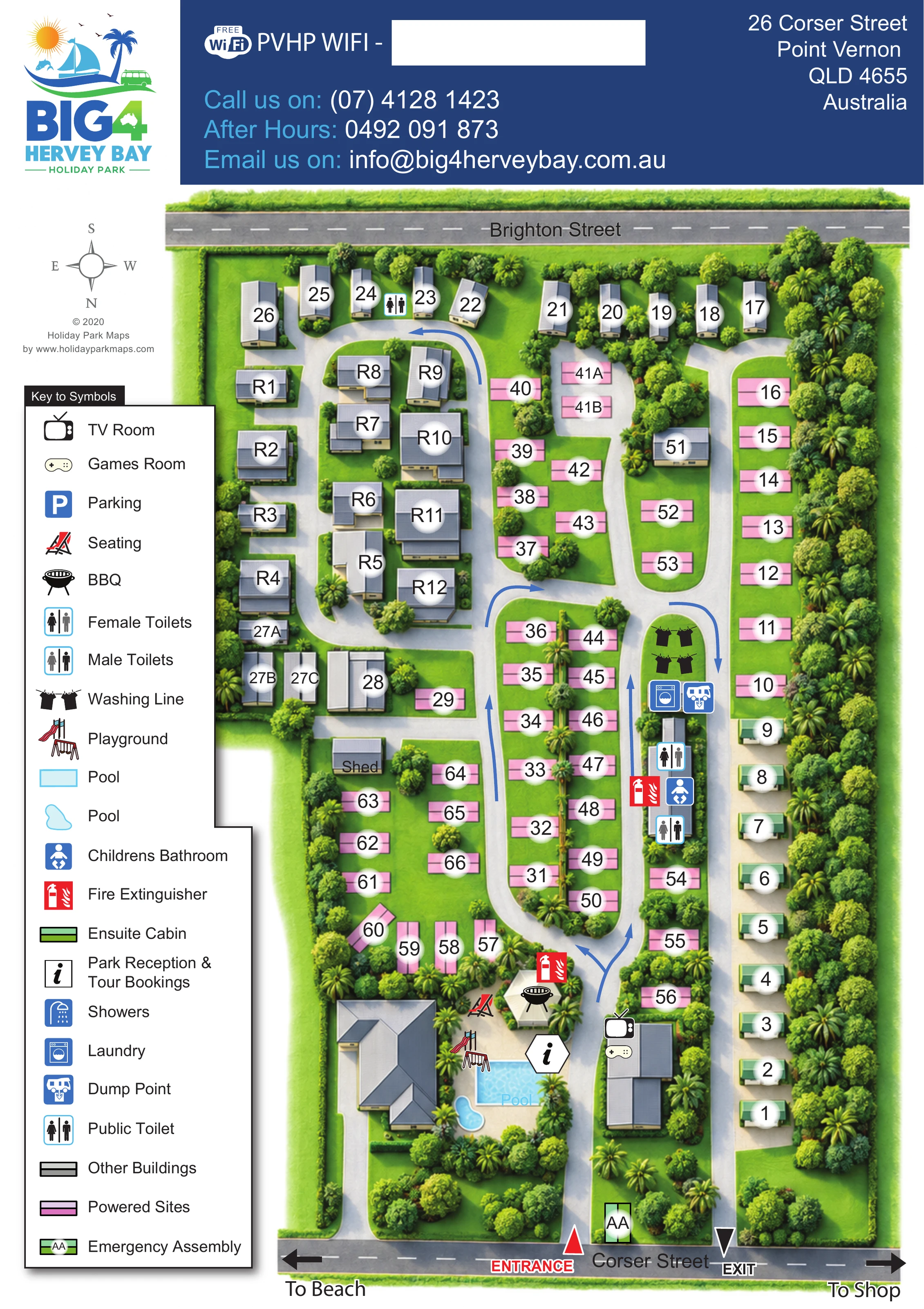
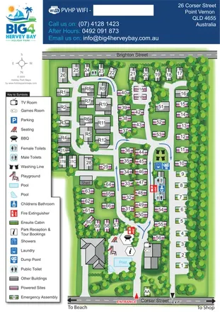
This illustrated map of BIG4 Hervey Bay Holiday Park presents a compact, tree-lined park at Point Vernon in Queensland. Set between Corser Street and Brighton Street, the plan brings together powered sites, ensuite cabins, communal facilities and a network of curving internal lanes on one portrait page. Green cabin symbols and pink powered-site symbols make the principal accommodation groups easy to distinguish, while large labels help guests locate individual positions.
The arrival area is a particular focus. Separate entrance and exit markers meet Corser Street, and reception, the pool, playground, barbecue area and recreation rooms are grouped just inside the park. Further along the internal routes, an amenities building brings together toilets, a children's bathroom, laundry and nearby washing lines. Blue circulation arrows help explain how the lanes connect around these facilities.
Dense illustrated trees give the map its landscaped character without obscuring the main routes. A prominent symbol key, branded header and directions towards the beach and shop complete a practical visitor-facing design for a coastal caravan and cabin park.
The artwork uses an overhead plan of an elongated park, with Corser Street along the bottom and Brighton Street across the top. Its compass places south upwards, making the street labels and entrance markers especially useful orientation cues. From the entrance, a pale grey lane leads into the communal area before joining the central circulation network. A separate lane beside the right-hand accommodation row reaches the marked exit. Blue arrows describe movement through the bends and around the central amenities island.
Accommodation is arranged in several distinct groups. Green-banded ensuite cabins line the right edge beneath a dense screen of illustrated trees. Pink-banded powered sites occupy the central strips, with another group curving around the lower-left area. Larger grey numbered footprints appear mainly towards the top and left; the key identifies this treatment as other buildings rather than defining a specific accommodation type. A labelled shed sits beside the left-hand sites.
Near arrival, the map shows reception and tour bookings, a rectangular pool with a smaller irregular pool shape alongside it, a playground, barbecue and seating. TV and games-room symbols identify a nearby building. The central service area includes toilet markers, a children's bathroom, laundry, washing lines and a dump point. Red fire-extinguisher markers and an AA assembly marker add another layer of visitor information.
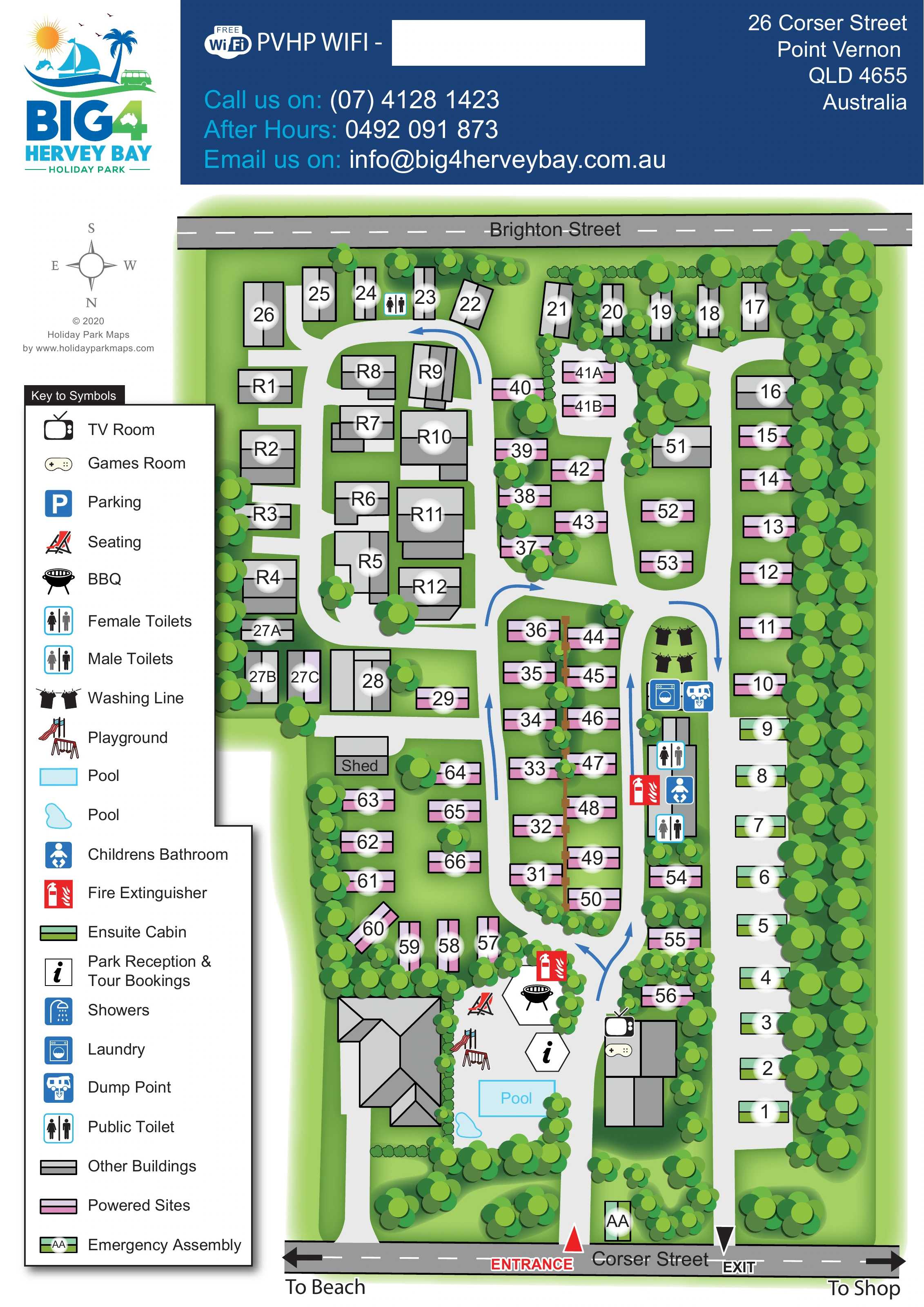
A tall key occupies the left margin, while the logo, address and contact banner span the top. The legend enlargement is a closer view of this same artwork, not a separate park section. Large haloed numbers, black footprint outlines, colour bands and layered tree canopies balance site identification with a clear impression of the park's planted setting.
 Enlarge this map ↗
KEEP EXPLORING
Chosen for shared landscapes, accommodation or facilities.
 Explore the map ↗
United Kingdom
A colour-zoned coastal park map with touring areas, woodland trails, ponds and a leisure club.
 Explore the map ↗
United Kingdom
Colour-coded accommodation, central leisure facilities and coastal paths on an illustrated headland park map.
 Explore the map ↗
United Kingdom
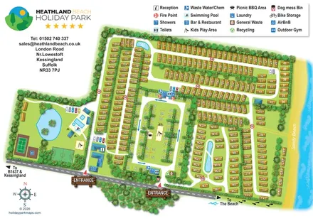
Illustrated Suffolk coastal park map with planted accommodation rows, central pitches, leisure facilities and beach directions.
Features may come from the sample artwork, its key or published park information. Approximate numbers describe the drawing and may cover only part of a park. They are intended to help you compare map examples. Current facilities and booking information should be checked with the park.
TAKE A CLOSER LOOK
View the illustrated map in detail or choose a file to download. These are sample maps; contact the park for current visitor information.


LET’S MAP YOUR PARK
For a map quotation, find your park and draw a rough boundary around it. The area you select helps us work out the design time and price.
Draw your park for a quote ↗Or talk to our map designers
01751 473136
 pvhp_large.png