
Kingfisher, Lakelands and Lakeside
Three named water features structure the northern accommodation groups; Kingfisher includes a small planted island.
ILLUSTRATED PARK MAP · P406
Bentley Country Park, Flag Hill, Great Bentley, Colchester, Essex · United Kingdom
 Enlarge the map ↗
A SENSE OF THE PLACE
Bentley Country Park is a family-run holiday home park between Thorrington and St Osyth in Essex. Landscaped grounds extend towards St Osyth Creek, with lakes and waterside habitats contributing to the setting.
Caravans and cabins are offered for sale, with garden space and parking associated with the plots. The map illustrates the park's layout and its relationship with the surrounding water and countryside.
LOOK CLOSER
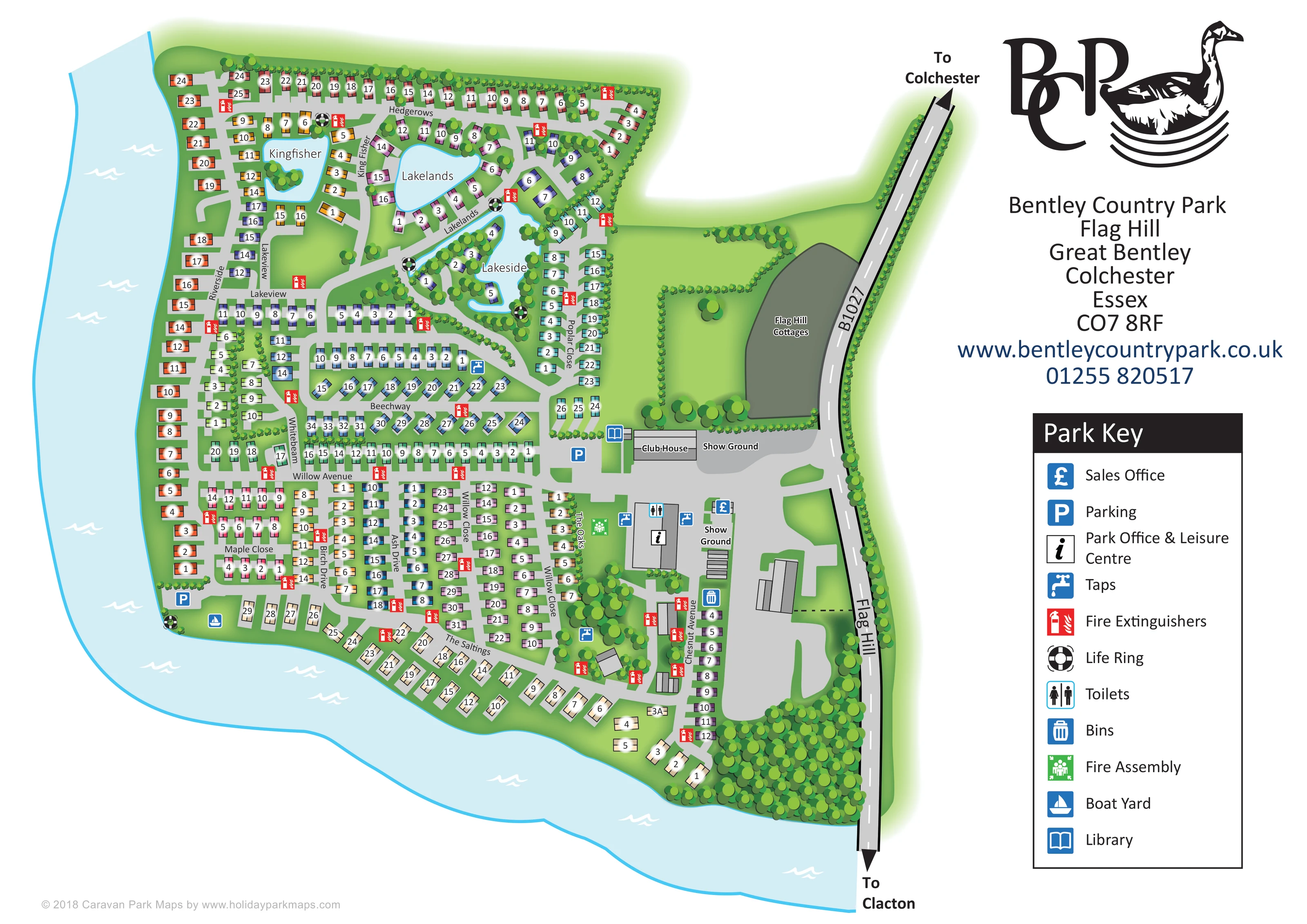
Three named water features structure the northern accommodation groups; Kingfisher includes a small planted island.
A broad expanse of pale-blue water follows the western and southern boundaries. Park information relates the setting to St Osyth Creek.
Tree-lined boundaries, planted lake edges, green plot surrounds, a large entrance-side lawn and dense south-eastern woodland soften the developed layout.
A labelled building beside the principal arrival area, parking and northern Show Ground.
An information symbol identifies the central entrance-side building using the combined office and leisure-centre label in the key.
A blue pound-sign marker appears beside the southern Show Ground near the entrance complex.
Two labelled Show Ground areas occupy the broad paved arrival zone.
An open-book marker locates the library beside the Club House.
A labelled building beside the principal arrival area, parking and northern Show Ground.
An information symbol identifies the central entrance-side building using the combined office and leisure-centre label in the key.
A blue pound-sign marker appears beside the southern Show Ground near the entrance complex.
Two labelled Show Ground areas occupy the broad paved arrival zone.
An open-book marker locates the library beside the Club House.
Parking markers appear by the Club House and at the south-western waterside corner.
A boat symbol locates the boat yard at the south-western edge beside the surrounding water.
A toilet marker appears at the office and leisure-centre building.
Blue tap markers identify water points around the central accommodation and entrance-side facilities.
A bin marker is shown beside the service buildings near Chesnut Avenue.
Repeated red extinguisher symbols are distributed throughout the accommodation lanes.
Black-and-white life-ring markers appear beside the internal lakes and at the south-western waterfront.
A green assembly marker appears beside the office and leisure-centre building.
Three named water features structure the northern accommodation groups; Kingfisher includes a small planted island.
A broad expanse of pale-blue water follows the western and southern boundaries. Park information relates the setting to St Osyth Creek.
Tree-lined boundaries, planted lake edges, green plot surrounds, a large entrance-side lawn and dense south-eastern woodland soften the developed layout.
The road runs along the eastern boundary, with the principal entrance opening into the central facilities area and arrows towards Colchester and Clacton.
Routes include Riverside, Hedgerows, Lakeview, Poplar Close, Beechway, Whitebeam, Willow Avenue, Maple Close, Birch Drive, Ash Drive, Willow Close, The Oaks, The Saltings and Chesnut Avenue.
A separately labelled roadside parcel lies north of the entrance. Its status as park guest accommodation is not established by the map.
READING THE MAP
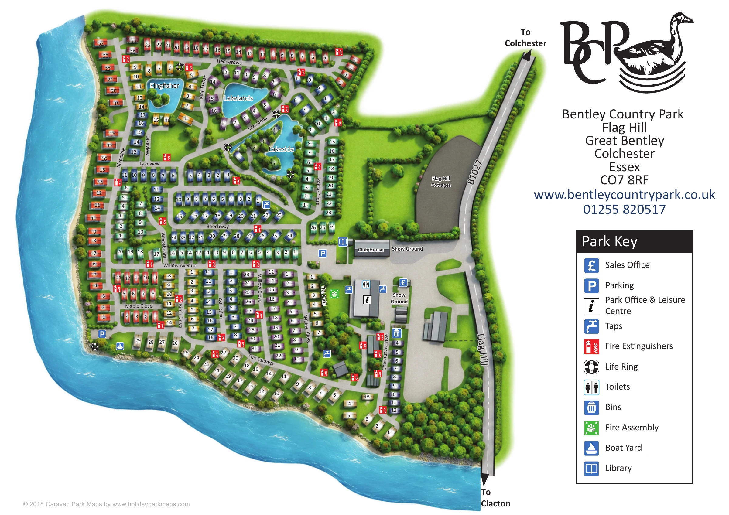
This illustrated map of Bentley Country Park presents a large holiday-home layout shaped by water, planting and a network of named neighbourhood roads. Located at Flag Hill in Great Bentley, Essex, the park is shown with a broad waterfront along its western and southern edges, plus three smaller lakes within the grounds. These water features give the plan its distinctive shape and provide useful landmarks among the many accommodation rows.
The artwork balances individual plot identification with a clear overview of the park. Numbered holiday homes follow straight avenues, short closes and curved waterside lanes, while trees and green spaces separate the groups. On the eastern side, the entrance from the B1027 leads into a concentrated area of offices, show grounds and communal facilities.
A separate right-hand column carries the park’s waterbird branding, address and a large symbol key. The result is a useful sample for holiday-home parks that need to explain a substantial residential-style layout without losing the character of their landscape or making arrival information difficult to find.
The plan follows Bentley Country Park’s irregular waterfront boundary, with pale-blue water extending down the western side and across the southern edge. Riverside runs beside the western frontage, while The Saltings follows the lower shoreline. In the north, accommodation wraps around Kingfisher, Lakelands and Lakeside, giving this part of the park a looser, more curved arrangement than the closely spaced avenues further south. A small planted island adds a distinctive landmark within Kingfisher.
Willow Avenue forms a clear cross-park route through the central accommodation. Roads such as Beechway, Maple Close, Birch Drive, Ash Drive and Willow Close divide the dense layout into smaller, named groups. Individual homes are illustrated with coloured roofs and white number discs, with their orientation changing to follow each road. Green plot surrounds, tree belts and planted lake margins keep the plan from becoming a continuous block of accommodation symbols.
The eastern arrival area connects directly to Flag Hill, labelled B1027, with arrows towards Colchester and Clacton. Two Show Grounds sit around the entrance-side facilities. The map identifies the Club House, library, sales office and combined Park Office & Leisure Centre, together with parking, toilets and an assembly point. Water taps and fire extinguishers are marked around the grounds, with life rings beside water and a boat-yard symbol at the south-western corner.
The single landscape-format artwork pairs this detailed site plan with a spacious branding and legend column. Its enlarged key view reveals the same facility symbols more clearly rather than representing a separate park section. Soft landscape shading, simplified roofs and circular tree canopies give the map an illustrated finish while keeping roads, numbers and service markers legible.
 Enlarge this map ↗
KEEP EXPLORING
Chosen for shared landscapes, accommodation or facilities.
 Explore the map ↗
United Kingdom
Ashby Park map with seven fishing lakes, colour-coded accommodation and illustrated wooded shorelines.
 Explore the map ↗
United Kingdom
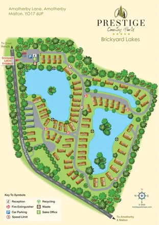
Brickyard Lakes map with lakeside holiday homes, wooded islands and clearly marked arrival facilities.
 Explore the map ↗
United Kingdom
Illustrated lakeside park plan with numbered holiday units, leisure buildings and a looping Woodland Walk.
Features may come from the sample artwork, its key or published park information. Approximate numbers describe the drawing and may cover only part of a park. They are intended to help you compare map examples. Current facilities and booking information should be checked with the park.
TAKE A CLOSER LOOK
View the illustrated map in detail or choose a file to download. These are sample maps; contact the park for current visitor information.


LET’S MAP YOUR PARK
For a map quotation, find your park and draw a rough boundary around it. The area you select helps us work out the design time and price.
Draw your park for a quote ↗Or talk to our map designers
01751 473136