
Illustrated shoreline
A stylised sandy shore, blue water, white surf and a small sailing boat accompany the road along the bottom edge, establishing the coastal setting.
ILLUSTRATED PARK MAP · P027
29 Dhu Varren, Portstewart Road, Portrush · United Kingdom
 Enlarge the map ↗
A SENSE OF THE PLACE
Blair's Holiday Park is based at 29 Dhu Varren, Portstewart Road, Portrush. The site is located between Portrush and Portstewart, with West Strand Beach described as five minutes away on foot. The original Blair's park has 145 privately owned holiday homes and is for private owners.
Play park, all-weather ball-games pitch, accessible shower/toilets, laundry and card-operated entry barrier are listed.
LOOK CLOSER
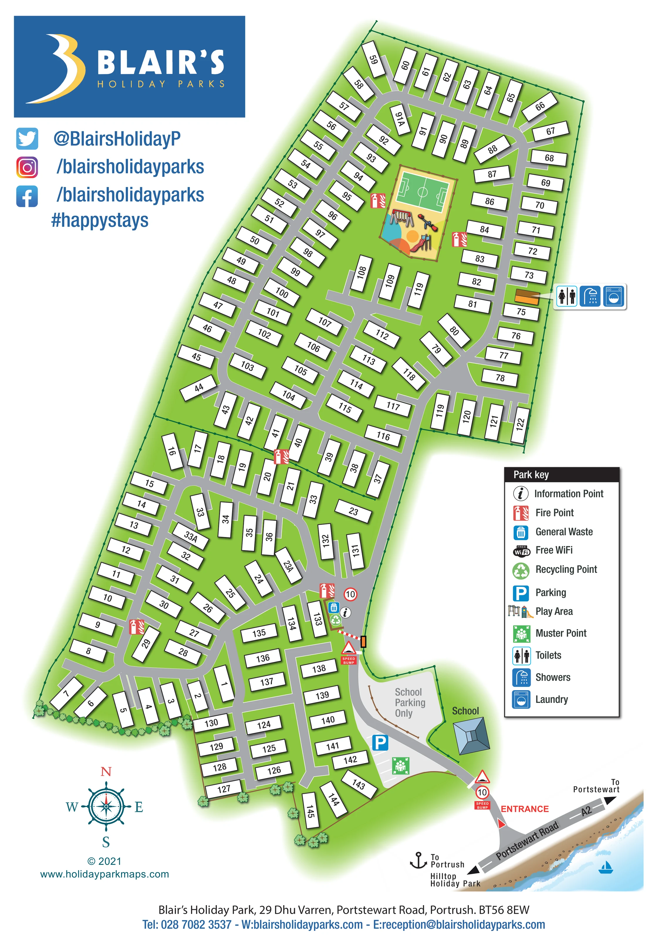
A stylised sandy shore, blue water, white surf and a small sailing boat accompany the road along the bottom edge, establishing the coastal setting.
Bright green ground, dark green boundary fencing, internal dividing fences and small clusters of trees define the park footprint.
A fenced recreation enclosure in the upper part of the park contains illustrated swings, a slide and other play equipment on coloured surfacing.
A small green court with white football-style markings occupies the upper half of the recreation enclosure.
A combined icon callout points to a small orange service building along the right-hand accommodation road.
An information symbol is positioned beside the internal entrance barrier and waste facilities.
General-waste and recycling symbols are grouped beside the internal arrival road.
Repeated red fire-point symbols are distributed through the accommodation areas, including beside the recreation enclosure.
A fenced recreation enclosure in the upper part of the park contains illustrated swings, a slide and other play equipment on coloured surfacing.
A small green court with white football-style markings occupies the upper half of the recreation enclosure.
A combined icon callout points to a small orange service building along the right-hand accommodation road.
An information symbol is positioned beside the internal entrance barrier and waste facilities.
General-waste and recycling symbols are grouped beside the internal arrival road.
Repeated red fire-point symbols are distributed through the accommodation areas, including beside the recreation enclosure.
A blue parking symbol identifies a marked parking area near the entrance, separate from the adjacent school-only parking.
A green muster-point symbol is shown within the entrance-side parking area.
Free WiFi appears in the park key, without a clearly identifiable location symbol on the plan.
A red entrance label marks the approach from Portstewart Road. A red-and-white barrier is illustrated farther inside, near the information and waste symbols.
Circular 10 signs and red speed-bump labels are shown on the arrival route.
Grey looping roads and short branches connect the numbered home rows, recreation area and service building.
The road along the lower edge is labelled Portstewart Road and A2, with arrows towards Portstewart and towards Portrush and Hilltop Holiday Park.
A school building and a separately labelled 'School Parking Only' area provide context beside the park entrance.
A stylised sandy shore, blue water, white surf and a small sailing boat accompany the road along the bottom edge, establishing the coastal setting.
Bright green ground, dark green boundary fencing, internal dividing fences and small clusters of trees define the park footprint.
Operator information lists accessible showers and toilets. The map's service callout identifies toilets and showers but does not separately mark accessibility.
READING THE MAP
This map of Blair’s Holiday Park in Portrush combines a clearly numbered holiday-home plan with a distinctive coastal presentation. The long site stretches diagonally across the portrait page, leaving room for the Blair’s branding, a prominent park key and an illustrated section of Portstewart Road beside the shore. Around 150 home positions give the artwork a substantial accommodation scale without overwhelming the arrival information or shared facilities.
The map shows the entrance from the A2, the internal barrier, parking and a network of grey roads serving perimeter and central rows of homes. In the upper part of the site, a fenced recreation area brings together play equipment and a marked ball-games pitch. Toilets, showers and laundry are identified by a compact callout on the right-hand side.
White accommodation footprints, bright green grounds and colour-coded symbols make this a useful sample for an established holiday-home park needing plot-level orientation, recognisable facilities and strong brand presence on one sheet.
The plan is arranged around an elongated, irregular boundary, with the entrance at the lower right and the largest accommodation area towards the top. White numbered home footprints follow the outside edges and form shorter rows between looping grey roads. Their changing angles reflect the bends in the road network, while small grey frontage strips help distinguish the units from the surrounding green space. An internal fence crosses the middle of the site, giving the two main accommodation areas a visible dividing line.
Arrival information is concentrated near Portstewart Road. The map labels the entrance, illustrates speed-bump and 10 signs, and shows a barrier farther along the approach. Park parking and a muster point sit near the entrance; the neighbouring school and its school-only parking are separately labelled. Information, general-waste and recycling symbols appear beside the internal arrival road, with red fire-point symbols repeated across the park.
The upper recreation enclosure is a particularly useful landmark. It contains a green pitch with white football-style markings alongside swings, a slide and colourful play surfacing. Farther right, a leader line links an orange building to toilet, shower and laundry symbols. The park key also includes Free WiFi, although no specific WiFi location is apparent on the plan.
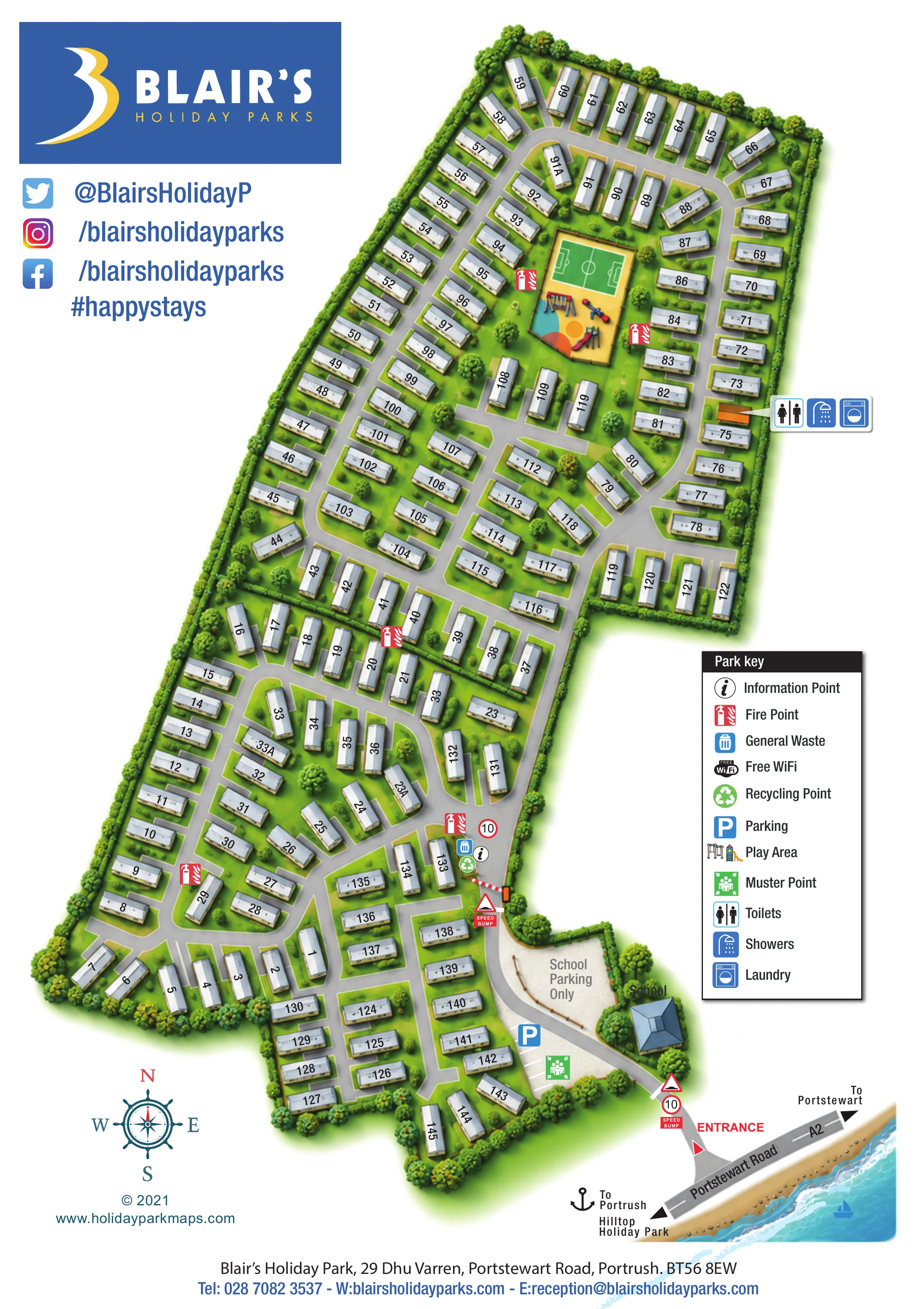
The page balances this practical detail with a large blue brand panel, social-media details, a decorative compass and a contact footer. Along the bottom, a stylised shoreline accompanies the A2 and its arrows towards Portstewart, Portrush and Hilltop Holiday Park. The enlarged detail view repeats the same artwork, clarifying the key and entrance rather than adding another mapped area.
 Enlarge this map ↗
KEEP EXPLORING
Chosen for shared landscapes, accommodation or facilities.
 Explore the map ↗
United Kingdom
Coastal park map with static-caravan rows, touring pitches, a camping field and two leisure clusters.
 Explore the map ↗
United Kingdom
Illustrated coastal holiday-home plan with dense alphanumeric plot labels, orange-roofed amenities, a numbered facility key and beach-side context.
 Explore the map ↗
United Kingdom
Coastal park plan with colour-coded pitches, named neighbourhoods and a Morecambe Bay walking route.
Features may come from the sample artwork, its key or published park information. Approximate numbers describe the drawing and may cover only part of a park. They are intended to help you compare map examples. Current facilities and booking information should be checked with the park.
LET’S MAP YOUR PARK
For a map quotation, find your park and draw a rough boundary around it. The area you select helps us work out the design time and price.
Draw your park for a quote ↗Or talk to our map designers
01751 473136