
Creek boundary
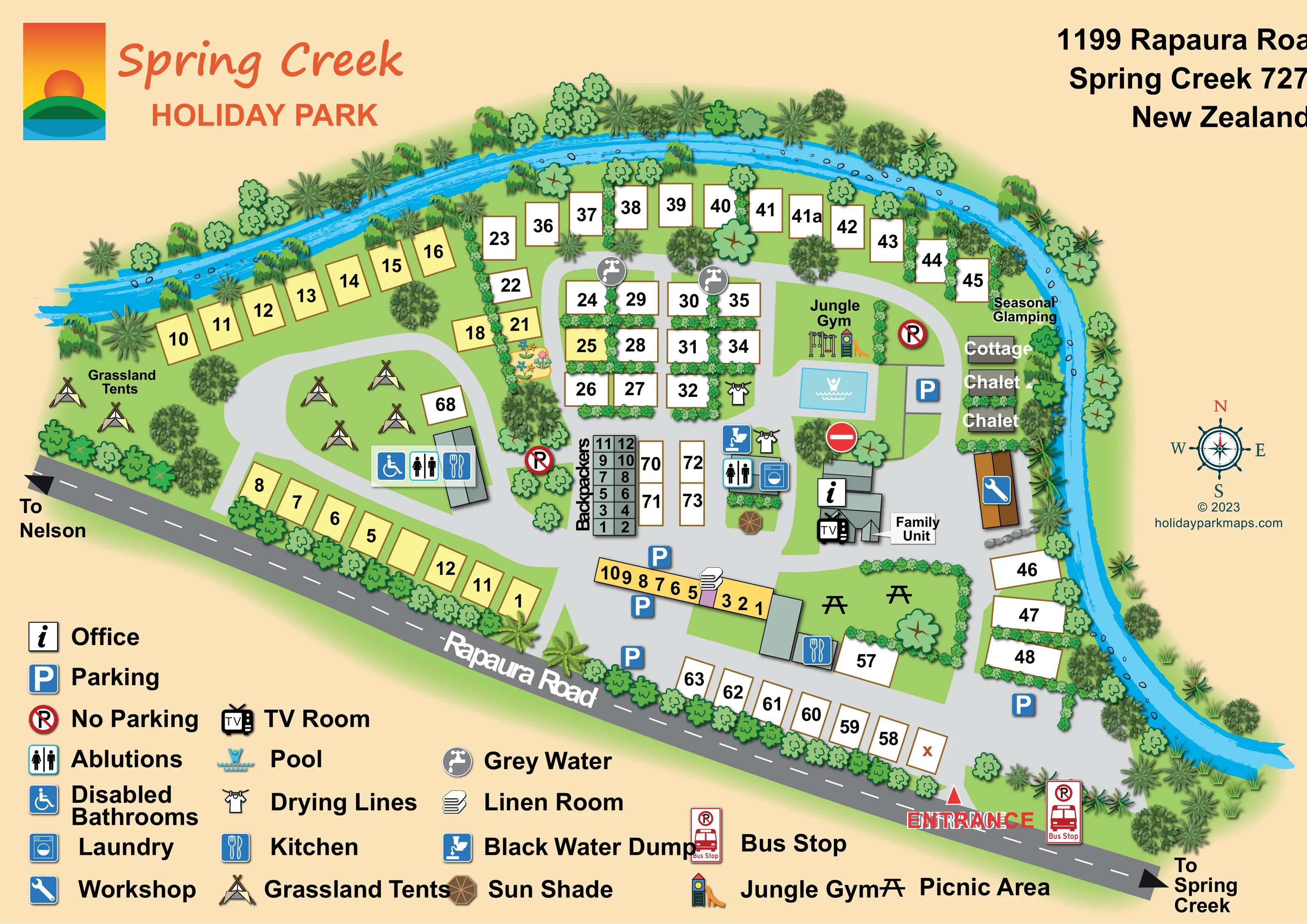
A bright blue, tree-lined creek wraps around the northern and eastern edges of the park.
ILLUSTRATED PARK MAP · P599
1199 Rapaura Road, Spring Creek, New Zealand · New Zealand
 Enlarge the map ↗
A SENSE OF THE PLACE
Spring Creek Holiday Park, now presented as Blenheim TOP 10 Holiday Park, offers a riverside base in New Zealand's Marlborough region. Accommodation ranges from cottages, chalets and cabins to powered sites and tent camping.
The creek and landscaped grounds shape the layout of this family-run park. Different accommodation types allow guests to choose between bringing their own camping setup and staying in a prepared unit while exploring the region.
LOOK CLOSER
A bright blue, tree-lined creek wraps around the northern and eastern edges of the park.
Dense boundary planting, hedge-divided pitches, scattered shade trees and a small flower bed organise the green grounds.
A red triangle and prominent ENTRANCE label mark the access near the south-eastern corner.
The road follows the southern boundary, with directional arrows towards Nelson and Spring Creek.
Broad pale-grey lanes link the entrance, central facilities, creekside pitches and a rounded western camping loop.
An information symbol identifies the office within the central-eastern building cluster.
Blue parking symbols appear beside accommodation and facilities; red no-parking symbols identify selected internal areas.
A red bus-stop sign is placed beside Rapaura Road near the entrance.
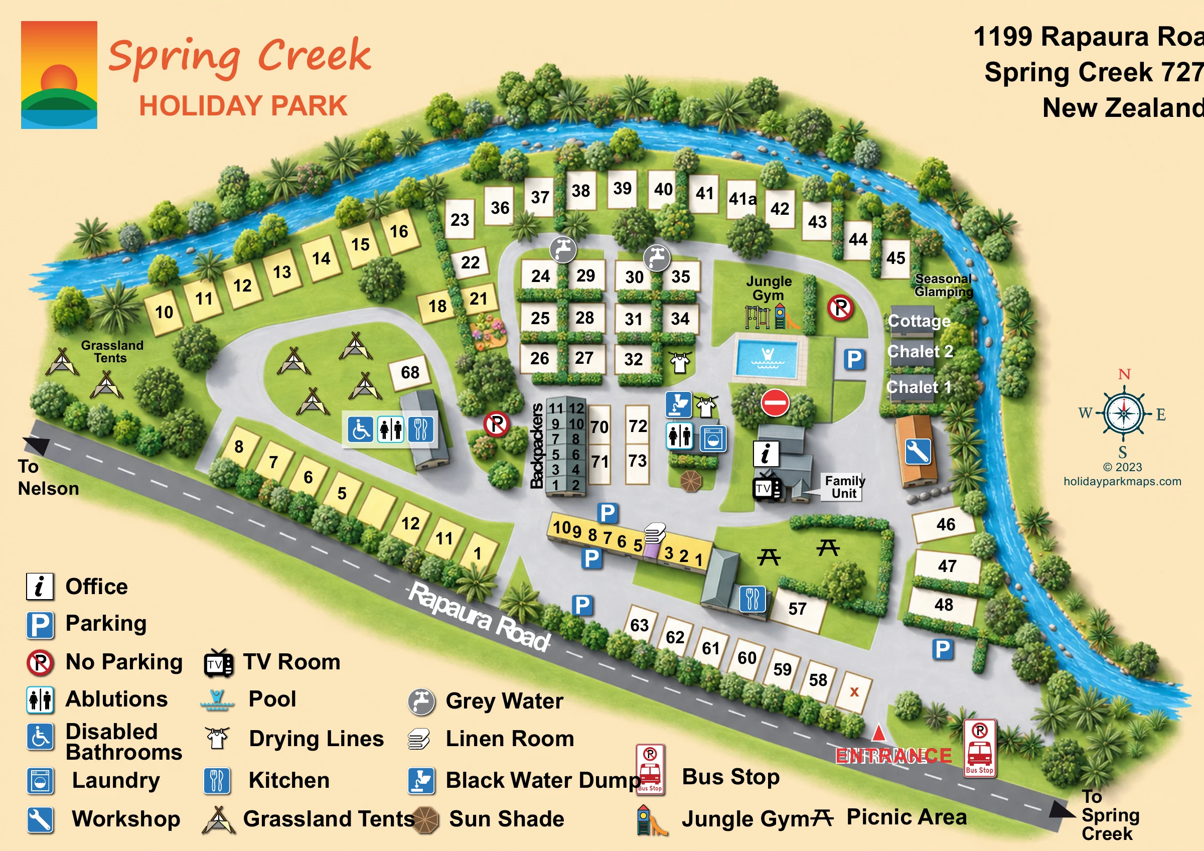
A bright blue, tree-lined creek wraps around the northern and eastern edges of the park.
Dense boundary planting, hedge-divided pitches, scattered shade trees and a small flower bed organise the green grounds.
A red triangle and prominent ENTRANCE label mark the access near the south-eastern corner.
The road follows the southern boundary, with directional arrows towards Nelson and Spring Creek.
Broad pale-grey lanes link the entrance, central facilities, creekside pitches and a rounded western camping loop.
An information symbol identifies the office within the central-eastern building cluster.
Blue parking symbols appear beside accommodation and facilities; red no-parking symbols identify selected internal areas.
A red bus-stop sign is placed beside Rapaura Road near the entrance.
A rectangular blue pool sits in the central-eastern recreation area.
A labelled climbing frame and slide stand immediately north of the pool.
Picnic-table symbols occupy a hedge-framed lawn near the southern kitchen building.
A brown parasol-style shade symbol appears beside the central ablutions and laundry area.
Toilet and washing facilities are marked at the western camping block and central service block.
A wheelchair symbol at the western facilities block corresponds to the legend wording Disabled Bathrooms.
Cutlery symbols identify kitchens at the western camping facilities and beside the southern picnic lawn.
A washing-machine symbol marks the central laundry, with drying-line symbols nearby and beside the central pitches.
A television symbol identifies a room in the office and family-unit building cluster.
Two grey circular tap symbols appear beside the central pitch groups and are identified as Grey Water in the legend.
A blue disposal symbol locates the black-water dump beside the central service block.
A folded-linen symbol marks a contrasting section of the long numbered accommodation strip.
A spanner symbol identifies the long brown-roofed building beside the eastern creek.
A red no-entry symbol appears on the lane immediately south of the pool.
READING THE MAP
A curving blue creek and a strong diagonal road frontage give this Spring Creek Holiday Park map its distinctive shape. Created for the park now presented as Blenheim TOP 10 Holiday Park in New Zealand’s Marlborough region, the artwork brings a varied camping and accommodation site together in one illustrated plan.
The map shows numbered pitches around the perimeter and in hedge-separated groups, open grassland tent areas at the western end, and a central concentration of rooms and shared facilities. A cottage and two chalets sit beside the eastern creek, while a seasonal glamping label adds another accommodation area to the picture. The swimming pool, jungle gym and picnic lawn provide easily recognised landmarks among the lanes and buildings.
The design combines practical numbering and service symbols with a more expressive treatment of water and planting. Its generous legend, prominent Rapaura Road entrance and directional arrows help visitors understand both arrival and movement within the grounds. For a mixed-accommodation park, this is a useful example of showing operational detail without losing the landscape that gives the site its character.
The single landscape-format plan places the park between Rapaura Road along the lower edge and a creek sweeping across the top before turning down the eastern boundary. The entrance is marked near the south-eastern corner with a red triangle and large lettering. From there, pale-grey lanes connect the main accommodation and facilities, continuing west into a rounded loop around a tent-camping lawn. Road arrows indicate Nelson in one direction and Spring Creek in the other.
Numbered pitch rectangles follow the creek and road frontage, with additional groups separated by hedges in the centre. White and pale-yellow fills distinguish some plots visually, although the legend does not define those colours. A numbered Backpackers block and a long yellow accommodation strip sit near the central parking areas. The eastern edge contains the named cottage, two chalets and a seasonal glamping label. A leader line identifies a family unit within the office building cluster.
The pool and labelled jungle gym form a prominent recreation area. Elsewhere, picnic tables occupy a hedge-framed lawn beside a kitchen, and a sun-shade symbol appears near the central service facilities. Repeated icons locate ablutions, kitchens and drying lines; separate symbols identify accessible bathrooms, laundry, the TV room, linen room, workshop, grey-water points and black-water disposal. Parking, no-parking and a no-entry sign add circulation detail, while a bus-stop marker sits beside the entrance road.
The illustration mixes crisp rectangles and roof outlines with shaded foliage and a lively, textured creek. Orange branding anchors the upper left, a large facility legend fills the lower margin, and a compass rose balances the right-hand side.
 Enlarge this map ↗
KEEP EXPLORING
Chosen for shared landscapes, accommodation or facilities.
 Explore the map ↗
United States
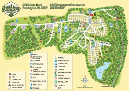
Woodland RV campground map with mixed camping, three water landmarks and a central recreation hub.
 Explore the map ↗
United Kingdom
A colour-zoned coastal park map with touring areas, woodland trails, ponds and a leisure club.
 Explore the map ↗
United Kingdom
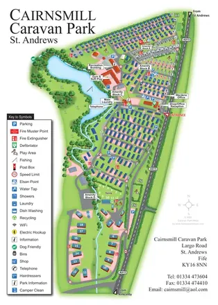
Portrait park map combining numbered caravan rows, touring and tent areas with a reservoir-side recreation hub.
Features may come from the sample artwork, its key or published park information. Approximate numbers describe the drawing and may cover only part of a park. They are intended to help you compare map examples. Current facilities and booking information should be checked with the park.
LET’S MAP YOUR PARK
For a map quotation, find your park and draw a rough boundary around it. The area you select helps us work out the design time and price.
Draw your park for a quote ↗Or talk to our map designers
01751 473136