
Tree-lined boundaries and planted divisions
Dense illustrated conifers and broadleaf trees frame the site, with hedges, shrubs and smaller trees separating internal areas.
ILLUSTRATED PARK MAP · P028
Pottery Lane, Strensall, York · United Kingdom
 Enlarge the map ↗
A SENSE OF THE PLACE
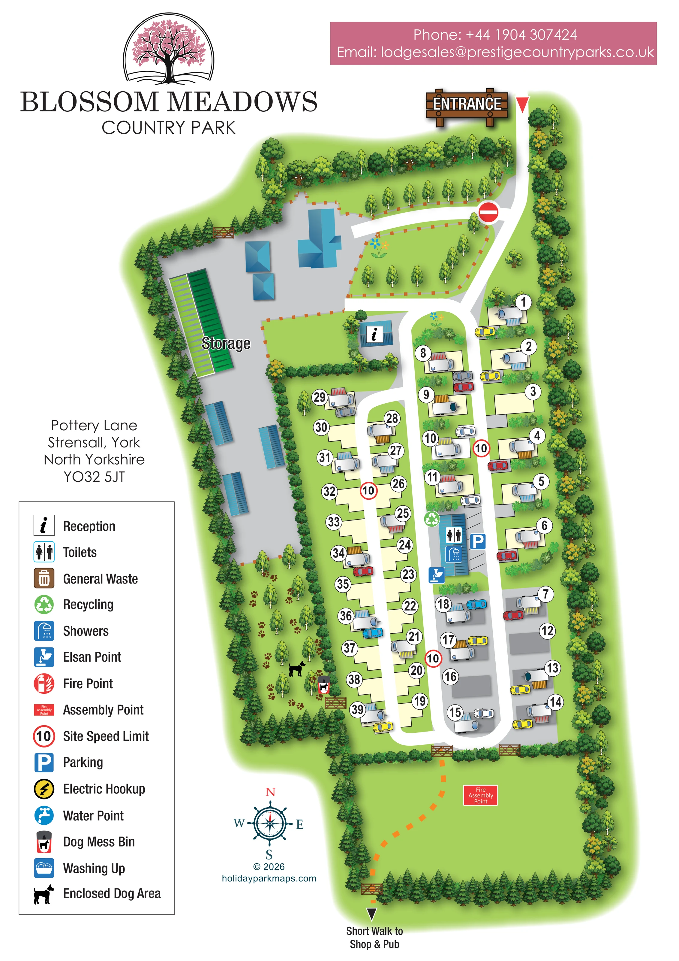
Blossom Meadows Country Park is based at Pottery Lane, Strensall, York. The seasonal touring park is at Strensall, surrounded by woodland and open countryside. Seasonal touring pitches and a two-bedroom rental cottage are advertised.
A field is provided for ball games and kite flying. Hardstanding/premium pitches, electric and water connections, washing-up sinks, amenities block, Wi-Fi and caravan storage are listed.
LOOK CLOSER
Dense illustrated conifers and broadleaf trees frame the site, with hedges, shrubs and smaller trees separating internal areas.
A large open green area beyond the pitch loops contains the assembly-point marker and a dashed walking route.
An information symbol identifies a small blue-roofed reception building beside the upper end of the pitch roads.
Toilet and shower symbols are placed on the central blue-roofed amenities building.
A chemical toilet disposal symbol appears beside the southern end of the amenities building.
A green recycling symbol is positioned beside the amenities block.
A blue parking symbol and marked bays sit immediately alongside the amenities block; cars also illustrate individual pitch arrangements.
A striped bay area labelled Storage occupies the upper part of the large western service yard.
An information symbol identifies a small blue-roofed reception building beside the upper end of the pitch roads.
Toilet and shower symbols are placed on the central blue-roofed amenities building.
A chemical toilet disposal symbol appears beside the southern end of the amenities building.
A green recycling symbol is positioned beside the amenities block.
A blue parking symbol and marked bays sit immediately alongside the amenities block; cars also illustrate individual pitch arrangements.
A striped bay area labelled Storage occupies the upper part of the large western service yard.
A tree-lined strip west of the pitches is marked with a dog silhouette, paw prints and a timber gate.
A dog waste bin symbol is shown near the gate at the southern end of the enclosed dog area.
A red labelled assembly-point marker stands within the large southern grass field.
Included in the key, without a clearly identifiable matching placement on the plan.
A fire-point symbol is explained in the key; a corresponding position is not clearly visible.
The key contains an electric hookup symbol, but does not establish individual hookup locations.
Water points are represented in the key without clear plotted positions.
Washing up appears in the symbol key, but its location is not explicitly marked on the plan.
Dense illustrated conifers and broadleaf trees frame the site, with hedges, shrubs and smaller trees separating internal areas.
A large open green area beyond the pitch loops contains the assembly-point marker and a dashed walking route.
Operator information describes a recreation field for ball games and kite flying; the illustrated southern field is not explicitly labelled with these activities.
A large timber-style ENTRANCE sign and red triangular marker identify arrival at the top right.
White roads descend from the entrance, divide around elongated pitch groups and curve together at the southern end. A branch leads west towards the service yard.
Red-ringed signs displaying 10 appear along the pitch roads, and a no-entry symbol marks the upper service-yard junction.
An orange dashed route crosses the southern field through illustrated gates and ends at an arrow labelled Short Walk to Shop & Pub. The destinations themselves are outside the plan.
READING THE MAP
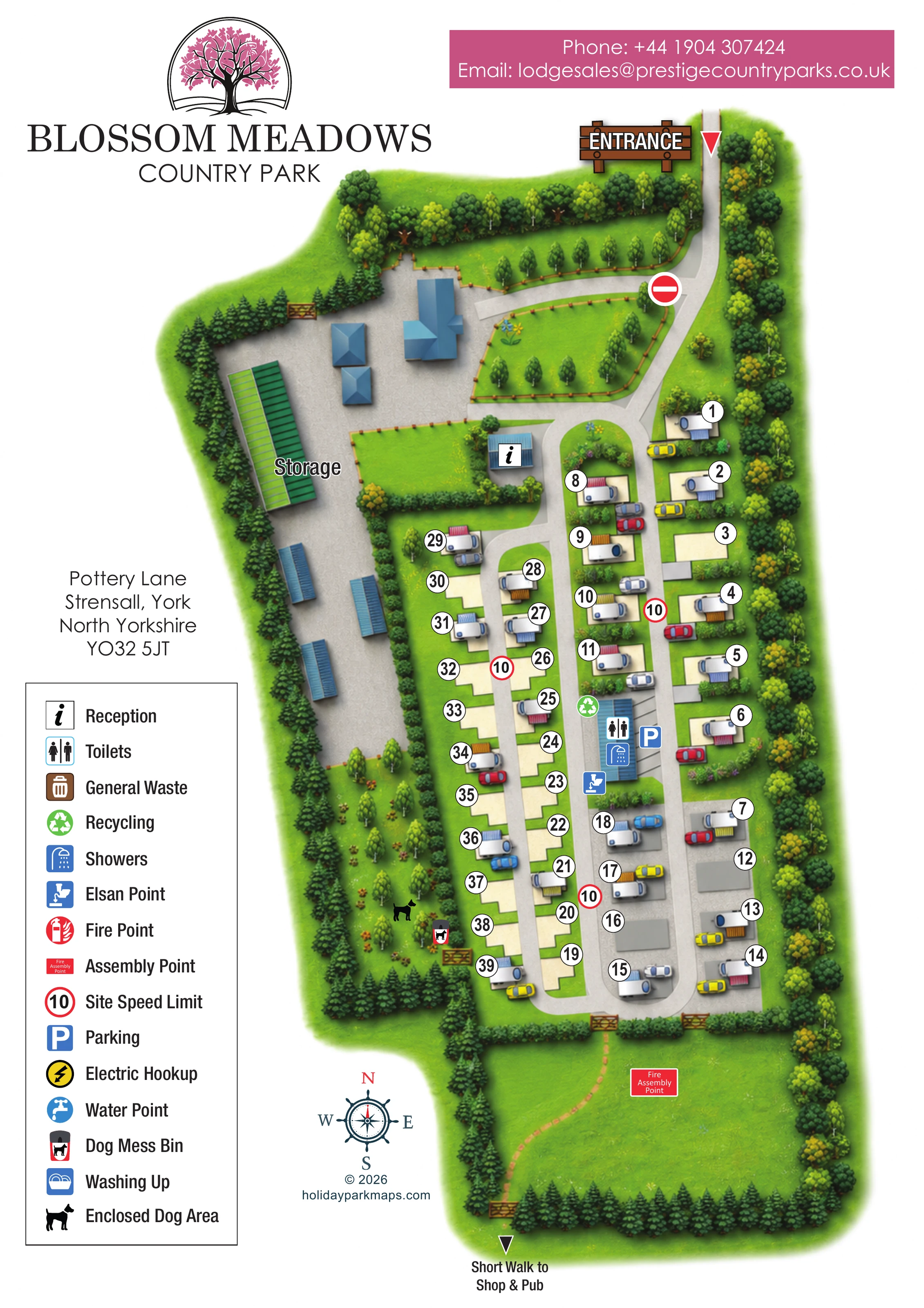
This illustrated map of Blossom Meadows Country Park presents a compact touring park at Strensall, near York, within a strongly tree-lined setting. Its tall portrait composition follows the shape of the site: arrival at the top, touring pitches through the middle and an open grass field at the bottom. Roughly 40 pitches are shown, using numbered outlines, small silver caravans, striped awnings and parked cars to make the accommodation layout easy to recognise.
The map gives particular attention to the relationship between visitor areas and practical facilities. Reception sits near the start of the pitch roads, the amenities block occupies a central position, and a separate storage yard lies to the west. An enclosed dog area is distinguished by paw prints and a dog symbol rather than relying on text alone. Beyond the pitches, an orange dashed walking route crosses the southern field towards an off-site shop and pub.
Blossom-pink branding, a prominent timber-style entrance sign and a generous symbol key turn the plan into a recognisable visitor-facing piece while retaining the everyday detail needed for finding pitches and facilities.
The single portrait plan is organised around a northern entrance, marked by a large illustrated wooden sign and red pointer. A white access road descends beside the eastern tree boundary, passing planted islands before reaching the touring-pitch loops. A branch heads west into a broad grey service yard containing blue-roofed buildings and a clearly labelled striped storage area. Reception is identified by an information symbol close to the transition between this yard and the accommodation roads.
Through the centre of the map, long parallel pitch rows follow connected white road loops. Pale cream pitch shapes contrast with the green ground, while a smaller southern group is drawn on grey hardstanding-style surfaces. Large circular number labels remain legible beside both occupied and empty outlines. The illustrated caravans have coloured awnings, and adjacent cars help explain how individual pitches relate to the roads. Hedges, shrubs and small trees break up the rows without obscuring their arrangement.
The amenities block forms a central landmark, with toilet, shower and Elsan symbols, a recycling marker and parking bays alongside. To the west, a narrow enclosed dog area is framed by trees and marked with paw prints, a dog silhouette, a waste-bin symbol and a timber gate.
At the bottom, gates connect the pitch area to a broad grass field. A red fire assembly-point label sits within it, and an orange dashed walking line leads to the southern boundary and the annotation ‘Short Walk to Shop & Pub’. The left margin contains the address and a tall facility key; the lower page includes a compass rose and designer credit. There is no separate inset or walking-map variant: the enlarged views show overlapping portions of this same artwork.
 Enlarge this map ↗
KEEP EXPLORING
Chosen for shared landscapes, accommodation or facilities.
 Explore the map ↗
United Kingdom
A woodland touring-park map with colour-coded pitches, a stream and footprint-marked walks.
 Explore the map ↗
United Kingdom
A wooded Allerton park plan with colour-coded neighbourhoods, touring pitches and a central facilities hub.
 Explore the map ↗
United Kingdom
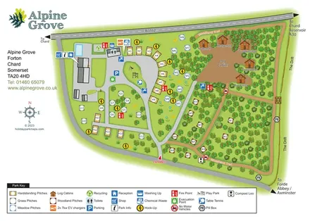
Colour-coded pitches, named log cabins and a woodland trail at Alpine Grove, Somerset.
Features may come from the sample artwork, its key or published park information. Approximate numbers describe the drawing and may cover only part of a park. They are intended to help you compare map examples. Current facilities and booking information should be checked with the park.
LET’S MAP YOUR PARK
For a map quotation, find your park and draw a rough boundary around it. The area you select helps us work out the design time and price.
Draw your park for a quote ↗Or talk to our map designers
01751 473136