
Tree-lined boundaries and central lawn
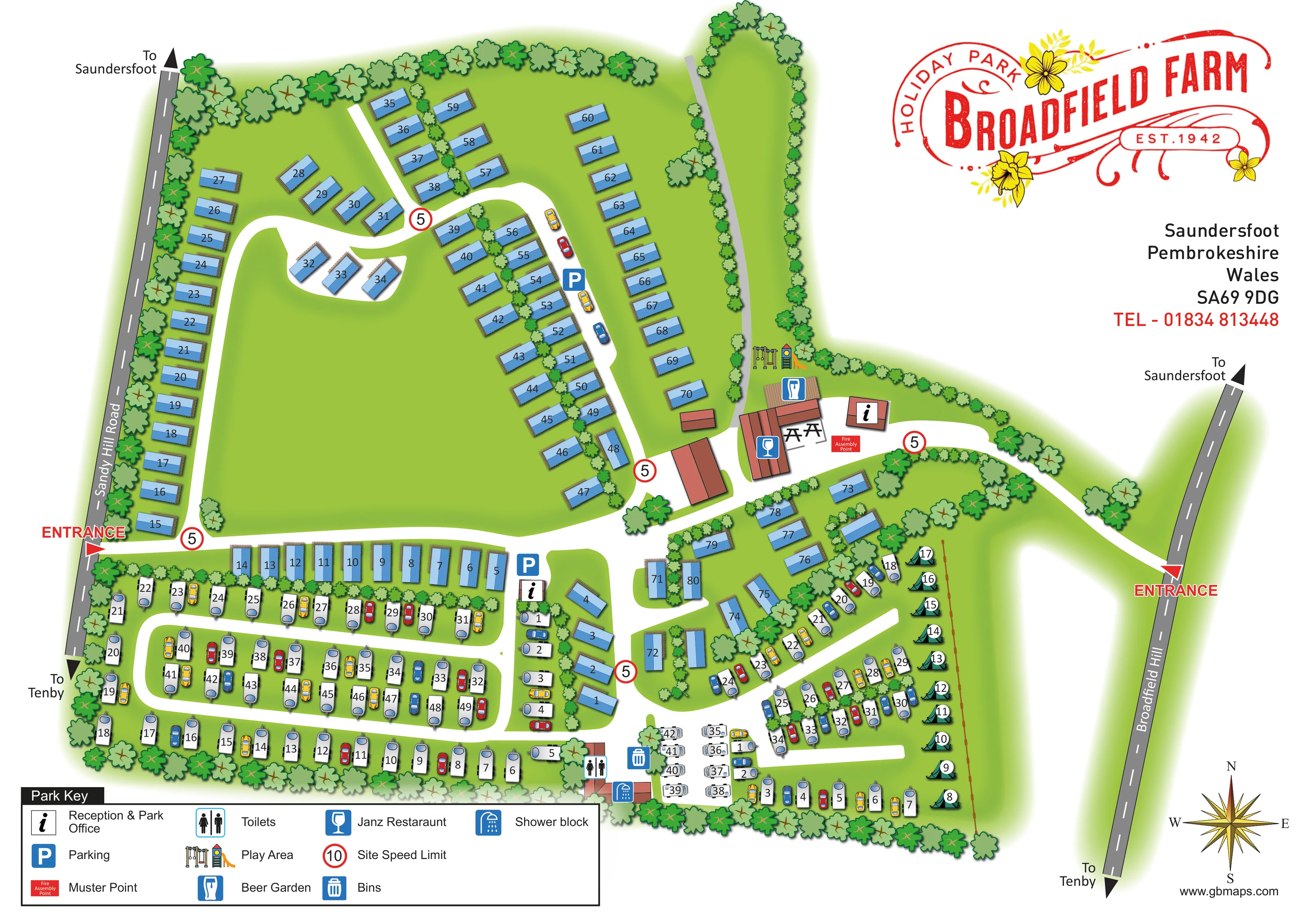
Continuous stylised trees frame much of the boundary, divide accommodation rows and surround a large open green area within the upper section.
ILLUSTRATED PARK MAP · P038
Saundersfoot, Pembrokeshire, Wales · United Kingdom
 Enlarge the map ↗
A SENSE OF THE PLACE
Broadfield Farm is a family-run holiday park near Saundersfoot in Pembrokeshire. It offers camping and touring, seasonal pitches and holiday home ownership between the countryside and the coast.
Grass pitches and gravel hardstandings cater for different touring arrangements. Jan'z restaurant and bar provides a place to eat on site, while Saundersfoot's beach and Tenby are nearby destinations for a day out.
LOOK CLOSER
Continuous stylised trees frame much of the boundary, divide accommodation rows and surround a large open green area within the upper section.
Information symbols appear at the eastern arrival and amenity cluster and beside the central parking area; the key identifies this symbol as reception and park office.
A wine-glass symbol marks a red-roofed building beside the eastern approach and central road junction.
A pint-glass symbol and illustrated picnic tables identify outdoor seating beside the restaurant.
Swings and a slide are drawn immediately north of the restaurant and beer-garden area.
Separate toilet and shower symbols mark the lower-central service buildings between the two touring sections.
Blue parking symbols mark a central junction and a parking stretch along the upper accommodation road; small cars also illustrate individual touring arrangements.
A bin symbol appears beside the lower-central washroom and motorhome area.
Information symbols appear at the eastern arrival and amenity cluster and beside the central parking area; the key identifies this symbol as reception and park office.
A wine-glass symbol marks a red-roofed building beside the eastern approach and central road junction.
A pint-glass symbol and illustrated picnic tables identify outdoor seating beside the restaurant.
Swings and a slide are drawn immediately north of the restaurant and beer-garden area.
Separate toilet and shower symbols mark the lower-central service buildings between the two touring sections.
Blue parking symbols mark a central junction and a parking stretch along the upper accommodation road; small cars also illustrate individual touring arrangements.
A bin symbol appears beside the lower-central washroom and motorhome area.
A red fire assembly point marker is shown near the eastern reception and restaurant cluster; the key calls it a muster point.
Repeated red-ringed speed symbols punctuate the internal roads. The displayed values differ between the plan and key.
Red entrance arrows connect the plan to Sandy Hill Road on the west and Broadfield Hill on the east. Both roads carry directional references to Saundersfoot and Tenby.
White internal routes link both entrances, branch through the upper static area and form loops and short lanes through the lower touring sections.
Continuous stylised trees frame much of the boundary, divide accommodation rows and surround a large open green area within the upper section.
READING THE MAP
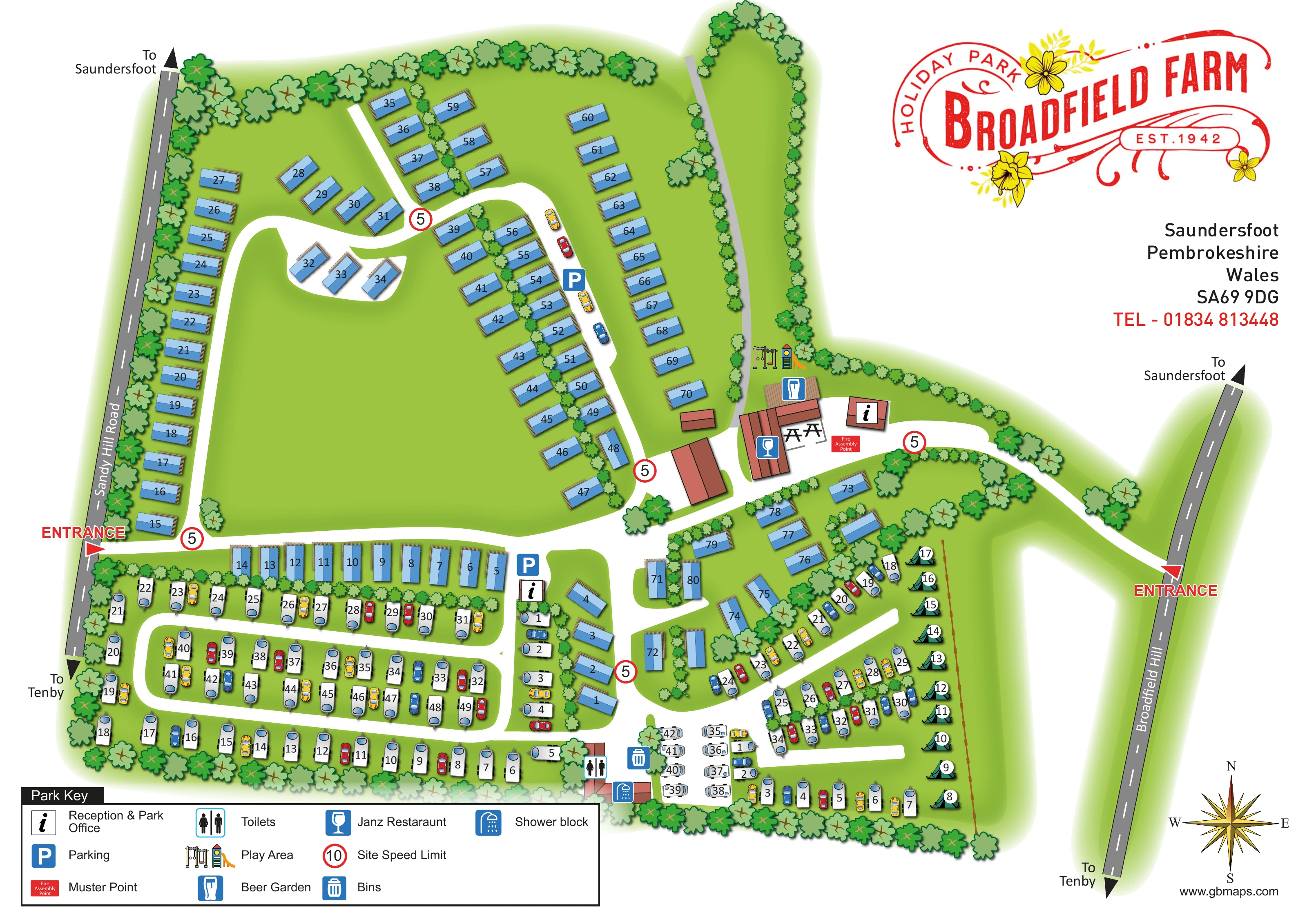
This illustrated map of Broadfield Farm Caravan Park brings together a varied holiday-park layout near Saundersfoot in Pembrokeshire. Blue static caravans surround a broad green lawn in the upper part of the plan, while touring caravans, motorhomes and a narrow camping strip occupy the lower sections. Tree-lined boundaries and planted divisions give each area a clear visual shape without obscuring the routes between them.
Two entrances are shown, one from Sandy Hill Road and the other from Broadfield Hill, with directions towards Saundersfoot and Tenby providing local context. The eastern approach leads past a compact group of visitor facilities: reception, Janz Restaurant, a beer garden and a play area. Toilets and showers sit further down, close to the touring accommodation.
The design combines practical numbering and familiar facility symbols with a distinctive presentation. A large red Broadfield Farm logo, yellow floral details and a decorative compass balance the detailed site plan. It is a useful example of mapping a mixed-accommodation park where visitors need to understand both their individual position and the wider organisation of the grounds.
The single landscape-format plan divides naturally into three accommodation areas. Across the upper section, blue static-caravan illustrations follow the western boundary and branch into rows around a large open lawn. White roads curve through these groups, with planted strips separating several back-to-back rows. Smaller clusters of static units continue around the central junction and towards the eastern side.
Below this, the western touring area uses a compact loop arrangement, with white caravan illustrations and brightly coloured cars set along both sides of the road. The eastern touring section follows shorter lanes and angled rows. A small group of motorhome illustrations sits near the lower-central service buildings, and green tent symbols form a narrow camping strip down the eastern boundary. Accommodation numbers are printed directly on the symbols rather than placed in separate label boxes.
The two red entrance markers connect to Sandy Hill Road on the left and Broadfield Hill on the right. Both external roads include destination arrows for Saundersfoot and Tenby. Inside the park, the eastern arrival passes the reception and restaurant cluster, where picnic tables, a beer-garden symbol and illustrated playground equipment make the social area easy to recognise. Parking markers appear at the central junction and along an upper lane. Toilets, showers and bins are grouped near the lower accommodation areas, while a fire assembly marker appears beside the eastern facilities.
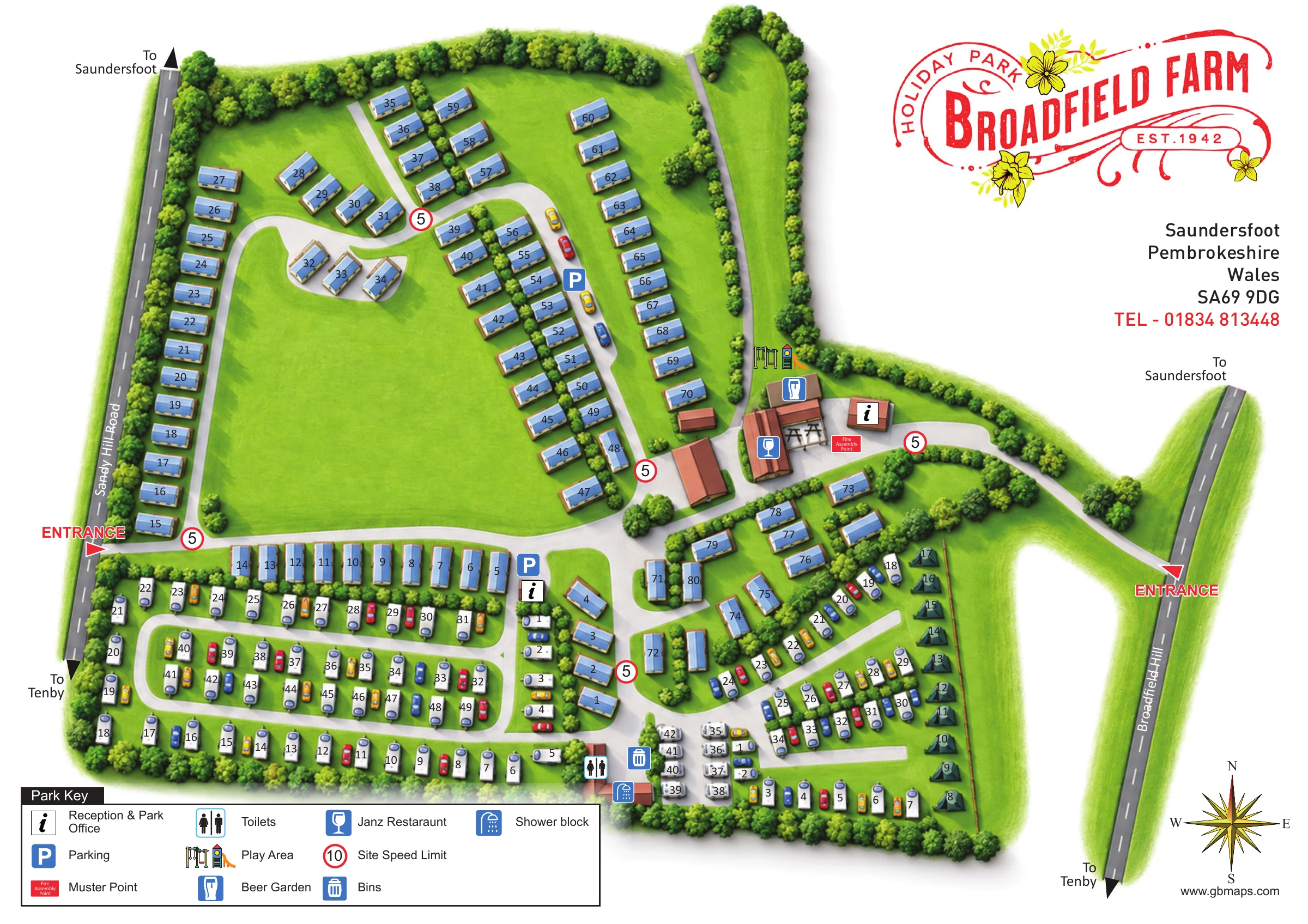
A boxed key explains the facility symbols along the bottom-left edge. The upper-right space is reserved for the park's red floral logo and location details, with an ornamental compass below. The accompanying detail images enlarge the key and lower-right corner of this same artwork rather than showing additional park sections.
 Enlarge this map ↗
KEEP EXPLORING
Chosen for shared landscapes, accommodation or facilities.
 Explore the map ↗
United Kingdom
North Morte Farm map with colour-coded holiday homes, separate touring pitches and open camping fields beside coastpath connections.
 Explore the map ↗
United Kingdom
A colour-zoned coastal park map with touring areas, woodland trails, ponds and a leisure club.
 Explore the map ↗
United Kingdom
Coastal touring-park plan with three named fields, four pitch categories and lagoon-side walking connections.
Features may come from the sample artwork, its key or published park information. Approximate numbers describe the drawing and may cover only part of a park. They are intended to help you compare map examples. Current facilities and booking information should be checked with the park.
TAKE A CLOSER LOOK
View the illustrated map in detail or choose a file to download. These are sample maps; contact the park for current visitor information.



LET’S MAP YOUR PARK
For a map quotation, find your park and draw a rough boundary around it. The area you select helps us work out the design time and price.
Draw your park for a quote ↗Or talk to our map designers
01751 473136
 broadfieldcaravanpark_large.png