
Fleet Lagoon shoreline
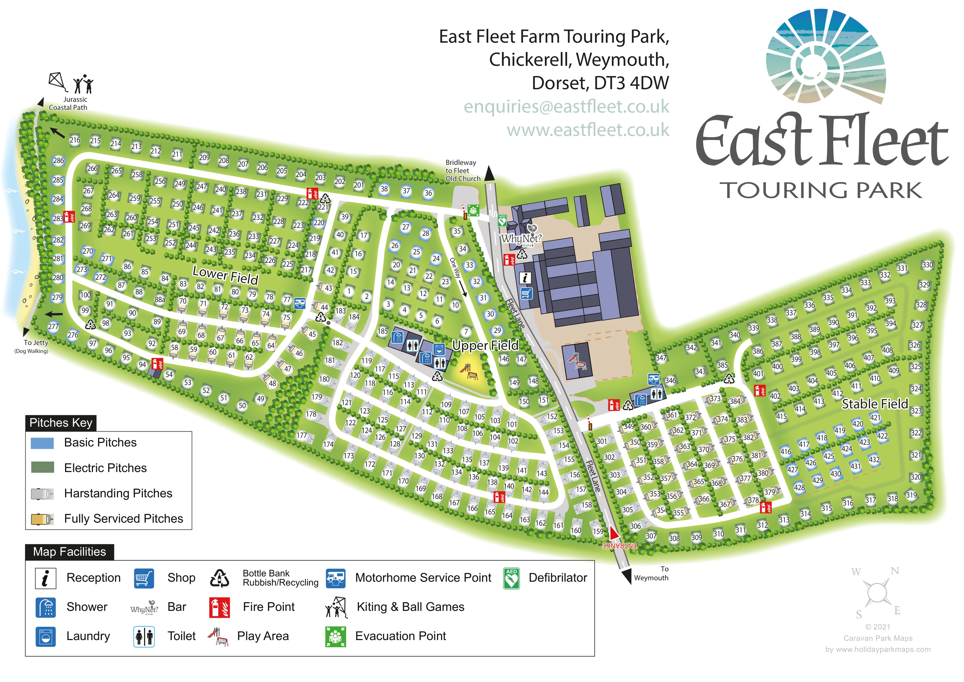
A narrow blue water strip and pale shoreline border the far-left side of the park. The catalogue identifies the water setting as Fleet Lagoon.
ILLUSTRATED PARK MAP · P455
East Fleet Farm Touring Park, Chickerell, Weymouth, Dorset · United Kingdom
 Enlarge the map ↗
A SENSE OF THE PLACE
East Fleet Farm is a touring and camping park on the shores of the Fleet Lagoon near Weymouth. Views across the water and the surrounding Dorset countryside give the site its character.
Its position suits visitors who want a coastal camping base with access to Weymouth and the wider Jurassic Coast. The map shows the camping areas and routes through the park, helping guests understand the layout before arrival.
LOOK CLOSER
A narrow blue water strip and pale shoreline border the far-left side of the park. The catalogue identifies the water setting as Fleet Lagoon.
Dense rounded tree and shrub motifs frame the park, divide the named fields and separate many pitch rows.
Three prominent field names organise the accommodation layout into recognisable sections.
Information symbol positioned within the main farm-building complex beside Fleet Lane.
Blue shopping-trolley symbol marks the shop in the central building complex.
The Why Not? Inn logo identifies the bar at the northern end of the main building group.
Grouped toilet and shower symbols mark facility buildings in Upper Field and near the entrance to Stable Field.
Washing-machine symbol accompanies the Upper Field amenity buildings.
Information symbol positioned within the main farm-building complex beside Fleet Lane.
Blue shopping-trolley symbol marks the shop in the central building complex.
The Why Not? Inn logo identifies the bar at the northern end of the main building group.
Grouped toilet and shower symbols mark facility buildings in Upper Field and near the entrance to Stable Field.
Washing-machine symbol accompanies the Upper Field amenity buildings.
Slide-and-swing illustrations appear on an open patch in Upper Field and over a separate building footprint beside the main courtyard.
The activity symbol appears at the upper-left coastal-path end of the plan; the artwork does not draw a separately bounded games area.
Blue motorhome symbols identify service locations in Lower Field and beside the Stable Field amenity block.
Repeated recycling symbols are distributed around the pitch areas and central facilities, using the legend's combined waste and bottle-bank category.
Red fire-point symbols recur along internal roads and around the accommodation fields.
Green AED symbol appears beside Fleet Lane near the Why Not? Inn.
Green assembly symbol marks the northern junction between the western internal road and Fleet Lane.
A narrow blue water strip and pale shoreline border the far-left side of the park. The catalogue identifies the water setting as Fleet Lagoon.
Dense rounded tree and shrub motifs frame the park, divide the named fields and separate many pitch rows.
Three prominent field names organise the accommodation layout into recognisable sections.
Fleet Lane passes through the middle of the plan, with the entrance marked at its lower end and an outward arrow labelled To Weymouth.
White looping roads serve the pitch groups. Barrier illustrations mark field access points, and a labelled one-way arrow appears in Upper Field.
A labelled arrow identifies the path connection at the upper-left shoreline corner.
The lower-left shoreline route is labelled To Jetty (Dog Walking); the jetty itself is outside the illustrated plan.
An arrow at the northern end of Fleet Lane identifies the onward bridleway direction to Fleet Old Church.
READING THE MAP
This illustrated map of East Fleet Farm Touring Park places a substantial touring and camping layout beside the Fleet Lagoon near Weymouth in Dorset. Three named areas—Lower Field, Upper Field and Stable Field—give structure to a plan of roughly 400 marked pitches, with Fleet Lane running between the western fields and the eastern section. The shoreline, planted boundaries and outward walking connections establish the park's coastal countryside character without distracting from practical arrival information.
The map distinguishes basic, electric, hardstanding and fully serviced pitches through a combination of colour and caravan-shaped symbols. White internal roads lead through the accommodation areas, while reception, the shop and the Why Not? Inn are grouped around the central farm buildings. Toilet and shower facilities, laundry, play areas and motorhome service points are also identified.
A large coastal logo, separate pitch and facility keys, and prominent field labels make this a useful sample for clients seeking a touring-park map that combines detailed pitch finding with a clear sense of place.
The plan spreads across a landscape page in two unequal wings. Lower Field and Upper Field lie to the left of Fleet Lane, with Stable Field extending to the right. The entrance is marked at the lower end of the lane, beside the arrow towards Weymouth. Further along, a sizeable cluster of lavender and charcoal roof shapes surrounds a sand-coloured courtyard, locating reception, the shop and the Why Not? Inn.
Within the fields, white roads form loops and connecting branches through rows of numbered pitches. Repeated tree and shrub motifs frame the outer boundary and divide many interior rows into smaller groups. Dark green and blue markers distinguish electric and basic pitches, while grey and gold caravan silhouettes identify hardstanding and fully serviced provision. A one-way arrow in Upper Field and barrier illustrations at access junctions add useful route detail.
The Upper Field amenity buildings carry toilet, shower and laundry symbols, with illustrated play equipment nearby. Another toilet and shower block serves the Stable Field approach, alongside a motorhome service marker. Recycling and fire-point symbols recur throughout the plan, and green symbols identify a defibrillator near the inn and an evacuation point at the northern lane junction.
Along the far-left boundary, blue water and a pale shoreline connect the site to its lagoon setting. Labels point towards the Jurassic Coastal Path and the jetty-bound dog-walking route, while the northern end of Fleet Lane indicates the bridleway to Fleet Old Church. Separate boxed legends occupy the lower margin beneath the artwork. The sample is a single complete plan; the enlarged views show details of that same composition.
KEEP EXPLORING
Chosen for shared landscapes, accommodation or facilities.
 Explore the map ↗
United Kingdom
Tree-framed mixed-accommodation park map with two entrances, touring loops and a clearly illustrated social hub.
 Explore the map ↗
United Kingdom
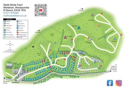
North Morte Farm map with colour-coded holiday homes, separate touring pitches and open camping fields beside coastpath connections.
 Explore the map ↗
United Kingdom
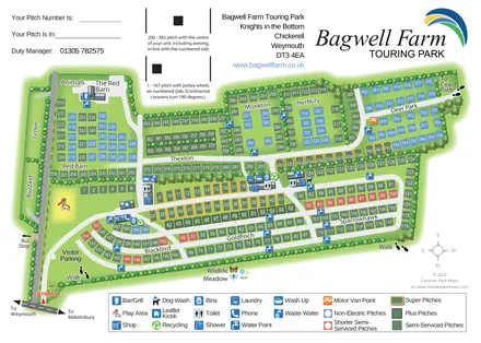
A colour-coded touring park plan with named pitch areas, service symbols and Coast Path links.
Features may come from the sample artwork, its key or published park information. Approximate numbers describe the drawing and may cover only part of a park. They are intended to help you compare map examples. Current facilities and booking information should be checked with the park.
TAKE A CLOSER LOOK
View the illustrated map in detail or choose a file to download. These are sample maps; contact the park for current visitor information.


LET’S MAP YOUR PARK
For a map quotation, find your park and draw a rough boundary around it. The area you select helps us work out the design time and price.
Draw your park for a quote ↗Or talk to our map designers
01751 473136