
Tree-lined boundaries and planted islands
Dense illustrated trees frame the park and highway, with smaller shrubs and planting islands separating accommodation and pitches.
ILLUSTRATED PARK MAP · P047
7419A Murray Valley Highway, Bundalong, Victoria · Australia
 Enlarge the map ↗
A SENSE OF THE PLACE
Bundalong Holiday Resort offers accommodation close to Bundalong Tavern and the Murray River in Victoria. Options include self-contained villas, simpler motel-style rooms and powered sites.
The location suits holidays centred on the river, fishing and time outdoors. The tavern provides a nearby place to eat and meet, while the range of accommodation allows groups and families to choose the style of stay that suits them.
LOOK CLOSER
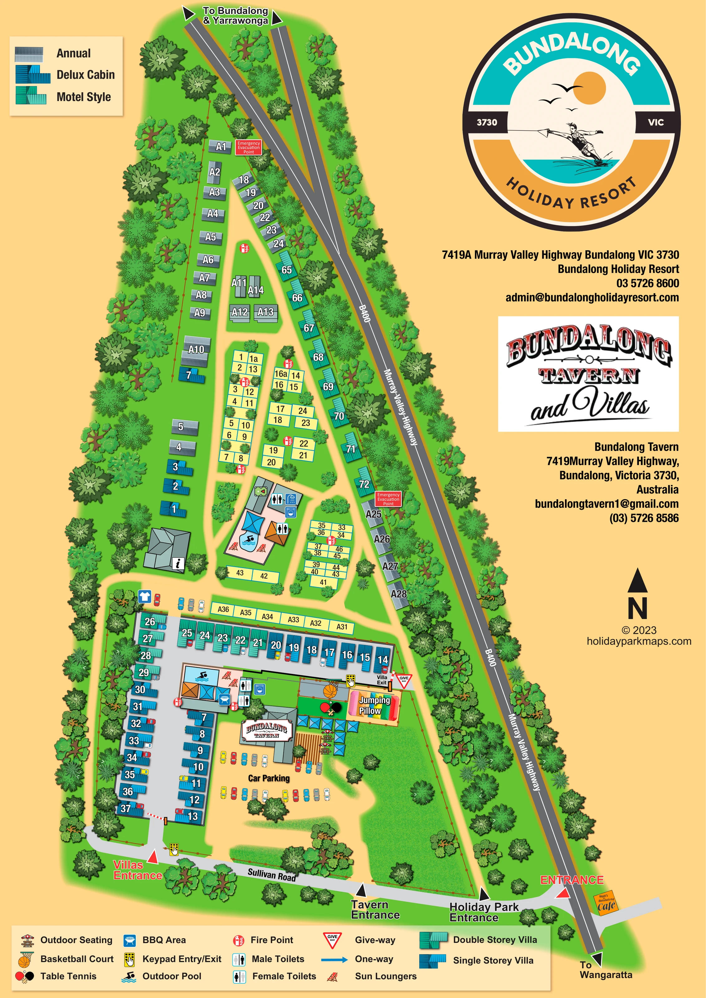
Dense illustrated trees frame the park and highway, with smaller shrubs and planting islands separating accommodation and pitches.
A broad textured green lawn occupies the south-eastern portion beside the tavern parking and recreation area.
A prominently branded building beside the southern car park, outdoor seating and recreation area.
Two pool areas are illustrated: one among the central holiday-park pitches and another beside the southern villa court.
Red lounger illustrations appear on the pool surrounds.
A labelled, brightly striped jumping pillow sits beside the tavern recreation area and villa exit.
A small grey court with an oversized basketball-and-hoop symbol is shown beside the jumping pillow.
A bat-and-ball symbol marks table tennis between the basketball court and tavern seating.
A prominently branded building beside the southern car park, outdoor seating and recreation area.
Two pool areas are illustrated: one among the central holiday-park pitches and another beside the southern villa court.
Red lounger illustrations appear on the pool surrounds.
A labelled, brightly striped jumping pillow sits beside the tavern recreation area and villa exit.
A small grey court with an oversized basketball-and-hoop symbol is shown beside the jumping pillow.
A bat-and-ball symbol marks table tennis between the basketball court and tavern seating.
An illustrated games-table symbol appears in the northern central amenity complex.
Picnic tables, parasols, a timber-coloured deck and blue shade structures are illustrated beside the tavern.
A blue barbecue symbol marks the southern pool and amenity area.
Toilet symbols identify facilities at the central holiday-park amenity complex and beside the southern pool.
A blue shower pictogram is placed at the northern central amenity building.
Washing-machine pictograms appear at the central and southern amenity areas.
An information symbol identifies a roofed building west of the central pool complex.
A labelled parking area lies in front of the tavern; small car illustrations also appear beside villas and near the section boundary.
A small orange café sign is illustrated across the highway near the Sullivan Road junction, outside the principal park boundary.
Repeated red fire-point symbols are distributed among the pitch groups and amenity areas.
Two red labelled evacuation-point markers appear in the northern holiday-park section.
Yellow keypad symbols and barrier illustrations mark the southern villa entrance and eastern villa exit.
Separate access points are labelled along Sullivan Road, with a further entrance marker at the highway junction.
The B400 Murray Valley Highway forms the eastern edge; Sullivan Road crosses the southern frontage. Direction labels point towards Bundalong and Yarrawonga, and towards Wangaratta.
A give-way sign is illustrated at the eastern villa exit.
A blue one-way arrow is included in the bottom legend; its placement on the internal road network is not clearly evident.
Dense illustrated trees frame the park and highway, with smaller shrubs and planting islands separating accommodation and pitches.
A broad textured green lawn occupies the south-eastern portion beside the tavern parking and recreation area.
READING THE MAP
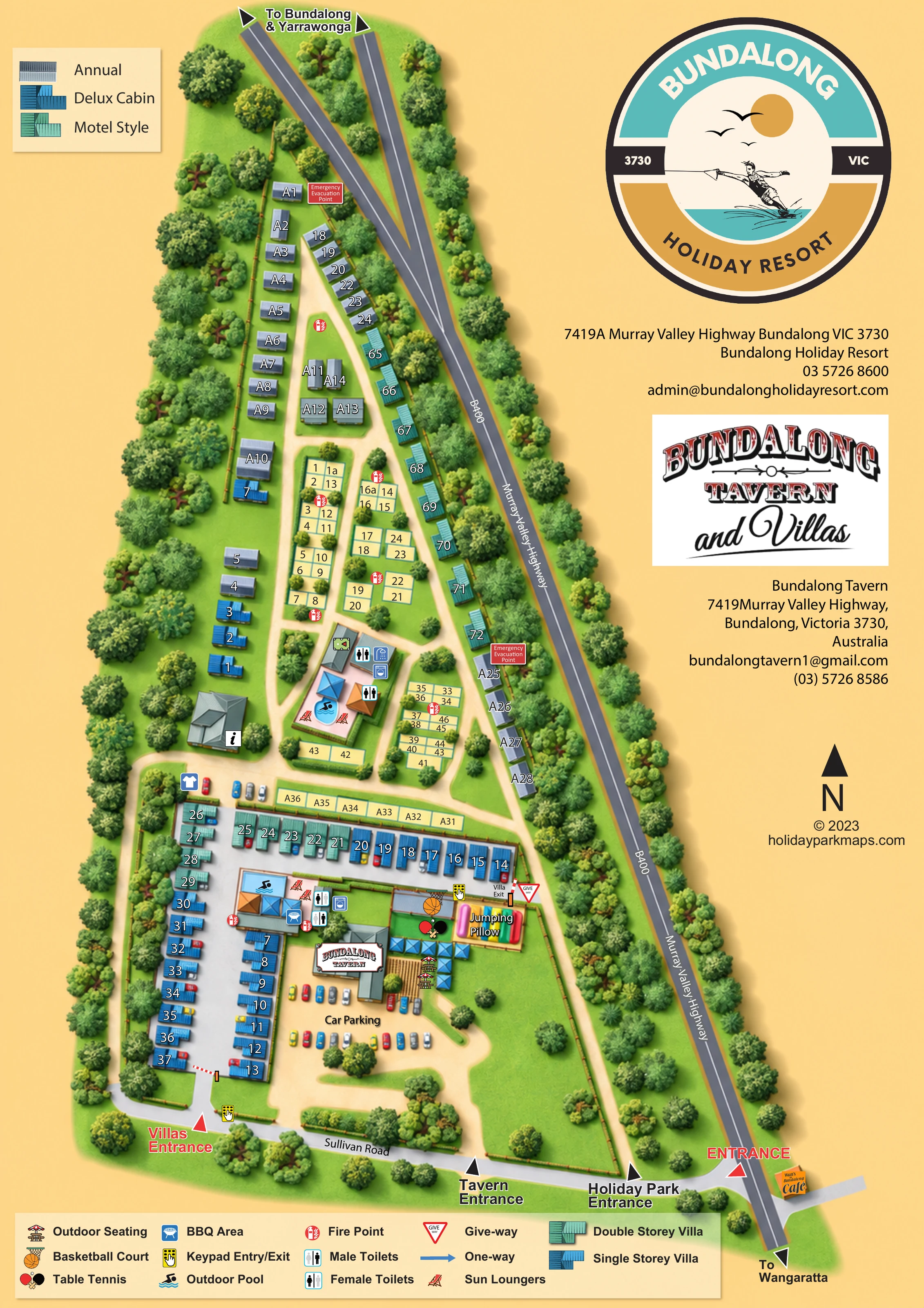
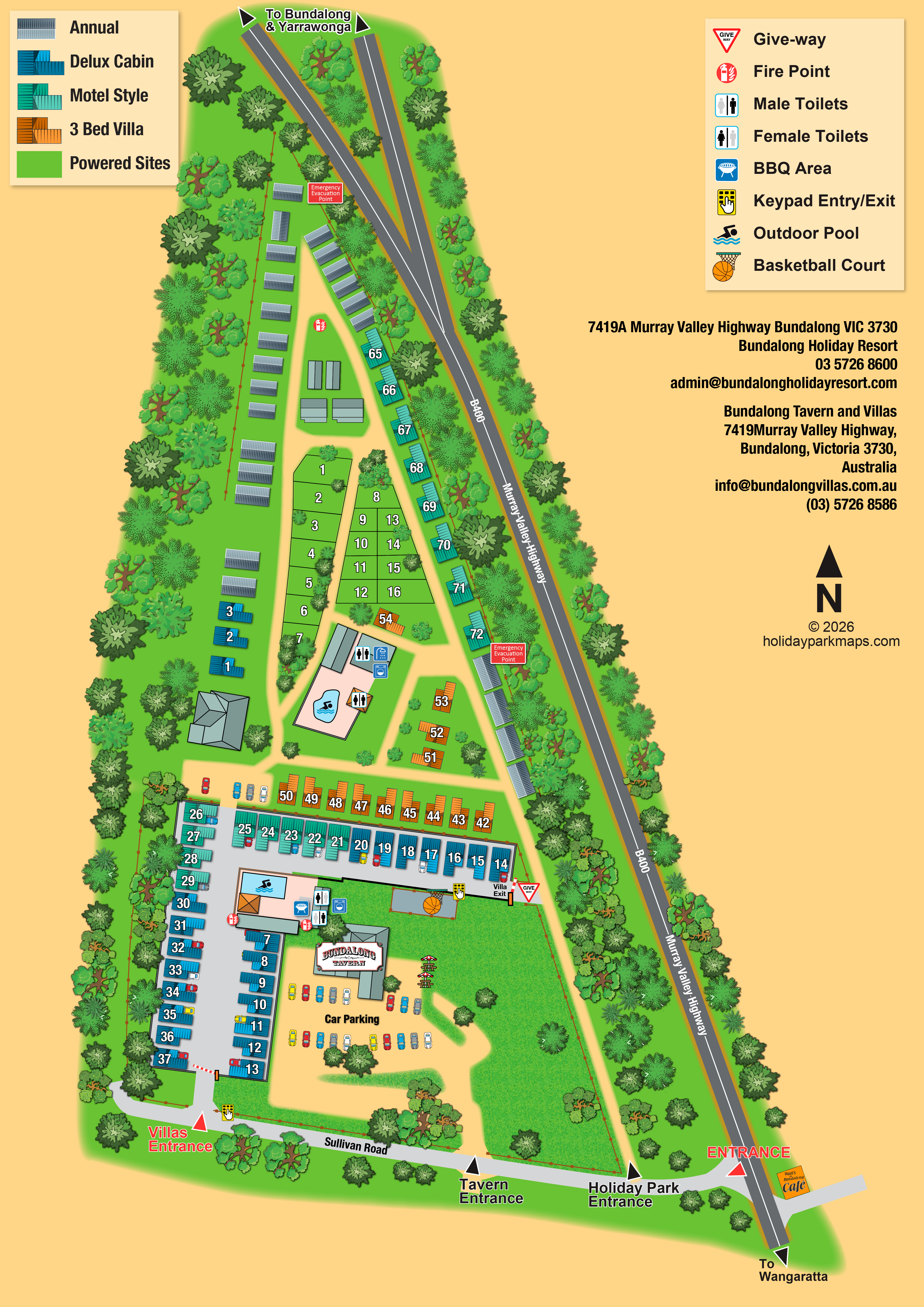
This illustrated map brings Bundalong Holiday Resort and the adjoining Bundalong Tavern and Villas together on one portrait-format visitor plan. Set beside the Murray Valley Highway in Bundalong, Victoria, the site is presented as a long, tree-lined holiday-park area leading into a compact villa and tavern complex near Sullivan Road. The nearby Murray River provides the wider holiday setting, while the artwork concentrates on accommodation, arrival points and on-site orientation.
Blue, turquoise and grey roof symbols distinguish the different accommodation groups, with numbered pitch rectangles arranged between planted islands and sandy-coloured lanes. Separate entrances for the villas, tavern and holiday park are especially prominent. Pools, a jumping pillow, basketball, table tennis and outdoor seating give visitors recognisable landmarks around the shared leisure areas.
The page also gives both businesses room for their own identity: a large circular resort badge and a separate tavern logo sit beside the plan. This makes the sample particularly relevant to adjoining holiday businesses that need a single map without losing the distinction between their accommodation, facilities and access routes.
The plan follows the site's elongated shape along the B400 Murray Valley Highway, with Sullivan Road forming the southern frontage. Destination arrows indicate Bundalong and Yarrawonga to the north and Wangaratta to the south. Large triangular pointers identify the highway approach and the separate villa, tavern and holiday-park entrances.
In the northern section, annual accommodation, deluxe cabins and motel-style units form rows along the outer edges. Groups of pale-yellow numbered pitches sit between branching sandy lanes, with shrubs breaking up the rows. A central amenity complex combines an illustrated outdoor pool, sun loungers, shade structures, toilet symbols, a shower symbol and laundry marking. A games-table illustration adds another useful landmark, while a nearby roofed building carries an information symbol. Red fire-point markers recur through the pitch areas, and two labelled emergency evacuation points appear near the highway-side accommodation.
The southern section changes character: blue and turquoise villas line a broad grey court, with small cars illustrated beside many units. Keypad symbols and barriers mark the villa entrance and separate exit, where a give-way sign is also shown. A second pool area includes loungers, toilets, laundry and a barbecue symbol.
Bundalong Tavern anchors the southern visitor area beside labelled car parking. Its outdoor seating, deck and blue shade structures lead towards a basketball court, table tennis and a brightly striped jumping pillow. An open lawn and substantial tree planting complete the lower site. The single-page artwork uses an upper accommodation key and a full-width bottom facility legend, with resort and tavern branding arranged in a spacious right-hand column.
 Enlarge this map ↗
KEEP EXPLORING
Chosen for shared landscapes, accommodation or facilities.
 Explore the map ↗
Australia
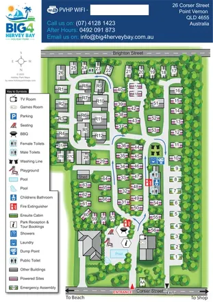
Tree-lined coastal park plan with colour-coded sites, separate entry and exit routes, and a pool-side visitor hub.
 Explore the map ↗
Australia
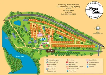
Numbered cabin rows, central amenities and wooded Ovens River frontage at Bundalong Riverside Resort.
 Explore the map ↗
Australia
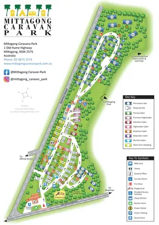
Tree-lined Mittagong Caravan Park plan with colour-coded cabins, powered sites and directional internal roads.
Features may come from the sample artwork, its key or published park information. Approximate numbers describe the drawing and may cover only part of a park. They are intended to help you compare map examples. Current facilities and booking information should be checked with the park.
TAKE A CLOSER LOOK
View the illustrated map in detail or choose a file to download. These are sample maps; contact the park for current visitor information.
LET’S MAP YOUR PARK
For a map quotation, find your park and draw a rough boundary around it. The area you select helps us work out the design time and price.
Draw your park for a quote ↗Or talk to our map designers
01751 473136