
Tree-lined grounds
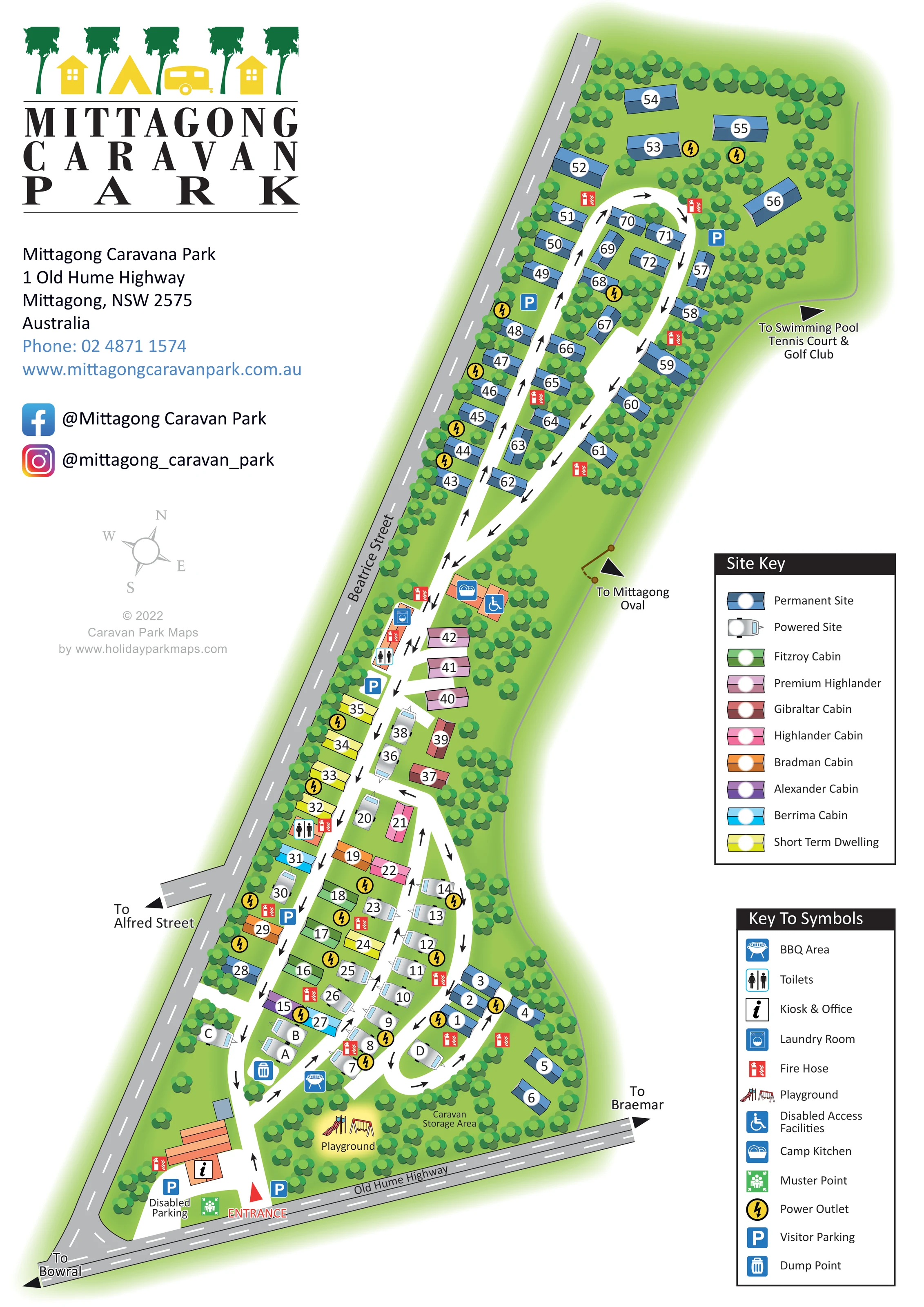
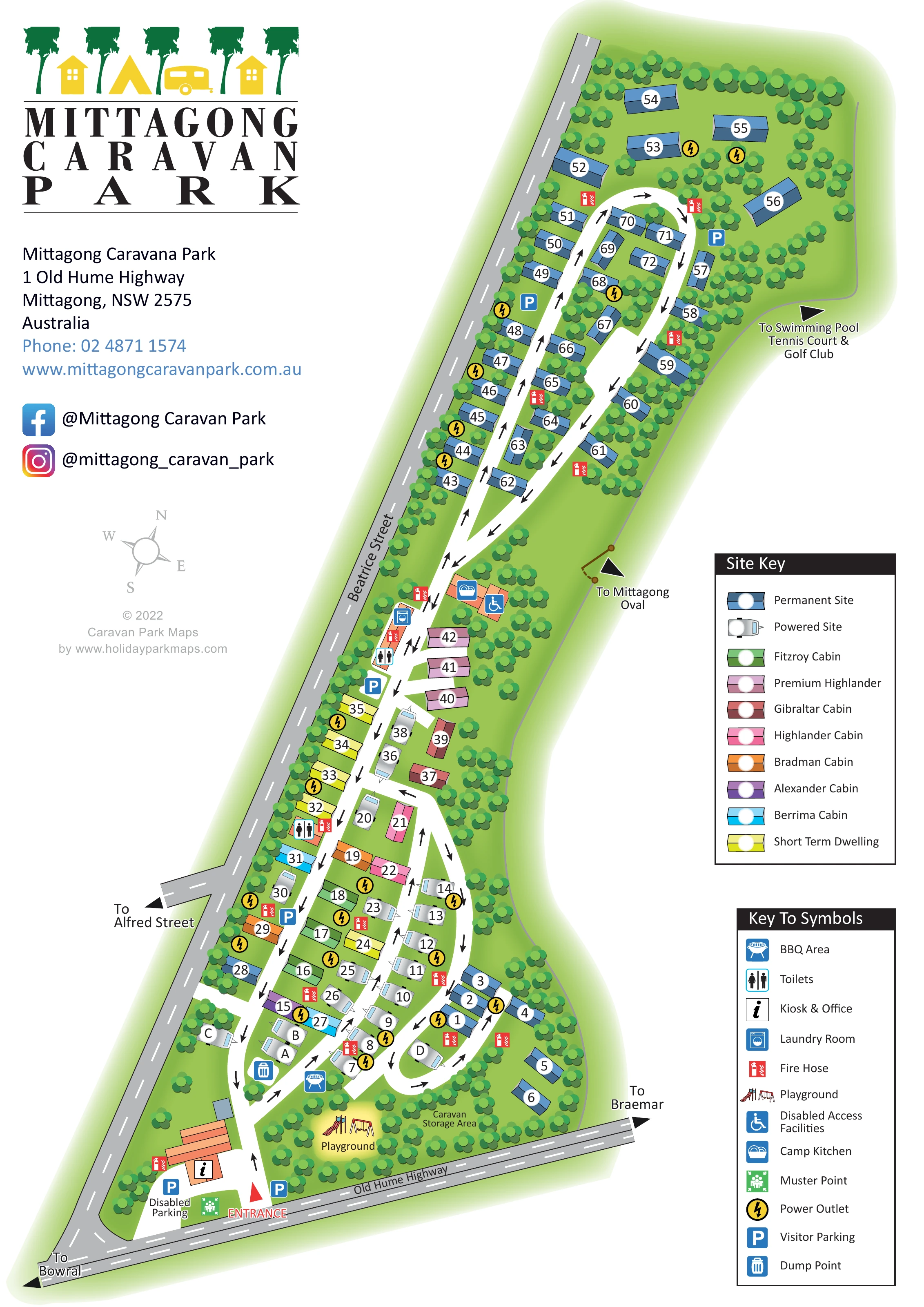
Dense clusters of stylised trees line the boundaries, divide accommodation groups and surround communal spaces.
ILLUSTRATED PARK MAP · P544
1 Old Hume Highway, Mittagong, New South Wales · Australia
 Enlarge the map ↗
A SENSE OF THE PLACE
Mittagong Holiday Park sits among gum trees in New South Wales' Southern Highlands. Self-contained cabins and caravan sites provide accommodation close to Mittagong and the surrounding towns.
Powered slab and gravel sites accommodate touring vehicles, with pet-friendly pitch options. Cabins offer cooking and living space for families, couples and other travellers, while regional wineries, gardens and trails provide destinations for days out.
LOOK CLOSER
Dense clusters of stylised trees line the boundaries, divide accommodation groups and surround communal spaces.
An orange-roofed building beside the entrance carries the information symbol for the kiosk and office.
An illustrated slide and swings occupy a highlighted clearing near the entrance, beside the caravan storage area.
A blue barbecue symbol marks a location just inside the lower accommodation loops.
The camp kitchen symbol appears on an orange amenity building near the transition to the long upper section.
Toilet symbols identify amenity locations beside the central spine road.
A washing-machine symbol marks the laundry beside the central amenity area.
A wheelchair symbol identifies facilities beside the camp kitchen; it does not define the accessibility of the wider park.
An orange-roofed building beside the entrance carries the information symbol for the kiosk and office.
An illustrated slide and swings occupy a highlighted clearing near the entrance, beside the caravan storage area.
A blue barbecue symbol marks a location just inside the lower accommodation loops.
The camp kitchen symbol appears on an orange amenity building near the transition to the long upper section.
Toilet symbols identify amenity locations beside the central spine road.
A washing-machine symbol marks the laundry beside the central amenity area.
A wheelchair symbol identifies facilities beside the camp kitchen; it does not define the accessibility of the wider park.
Blue parking symbols are distributed from the entrance through the central area and into the upper section.
Disabled parking is explicitly labelled beside the entrance office.
The symbol key identifies a blue disposal icon as the dump point, positioned beside the lower internal road.
Yellow circular lightning symbols mark power outlets throughout the accommodation areas.
Red fire-hose symbols recur beside accommodation rows and amenity buildings.
A green muster-point symbol appears beside the entrance and office parking area.
A labelled, tree-filled area sits along Old Hume Highway to the right of the playground.
Dense clusters of stylised trees line the boundaries, divide accommodation groups and surround communal spaces.
A red entrance marker leads from Old Hume Highway into white internal roads with black directional arrows, lower loops and a long upper circuit.
Grey external roads frame the lower and left edges. Directional labels point towards Bowral, Braemar and Alfred Street.
A thin route line and arrow on the right-hand boundary indicate the direction to Mittagong Oval.
An outward-facing arrow at the upper right references these nearby recreation destinations rather than depicting them as on-site facilities.
READING THE MAP
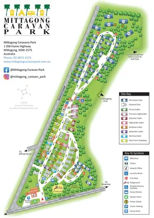
This illustrated map of Mittagong Caravan Park presents a long, tree-lined site in New South Wales’ Southern Highlands. Set between Old Hume Highway and Beatrice Street, the park has a broad entrance area that leads into compact accommodation loops and then a much longer upper circuit. The portrait composition follows that unusual shape, keeping the complete layout together while leaving room for prominent branding and two clear reference keys.
The map shows a varied accommodation mix: powered touring sites, permanent sites, short-term dwellings and several named cabin styles. Coloured roof symbols distinguish the cabins, while caravan silhouettes make touring pitches easy to recognise. Around the entrance, the office, parking, playground and caravan storage area establish the main arrival landmarks. Further into the park, symbols identify toilets, laundry, a camp kitchen and other practical facilities.
For a sample gallery, this is a useful example of a mixed-accommodation caravan park map that combines site identification, internal circulation and surrounding-road orientation. Tree clusters give the plan its character without obscuring the numbered accommodation or directional road arrows.
The single-page artwork arranges the complete park diagonally across a tall white page. Old Hume Highway forms the lower frontage, with Beatrice Street extending along the left boundary. The red entrance marker leads directly towards the kiosk and office, labelled disabled parking and a green muster-point symbol. A playground illustration and the labelled caravan storage area occupy the tree-filled grounds to the right.
Inside the entrance, white roads divide into several short loops. Powered touring sites appear as pale caravan silhouettes, interspersed with coloured cabin roofs and blue permanent-site symbols. Large white number or letter discs provide individual accommodation references. The cabin key distinguishes Fitzroy, Premium Highlander, Gibraltar, Highlander, Bradman, Alexander and Berrima accommodation, alongside permanent sites, powered sites and short-term dwellings.
The central road passes further cabin groups and amenity buildings before continuing into the narrow upper section. Here, blue permanent-site symbols line both sides of an elongated circuit and its central strip. Repeated black road arrows make the intended circulation visible. Tree clusters screen the boundary and separate the accommodation rows, while parking, power-outlet and fire-hose symbols remain prominent against the green ground.
The facility key explains the BBQ area, toilets, kiosk and office, laundry, playground, disabled access facilities, camp kitchen, muster point, power outlets, visitor parking and dump point. Destination arrows add context beyond the park, pointing towards Bowral, Braemar, Alfred Street, Mittagong Oval and nearby swimming, tennis and golf facilities. A large logo and contact block fill the upper left, with a compass rose below and both legends stacked on the right. The enlarged detail views show portions of this same page, not separate map variants.
KEEP EXPLORING
Chosen for shared landscapes, accommodation or facilities.
 Explore the map ↗
Australia
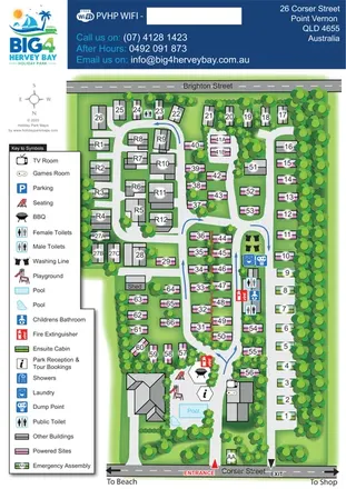
Tree-lined coastal park plan with colour-coded sites, separate entry and exit routes, and a pool-side visitor hub.
 Explore the map ↗
Australia
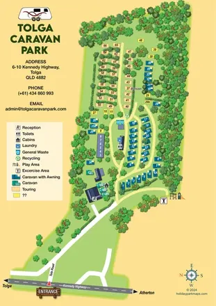
Tree-lined caravan park map with touring rows, central amenities and a clearly illustrated highway approach.
 Explore the map ↗
United Kingdom
A wooded Allerton park plan with colour-coded neighbourhoods, touring pitches and a central facilities hub.
Features may come from the sample artwork, its key or published park information. Approximate numbers describe the drawing and may cover only part of a park. They are intended to help you compare map examples. Current facilities and booking information should be checked with the park.
TAKE A CLOSER LOOK
View the illustrated map in detail or choose a file to download. These are sample maps; contact the park for current visitor information.


LET’S MAP YOUR PARK
For a map quotation, find your park and draw a rough boundary around it. The area you select helps us work out the design time and price.
Draw your park for a quote ↗Or talk to our map designers
01751 473136
 mittagong_large.png