
Ovens River
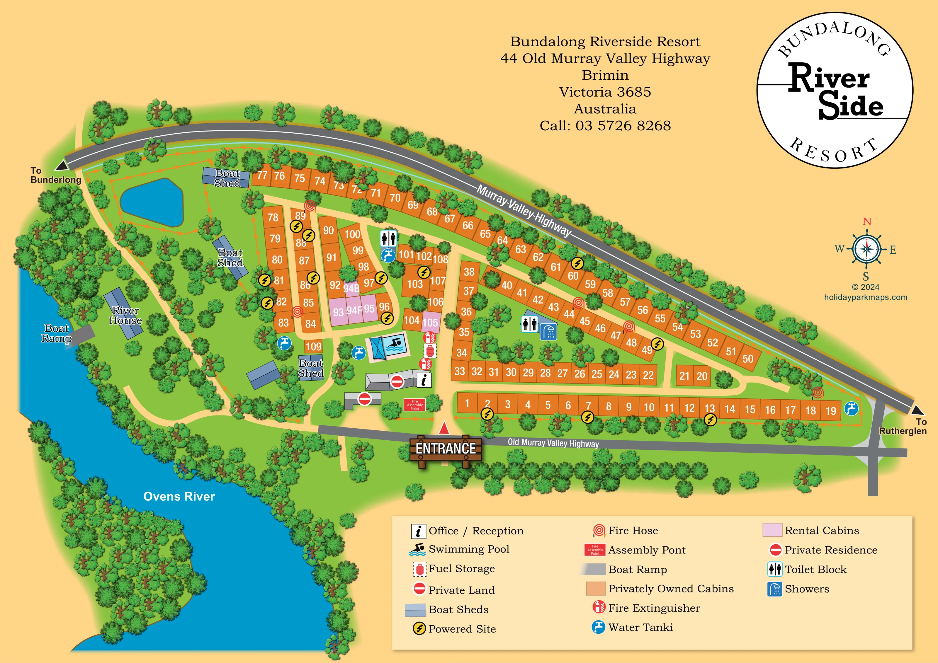
The named river curves along the western and lower edges of the illustration, with densely wooded banks and a wooded projection on the opposite side.
ILLUSTRATED PARK MAP · P048
44 Old Murray Valley Highway, Brimin, Victoria · Australia
 Enlarge the map ↗
A SENSE OF THE PLACE
Bundalong Riverside Resort lies beside the Ovens River in regional Victoria. It offers cabins, a larger house overlooking the river, and powered pitches for caravans and tents.
Some cabins face the pool, while the wider location is associated with boating and fishing around the Ovens and Murray rivers. The park map shows the relationship between accommodation, touring spaces and the riverside setting.
LOOK CLOSER
The named river curves along the western and lower edges of the illustration, with densely wooded banks and a wooded projection on the opposite side.
Dense tree clusters frame the river, while scattered trees and planted strips separate accommodation rows, roads and facilities.
An irregular blue waterbody is drawn inside an outlined area at the north-western end of the park; its purpose is not specified.
An information symbol marks the office/reception building just inside the entrance, below the swimming pool.
A rectangular blue pool with a swimmer symbol and an illustrated blue shade structure forms a central landmark near the rental cabins.
Toilet symbols occur in two internal locations, with showers marked beside the block serving the eastern accommodation rows.
Repeated blue tap symbols appear near the central facilities, western accommodation and eastern end of the park; the legend labels the symbol 'Water Tanki'.
Yellow circles containing black lightning bolts mark power provision at selected positions along the accommodation rows.
An information symbol marks the office/reception building just inside the entrance, below the swimming pool.
A rectangular blue pool with a swimmer symbol and an illustrated blue shade structure forms a central landmark near the rental cabins.
Toilet symbols occur in two internal locations, with showers marked beside the block serving the eastern accommodation rows.
Repeated blue tap symbols appear near the central facilities, western accommodation and eastern end of the park; the legend labels the symbol 'Water Tanki'.
Yellow circles containing black lightning bolts mark power provision at selected positions along the accommodation rows.
A labelled grey ramp extends from the wooded western side of the park into the Ovens River, close to the River House.
Several blue-grey sheds are labelled in the western and central-western parts of the park, reinforcing its boating character.
Red hose symbols are distributed around the internal routes and plot rows; extinguisher symbols are grouped near the pool and fuel-storage area.
A red labelled assembly-point panel sits near reception and the entrance.
A red storage-cylinder symbol within a dashed outline is positioned beside the central pool area.
Red no-entry-style symbols identify private areas around buildings near reception. The legend separately lists private residence and private land.
The named river curves along the western and lower edges of the illustration, with densely wooded banks and a wooded projection on the opposite side.
Dense tree clusters frame the river, while scattered trees and planted strips separate accommodation rows, roads and facilities.
An irregular blue waterbody is drawn inside an outlined area at the north-western end of the park; its purpose is not specified.
A prominent entrance sign marks access from Old Murray Valley Highway. Murray Valley Highway follows the upper boundary, with external direction arrows towards Bundalong and Rutherglen.
Pale cream lanes link the entrance, accommodation blocks, central amenities and wooded western riverside area.
READING THE MAP
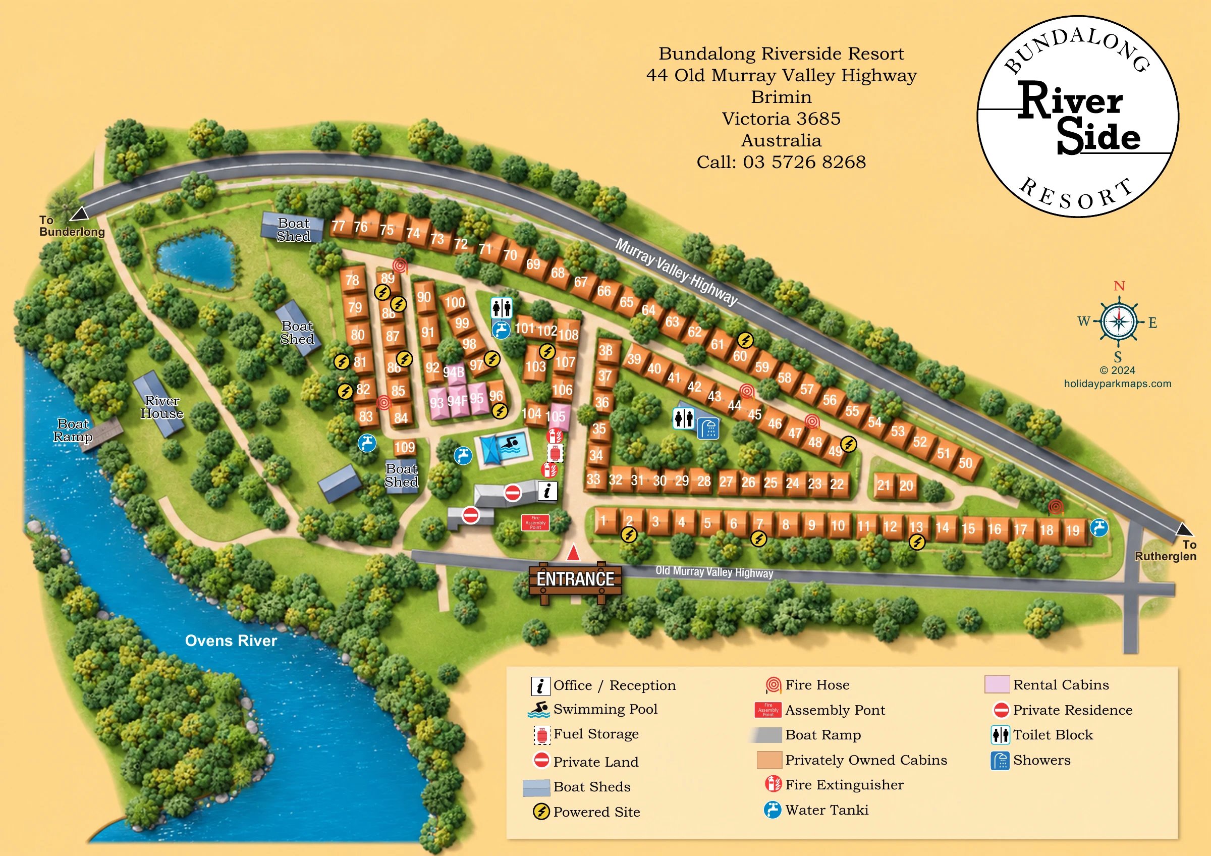
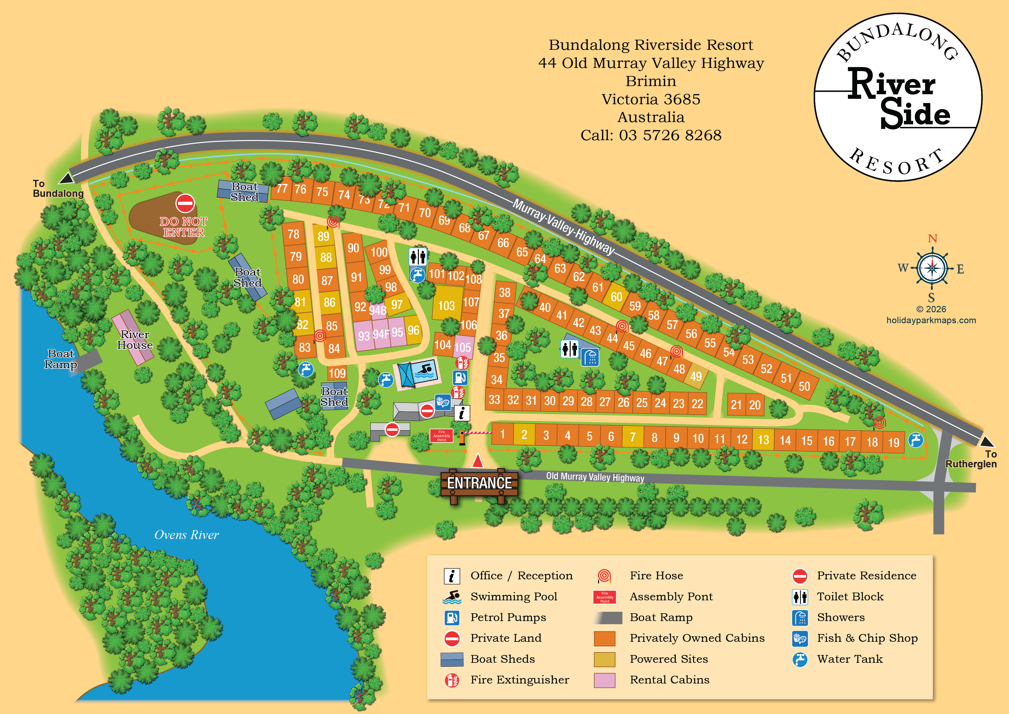
This illustrated map of Bundalong Riverside Resort brings together a closely organised cabin park and a leafy river frontage in regional Victoria, Australia. The Ovens River sweeps around the left-hand side of the artwork, bordered by dense trees, while long rows of numbered accommodation plots extend towards the road junction at the opposite end. The contrast makes the park’s shape and riverside character immediately apparent.
Orange plots identify privately owned cabins, with a small group of pink rental cabins gathered near the swimming pool. A separately labelled River House, several boat sheds and a river access ramp give the western part of the plan a distinctive boating focus. Reception, toilet facilities, showers, water symbols and fire equipment are integrated into the accommodation layout rather than presented as a disconnected list.
A bold entrance sign anchors arrival from Old Murray Valley Highway. Named roads, destination arrows, a compass rose and a substantial three-column legend complete the page, alongside the resort’s circular logo. The result is a useful sample for parks needing to explain both numbered accommodation and a less formal natural waterfront.
The single landscape-format plan shows an elongated site bounded by Murray Valley Highway above, Old Murray Valley Highway below and the Ovens River to the west. Its eastern end narrows towards the road junction, while the western side opens into tree-covered grounds around the river. An oversized timber-style entrance sign marks the arrival point near the lower centre, with reception and a fire assembly point just inside.
Pale cream internal lanes divide the accommodation into readable strips and blocks. Long orange rows follow the upper highway boundary and lower approach road, with shorter rows enclosing an internal green area and further compact blocks towards the pool. Large white numbers make individual plots easy to pick out. The legend identifies orange as privately owned cabins and pink as rental cabins; the pink plots form a small central group near the pool. Yellow lightning symbols overlay selected locations to identify powered sites.
The facility cluster includes the illustrated swimming pool and blue shade structure, reception, fuel storage and extinguisher markers. Toilet symbols appear in two locations, and showers are marked beside the eastern block. Blue water symbols and red hose symbols recur across the plan. Private-area markers distinguish buildings near reception from the visitor-facing facilities.
To the west, a branching lane reaches the River House and labelled boat ramp. Several blue-grey boat sheds sit among the trees, and an unlabelled pond-like feature occupies the north-western grounds. Dense foliage gives the riverbanks a different visual texture from the orderly accommodation rows. The lower-right legend, upper address block, circular resort logo and right-hand compass share the open ochre background without requiring a separate inset.
 Enlarge this map ↗
KEEP EXPLORING
Chosen for shared landscapes, accommodation or facilities.
 Explore the map ↗
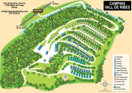
Spain
Wooded campsite map with a river-crossing approach, curved touring rows, lodges and paired outdoor pools.
 Explore the map ↗
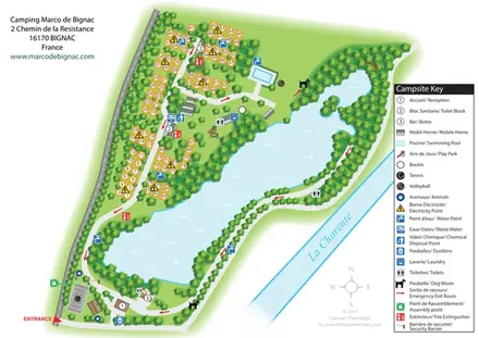
France
Bilingual lakeside campsite map with numbered pitches, recreation areas and colour-coded service points.
 Explore the map ↗
United Kingdom
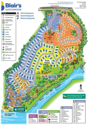
A colourful riverside park map combining touring pitches, holiday accommodation and treetop adventures.
Features may come from the sample artwork, its key or published park information. Approximate numbers describe the drawing and may cover only part of a park. They are intended to help you compare map examples. Current facilities and booking information should be checked with the park.
TAKE A CLOSER LOOK
View the illustrated map in detail or choose a file to download. These are sample maps; contact the park for current visitor information.
LET’S MAP YOUR PARK
For a map quotation, find your park and draw a rough boundary around it. The area you select helps us work out the design time and price.
Draw your park for a quote ↗Or talk to our map designers
01751 473136