
Beach and sea frontage
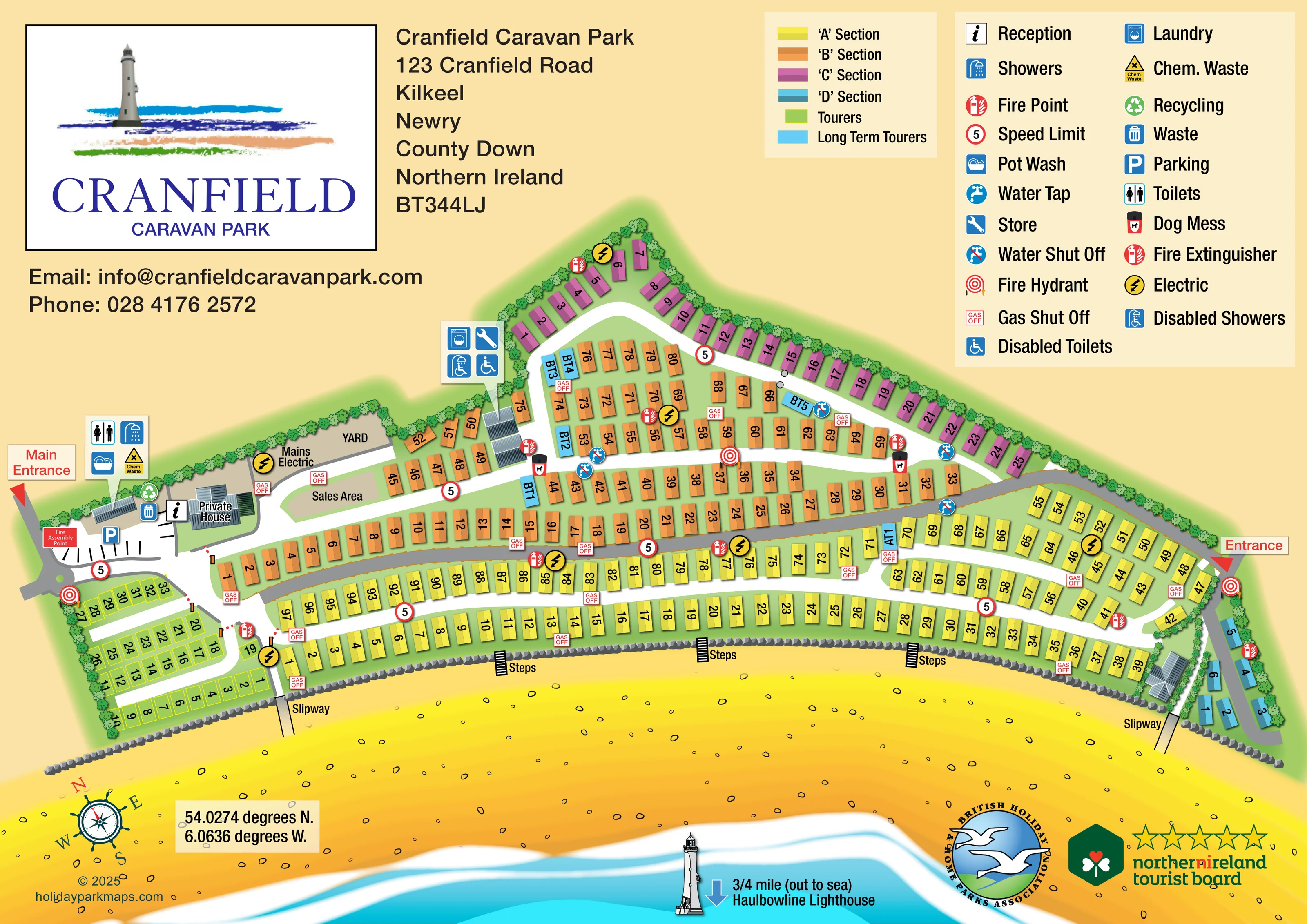
A broad golden beach with scattered pebble marks fills the foreground, edged by white surf and turquoise sea.
ILLUSTRATED PARK MAP · P092
Northern Ireland CRANFIELD · United Kingdom
 Enlarge the map ↗
A SENSE OF THE PLACE
Cranfield Caravan Park is a long-established family business beside the coast at the mouth of Carlingford Lough. Sea and beach views, with the Mourne Mountains beyond, form the backdrop to holiday homes and touring stays.
The touring area provides fully serviced hardstanding pitches on the seafront. Its rules exclude tents, gazebos and awnings, so the park's touring offer is best understood as a serviced vehicle stay beside the beach.
LOOK CLOSER
A broad golden beach with scattered pebble marks fills the foreground, edged by white surf and turquoise sea.
Repeated leafy shrubs define the inland and end boundaries, while individually drawn grey stones form the beachfront edge.
An illustrated lighthouse and outward-pointing arrow identify an offshore landmark rather than an on-site facility.
Information symbol beside the private house and arrival parking at the main western entrance.
Marked parking bays within the entrance forecourt.
A callout points to the western amenity building beside the touring area.
Wheelchair toilet and shower symbols appear in the central-western service-building callout.
Laundry symbol grouped with the store and accessible washroom symbols beside the central-western buildings.
Information symbol beside the private house and arrival parking at the main western entrance.
Marked parking bays within the entrance forecourt.
A callout points to the western amenity building beside the touring area.
Wheelchair toilet and shower symbols appear in the central-western service-building callout.
Laundry symbol grouped with the store and accessible washroom symbols beside the central-western buildings.
A wrench symbol labelled Store in the key is included in the central-western building callout; the artwork does not identify it as a retail shop.
Dishwashing symbol in the western amenity-building callout.
Chemical waste symbol grouped with the western toilets, showers and pot wash.
Waste and recycling symbols beside the entrance-side buildings.
Dog-waste bin symbols appear along internal routes in the central accommodation area.
A water-tap symbol is defined in the key. The clearly visible tap-like symbols on the plan are water shut-off markers.
Repeated red fire-equipment symbols throughout the accommodation rows, hydrant symbols at entrances and centrally, and a labelled fire assembly point beside the main entrance.
Yellow electrical symbols, a labelled mains-electric position, gas shut-off markers and water shut-off markers are distributed around the plan.
Separate labelled sales area and yard immediately east of the entrance-side private house.
A roofed building beside reception is explicitly labelled Private House.
Large red arrows identify the main western entrance and a second entrance at the eastern end.
A grey connecting road and white internal lanes provide access through the curved accommodation rows; repeated speed-limit symbols are shown.
Several labelled stairways interrupt the seafront stone boundary, with a labelled slipway near each end of the frontage.
A broad golden beach with scattered pebble marks fills the foreground, edged by white surf and turquoise sea.
Repeated leafy shrubs define the inland and end boundaries, while individually drawn grey stones form the beachfront edge.
An illustrated lighthouse and outward-pointing arrow identify an offshore landmark rather than an on-site facility.
READING THE MAP
This illustrated map of Cranfield Caravan Park makes its beachfront setting the organising feature of the page. The park stretches along a curved strip of coast in County Down, Northern Ireland, with rows of caravans set behind a stone-edged beach. Golden sand, white surf and turquoise water give the artwork a strong coastal identity, reinforced by the lighthouse in the park logo and the offshore reference to Haulbowline Lighthouse.
The plan combines a substantial static-caravan layout with a compact touring area at the western end. Four accommodation sections use distinct colours, while touring pitches and long-term tourers receive their own treatments. This makes the dense arrangement easier to understand without replacing the individual unit labels visitors need.
Arrival information is equally prominent: the main entrance leads to reception and parking, and a second entrance is marked at the opposite end. Amenity callouts, a generous facilities key, beach steps and slipways add practical detail. The result is a sample suited to coastal caravan parks that need both clear section-based navigation and a recognisable sense of place.
The single landscape-format plan shows the park as an elongated coastal site, widening inland towards a pointed upper boundary. A grey connecting road runs from the western arrival area towards the eastern entrance. White internal lanes curve through the accommodation, creating several long rows that follow the beachfront and shorter rows within the central area.
Yellow A-section caravans occupy much of the seafront. Orange B-section units fill the central inland portion, purple C-section units trace the upper planted edge, and a small blue D section sits at the eastern end. Outlined green touring pitches form a compact western pocket beside the beach. Cyan long-term touring positions are distinguished from both these pitches and the main caravan sections.
At the main entrance, parking bays and the reception symbol sit beside a labelled private house. A nearby building callout identifies toilets, showers, pot washing and chemical waste disposal, with waste and recycling symbols close by. Further into the park, another callout groups laundry, store, accessible toilets and accessible showers. The sales area and yard are separately labelled. Fire equipment, hydrants, dog-waste bins, electrical points and utility shut-offs add an operational layer to the visitor plan.
Along the shore, individually drawn grey stones separate the park from the golden beach. Several labelled steps and two slipways make the access points conspicuous. The sea forms a decorative lower border, with an illustrated Haulbowline Lighthouse reference offshore. A large park identity block, separate accommodation and facility keys, a nautical compass and tourism-related graphics frame the plan without requiring a separate inset.
KEEP EXPLORING
Chosen for shared landscapes, accommodation or facilities.
 Explore the map ↗
United Kingdom
Coastal park map with static-caravan rows, touring pitches, a camping field and two leisure clusters.
 Explore the map ↗
United Kingdom
Coastal park plan with colour-coded pitches, named neighbourhoods and a Morecambe Bay walking route.
 Explore the map ↗
United Kingdom
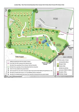
Illustrated touring-park plan with facilities, public footpaths and adjoining field-access details.
Features may come from the sample artwork, its key or published park information. Approximate numbers describe the drawing and may cover only part of a park. They are intended to help you compare map examples. Current facilities and booking information should be checked with the park.
LET’S MAP YOUR PARK
For a map quotation, find your park and draw a rough boundary around it. The area you select helps us work out the design time and price.
Draw your park for a quote ↗Or talk to our map designers
01751 473136