
River Brue
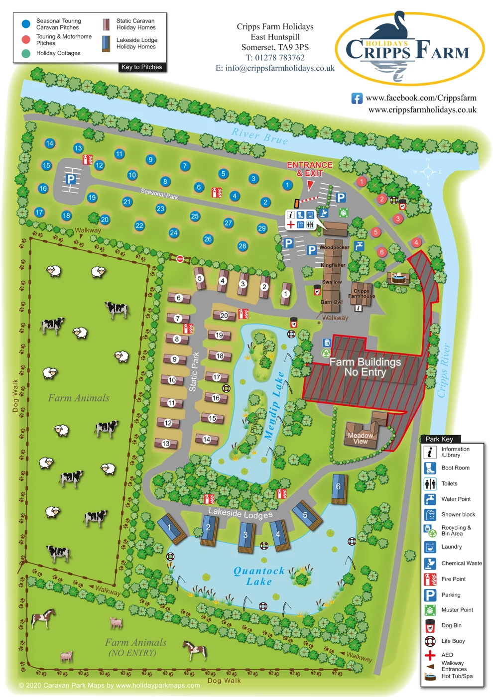
A broad light-blue river runs across the top of the plan and meets the river along the eastern side.
ILLUSTRATED PARK MAP · P093
Cripps Farm Holidays, East Huntspill, Somerset · United Kingdom
 Enlarge the map ↗
A SENSE OF THE PLACE
Cripps Farm Holidays is based at East Huntspill, Somerset. Touring pitches overlook the meeting of the Cripps and Brue rivers. Four self-catering cottages are listed, with pets accepted in Barn Owl and Kingfisher. The touring page advertises six fully serviced hardstanding pitches and 47 seasonal pitches.
Heated washrooms, laundry, Wi-Fi and chargeable fishing are listed.
LOOK CLOSER
A broad light-blue river runs across the top of the plan and meets the river along the eastern side.
The eastern watercourse joins River Brue beside the touring area. Supplied research also describes touring pitches overlooking the meeting of these rivers.
An elongated lake separates Static Park from the farm complex. It contains planted islands labelled Private and has fishing-rod and lifebuoy illustrations along its banks.
A broad rounded lake anchors the lower part of the map. Lodges sit along its northern shore, with reeds, lily pads, a small planted island, fishing rods and lifebuoys around the water.
Planted islands within Mendip Lake carry explicit private-access labels.
Fenced green fields illustrated with livestock provide the map's farm setting. The southern field is explicitly marked no entry, and the northern field has a no-entry gate.
Repeated tree and shrub symbols define riverbanks, field edges, pitch boundaries and lake margins. They are illustrative planting cues rather than evidence of measured woodland extent or individual tree positions.
Information/library symbols occur in the shared service-building callout and at Cripps Farmhouse. Neither location is explicitly labelled reception.
Information/library symbols occur in the shared service-building callout and at Cripps Farmhouse. Neither location is explicitly labelled reception.
A boot room is identified within the shared service-building callout.
Toilets are located by the shared service-building callout. No accessible-toilet designation is shown.
A shower block is indicated in the service-building callout. Supplied research additionally describes heated washrooms; heating is not specified on the map.
Laundry is included in the shared service-building callout and is also listed in the supplied research.
A water point is marked between the cottage row and the touring/motorhome pitches.
Chemical-waste disposal is marked close to the arrival parking and shared service building.
A combined refuse and recycling location is shown on the edge of the restricted farm-building area.
Fire-point symbols are distributed through the seasonal, static and lodge areas.
Parking is indicated by blue P symbols and white bay markings. Bay capacity has not been inferred from the schematic markings.
A muster point is marked in the arrival area.
An AED is identified in the service-building callout. This is an artwork location, not a newly verified emergency-equipment location.
Lifebuoy symbols are placed beside the river-side touring pitches and around both lakes.
Dog-waste bins are shown at the river-side touring area, beside the cottages and near the northern end of Mendip Lake.
A dog walk is explicitly labelled along the western and southern edges of the farm-animal fields. Paw prints also indicate connecting walking routes.
Walkway labels and brown triangular markers identify pedestrian access points around the fields and lakes.
A hot-tub/spa pictogram is located on a small building or platform near Cripps Farmhouse. The map does not establish who may use it or whether access is communal.
Fishing is suggested by rod illustrations along both lakes. Supplied research explicitly lists chargeable fishing; the rods are not treated as an inventory of fishing pegs.
Farm-animal fields are depicted with livestock illustrations. Restricted-entry wording and a no-entry gate mean this should not be described as an accessible petting attraction.
Wi-Fi is listed in the supplied research but is not identified by a symbol or text on the map.
The supplied touring-page research describes fully serviced hardstanding pitches. The map shows touring/motorhome pads and a water point but does not separately identify electrical hook-ups or pitch drainage.
A broad light-blue river runs across the top of the plan and meets the river along the eastern side.
The eastern watercourse joins River Brue beside the touring area. Supplied research also describes touring pitches overlooking the meeting of these rivers.
An elongated lake separates Static Park from the farm complex. It contains planted islands labelled Private and has fishing-rod and lifebuoy illustrations along its banks.
A broad rounded lake anchors the lower part of the map. Lodges sit along its northern shore, with reeds, lily pads, a small planted island, fishing rods and lifebuoys around the water.
Planted islands within Mendip Lake carry explicit private-access labels.
Fenced green fields illustrated with livestock provide the map's farm setting. The southern field is explicitly marked no entry, and the northern field has a no-entry gate.
Repeated tree and shrub symbols define riverbanks, field edges, pitch boundaries and lake margins. They are illustrative planting cues rather than evidence of measured woodland extent or individual tree positions.
READING THE MAP
Our Cripps Farm Holidays sample illustrates a mixed holiday park in a riverside farm setting at East Huntspill, Somerset. The River Brue and Cripps River shape the site, while Mendip Lake and Quantock Lake provide prominent internal landmarks. Different accommodation areas are distinguished within a plan that also gives space to walking routes, fishing and the working-farm surroundings.
The artwork includes seasonal touring pitches, short-stay touring and motorhome provision, static caravan holiday homes, lakeside lodges and a named cottage row. Service facilities, parking, waste points and visitor information are shown alongside a perimeter dog walk and other leisure features. Restricted farm areas remain visually separate from the visitor routes.
This is a useful design reference for parks offering several accommodation types or combining holidays with fishing, countryside walks and farm character. It demonstrates how water, paths and named areas can structure a detailed map, helping visitors understand the whole site while still finding individual pitches and facilities.
This single-page portrait map presents Cripps Farm Holidays as an illustrated overhead plan framed by River Brue across the top and Cripps River down the right-hand side. A large swan-and-reflection logo, contact block, website and Facebook address occupy the white header. The accommodation key sits at upper left, while a tall Park Key fills the lower-right margin. There is no inset map or scale bar; a small compass near the river junction indicates north towards the top.
The plan separates its accommodation through both colour and drawing style. Blue numbered circles mark seasonal touring pitches on tan pads across the northern section. Red circles identify touring and motorhome pitches beside the river junction. Static Park uses pink and mauve caravan roofs with white number discs, arranged along a curving road west of Mendip Lake. Blue-roofed lodges with brown decking follow the northern shore of Quantock Lake. Woodpecker, Kingfisher, Swallow and Barn Owl are named directly on a brown-roofed cottage row beside parking and Cripps Farmhouse.
Grey roads connect the arrival area, courtyard and accommodation sections. A striped barrier and prominent red entrance-and-exit label provide an arrival landmark. The service building is identified by a compact callout containing information, boot-room, laundry, AED, shower and toilet symbols. Further symbols locate water, chemical-waste disposal, parking, recycling, fire points, a muster point, dog bins, lifebuoys and a hot tub/spa.
The rural setting is expressed through fenced animal fields, livestock illustrations, repeated tree symbols, reeds, lily pads and fishing rods. Brown paw prints trace dog walks and connecting walkways around the fields and southern lake. Red diagonal hatching and no-entry wording clearly separate the farm buildings from visitor areas; islands in Mendip Lake are labelled private. Shadows and softly graduated greens give depth to the otherwise schematic plan. Most labels are clear in the detailed images, although the pale river names and white compass are less prominent. The footer carries a 2020 designer copyright credit rather than an explicit survey date.
KEEP EXPLORING
Chosen for shared landscapes, accommodation or facilities.
 Explore the map ↗
United Kingdom
Woodland park map with mixed pitches, bell tents, lodges and a fishing lake.
 Explore the map ↗
United Kingdom
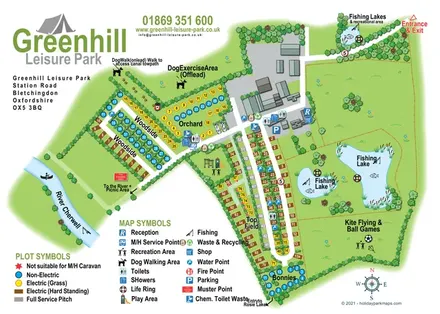
Illustrated camping and touring map with fishing lakes, dog areas and colour-coded pitches.
 Explore the map ↗
United Kingdom
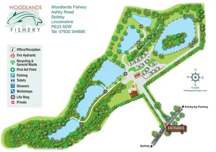
Illustrated fishery map with lakeside routes, wooded waters and a compact touring area.
Features may come from the sample artwork, its key or published park information. Approximate numbers describe the drawing and may cover only part of a park. They are intended to help you compare map examples. Current facilities and booking information should be checked with the park.
TAKE A CLOSER LOOK
View the illustrated map in detail or choose a file to download. These are sample maps; contact the park for current visitor information.


LET’S MAP YOUR PARK
For a map quotation, find your park and draw a rough boundary around it. The area you select helps us work out the design time and price.
Draw your park for a quote ↗Or talk to our map designers
01751 473136