
Beach and Bristol Channel
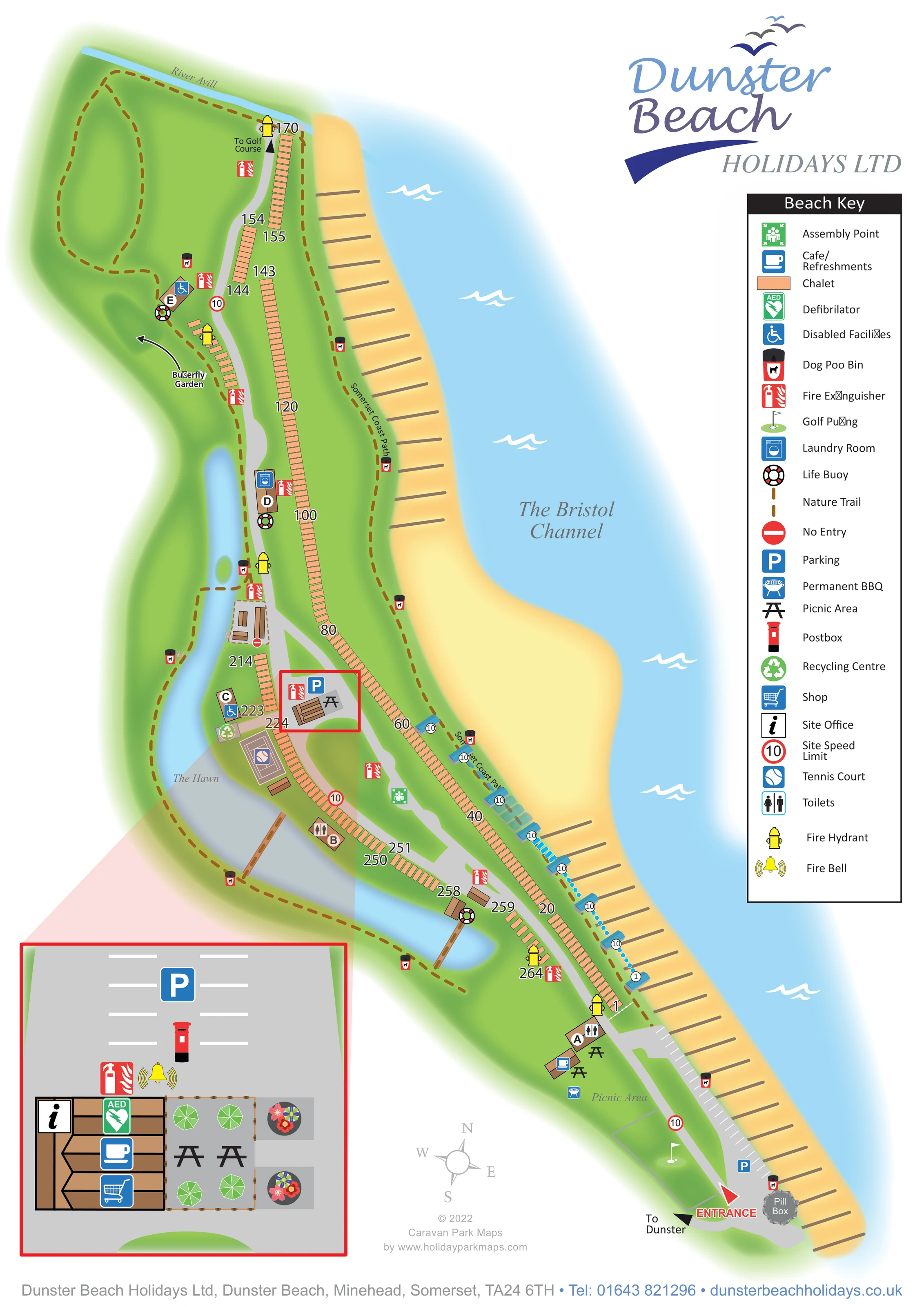
A broad yellow beach borders pale blue water labelled The Bristol Channel; repeated brown groyne-like lines articulate the shoreline.
ILLUSTRATED PARK MAP · P453
Dunster Beach Holidays Ltd, Dunster Beach, Minehead, Somerset · United Kingdom
 Enlarge the map ↗
A SENSE OF THE PLACE
Dunster Beach is a coastal holiday site near Minehead and the historic village of Dunster, on the edge of Exmoor. Its beach and foreshore are central to the setting.
The holiday company was established in 1965 to secure the coastal land for its shareholders. Shared facilities include parking, toilets and refreshments, while the map records the layout of the beach holiday community and its access routes.
LOOK CLOSER
A broad yellow beach borders pale blue water labelled The Bristol Channel; repeated brown groyne-like lines articulate the shoreline.
An elongated inland waterbody curves behind the chalet rows, with a small island-like green shape and pedestrian crossings.
A narrow blue river marks the upper end of the illustrated site.
A curved directional arrow points towards a green area on the inland side of the upper chalet rows.
A grey illustrated structure labelled Pill Box provides a distinctive landmark beside the entrance and beach parking.
A labelled brown dashed route follows the landward edge of the beach, alongside the coastal chalet row.
Brown dashed paths loop through the upper green area and continue around The Hawn, connecting with illustrated crossings.
A red entrance arrow marks arrival at the lower end of the plan, with a separate black arrow pointing towards Dunster.
A broad yellow beach borders pale blue water labelled The Bristol Channel; repeated brown groyne-like lines articulate the shoreline.
An elongated inland waterbody curves behind the chalet rows, with a small island-like green shape and pedestrian crossings.
A narrow blue river marks the upper end of the illustrated site.
A labelled brown dashed route follows the landward edge of the beach, alongside the coastal chalet row.
Brown dashed paths loop through the upper green area and continue around The Hawn, connecting with illustrated crossings.
A curved directional arrow points towards a green area on the inland side of the upper chalet rows.
A red entrance arrow marks arrival at the lower end of the plan, with a separate black arrow pointing towards Dunster.
Marked beachfront parking bays lie near the entrance, with another parking area at the central facilities hub.
The information symbol identifies the site office in the enlarged central facilities inset.
A shopping-trolley symbol marks the shop within the central facilities building shown in the inset.
Cup symbols identify refreshments at the central hub and beside the lower picnic area.
Picnic-table symbols appear near the entrance and central facilities; the inset depicts outdoor tables and green parasols.
A barbecue symbol is positioned in the labelled picnic area near the entrance.
A flag-and-green symbol marks a outlined putting area beside the entrance road.
An arrow at the upper end of the site points towards a golf course beyond the depicted accommodation.
An outlined court with a tennis symbol sits beside The Hawn, close to the central facilities.
A washing-machine symbol marks the building labelled D beside the main road and inland waterbody.
Toilet symbols mark buildings A and B; wheelchair symbols mark facilities at C and E. These symbols identify mapped facilities rather than guaranteeing accessibility throughout the site.
A green recycling symbol appears beside building C, near the tennis court.
A red postbox is shown beside parking in the central facilities inset.
A green AED symbol is placed on the central facilities building in the enlarged inset.
Repeated extinguisher and hydrant symbols are distributed along the chalet rows and roads; a fire bell is shown at the central hub.
A green assembly-point symbol marks open space between the lower accommodation rows.
Life-buoy symbols appear at several positions beside The Hawn and associated facilities.
Repeated black-and-red dog waste bin symbols line the coastal path and inland walking routes.
Red-ringed 10 speed-limit symbols punctuate the internal roads, and a no-entry symbol marks a small central service area.
A grey illustrated structure labelled Pill Box provides a distinctive landmark beside the entrance and beach parking.
READING THE MAP
This illustrated map of Dunster Beach Holidays places a long coastal chalet community between the Bristol Channel and The Hawn, an inland waterbody that curves behind the accommodation. The Somerset setting is central to the composition: a broad yellow beach runs down one side, while green open space, waterside paths and the River Avill frame the rest of the site.
The plan shows approximately 250 chalet-style holiday homes in closely spaced rows, with a grey internal road linking the entrance to the upper end of the park. Visitors can locate parking, refreshments, picnic areas, putting, tennis and shared facilities through a consistent set of coloured symbols. The Somerset Coast Path and inland nature trail are distinguished from the roads with brown dashed lines.
A separate enlargement brings the central office, shop and refreshments area into focus without interrupting the overall coastal layout. Together with the numbered chalet rows, lettered buildings and prominent beach landmarks, this makes the sample particularly relevant to holiday communities where a narrow site, repeated accommodation and several walking routes need to be understood at a glance.
The portrait artwork follows the site diagonally from the River Avill at the upper left to the entrance at the lower right. Peach chalet footprints form a long ribbon beside the beach, with further rows on the inland side of the grey road. Large number labels identify positions along these rows, while buildings A–E provide additional reference points for shared facilities.
The beach is drawn as a sweeping yellow strip with repeated brown groyne-like lines. Beyond it, pale blue water, white wave motifs and the label The Bristol Channel establish the coastal setting. On the opposite side, The Hawn curves around the lower accommodation and extends into a narrower upper section. Brown dashed nature trails follow its banks and loop through the green area towards the River Avill. The Somerset Coast Path follows the beach edge, and a curved arrow identifies the butterfly garden inland.
At arrival, the map shows beachfront parking, a pill box, putting, picnic tables, a permanent barbecue, refreshments and toilets. Farther along the site are a tennis court, recycling point, laundry and facilities marked with wheelchair symbols. Fire equipment, life buoys and dog waste bins are distributed through the plan, while an assembly point occupies open space between the lower rows.
A red box locates the central visitor-services cluster, linked to a larger inset at the lower left. This enlargement shows the office, shop, café or refreshments, defibrillator, postbox, parking and outdoor tables with green parasols. The large park logo and vertical Beach Key occupy the upper right. The overview and enlarged quadrant views represent this same single-page design, not separate park sections or alternative maps.
KEEP EXPLORING
Chosen for shared landscapes, accommodation or facilities.
 Explore the map ↗
United Kingdom
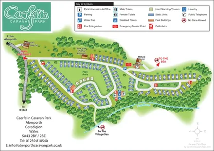
Woodland-framed caravan park plan with numbered and lettered units, a central play area and routes towards Aberporth’s village and sea.
 Explore the map ↗
United Kingdom
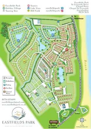
Six colour-coded neighbourhoods, lakeside layouts and coastal access on the Eastfields Park map.
 Explore the map ↗
United Kingdom
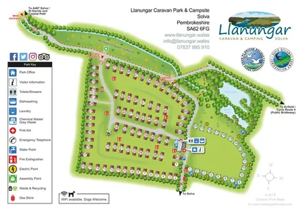
Illustrated Llanungar park plan with static caravans, camping pitches, wildlife ponds and clearly marked entrances.
Features may come from the sample artwork, its key or published park information. Approximate numbers describe the drawing and may cover only part of a park. They are intended to help you compare map examples. Current facilities and booking information should be checked with the park.
TAKE A CLOSER LOOK
View the illustrated map in detail or choose a file to download. These are sample maps; contact the park for current visitor information.


LET’S MAP YOUR PARK
For a map quotation, find your park and draw a rough boundary around it. The area you select helps us work out the design time and price.
Draw your park for a quote ↗Or talk to our map designers
01751 473136