
Beach and sea
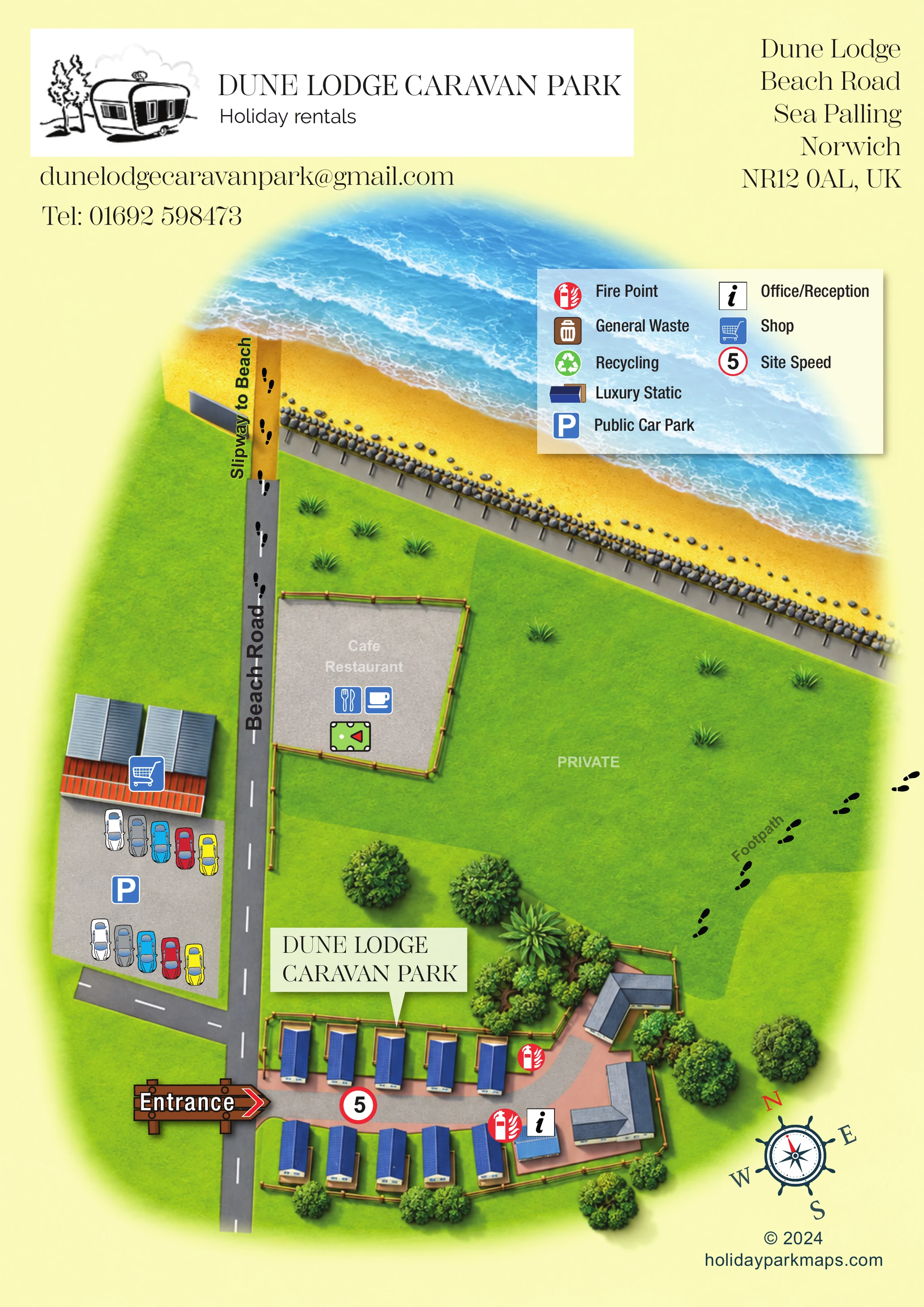
A broad golden beach and blue sea form the upper edge of the illustration, with pale streaks suggesting waves.
ILLUSTRATED PARK MAP · P104
Dune Lodge, Beach Road, Sea Palling, Norwich · United Kingdom
 Enlarge the map ↗
A SENSE OF THE PLACE
Dune Lodge is a small family-run caravan park at Sea Palling in Norfolk. Its location offers direct access towards the beach, with the coastal path running beside the site.
Holiday caravans have private garden areas and parking, and a dog-friendly option is available. The village provides places to eat and basic shopping, while the coast around Horsey and the Norfolk Broads offer options for days out.
LOOK CLOSER
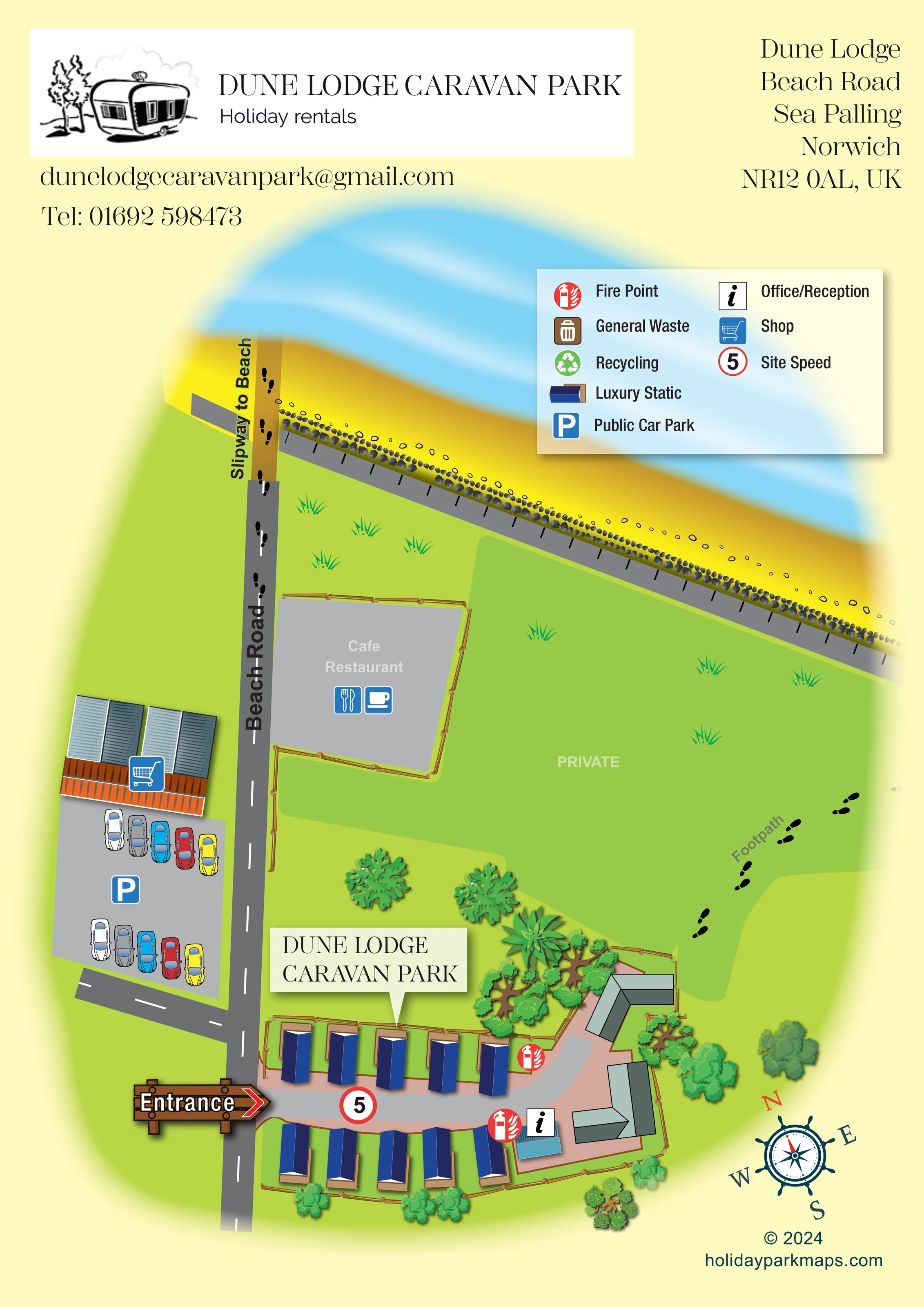
A broad golden beach and blue sea form the upper edge of the illustration, with pale streaks suggesting waves.
A long diagonal grey coastal strip separates the green land from the beach, bordered by rows of small illustrated rocks.
The large green area between the caravan park and the coast is explicitly labelled 'PRIVATE'.
Clusters of leafy trees frame the eastern buildings and caravan enclosure; timber-style fences define the park and nearby café area.
An information symbol identifies office/reception at the eastern end of the caravan rows, beside a small blue-roofed structure.
Two red fire-point symbols are positioned near the eastern end of the internal lane and reception area.
A shopping-trolley symbol marks a roofed building across Beach Road from the park, adjoining the public car park.
A fenced grey area beside Beach Road, north of the park entrance, is labelled 'Cafe Restaurant' and carries cup and cutlery symbols.
An information symbol identifies office/reception at the eastern end of the caravan rows, beside a small blue-roofed structure.
Two red fire-point symbols are positioned near the eastern end of the internal lane and reception area.
A shopping-trolley symbol marks a roofed building across Beach Road from the park, adjoining the public car park.
A fenced grey area beside Beach Road, north of the park entrance, is labelled 'Cafe Restaurant' and carries cup and cutlery symbols.
A blue parking symbol and illustrated cars identify a public car park opposite the park, with its own connection to Beach Road.
A brown bin symbol is included in the legend; no corresponding position is clearly marked on the plan.
A green recycling symbol appears in the legend without a clearly identifiable mapped location.
A large timber-style arrow sign points from Beach Road into the short internal lane between the caravan rows.
The principal surrounding road runs up the left side of the park and continues towards the beach slipway.
A gold strip labelled 'Slipway to Beach' continues from Beach Road through the coastal edge towards the sand and sea.
A diagonal route beside the park is labelled 'Footpath' and represented by repeated black footprints.
A red-ringed '5' symbol is placed on the internal lane and explained as 'Site Speed' in the legend; the artwork does not state a unit.
A broad golden beach and blue sea form the upper edge of the illustration, with pale streaks suggesting waves.
A long diagonal grey coastal strip separates the green land from the beach, bordered by rows of small illustrated rocks.
The large green area between the caravan park and the coast is explicitly labelled 'PRIVATE'.
Clusters of leafy trees frame the eastern buildings and caravan enclosure; timber-style fences define the park and nearby café area.
READING THE MAP
This illustrated map of Dune Lodge Caravan Park places a small holiday-caravan site within its coastal surroundings at Sea Palling in Norfolk. Rather than filling the page with accommodation plots, the design gives generous space to the beach, sea and routes that help explain the park's location. Beach Road runs beside the site and continues towards a clearly labelled beach slipway, while a footprint-marked footpath appears beyond the park's eastern buildings.
The caravan enclosure sits at the foot of the portrait page, with roughly ten blue-roofed static caravans arranged along a short internal lane. A large entrance arrow, a park-name callout and an office/reception symbol make the arrival area easy to recognise. The map also includes a nearby shop, public car park and café/restaurant, distinguishing the park itself from useful surrounding landmarks.
Bright greens, golden sand and pale blue water establish the seaside setting. Illustrated trees, fences and dimensional roof shapes give the compact site character, while the separate symbol key keeps practical information together.
The single portrait map combines a compact accommodation plan with a broader illustration of the adjoining coast. At the bottom, two short rows of static caravans face a light grey access lane edged with salmon-pink ground. The repeated caravan symbols have dark blue roofs, white highlights and tan deck or base details, with green spaces between them and timber-style fencing around the enclosure. The lane enters from Beach Road and curves towards reception and a group of larger, unlabelled grey-green-roofed buildings at its eastern end.
Arrival is emphasised by a substantial wooden arrow labelled 'Entrance'. A cream pointer bearing the park name identifies the caravan area, while red fire-point symbols, an information marker and a red-ringed '5' add practical wayfinding detail. Across Beach Road, illustrated cars and a blue parking icon mark the public car park beside the shop. Farther towards the coast, the café/restaurant is represented by a fenced grey area with cup and cutlery symbols.
The upper half is dominated by the beach and sea. Beach Road continues into a gold-coloured strip labelled 'Slipway to Beach', with black footprints reinforcing its walking connection. A diagonal grey coastal edge, lined with small rocks, separates the sand from green land. Another footprint trail marks the labelled footpath beside the park, and the broad intervening green area carries a 'PRIVATE' label.
A translucent, shadowed legend floats over the coastal scene. It includes accommodation, reception, shop, parking, fire and speed symbols, plus waste and recycling entries. The white branded header, address block and nautical compass complete the page. The enlarged detail views show portions of this same artwork, not separate park sections or alternative maps.
 Enlarge this map ↗
KEEP EXPLORING
Chosen for shared landscapes, accommodation or facilities.
 Explore the map ↗
United Kingdom
Coastal park map with static-caravan rows, touring pitches, a camping field and two leisure clusters.
 Explore the map ↗
United Kingdom
Illustrated coastal holiday-home plan with dense alphanumeric plot labels, orange-roofed amenities, a numbered facility key and beach-side context.
 Explore the map ↗
United Kingdom
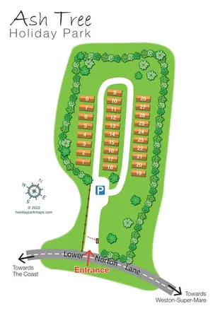
Tree-lined holiday-home park plan with a numbered road loop and clear Lower Norton Lane entrance.
Features may come from the sample artwork, its key or published park information. Approximate numbers describe the drawing and may cover only part of a park. They are intended to help you compare map examples. Current facilities and booking information should be checked with the park.
LET’S MAP YOUR PARK
For a map quotation, find your park and draw a rough boundary around it. The area you select helps us work out the design time and price.
Draw your park for a quote ↗Or talk to our map designers
01751 473136