
Quiet Garden
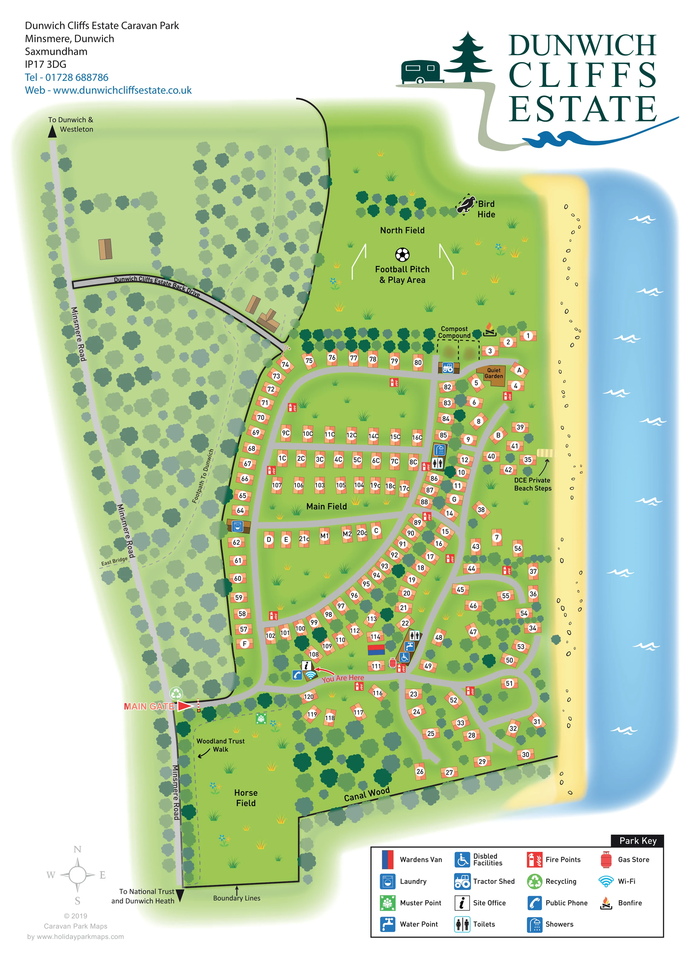
A small ochre garden shape is labelled beside the northern service area and eastern access lane.
ILLUSTRATED PARK MAP · P454
Dunwich Cliffs Estate Caravan Park, Minsmere, Dunwich, Saxmundham · United Kingdom
 Enlarge the map ↗
A SENSE OF THE PLACE
Dunwich Cliffs Estate Caravan Park is based at Minsmere, Dunwich, Saxmundham. Pitches range from private plots with large gardens to lower-maintenance plots.
Separate fields are devoted to play and exercise. The park explicitly states that it has no clubhouse, pool or shop.
LOOK CLOSER
A small ochre garden shape is labelled beside the northern service area and eastern access lane.
Main Field names the central accommodation area; North Field is a broad open recreational space above it.
A large open southern area is labelled Horse Field, separate from the main caravan layout.
Dense tree symbols cover the western side and parts of the southern boundary, where Canal Wood is labelled.
A long yellow beach and blue sea form the eastern edge of the plan, with pebble marks and stylised white waves.
An information symbol identifies the office beside the lower-central arrival and service area.
A blue-and-red rectangular symbol marks the warden's van near the office and lower service cluster.
Toilet and shower symbols appear in service clusters near the eastern side of Main Field and near the lower-central arrival area.
An information symbol identifies the office beside the lower-central arrival and service area.
A blue-and-red rectangular symbol marks the warden's van near the office and lower service cluster.
Toilet and shower symbols appear in service clusters near the eastern side of Main Field and near the lower-central arrival area.
A wheelchair symbol marks facilities in the lower service cluster. It does not establish accessibility throughout the park.
A washing-machine symbol marks a laundry on the western side of Main Field.
A blue tap symbol appears beside the lower-central facilities.
Telephone and Wi-Fi symbols are grouped beside the site office and You Are Here marker.
Repeated red fire-point symbols are distributed along the accommodation roads.
A red cylinder symbol marks the gas store beside the lower service area.
A green recycling symbol is positioned beside the main gate.
A green assembly symbol is shown south of the entrance road, beside the open field.
A tractor symbol marks an operational building at the northern edge of the accommodation, close to Quiet Garden.
A labelled dashed enclosure sits between North Field and the northern caravan plots.
A bonfire symbol appears near the compost compound at the southern edge of North Field.
North Field contains a labelled football pitch and play area, illustrated with goal outlines and a football.
A bird illustration and Bird Hide label mark a location towards the coastal side of North Field.
A small ochre garden shape is labelled beside the northern service area and eastern access lane.
Main Field names the central accommodation area; North Field is a broad open recreational space above it.
A large open southern area is labelled Horse Field, separate from the main caravan layout.
Dense tree symbols cover the western side and parts of the southern boundary, where Canal Wood is labelled.
A long yellow beach and blue sea form the eastern edge of the plan, with pebble marks and stylised white waves.
A labelled arrow points to illustrated steps linking the eastern caravan area with the beach.
The main gate enters from Minsmere Road on the western side. The road is labelled towards Dunwich and Westleton to the north.
A separate curved drive crosses the western woodland from Minsmere Road towards the north-western edge of the caravan area.
Dashed routes include Footpath To Dunwich, Woodland Trust Walk and an East Bridge reference. A southern arrow indicates National Trust land and Dunwich Heath.
Heavy black lines identify portions of the estate boundary, including the southern Horse Field and Canal Wood edge.
READING THE MAP
This illustrated map of Dunwich Cliffs Estate Caravan Park places its caravan plots between woodland and the coast at Minsmere, Dunwich. A long strip of yellow beach and blue sea runs down the right-hand side, while tree-filled grounds and Minsmere Road frame the west. The result is a site plan that explains both the accommodation layout and the landscape around it.
Approximately 150 caravan plots are shown, arranged in central rows and winding lanes towards the beach. Beyond the accommodation, the map gives generous space to North Field, its football pitch and play area, a bird hide, Horse Field and the woodland walking routes. Private beach steps provide another clear destination.
The design combines practical plot labels and a colour-coded facility key with simple landscape illustration. A prominent main-gate arrow and You Are Here marker establish the arrival point, while the estate logo, contact block and spacious portrait layout make the artwork suitable for a branded visitor information display.
The plan follows an elongated stretch of coast, with the sea on the eastern edge and Minsmere Road on the west. The main gate opens into the lower part of the caravan area, where a red You Are Here arrow identifies the arrival position beside the office, telephone and Wi-Fi symbols. From here, broad grey lanes connect the central accommodation rows with curved perimeter roads and smaller loops nearer the beach.
Main Field contains the most regular arrangement of caravans. Peach plot rectangles carry white number or letter badges, with their angles changing to follow the road layout. Trees separate many of the eastern and southern plots, giving those sections a less regimented appearance. Two service clusters show toilets and showers; the lower cluster also includes a wheelchair symbol, water point and gas store. Laundry, recycling, a muster point and repeated fire-point symbols are marked elsewhere on the plan.
North Field is drawn as an extensive open green space, with football goals, a play-area label and a bird-hide marker. Its southern edge includes the compost compound, bonfire symbol, tractor shed and Quiet Garden. To the south, Horse Field and Canal Wood extend the landscape beyond the accommodation. Dashed woodland routes identify the footpath to Dunwich and Woodland Trust Walk, with directional references to East Bridge, National Trust land and Dunwich Heath.
The yellow beach carries small pebble marks, and white wave strokes animate the blue sea. An arrow highlights the DCE private beach steps. The single portrait artwork is completed by the estate branding above, a compass below and a boxed facility key at the lower right; the enlarged details show this same footer rather than a separate map.
KEEP EXPLORING
Chosen for shared landscapes, accommodation or facilities.
 Explore the map ↗
United Kingdom
A colour-zoned coastal park map with touring areas, woodland trails, ponds and a leisure club.
 Explore the map ↗
United Kingdom
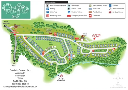
Woodland-framed caravan park plan with numbered and lettered units, a central play area and routes towards Aberporth’s village and sea.
 Explore the map ↗
United Kingdom
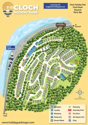
Woodland caravan-park map with coastal context, Cloch Lighthouse and clearly marked visitor facilities.
Features may come from the sample artwork, its key or published park information. Approximate numbers describe the drawing and may cover only part of a park. They are intended to help you compare map examples. Current facilities and booking information should be checked with the park.
TAKE A CLOSER LOOK
View the illustrated map in detail or choose a file to download. These are sample maps; contact the park for current visitor information.


LET’S MAP YOUR PARK
For a map quotation, find your park and draw a rough boundary around it. The area you select helps us work out the design time and price.
Draw your park for a quote ↗Or talk to our map designers
01751 473136