
Fishing Lake
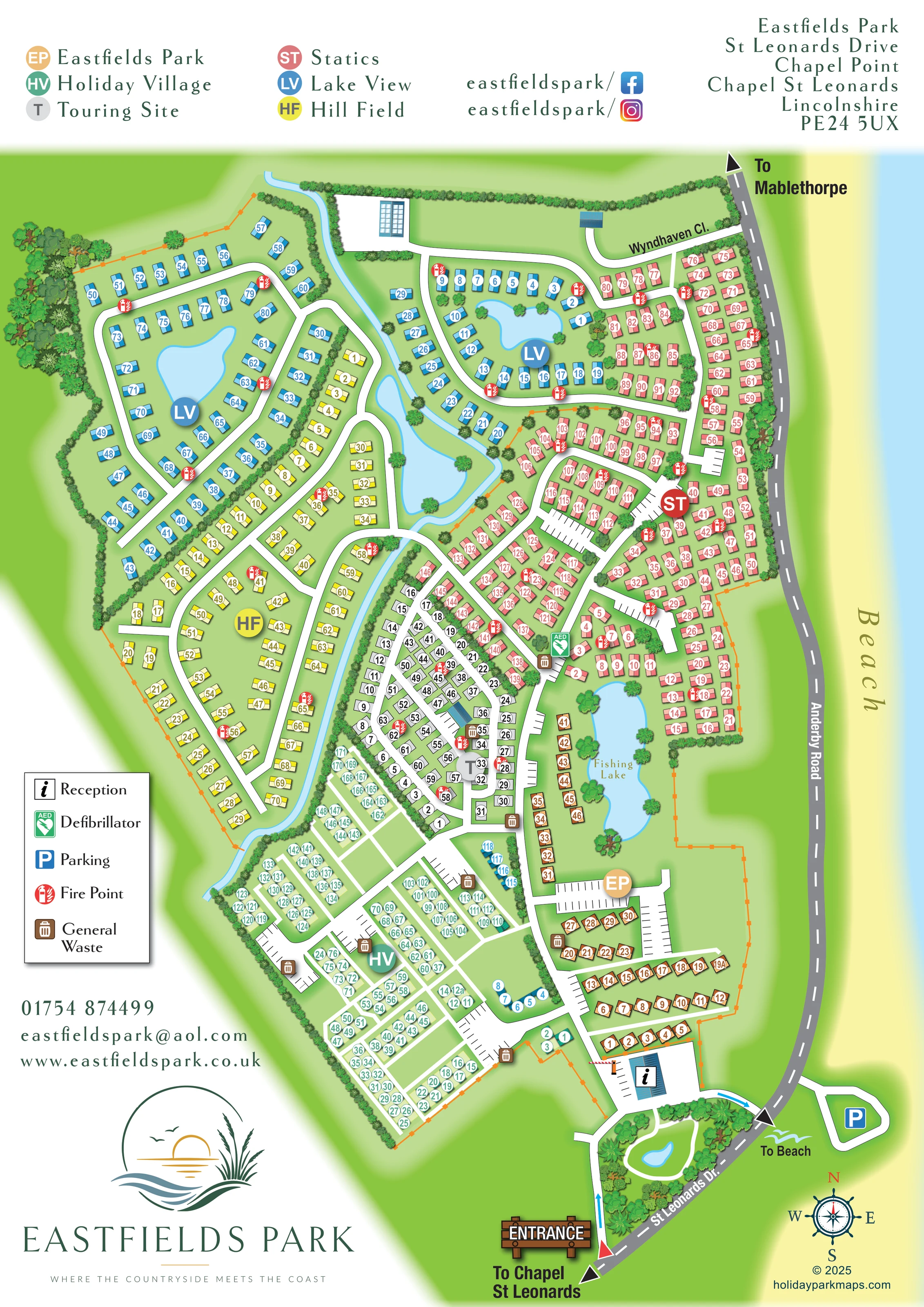
A long, irregular lake is labelled Fishing Lake on the eastern side of the park, between the lower Statics area and orange Eastfields Park units.
ILLUSTRATED PARK MAP · P106
Eastfields Park, St Leonards Drive, Chapel Point, Chapel St Leonards, Lincolnshire · United Kingdom
 Enlarge the map ↗
A SENSE OF THE PLACE
Eastfields Park is a family-run holiday home and touring park at Chapel Point near Chapel St Leonards. The beach, countryside and Lincolnshire Coastal Country Park are close to its grounds.
Conservation lakes and a fishing lake form part of the landscaped setting. Nightly and seasonal touring options sit alongside holiday home ownership, giving visitors different ways to return to this stretch of the Lincolnshire coast.
LOOK CLOSER
A long, irregular lake is labelled Fishing Lake on the eastern side of the park, between the lower Statics area and orange Eastfields Park units.
Two prominent ponds sit within the northern blue Lake View accommodation loops, making water a defining feature of that neighbourhood.
A narrow blue watercourse runs through the western-central part of the plan, widening into a larger irregular water body and passing beneath connecting routes.
The southern arrival route wraps around a densely planted island containing a small pond and a curved white route.
Tree belts enclose much of the park, while hedges separate accommodation rows, line the watercourse and frame individual lakes.
A broad pale-yellow beach strip and light-blue sea occupy the right-hand edge. A To Beach label beside the southern road junction provides a directional reference.
An information symbol identifies the blue-roofed reception building beside the southern arrival area, with parking bays and an illustrated barrier nearby.
A green AED symbol marks a location near the meeting point of the Statics and Touring Site areas.
An information symbol identifies the blue-roofed reception building beside the southern arrival area, with parking bays and an illustrated barrier nearby.
A green AED symbol marks a location near the meeting point of the Statics and Touring Site areas.
Marked parking bays occur beside several accommodation sections and reception. A blue P symbol identifies a separate parking area across the coastal road near the beach direction.
Repeated red circular fire-point symbols are distributed through the northern holiday-home areas and the central touring section.
Brown bin symbols identify several waste locations, particularly around the touring area, Holiday Village and southern access roads.
A long, irregular lake is labelled Fishing Lake on the eastern side of the park, between the lower Statics area and orange Eastfields Park units.
Two prominent ponds sit within the northern blue Lake View accommodation loops, making water a defining feature of that neighbourhood.
A narrow blue watercourse runs through the western-central part of the plan, widening into a larger irregular water body and passing beneath connecting routes.
The southern arrival route wraps around a densely planted island containing a small pond and a curved white route.
Tree belts enclose much of the park, while hedges separate accommodation rows, line the watercourse and frame individual lakes.
A broad pale-yellow beach strip and light-blue sea occupy the right-hand edge. A To Beach label beside the southern road junction provides a directional reference.
A wooden-style ENTRANCE sign and red triangular marker identify arrival from St Leonards Drive at the bottom of the plan. Blue arrows show the illustrated route towards reception.
The grey coastal road follows the park's eastern edge, with directional arrows towards Chapel St Leonards to the south and Mablethorpe to the north.
Wyndhaven Cl. labels the northern access lane connecting the upper park layout to the coastal road.
White lanes form lakeside loops, short branches and more regular southern grids. Connecting routes cross the illustrated watercourse.
Published park information describes conservation lakes within the landscaped setting and proximity to the Lincolnshire Coastal Country Park. Individual unlabelled ponds are not assigned a conservation function by the artwork.
READING THE MAP
This illustrated map of Eastfields Park brings together a large holiday-home and touring layout beside the Lincolnshire coast. At Chapel Point, near Chapel St Leonards, the park is presented as six clearly named neighbourhoods, each with its own colour: Eastfields Park, Holiday Village, Touring Site, Statics, Lake View and Hill Field. Matching unit symbols and prominent section badges help visitors move from an overview of the grounds to a particular accommodation area.
Water is central to the composition. Two ponds sit within the Lake View loops, a blue watercourse threads through the grounds, and a labelled fishing lake lies towards the eastern side. Trees and hedges define boundaries without obscuring the white internal roads. Along the right-hand edge, the coastal road, beach and sea explain the park's relationship with its surroundings.
The southern entrance, reception and landscaped arrival island provide a clear starting point. A separate facility legend, external destination arrows and a nautical compass complete a map designed to explain both a substantial site and its distinctive countryside-and-coast setting.
The portrait plan follows Eastfields Park's elongated footprint, with arrival at the bottom and the coastal road running up the right-hand side. An illustrated entrance sign marks the approach from St Leonards Drive. Blue route arrows lead around a planted island containing a small pond towards the reception building, its parking area and a drawn barrier. From here, a white internal road connects the southern accommodation groups with the centre and north of the park.
The six sections have noticeably different arrangements. Orange Eastfields Park units occupy rows near reception and extend beside the fishing lake. Mint-green Holiday Village uses a relatively regular network of lanes and paired rows in the south-west. The grey Touring Site forms a compact central group, while coral-red Statics occupies branching roads and courts to the east. Yellow Hill Field follows longer curving lanes along the western side. Blue Lake View is arranged around two northern ponds and beside the watercourse, giving that section a particularly recognisable landscape structure.
Numbered unit labels, large circular section badges and the header key work together rather than relying on colour alone. Red fire-point symbols and brown waste symbols recur around the grounds; a green defibrillator symbol appears near the central junction between touring and static accommodation. Parking is shown through drawn bays and a blue P marker across the coastal road.
The map also labels Wyndhaven Close, directions to Mablethorpe and Chapel St Leonards, and the beach. Its white margins accommodate contact information, social icons, a boxed facility key and the park's large wave-and-reed logo. The artwork is a single whole-park plan, with no separate walking-map variant or inset.
KEEP EXPLORING
Chosen for shared landscapes, accommodation or facilities.
 Explore the map ↗
United Kingdom
A lakeside holiday-park and fishery map with numbered accommodation, fishing positions and clearly grouped visitor services.
 Explore the map ↗
United Kingdom
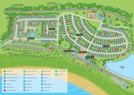
Coastal holiday-park plan with named caravan neighbourhoods, dune paths, leisure facilities and a wildlife lake.
 Explore the map ↗
United Kingdom
Illustrated lakeside park plan with numbered holiday units, leisure buildings and a looping Woodland Walk.
Features may come from the sample artwork, its key or published park information. Approximate numbers describe the drawing and may cover only part of a park. They are intended to help you compare map examples. Current facilities and booking information should be checked with the park.
LET’S MAP YOUR PARK
For a map quotation, find your park and draw a rough boundary around it. The area you select helps us work out the design time and price.
Draw your park for a quote ↗Or talk to our map designers
01751 473136