
Woodland setting
Dense illustrated woodland surrounds the park and forms planted strips and pockets between accommodation rows.
ILLUSTRATED PARK MAP · P081
Cloch Holiday Park, Cloch Road, Gourock · United Kingdom
 Enlarge the map ↗
A SENSE OF THE PLACE
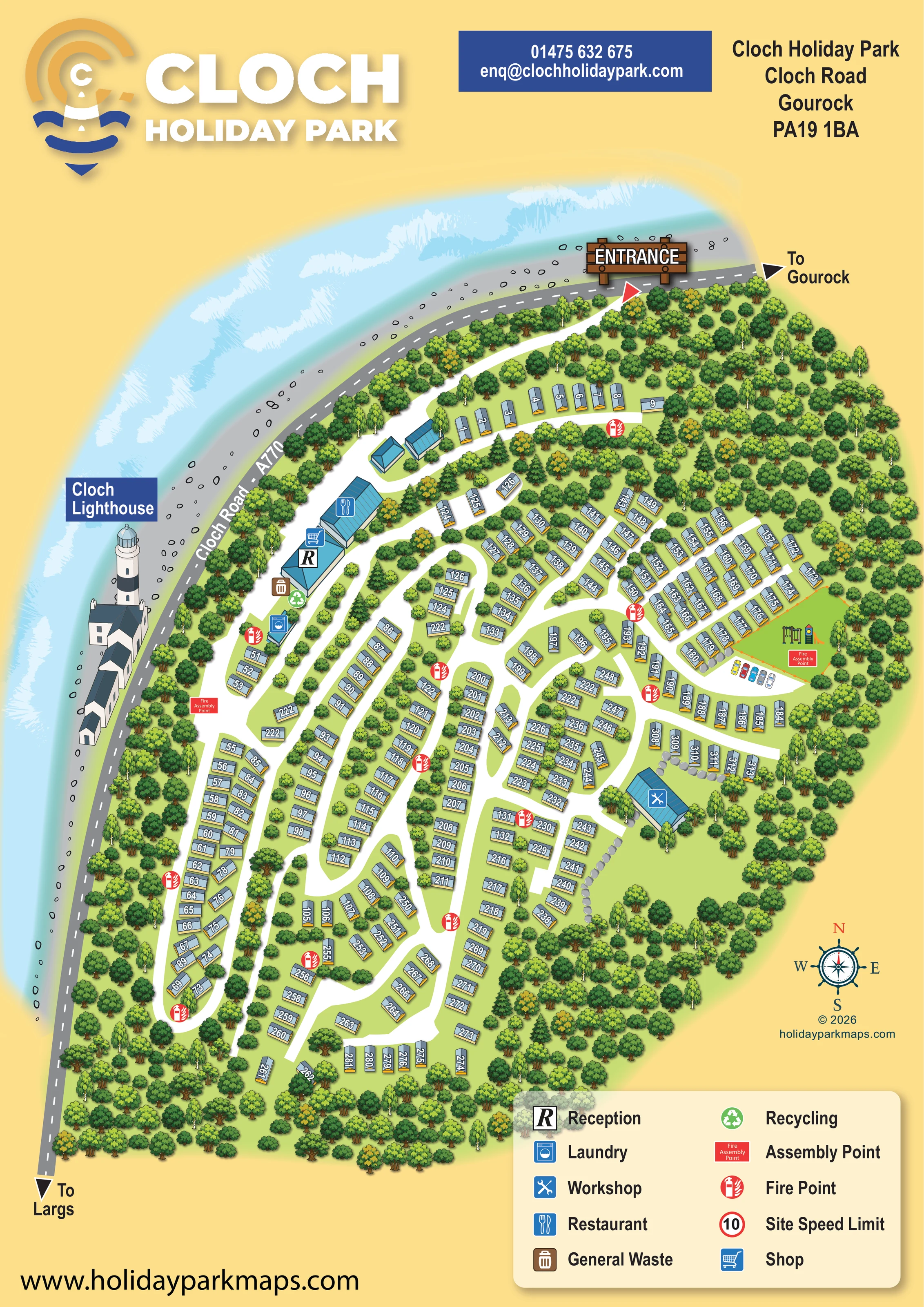
Cloch Holiday Park is based at Cloch Road, Gourock. The operator describes a 24-acre park in mature woodland on Scotland’s west coast.
The park provides a shop, laundrette and outdoor children’s play area. The park provides a bar and restaurant, takeaway service and weekend entertainment. Cloch Leisure offers a swimming pool and gym, with pay-as-you-go and membership options.
LOOK CLOSER
Dense illustrated woodland surrounds the park and forms planted strips and pockets between accommodation rows.
Pale blue water, white wave textures and a grey shore with scattered outlined stones frame the upper-left side of the artwork.
A labelled illustration of the striped lighthouse and adjoining buildings stands outside the park on the shore side of Cloch Road.
Grey boulder lines appear beside some eastern accommodation rows and along the open green space near the workshop.
Marked with a prominent R on a blue-roofed building in the roadside facilities cluster.
A shopping-trolley symbol marks the shop at the reception building.
A cutlery symbol identifies the larger building adjoining the reception and shop cluster.
A washing-machine symbol marks a smaller building further along the western internal road.
Marked with a prominent R on a blue-roofed building in the roadside facilities cluster.
A shopping-trolley symbol marks the shop at the reception building.
A cutlery symbol identifies the larger building adjoining the reception and shop cluster.
A washing-machine symbol marks a smaller building further along the western internal road.
A crossed-tools symbol identifies a separate blue-roofed building on the eastern side of the accommodation network.
An orange-fenced green enclosure contains illustrated swings and a slide on the eastern side of the park.
A small row of cars is shown beside the road immediately below the play enclosure.
Brown waste and green recycling symbols are grouped beside the reception building.
Repeated red circular fire-point symbols are distributed throughout the accommodation roads.
Red labelled rectangles mark assembly points near the western facilities area and within the eastern play-area enclosure.
The legend includes a red-ringed 10 symbol labelled Site Speed Limit; no specific on-plan placement is apparent.
A large timber-style ENTRANCE sign and red pointer identify access at the northern edge of the plan.
The grey coastal road runs around the upper and western boundaries, with directional arrows towards Gourock and Largs.
Broad white roads connect the entrance, roadside facilities and numerous accommodation rows through loops, junctions and short branches.
Dense illustrated woodland surrounds the park and forms planted strips and pockets between accommodation rows.
Pale blue water, white wave textures and a grey shore with scattered outlined stones frame the upper-left side of the artwork.
A labelled illustration of the striped lighthouse and adjoining buildings stands outside the park on the shore side of Cloch Road.
Grey boulder lines appear beside some eastern accommodation rows and along the open green space near the workshop.
Operator information describes these wider park offerings. The map identifies a restaurant but does not separately label a bar, takeaway or entertainment venue.
Operator information identifies a swimming pool and gym through Cloch Leisure; neither is explicitly located or labelled on this artwork.
READING THE MAP
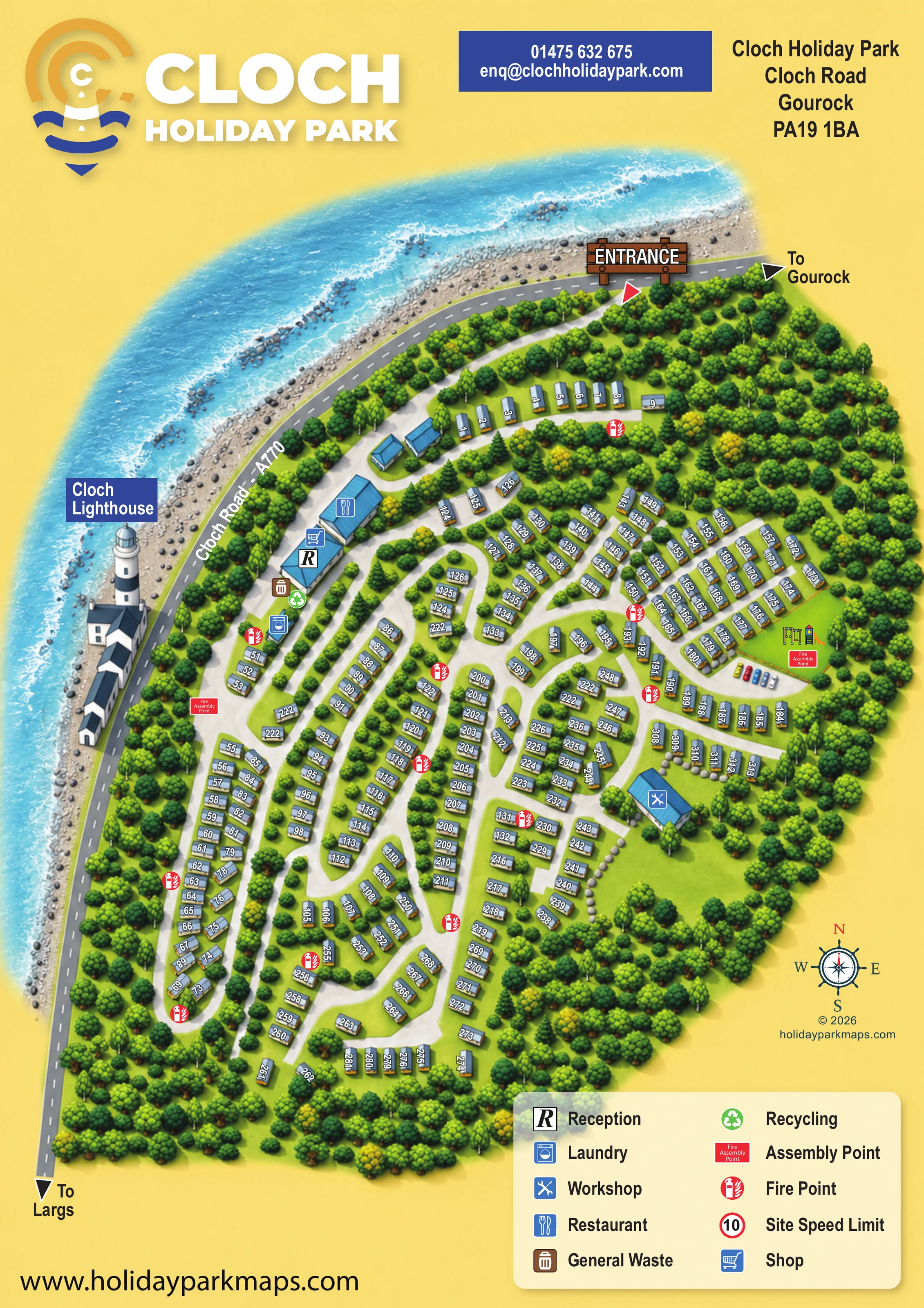
This illustrated map of Cloch Holiday Park in Gourock brings a wooded coastal setting into the same view as the park’s accommodation and everyday visitor facilities. Cloch Road curves along the shoreline, with pale blue water and a detailed drawing of Cloch Lighthouse giving the plan a strong sense of place. Inside the park, broad white roads wind between numbered caravan-style holiday homes and dense groups of trees.
The map shows reception, the shop and restaurant together near the western side of the park, with a separate laundry building nearby. Further inland, an illustrated children’s play area and a workshop help visitors recognise different parts of the site. Fire points and assembly points use conspicuous red symbols, explained in a generous two-column key.
A warm yellow page background, blue lighthouse branding and a nautical compass tie the practical plan to its coastal identity. This sample is particularly relevant to woodland caravan parks that need to make a complex road network readable while retaining the landscape and landmarks that distinguish their location.
The single portrait map places the park inland of Cloch Road, labelled A770, with arrows towards Gourock at the upper right and Largs at the lower left. An oversized timber-style entrance sign marks the access near the top of the artwork. From there, a white arrival road curves through trees towards the roadside facilities before joining the main accommodation network.
Reception and the shop share a marked building beside the larger restaurant. Waste and recycling symbols sit alongside this cluster, while the laundry occupies a smaller building further down the same side of the park. The numbered caravan-style units extend through central and southern rows, following branching roads, curved loops and short side roads. Their grey-blue roofs and yellow end panels remain consistent throughout, with numbers turned to suit each unit’s orientation.
On the eastern side, swings and a slide identify an orange-fenced play enclosure, with a small row of parked cars beside its approach. A separate workshop stands below this area. Grey boulders edge some nearby rows and an open green pocket. Red fire-point symbols recur across the accommodation areas, and labelled assembly points appear near the western facilities and the playground.
The landscape is integral to the composition: varied tree canopies surround and divide the accommodation, while textured blue water and a stony shoreline frame the coastal road. Cloch Lighthouse is illustrated outside the park as a prominent local landmark. A cream legend panel, nautical compass and large branded header complete the page. The enlarged detail views reveal parts of this same artwork; there is no separate walking map or secondary site plan.
 Enlarge this map ↗
KEEP EXPLORING
Chosen for shared landscapes, accommodation or facilities.
 Explore the map ↗
United Kingdom
A colour-zoned coastal park map with touring areas, woodland trails, ponds and a leisure club.
 Explore the map ↗
United Kingdom
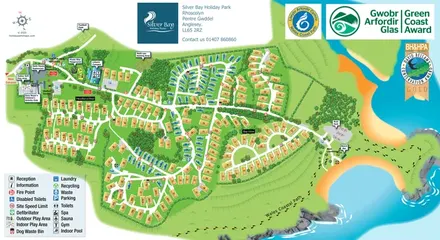
Illustrated Anglesey holiday-park map with numbered homes, family facilities and a footprint-marked coastal path.
 Explore the map ↗
United Kingdom
Trevornick’s colour-coded park map, with mixed accommodation, fishing ponds, golf and wooded trails.
Features may come from the sample artwork, its key or published park information. Approximate numbers describe the drawing and may cover only part of a park. They are intended to help you compare map examples. Current facilities and booking information should be checked with the park.
LET’S MAP YOUR PARK
For a map quotation, find your park and draw a rough boundary around it. The area you select helps us work out the design time and price.
Draw your park for a quote ↗Or talk to our map designers
01751 473136