
Morecambe Bay
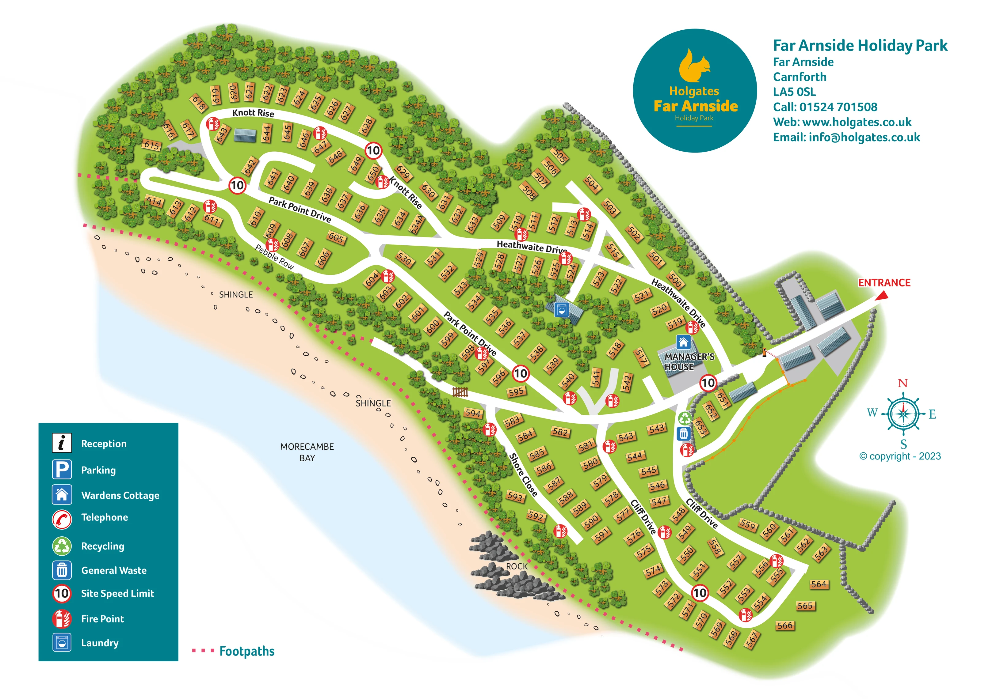
Named water body along the western and south-western edge, illustrated in pale blue.
ILLUSTRATED PARK MAP · P117
Far Arnside Holiday Park, Far Arnside, Carnforth · United Kingdom
 Enlarge the map ↗
A SENSE OF THE PLACE
Far Arnside is a small Holgates holiday home park on the Silverdale coastline, overlooking Morecambe Bay. Landscaped grounds and coastal views create a setting for holiday home ownership.
Walking routes lead into the surrounding countryside. Owners also have access to leisure facilities at the separate Silverdale park nearby, including its swimming pool, sauna and steam room. The map focuses on Far Arnside's own layout.
LOOK CLOSER
Named water body along the western and south-western edge, illustrated in pale blue.
A broad peach-coloured coastal strip is labelled SHINGLE and scattered with small outlined pebbles.
Prominent shaded grey rock clusters interrupt the shingle near the southern accommodation area; ROCK is also labelled.
Dense trees enclose the northern end, with planted coastal margins and smaller clusters between accommodation groups.
Segmented grey stone walls define the inland boundary, entrance grounds and open green enclosures beside Cliff Drive.
A red ENTRANCE label and arrow identify the approach from the right. A red-and-white barrier is drawn where the entrance road enters the park.
Heathwaite Drive, Park Point Drive, Knott Rise, Pebble Row, Shore Close and Cliff Drive organise the accommodation into recognisable road-based groups.
Pink dotted footpaths follow the shoreline boundary and extend towards the western edge. Their line style is explained separately beside the legend.
Named water body along the western and south-western edge, illustrated in pale blue.
A broad peach-coloured coastal strip is labelled SHINGLE and scattered with small outlined pebbles.
Prominent shaded grey rock clusters interrupt the shingle near the southern accommodation area; ROCK is also labelled.
Dense trees enclose the northern end, with planted coastal margins and smaller clusters between accommodation groups.
Segmented grey stone walls define the inland boundary, entrance grounds and open green enclosures beside Cliff Drive.
A red ENTRANCE label and arrow identify the approach from the right. A red-and-white barrier is drawn where the entrance road enters the park.
Heathwaite Drive, Park Point Drive, Knott Rise, Pebble Row, Shore Close and Cliff Drive organise the accommodation into recognisable road-based groups.
Pink dotted footpaths follow the shoreline boundary and extend towards the western edge. Their line style is explained separately beside the legend.
A roofed building close to the entrance is labelled MANAGER'S HOUSE and carries the blue house symbol described in the legend as Wardens Cottage.
A blue washing-machine symbol locates the laundry in a small roofed building amongst central planting, south of Heathwaite Drive.
Green recycling and blue general-waste symbols are grouped on the internal road just south of the entrance and manager's house.
Repeated red fire-point symbols are distributed throughout the accommodation roads.
Red-ringed signs displaying 10 appear at several junctions and road sections; the legend identifies them as site speed-limit symbols.
Several blue-grey roofed buildings stand on grey hardstanding around the entrance approach. Their individual functions are not labelled.
Reception appears in the legend, but a corresponding location is not clearly identified on the plan.
Parking is included in the legend; no clearly placed parking symbol is visible on the main plan.
A telephone symbol is explained in the legend without a clearly identifiable position on the plan.
READING THE MAP
This illustrated map of Far Arnside Holiday Park places its Morecambe Bay setting at the centre of the design. The shoreline runs along one side of the plan, with pale blue water, a peach-coloured shingle strip and shaded rock formations giving the accommodation layout a clear coastal context. Tree-lined boundaries and planted spaces soften the rows of numbered holiday-home plots.
The park is organised around named roads rather than large accommodation zones. Knott Rise, Park Point Drive, Heathwaite Drive and Cliff Drive help readers follow the branching layout from the eastern entrance to the northern and southern groups. Orange plot markers contrast with broad white roads, while a pink dotted footpath traces the coastal edge.
Practical information includes the manager's house, laundry, recycling and general waste, alongside repeated fire-point and speed-limit symbols. A teal Holgates identity panel and matching legend bring the page together. It is a useful sample for coastal holiday-home parks needing individual-plot wayfinding without losing the character of their landscape.
The single-page plan shows an irregular strip of holiday-home accommodation between Morecambe Bay and a stone-walled inland boundary. Its northern end broadens into a wooded lobe, while the southern plots gather around the curved roads of Cliff Drive. Approximately 150 numbered orange footprints convey the overall scale without illustrating each home as a separate building.
Arrival is marked on the eastern side by a red entrance arrow. The approach passes several roofed buildings on grey hardstanding and a drawn barrier before reaching the manager's house. From this area, Heathwaite Drive leads towards the northern plots, while Park Point Drive connects the central and western parts of the site. Knott Rise curves around the northern accommodation; Pebble Row and Shore Close provide smaller coastal branches.
A laundry symbol appears on a building within the central planting. Recycling and general-waste icons sit together south of the entrance, and red fire-point symbols recur beside the roads. Circular signs displaying 10 are also placed around the network. The lower-left legend explains these symbols and includes reception, parking and telephone entries, although their positions are not clearly marked in the main plan.
Landscape detail gives the page its particular identity. Dense tree clusters frame the upper boundary and shoreline, grey stone walls enclose the inland green spaces, and a pink dotted footpath follows the bay-facing edge. Small pebbles and larger rock piles distinguish the foreshore. The upper-right Holgates badge and contact block balance the legend below, with a nautical compass completing the right-hand margin.
KEEP EXPLORING
Chosen for shared landscapes, accommodation or facilities.
 Explore the map ↗
United Kingdom
A colour-zoned coastal park map with touring areas, woodland trails, ponds and a leisure club.
 Explore the map ↗
United Kingdom
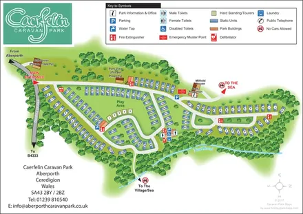
Woodland-framed caravan park plan with numbered and lettered units, a central play area and routes towards Aberporth’s village and sea.
 Explore the map ↗
United Kingdom
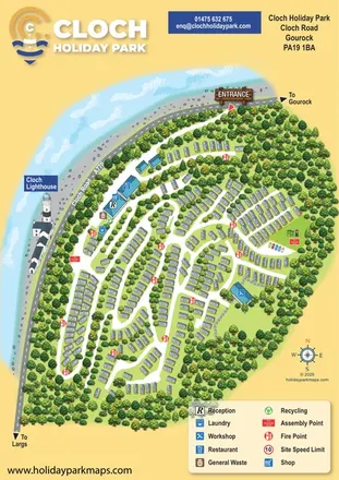
Woodland caravan-park map with coastal context, Cloch Lighthouse and clearly marked visitor facilities.
Features may come from the sample artwork, its key or published park information. Approximate numbers describe the drawing and may cover only part of a park. They are intended to help you compare map examples. Current facilities and booking information should be checked with the park.
LET’S MAP YOUR PARK
For a map quotation, find your park and draw a rough boundary around it. The area you select helps us work out the design time and price.
Draw your park for a quote ↗Or talk to our map designers
01751 473136