
Wooded setting
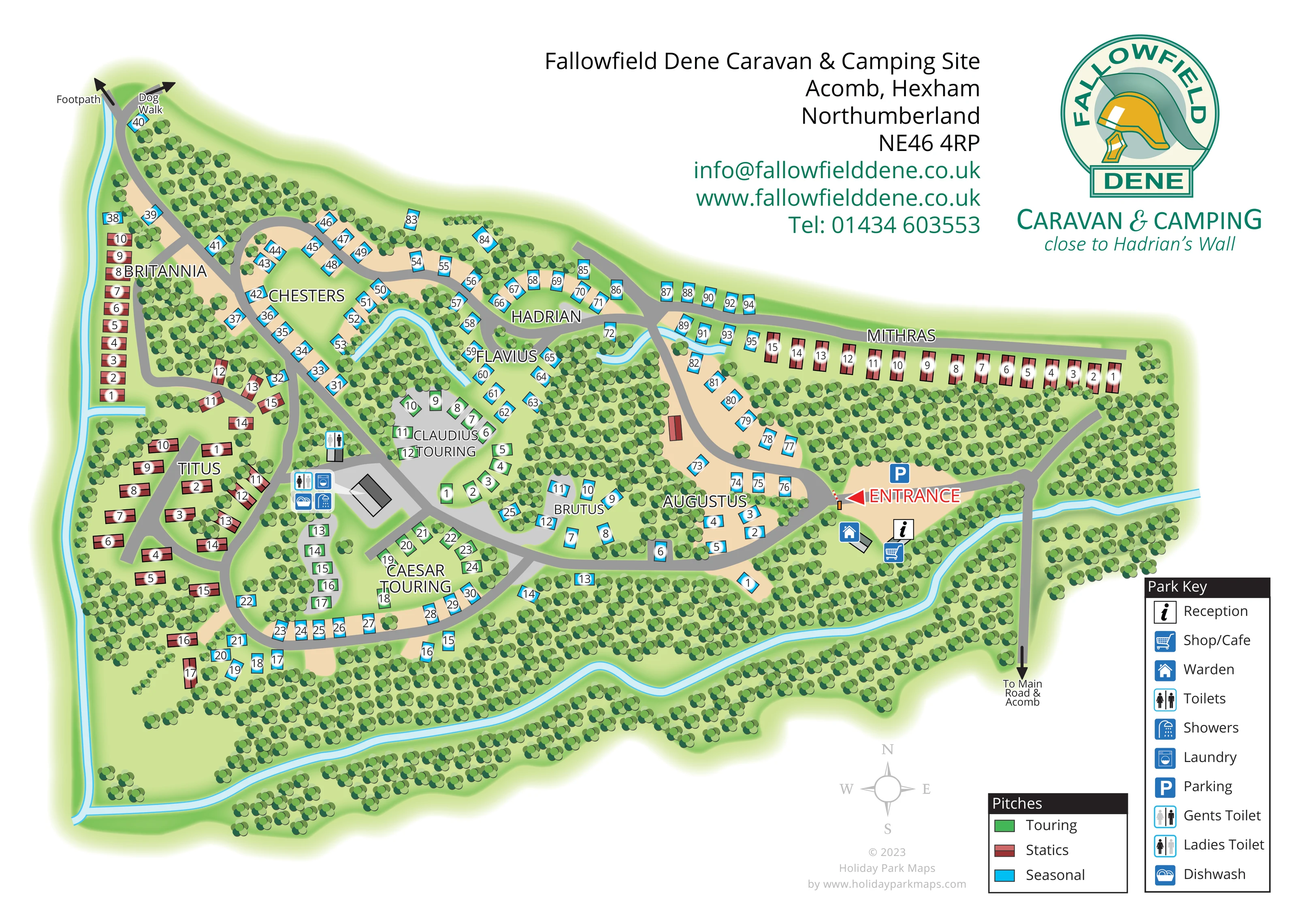
Dense tree symbols surround the park, separate its named sections and fill substantial internal woodland pockets.
ILLUSTRATED PARK MAP · P116
Fallowfield Dene Caravan & Camping Site, Acomb, Hexham, Northumberland · United Kingdom
 Enlarge the map ↗
A SENSE OF THE PLACE
Fallowfield Dene is a caravan and camping site in mature woodland near Acomb and Hexham. Its location in Hadrian's Wall country provides a base for exploring Roman heritage and the Northumberland landscape.
Pitches are arranged in separate, sheltered areas with Roman names. Toilets, showers and laundry facilities support stays, while the wooded setting gives the park a more secluded character.
LOOK CLOSER
Dense tree symbols surround the park, separate its named sections and fill substantial internal woodland pockets.
A pale-blue watercourse follows much of the western and southern perimeter, with smaller winding reaches among the northern sections. It is not named.
An information symbol marks reception beside the entrance-side buildings.
A shopping-trolley symbol identifies the combined shop/café location beside reception.
A house symbol marks the warden location just inside the entrance area.
A blue P marks parking on the open arrival area beside the entrance.
Toilet symbols appear at the central service area and slightly farther north beside the touring sections; the key distinguishes general, gents' and ladies' toilet symbols.
A shower symbol is grouped with the central service facilities west of Claudius Touring.
An information symbol marks reception beside the entrance-side buildings.
A shopping-trolley symbol identifies the combined shop/café location beside reception.
A house symbol marks the warden location just inside the entrance area.
A blue P marks parking on the open arrival area beside the entrance.
Toilet symbols appear at the central service area and slightly farther north beside the touring sections; the key distinguishes general, gents' and ladies' toilet symbols.
A shower symbol is grouped with the central service facilities west of Claudius Touring.
A washing-machine symbol identifies laundry facilities in the central service cluster.
A dishwashing symbol accompanies the central toilets, showers and laundry.
Dense tree symbols surround the park, separate its named sections and fill substantial internal woodland pockets.
A pale-blue watercourse follows much of the western and southern perimeter, with smaller winding reaches among the northern sections. It is not named.
A large red entrance arrow and illustrated barrier mark the transition from the arrival area to the internal park roads.
The approach road runs down the eastern side of the plan and is labelled 'To Main Road & Acomb'.
An outward arrow at the north-western end identifies a footpath connection.
A separate outward arrow beside the north-western road end identifies the dog walk; its route beyond the plan is not drawn.
Britannia, Chesters, Hadrian, Flavius, Titus, Augustus, Mithras, Caesar Touring, Claudius Touring and Brutus provide named wayfinding areas.
READING THE MAP
This illustrated map of Fallowfield Dene Caravan & Camping Site presents a woodland park near Acomb and Hexham in Northumberland. Rather than treating the site as a regular grid, the plan follows its winding roads, sheltered clearings and separate accommodation areas. Dense green tree symbols give the setting a strong visual identity, while a pale-blue watercourse helps define the western and southern edges.
The map distinguishes static caravans, touring pitches and seasonal pitches with three clear colours. Roman-themed section names, including Britannia, Hadrian, Mithras and Caesar Touring, connect practical wayfinding with the park's Hadrian's Wall country setting. Numbered positions provide the finer detail within each area.
Arrival is made especially prominent: a red entrance arrow leads visitors towards the internal roads, with parking, reception, shop/café and the warden location grouped nearby. Central service symbols identify toilets, showers, laundry and dishwashing. Separate arrows mark a footpath and dog walk at the opposite end of the site. The result is a sample centred on navigating a dispersed, tree-filled park without losing its distinctive character.
The complete landscape-format plan shows an irregular woodland site arranged around connected grey road loops. Visitors approach from the lower right along the road labelled towards the main road and Acomb. After crossing the illustrated watercourse, they reach an open arrival area with parking and nearby reception, shop/café and warden symbols. A large red entrance arrow and small barrier illustration identify the way into the accommodation lanes.
The accommodation is divided into named sections rather than one continuous grid. Britannia runs along the western side, Titus occupies a branching group farther south, and Mithras forms a long row across the north-east. Chesters, Hadrian and Flavius sit among the northern woodland clearings, while Augustus and Brutus occupy curved lanes nearer the centre and entrance. Claudius Touring and Caesar Touring are positioned around the central service area. Red static caravan symbols, cyan seasonal pitches and green touring pitches give these areas an immediate visual distinction, supported by individual numbers.
Toilet, shower, laundry and dishwashing symbols cluster beside grey-roofed service buildings, with another toilet marker slightly farther north. At the north-western tip, outward arrows identify the footpath and dog walk. Dense tree motifs separate the pitch groups and surround the perimeter, while blue water lines provide additional landmarks.
The upper-right header carries the park name, address, contact details and Roman-helmet logo. Two lower-right keys explain accommodation colours and facility pictograms, alongside a pale compass. The accompanying detail view is an enlargement of this same artwork, clarifying the entrance, nearby buildings and legends rather than showing another park section.
KEEP EXPLORING
Chosen for shared landscapes, accommodation or facilities.
 Explore the map ↗
United Kingdom
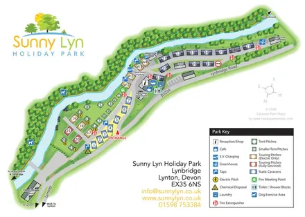
A woodland estate park map combining caravan loops, touring pitches, riverside paths and Bruce’s Cave landmarks.
 Explore the map ↗
United Kingdom
A river-led site plan with colour-coded pitches, central facilities and local walking directions.
 Explore the map ↗
Denmark
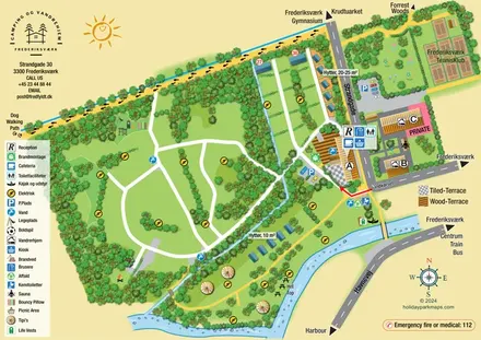
Illustrated canal-side campsite and hostel map with cabins, tipis, walking routes and town connections.
Features may come from the sample artwork, its key or published park information. Approximate numbers describe the drawing and may cover only part of a park. They are intended to help you compare map examples. Current facilities and booking information should be checked with the park.
TAKE A CLOSER LOOK
View the illustrated map in detail or choose a file to download. These are sample maps; contact the park for current visitor information.


LET’S MAP YOUR PARK
For a map quotation, find your park and draw a rough boundary around it. The area you select helps us work out the design time and price.
Draw your park for a quote ↗Or talk to our map designers
01751 473136