
Main Field and Circus Field
Two named grassy accommodation areas form the main structure of the plan.
ILLUSTRATED PARK MAP · P492
Kings Loke, Hemsby, Great Yarmouth, Norfolk · United Kingdom
 Enlarge the map ↗
A SENSE OF THE PLACE
Hemsby Tents & Touring is based at Kings Loke, Hemsby, Great Yarmouth, Norfolk. The two grassy fields offer electric and non-electric pitches for tents, caravans and motorhomes.
16-amp hook-ups, free Wi-Fi and communal barbecue areas are listed. A children's playpark is on the main field. Beachside Bites serves food beside reception; the Dolphin Bar and laundry facilities are at nearby Long Beach Park.
LOOK CLOSER
Two named grassy accommodation areas form the main structure of the plan.
Continuous scalloped hedging and layered tree canopies enclose the fields, with larger planted pockets within Circus Field.
An information symbol marks the tan building beside Kings Loke at the Main Field entrance.
A parking symbol identifies the grey arrival area immediately inside Main Field.
Toilet symbols appear at amenity clusters in both fields.
Wheelchair toilet symbols are shown at the two amenity clusters; the legend calls these Disabled Toilets.
Shower symbols identify facilities in Main Field and beside the central buildings in Circus Field.
Dishwashing symbols appear at both amenity clusters. The legend uses the same symbol for Washing Up and Pot Washing.
An information symbol marks the tan building beside Kings Loke at the Main Field entrance.
A parking symbol identifies the grey arrival area immediately inside Main Field.
Toilet symbols appear at amenity clusters in both fields.
Wheelchair toilet symbols are shown at the two amenity clusters; the legend calls these Disabled Toilets.
Shower symbols identify facilities in Main Field and beside the central buildings in Circus Field.
Dishwashing symbols appear at both amenity clusters. The legend uses the same symbol for Washing Up and Pot Washing.
Repeated tap symbols mark water points among the pitches and around the amenity buildings in both fields.
Chemical toilet disposal symbols are shown at the amenity clusters in both fields.
Yellow rectangular sandpit illustrations appear near the southern edge of Main Field and above the Circus Field amenity buildings.
A dog waste symbol is placed beside the lower access road in Circus Field.
A bin symbol marks the compound near the southern entrance to Circus Field.
Two named grassy accommodation areas form the main structure of the plan.
Continuous scalloped hedging and layered tree canopies enclose the fields, with larger planted pockets within Circus Field.
Kings Loke runs along the eastern side of Main Field and bends east near the junction serving both fields.
An eastward arrow beside Kings Loke points towards these destinations; they are not depicted within the park plan.
Yellow numbered circles identify electric pitches around the field edges and in Main Field's internal rows.
Supplied operator information lists a playpark on the main field. The artwork specifically labels sandpits rather than a wider playpark.
Supplied operator information places this food outlet beside reception; it is not named on the artwork.
Supplied operator information lists free Wi-Fi, 16-amp hook-ups and communal barbecue areas. Wi-Fi and barbecue locations are not mapped.
READING THE MAP
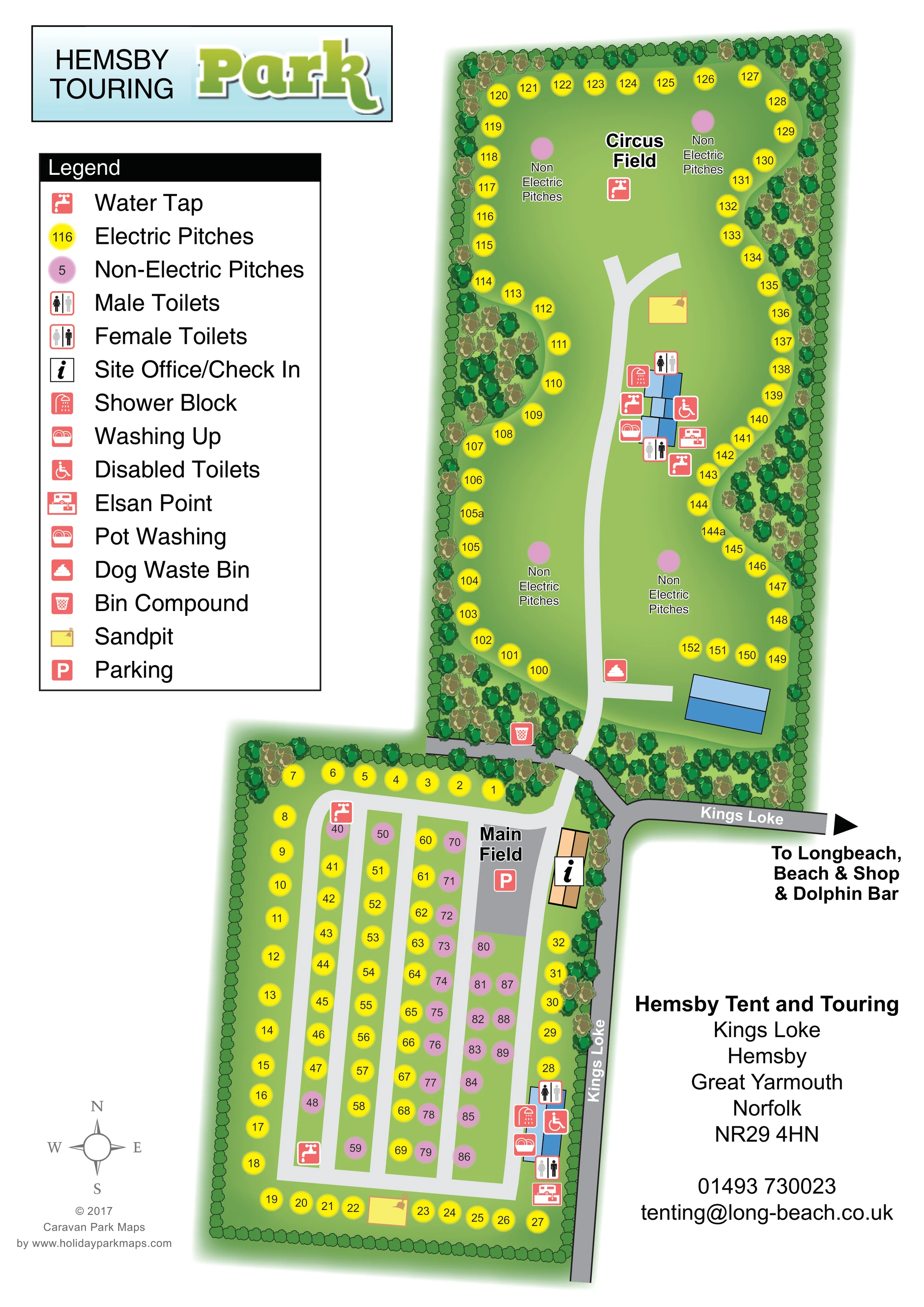
This map of Hemsby Tents & Touring in Hemsby, Norfolk, brings two grassy pitching fields together in a single portrait layout. Main Field occupies the lower part of the page, with neatly arranged pitch rows, an arrival area and a check-in building beside Kings Loke. Circus Field stretches northwards, combining perimeter pitches with larger open areas labelled for non-electric pitching. Their different shapes and arrangements are easy to recognise at a glance.
Bright yellow and pink pitch markers distinguish electric from non-electric provision, while a large legend explains the everyday facilities that touring and camping visitors need to find. Toilets, showers, water taps, washing-up points and Elsan disposal facilities are grouped around the two amenity areas. Sandpits and tree-lined boundaries add useful detail without obscuring the practical plan.
The artwork also connects the park to its surroundings through an arrow towards Longbeach, the beach, shop and Dolphin Bar. It is a useful example of a pitch-led map that prioritises arrival, field identification and facilities rather than illustrating individual accommodation units.
The plan uses an overhead view to show two connected but distinctly organised fields. Kings Loke runs up the eastern edge of Main Field before turning towards the right-hand side of the page. At the shared junction, visitors can identify the Main Field entrance, the site office/check-in building and the adjacent parking area. A separate entrance leads north into Circus Field.
Main Field is enclosed by a continuous green boundary and arranged around a pale-grey perimeter lane, with several parallel aisles dividing the internal pitching rows. Yellow electric markers are mixed with pink non-electric markers, making the allocation visible without drawing tents or vehicles. The amenity cluster sits along the eastern side and includes male and female toilets, a shower block, disabled toilets, washing-up facilities and an Elsan point. Water taps are distributed within the field, and a sandpit sits near its southern edge.
Circus Field has a more open layout. A curving central access road serves blue-roofed amenity buildings and branches towards the northern grass area. Electric pitch markers follow much of the perimeter, while several central spaces are labelled Non Electric Pitches. Toilets, showers, water, washing-up and disposal symbols surround the central buildings. A second sandpit lies further north; a dog waste bin and bin compound are marked nearer the entrance.
The large legend, field labels and compass support navigation, while the eastward destination arrow keeps the beach, shop and Dolphin Bar distinct from on-site facilities. The accompanying enlargement repeats the legend and a small part of Main Field for legibility; it is a detail view of the same artwork, not an additional park section.
KEEP EXPLORING
Chosen for shared landscapes, accommodation or facilities.
 Explore the map ↗
United Kingdom
Coastal park map with static-caravan rows, touring pitches, a camping field and two leisure clusters.
 Explore the map ↗
United Kingdom
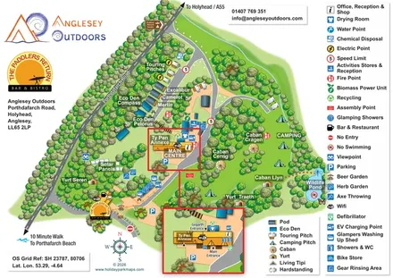
Illustrated camping and glamping map with an activity-centre inset and wildlife pond.
 Explore the map ↗
United Kingdom
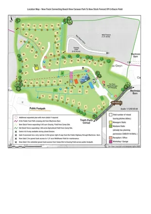
Illustrated touring-park plan with facilities, public footpaths and adjoining field-access details.
Features may come from the sample artwork, its key or published park information. Approximate numbers describe the drawing and may cover only part of a park. They are intended to help you compare map examples. Current facilities and booking information should be checked with the park.
TAKE A CLOSER LOOK
View the illustrated map in detail or choose a file to download. These are sample maps; contact the park for current visitor information.
LET’S MAP YOUR PARK
For a map quotation, find your park and draw a rough boundary around it. The area you select helps us work out the design time and price.
Draw your park for a quote ↗Or talk to our map designers
01751 473136