
Dog-marked grass area
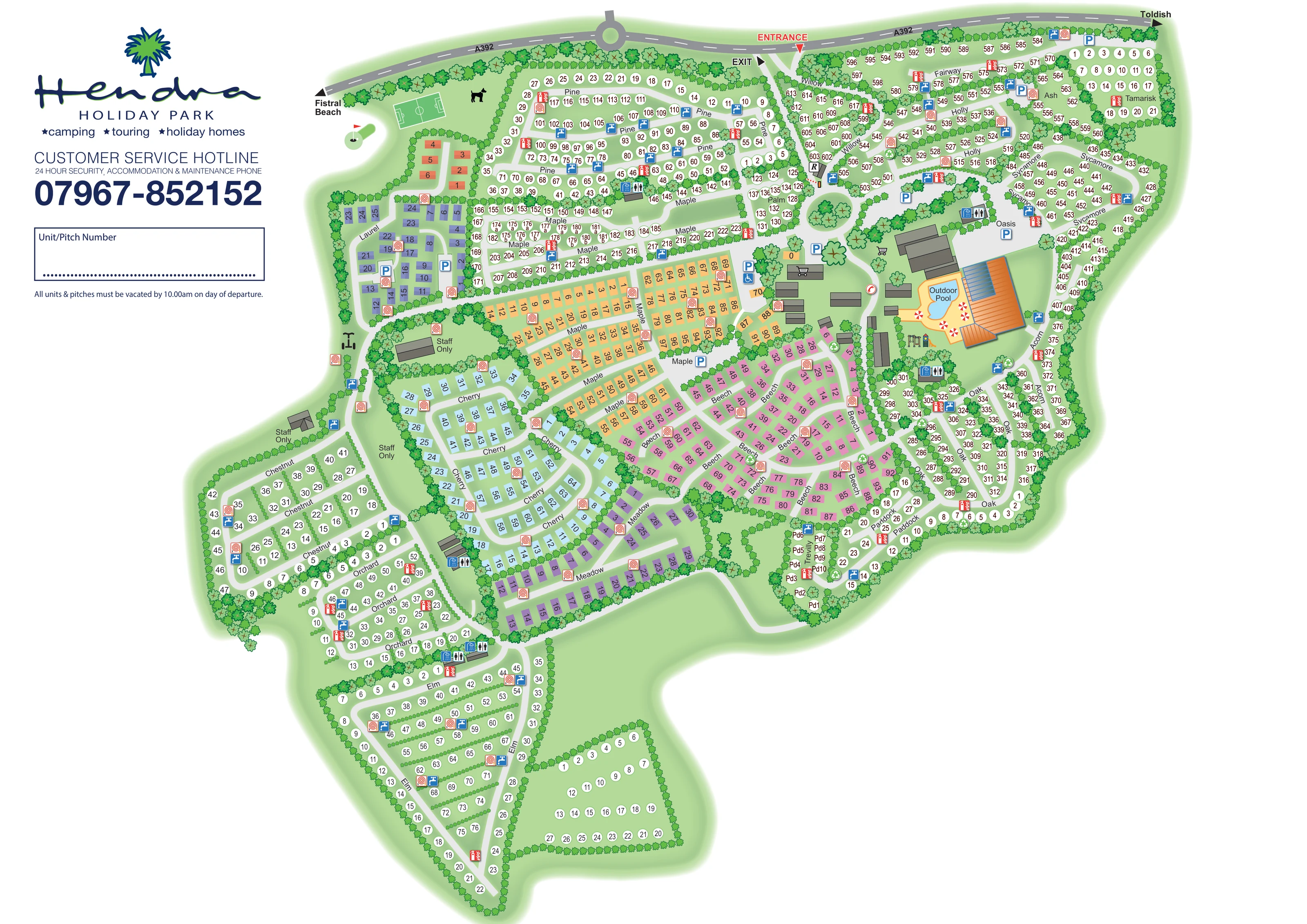
A dog silhouette appears in the grass beside the football pitch. It suggests a dog-related space without specifying its boundaries or rules.
ILLUSTRATED PARK MAP · P493
Newquay, Cornwall · United Kingdom
 Enlarge the map ↗
A SENSE OF THE PLACE
Hendra Holiday Park is an independent, family-owned park near Newquay. It has developed from its touring origins into a site offering camping, caravans, lodges and a holiday house.
Different accommodation areas cater for families and couples, including the Meadow Retreat lodge development. Its Cornish countryside setting provides access to Newquay and the beaches of the north coast, while the map helps guests navigate the larger park.
LOOK CLOSER
A dog silhouette appears in the grass beside the football pitch. It suggests a dog-related space without specifying its boundaries or rules.
Dense illustrated trees outline the irregular park boundary and separate accommodation neighbourhoods; smaller shrub rows divide many pitch groups.
A labelled, irregularly shaped blue pool sits beside the prominent orange-roofed leisure building, within a pale terrace illustrated with red-and-white parasols.
Oasis is named beside the central leisure buildings and parking area. Its detailed indoor facilities are not specified on this artwork.
An R marker identifies a small building on the arrival route, just before the internal roundabout.
Shopping-trolley pictograms mark buildings within the central facilities cluster; individual businesses are not named.
Illustrated swings and a small play tower appear immediately below the outdoor pool terrace.
A white-lined football pitch occupies the grass recreation space along the north-west edge.
A labelled, irregularly shaped blue pool sits beside the prominent orange-roofed leisure building, within a pale terrace illustrated with red-and-white parasols.
Oasis is named beside the central leisure buildings and parking area. Its detailed indoor facilities are not specified on this artwork.
An R marker identifies a small building on the arrival route, just before the internal roundabout.
Shopping-trolley pictograms mark buildings within the central facilities cluster; individual businesses are not named.
Illustrated swings and a small play tower appear immediately below the outdoor pool terrace.
A white-lined football pitch occupies the grass recreation space along the north-west edge.
A dog silhouette appears in the grass beside the football pitch. It suggests a dog-related space without specifying its boundaries or rules.
Paired toilet and shower pictograms identify several service blocks distributed around the main pitch areas and the southern accommodation fields.
Blue tap symbols are repeated beside roads and pitch rows across the park.
Red extinguisher and hose-reel-style symbols mark repeated equipment points throughout the accommodation areas.
Green circular recycling symbols appear at several road junctions and accommodation-area edges.
Blue P markers identify parking near Oasis, the central buildings, Laurel and northern pitch areas.
A wheelchair pictogram accompanies a central parking marker. This is a mapped designation, not evidence of wider accessibility provision.
A red circular handset symbol appears beside the central internal road.
Several grey buildings and enclosed spaces on the western side are explicitly labelled Staff Only.
Dense illustrated trees outline the irregular park boundary and separate accommodation neighbourhoods; smaller shrub rows divide many pitch groups.
Separate entrance and exit arrows connect the northern boundary to the A392, with an internal roundabout leading towards the central facilities.
The A392 carries outward directional labels for Fistral Beach to the left and Toldish to the right; neither destination is depicted as part of the park.
READING THE MAP
This map of Hendra Holiday Park near Newquay brings a large, mixed-accommodation site into one clearly organised plan. Camping and touring pitches spread around the outer fields, while coloured holiday-home blocks form distinct neighbourhoods through the centre. Tree-themed names such as Pine, Maple, Cherry, Beech and Elm give guests a useful intermediate reference between the park entrance and their individual unit or pitch.
The Cornish countryside setting is expressed through green ground colours, planted divisions and dense illustrated tree belts. Along the top of the artwork, the A392 provides the arrival context, with separate entrance and exit arrows and directions towards Fistral Beach and Toldish. Within the park, the outdoor pool and substantial leisure buildings create a strong visual landmark beside the central road network.
The design combines practical numbered wayfinding with small recreational illustrations and repeated service symbols. A generous branded panel on the left provides guest information and a place to record a unit or pitch number, making the artwork suitable for an arrival handout as well as a whole-park orientation map.
The plan is arranged around a northern arrival route from the A392. An R-marked building stands before the internal roundabout, from which roads lead towards the central facilities and branch into the accommodation neighbourhoods. The main footprint spreads east and west, then narrows into a substantial southern extension containing Chestnut, Orchard and Elm.
Accommodation is represented in two contrasting ways. White numbered circles occupy the larger pitch fields, including Pine, Willow, Fairway, Holly, Sycamore, Oak and Acorn. Coloured rectangles identify the central holiday-home areas: yellow-orange Maple, pink Beech, pale blue Cherry and purple-toned Meadow and Laurel. The colours distinguish neighbourhoods visually, although the artwork does not include a key linking them to specific accommodation grades. Names are repeated along roads, helping readers follow an area across several rows.
The central leisure cluster is particularly prominent. A labelled outdoor pool has an irregular blue outline, a pale terrace and red-and-white parasols, beside an orange-roofed building with blue roof panels. Oasis is named nearby. Small play equipment appears below the pool, shopping-trolley symbols identify central buildings, and parking is marked around the facilities. A football pitch and dog silhouette occupy the north-west grass area.
Across the wider plan, repeated pictograms show toilets and showers, water taps, fire equipment and recycling points. Staff-only buildings are labelled along the western side. Trees and shrubs separate fields, line routes and soften the boundary. The large Hendra logo and guest-information panel occupy the upper-left white space. The detail views enlarge overlapping portions of this same single-page design; they are not additional maps or accommodation areas.
KEEP EXPLORING
Chosen for shared landscapes, accommodation or facilities.
 Explore the map ↗
United Kingdom
A colour-zoned coastal park map with touring areas, woodland trails, ponds and a leisure club.
 Explore the map ↗
United Kingdom
Colour-coded accommodation, central leisure facilities and coastal paths on an illustrated headland park map.
 Explore the map ↗
United Kingdom
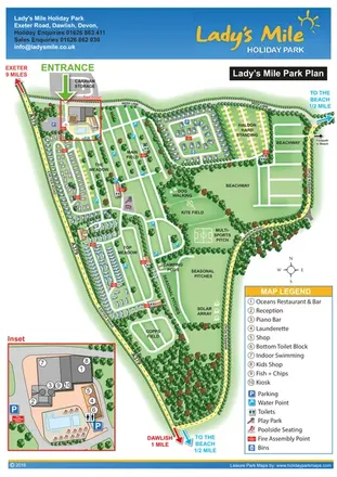
Portrait park plan with named fields, numbered accommodation, beach directions and an enlarged leisure-complex inset.
Features may come from the sample artwork, its key or published park information. Approximate numbers describe the drawing and may cover only part of a park. They are intended to help you compare map examples. Current facilities and booking information should be checked with the park.
TAKE A CLOSER LOOK
View the illustrated map in detail or choose a file to download. These are sample maps; contact the park for current visitor information.


LET’S MAP YOUR PARK
For a map quotation, find your park and draw a rough boundary around it. The area you select helps us work out the design time and price.
Draw your park for a quote ↗Or talk to our map designers
01751 473136